|
State Route 531 (Ohio)
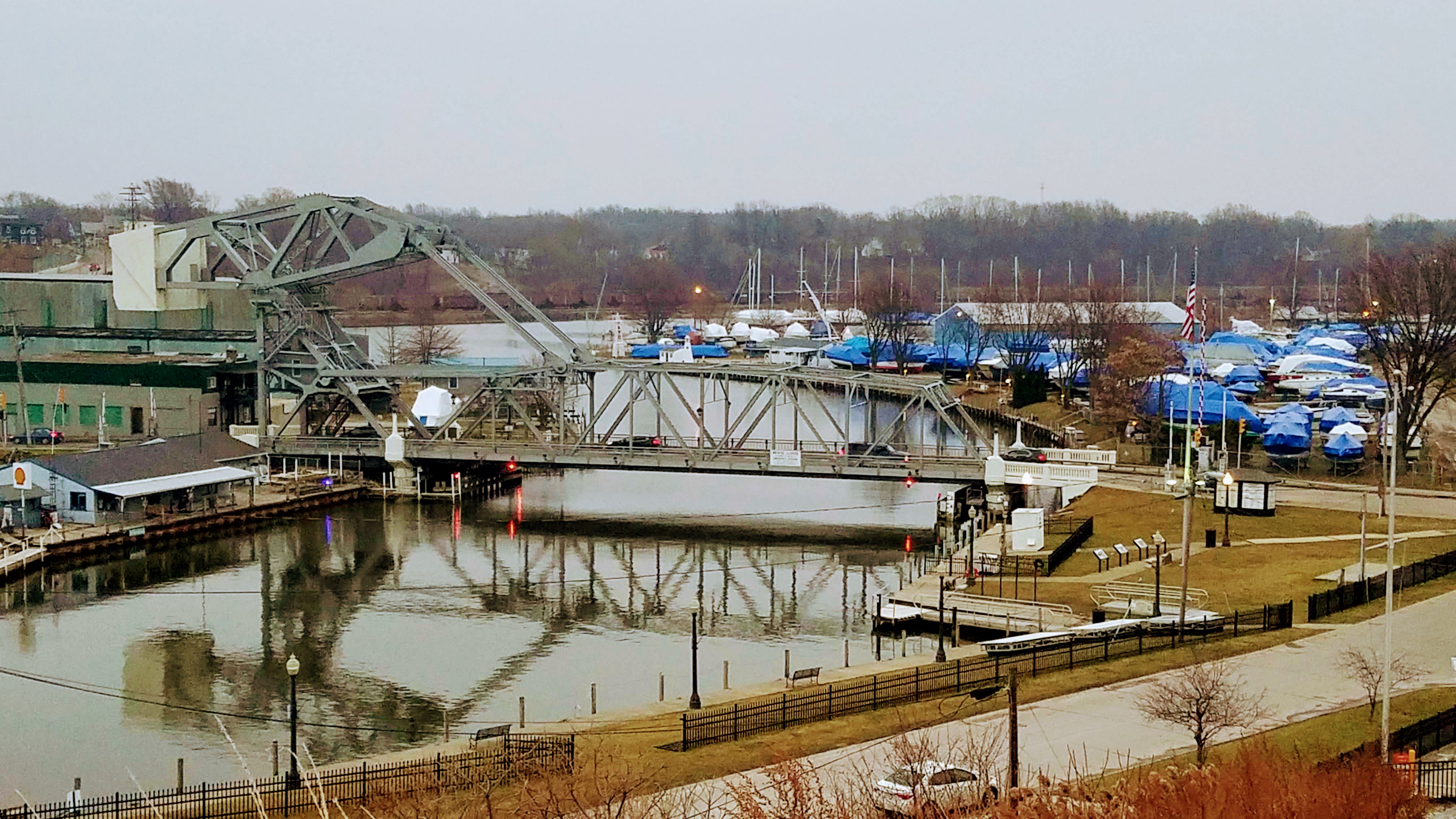
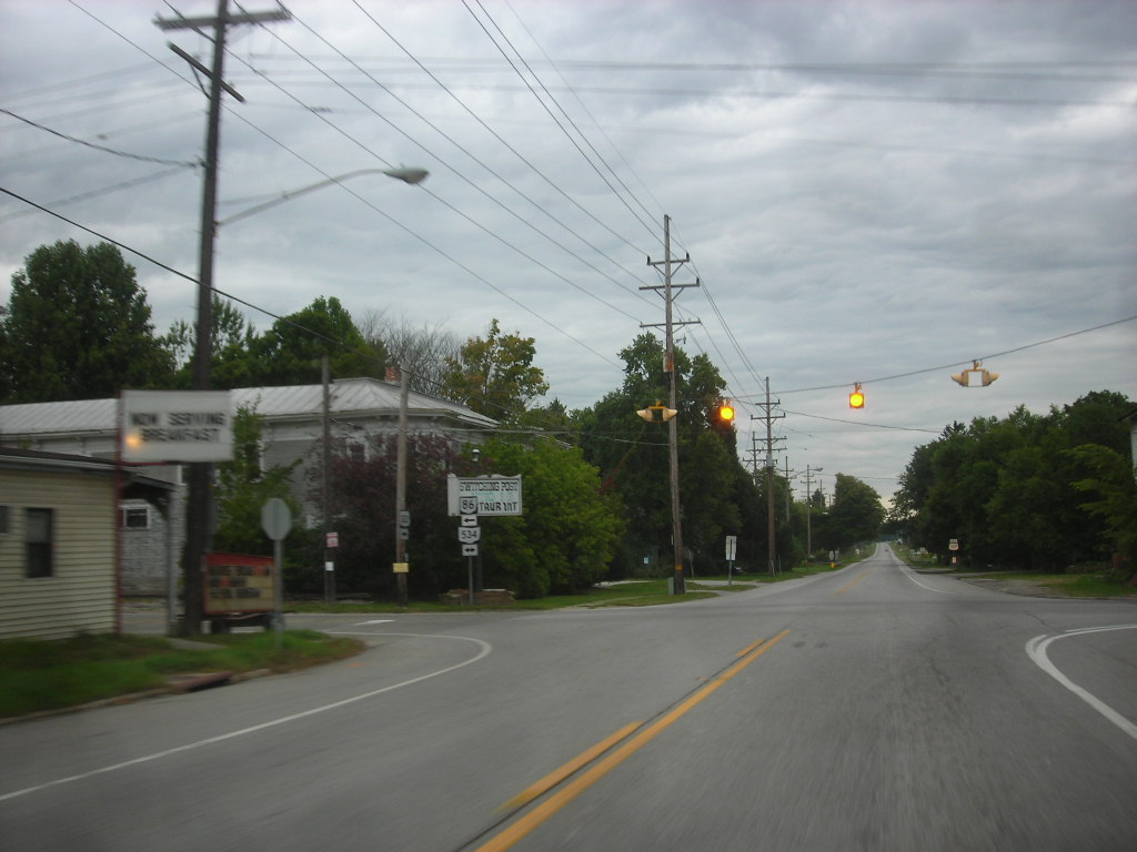
State Route 531 (SR 531) is an east–west state highway in the U.S. state of Ohio. The western terminus of State Route 531 is at the northern terminus of State Route 534 in Geneva-on-the-Lake, at a curve along Lake Road. The route's eastern terminus is at the northern terminus of State Route 7, at a signalized intersection in Conneaut. Following mostly along the Lake Erie shoreline, it is named Lake Road for most of its length. Due to its proximity to the shoreline, sections west of Ashtabula have had to be re-routed as a result of lake erosion. The route crosses the Ashtabula River in Ashtabula via a Strauss bascule bridge, the Ashtabula lift bridge. Route description The entirety of State Route 531 is situated in the northern portion of Ashtabula County Ashtabula County ( ) is the northeasternmost county in the U.S. state of Ohio. As of the 2020 census, the population was 97,574. The county seat is Jefferson. The county was created in 1808 and later org ... [...More Info...] [...Related Items...] OR: [Wikipedia] [Google] [Baidu] |
Geneva-on-the-Lake, Ohio
Geneva-on-the-Lake is a village in northwestern Ashtabula County, Ohio, United States, along the southern shore of Lake Erie. A small resort town, the population was 916 at the 2020 census. It is part of the Ashtabula micropolitan area, northeast of Cleveland. Geography Geneva-on-the-Lake is located at (41.857753, -80.946372). According to the United States Census Bureau, the village has a total area of , of which is land and is water. Demographics 2010 census As of the census of 2010, there were 1,288 people, 589 households, and 326 families residing in the village. The population density was . There were 1,136 housing units at an average density of . The racial makeup of the village was 95.9% White, 0.2% African American, 0.2% Native American, 0.2% Asian, 0.2% Pacific Islander, 0.8% from other races, and 2.4% from two or more races. Hispanic or Latino of any race were 3.2% of the population. There were 589 households, of which 24.8% had children under the age of ... [...More Info...] [...Related Items...] OR: [Wikipedia] [Google] [Baidu] |
Lake Erie
Lake Erie ( "eerie") is the fourth largest lake by surface area of the five Great Lakes in North America and the eleventh-largest globally. It is the southernmost, shallowest, and smallest by volume of the Great Lakes and therefore also has the shortest average water residence time. At its deepest point Lake Erie is deep. Situated on the International Boundary between Canada and the United States, Lake Erie's northern shore is the Canadian province of Ontario, specifically the Ontario Peninsula, with the U.S. states of Michigan, Ohio, Pennsylvania, and New York on its western, southern, and eastern shores. These jurisdictions divide the surface area of the lake with water boundaries. The largest city on the lake is Cleveland, anchoring the third largest U.S. metro area in the Great Lakes region, after Greater Chicago and Metro Detroit. Other major cities along the lake shore include Buffalo, New York; Erie, Pennsylvania; and Toledo, Ohio. Situated below Lake Huron, Erie's p ... [...More Info...] [...Related Items...] OR: [Wikipedia] [Google] [Baidu] |
Ohio Department Of Transportation
The Ohio Department of Transportation (ODOT; ) is the administrative department of the Ohio state government responsible for developing and maintaining all state and U.S. roadways outside of municipalities and all Interstates except the Ohio Turnpike. In addition to highways, the department also helps develop public transportation and public aviation programs. ODOT is headquartered in Columbus, Ohio. Formerly, under the direction of Michael Massa, ODOT initiated a series of interstate-based Travel Information Centers, which were later transferred to local sectors. The Director of Transportation is part of the Governor's Cabinet. ODOT has divided the state into 12 regional districts to facilitate development. Each district is responsible for the planning, design, construction, and maintenance of the state and federal highways in its region. The department employs over 6,000 people and has an annual budget approaching $3 billion. It celebrated its 100th anniversary in 2005 and ... [...More Info...] [...Related Items...] OR: [Wikipedia] [Google] [Baidu] |
Federal Highway Administration
The Federal Highway Administration (FHWA) is a division of the United States Department of Transportation that specializes in highway transportation. The agency's major activities are grouped into two programs, the Federal-aid Highway Program and the Federal Lands Highway Program. Its role had previously been performed by the Office of Road Inquiry, Office of Public Roads and the Bureau of Public Roads. History Background The organization has several predecessor organizations and complicated history. The Office of Road Inquiry (ORI) was founded in 1893. In 1905, that organization's name was changed to the Office of Public Roads (OPR) which became a division of the United States Department of Agriculture. The name was changed again to the Bureau of Public Roads in 1915 and to the Public Roads Administration (PRA) in 1939. It was then shifted to the Federal Works Agency which was abolished in 1949 when its name reverted to Bureau of Public Roads under the Department of Commerce ... [...More Info...] [...Related Items...] OR: [Wikipedia] [Google] [Baidu] |
National Highway System (United States)
The National Highway System (NHS) is a network of strategic highways within the United States, including the Interstate Highway System and other roads serving major airports, ports, military bases, rail or truck terminals, railway stations, pipeline terminals and other strategic transport facilities. Altogether, it constitutes the largest highway system in the world. Individual states are encouraged to focus federal funds on improving the efficiency and safety of this network. The roads within the system were identified by the United States Department of Transportation (USDOT) in cooperation with the states, local officials, and metropolitan planning organizations (MPOs) and approved by the United States Congress in 1995. Legislation The Intermodal Surface Transportation Efficiency Act (ISTEA) in 1991 established certain key routes such as the Interstate Highway System, be included. The act provided a framework to develop a National Intermodal Transportation System which "cons ... [...More Info...] [...Related Items...] OR: [Wikipedia] [Google] [Baidu] |
Ashtabula Lift Bridge
The Ashtabula lift bridge (also known as the West Fifth Street bridge) is a Strauss bascule bridge that carries Ohio State Route 531 over the Ashtabula River in the harbor of Ashtabula, Ohio. Besides its importance as a major transportation route in Ashtabula, the bridge occupies a crucial location in the city's built environment; the Ashtabula Harbour Commercial District terminates at the bridge's western end. History A river crossing had been at the bridge's site long before it was constructed. In 1889, a 19th-century pontoon bridge on the site was replaced by a through truss bridge, which permitted river access because it was a swing bridge. In 1925, the bridge was constructed by a Cleveland firm, Wendell P. Brown, for $179,000. The lifting action depends on electric motors and a massive concrete counterweight. It is one of only two of its type that remain in service in the state of Ohio,David Borsvold, (2003''Ashtabula'' Arcadia Publishing, 18. and the only one extant i ... [...More Info...] [...Related Items...] OR: [Wikipedia] [Google] [Baidu] |
Bascule Bridge
A bascule bridge (also referred to as a drawbridge or a lifting bridge) is a moveable bridge with a counterweight that continuously balances a span, or leaf, throughout its upward swing to provide clearance for boat traffic. It may be single- or double-leafed. The name comes from the French term for balance scale, which employs the same principle. Bascule bridges are the most common type of movable span because they open quickly and require relatively little energy to operate, while providing the possibility for unlimited vertical clearance for marine traffic. History Bascule bridges have been in use since ancient times, but until the adoption of steam power in the 1850s, very long, heavy spans could not be moved quickly enough for practical application. Types There are three types of bascule bridge and the counterweights to the span may be located above or below the bridge deck. The fixed-trunnion (sometimes a "Chicago" bascule) rotates around a large axle that raises the ... [...More Info...] [...Related Items...] OR: [Wikipedia] [Google] [Baidu] |
Ashtabula River
The Ashtabula River is a river located northeast of Cleveland in Ohio. The river flows into Lake Erie at the city of Ashtabula, Ohio. It is in length and drains . Name ''Ashtabula'' derives from Lenape language ''ashte-pihële'', 'always enough (fish) to go around, to be given away', a contraction from ''apchi'' 'always' + ''tepi'' 'enough' + ''hële'' (verb of motion). According to the Geographic Names Information System, the Ashtabula River has also been known as: * Ashtibula River * Riviere Auscubalu * Riviere Oscubolu Watershed On October 30, 2008 the river was designated a State Scenic River by the Director of the Ohio Department of Natural Resources. Pollution In 1985 the first two miles of the river was named an "Area of Concern" by the International Joint Commission, primarily because of Fields Brook, a tributary that had received discharges from 19 industries between the 1940s and 1970s. The cleanup was deemed complete in 2014 and the river was delisted in 2021. Tribu ... [...More Info...] [...Related Items...] OR: [Wikipedia] [Google] [Baidu] |
Ohio State Route 7
State Route 7 (SR 7), formerly known as Inter-county Highway 7 until 1921 and State Highway 7 in 1922, is a north–south state highway in the southern and eastern portions of the U.S. state of Ohio. At about in length, it is the longest state route in Ohio. Its southern terminus is an interchange with U.S. Route 52 (US 52) just west of Chesapeake. Its northern terminus also serves as the eastern terminus of SR 531 in Conneaut. The path of SR 7 stays within of the Ohio River (Ohio's border with West Virginia) for the southern portion, with the river being visible from much of the route. The road also remains within of the Pennsylvania state line for the northern portion. Route description SR 7 starts in Chesapeake and runs along the Ohio River for about . This portion of the highway encounters routes like US 35, US 33, US 50, and Interstate 77 (I-77). It passes through many Ohio River towns like Marietta, Bellaire, and Steube ... [...More Info...] [...Related Items...] OR: [Wikipedia] [Google] [Baidu] |
Ashtabula, Ohio
Ashtabula ( ) is a city in Ashtabula County, Ohio, Ashtabula County, Ohio, United States, and the center of the United States micropolitan area, Ashtabula micropolitan area. It is located at the mouth of the Ashtabula River on Lake Erie, northeast of Cleveland. As of the 2020 United States Census, 2020 census, the city had a total population of 17,975. Like many other cities in the Rust Belt, it has lost population due to a decline in industrial jobs since the 1960s. The name ''Ashtabula'' is derived from , which means 'always enough fish to be shared around' in the Lenape language. The city became an important destination on the Underground Railroad in the middle 19th century, as refugee Slavery in the United States, slaves could take ships to Canada and freedom. Even in the free state of Ohio, they were at risk of being captured by slavecatchers. Beginning in the late 19th century, the city became a #Port, major coal port on Lake Erie at the mouth of the Ashtabula River nor ... [...More Info...] [...Related Items...] OR: [Wikipedia] [Google] [Baidu] |
Ohio State Route 534
State Route 534 (SR 534) is a north–south state highway in the northeastern portion of the U.S. state of Ohio. The southern terminus of SR 534 is at its junction with the duplex of U.S. Route 62 (US 62) and SR 173 nearly west of Salem. Its northern terminus is a curve in Geneva-on-the-Lake where the highway directly transitions into SR 531 at that route's western terminus. Route description SR 534's path takes it through the western portions of Mahoning, Trumbull and Ashtabula Counties. There are no segments of this highway that are included within the National Highway System (NHS). The NHS is a network of highways deemed most important for the nation's economy, mobility and defense. History SR 534 debuted in 1937. It was originally routed along the majority of its current alignment, excepting a short stretch in northwestern Ashtabula County. Prior to its inception, SR 534 consisted of previously un-numbered roads ... [...More Info...] [...Related Items...] OR: [Wikipedia] [Google] [Baidu] |


