|
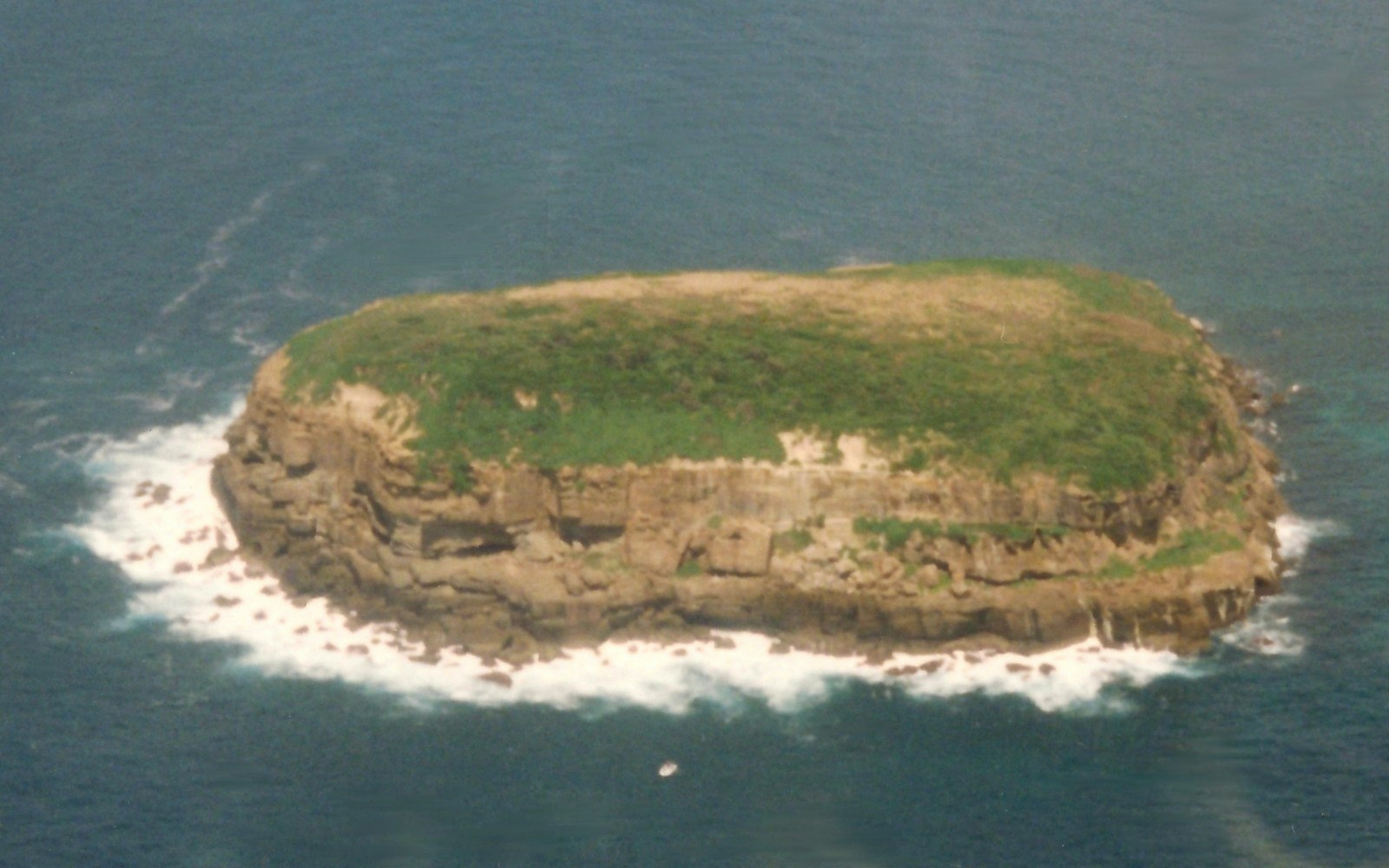
Stanley Island, Queensland
Stanley Island is part of the Great Barrier Reef Marine Park at the tip of Cape Melville, Queensland in Bathurst Bay. It is located North of Denham Island and Flinders Island in the Flinders Group National Park in Princess Charlotte Bay. The island is a popular tourist destination with fine anchorage between the islands and along various coastal stretches. Stanley Island was first declared a national park in 1939. Cape Flinders is the name of the northern tip of Stanley Island and the ship ''Frederick'' was wrecked there in 1818. Rock art Stanley island is an integral part of the mythological complex of the Flinders Group. There are several spectacular rock art sites on Stanley Island, the best known being the huge Yintayin rock shelter (Tindale's "Endaen") known as the "Ship" rock shelter. Other islands in the group also contain rock art, all of which are considered to be of international significance. The rock art covering the walls of the Ship shelter shows ... [...More Info...] [...Related Items...] OR: [Wikipedia] [Google] [Baidu] |
Coral Sea
The Coral Sea () is a marginal sea of the South Pacific off the northeast coast of Australia, and classified as an interim Australian bioregion. The Coral Sea extends down the Australian northeast coast. Most of it is protected by the French Natural Park of the Coral Sea (french: Parc Naturel de la Mer de Corail) and the Australian Coral Sea Marine Park. The sea was the location for the Battle of the Coral Sea, a major confrontation during World War II between the navies of the Empire of Japan, and the United States and Australia. The sea contains numerous islands and reefs, as well as the world's largest reef system, the Great Barrier Reef (GBR), which was declared a World Heritage Site by UNESCO in 1981. All previous oil exploration projects were terminated at the GBR in 1975, and fishing is restricted in many areas. The reefs and islands of the Coral Sea are particularly rich in birds and aquatic life and are a popular tourist destination, both domestically and internat ... [...More Info...] [...Related Items...] OR: [Wikipedia] [Google] [Baidu] |
Rock Art
In archaeology, rock art is human-made markings placed on natural surfaces, typically vertical stone surfaces. A high proportion of surviving historic and prehistoric rock art is found in caves or partly enclosed rock shelters; this type also may be called cave art or parietal art. A global phenomenon, rock art is found in many culturally diverse regions of the world. It has been produced in many contexts throughout human history. In terms of technique, the four main groups are: * cave paintings, * petroglyphs, which are carved or scratched into the rock surface, * sculpted rock reliefs, and * geoglyphs, which are formed on the ground. The oldest known rock art dates from the Upper Palaeolithic period, having been found in Europe, Australia, Asia, and Africa. Anthropologists studying these artworks believe that they likely had magico-religious significance. The archaeological sub-discipline of rock art studies first developed in the late-19th century among Francophone scholar ... [...More Info...] [...Related Items...] OR: [Wikipedia] [Google] [Baidu] |
List Of Islands Of Australia
This is a list of selected Australian islands grouped by State or Territory. Australia has 8,222 islands within its maritime borders. Largest islands The islands larger than are: * Tasmania (Tas) ; * Melville Island, Northern Territory (NT), ; * Kangaroo Island, South Australia (SA), ; * Groote Eylandt (NT), ; * Bathurst Island (NT), ; * Fraser Island, Queensland (Qld), ; * Flinders Island (Tas), ; * King Island (Tas), ; and * Mornington Island (Qld), . New South Wales * Amherst Island, in Lake Mummuga * Bare Island, near the north headland of Botany Bay * Belowla Island, off Kioloa Beach * Bird Island, located near Budgewoi, east of the Central Coast * Boondelbah Island, at the mouth of Port Stephens * Brisbane Water: ** Pelican Island ** Riley's Island ** St Hubert's Island (largely artificial, created by raising an inter-tidal wetland above high water level) * Broughton Island, located north of Port Stephens * Broulee Island, located off the coast at ... [...More Info...] [...Related Items...] OR: [Wikipedia] [Google] [Baidu] |
Castle Peak (Queensland)
Castle Peak may refer to: Mountains * Castle Peak (Alaska), Wrangell Mountains * Castle Peak (California), Sierra Nevada range * Castle Peak (Colorado), Elk Mountains * Castle Peak (Sawatch Range), Sawatch Range, Colorado * Castle Peak (Idaho), White Cloud Mountains, Idaho * Castle Peak (Texas) * Castle Peak (Washington), North Cascades * Castle Peak (Hong Kong) (, sometimes transliterated Tsing Shan), a mountain in the western New Territories of Hong Kong ** Castle Peak Bay (青山灣), a bay outside Tuen Mun, near Castle Peak, Hong Kong ** Castle Peak Beach (青山灣泳灘), a gazetted beach in Tuen Mun, Hong Kong ** Castle Peak Hospital (青山醫院), a psychiatric hospital in Hong Kong, to the east of Castle Peak at Tuen Mun ** Castle Peak Road (青山道 and 青山公路), a road in Hong Kong running north from Kowloon ** Tsing Shan Monastery (青山禪院), a monastery at the foot of Castle Peak, Hong Kong * Castle Peak (Antarctica) Other uses * Castle Peak, in El Escorp ... [...More Info...] [...Related Items...] OR: [Wikipedia] [Google] [Baidu] |
James Cook
James Cook (7 November 1728 Old Style date: 27 October – 14 February 1779) was a British explorer, navigator, cartographer, and captain in the British Royal Navy, famous for his three voyages between 1768 and 1779 in the Pacific Ocean and to New Zealand and Australia in particular. He made detailed maps of Newfoundland prior to making three voyages to the Pacific, during which he achieved the first recorded European contact with the eastern coastline of Australia and the Hawaiian Islands, and the first recorded circumnavigation of New Zealand. Cook joined the British merchant navy as a teenager and joined the Royal Navy in 1755. He saw action in the Seven Years' War and subsequently surveyed and mapped much of the entrance to the St. Lawrence River during the siege of Quebec, which brought him to the attention of the Admiralty and the Royal Society. This acclaim came at a crucial moment for the direction of British overseas exploration, and it led to his commission in ... [...More Info...] [...Related Items...] OR: [Wikipedia] [Google] [Baidu] |
Prau
Proas are various types of multi-hull outrigger sailboats of the Austronesian peoples. The terms were used for native Austronesian ships in European records during the Colonial era indiscriminately, and thus can confusingly refer to the double-ended single-outrigger boats of Oceania, the double-outrigger boats of Island Southeast Asia, and sometimes ships with no outriggers or sails at all. In its most common usage, the term ''proa'' refers to the Pacific proas which consist of two (usually) unequal-length parallel hulls. It is sailed so that one hull is kept to windward, and the other to leeward. It is double-ended, since it needs to " shunt" to reverse direction when tacking. It is most famously used for the ''sakman'' ships of the Chamorro people of the Northern Marianas, which were known as the "flying proas" for their remarkable speed. In Island Southeast Asia, the term ''proa'' may also sometimes be used, but the terms perahu, prau, prahu, paraw and prow are more c ... [...More Info...] [...Related Items...] OR: [Wikipedia] [Google] [Baidu] |
Macassan
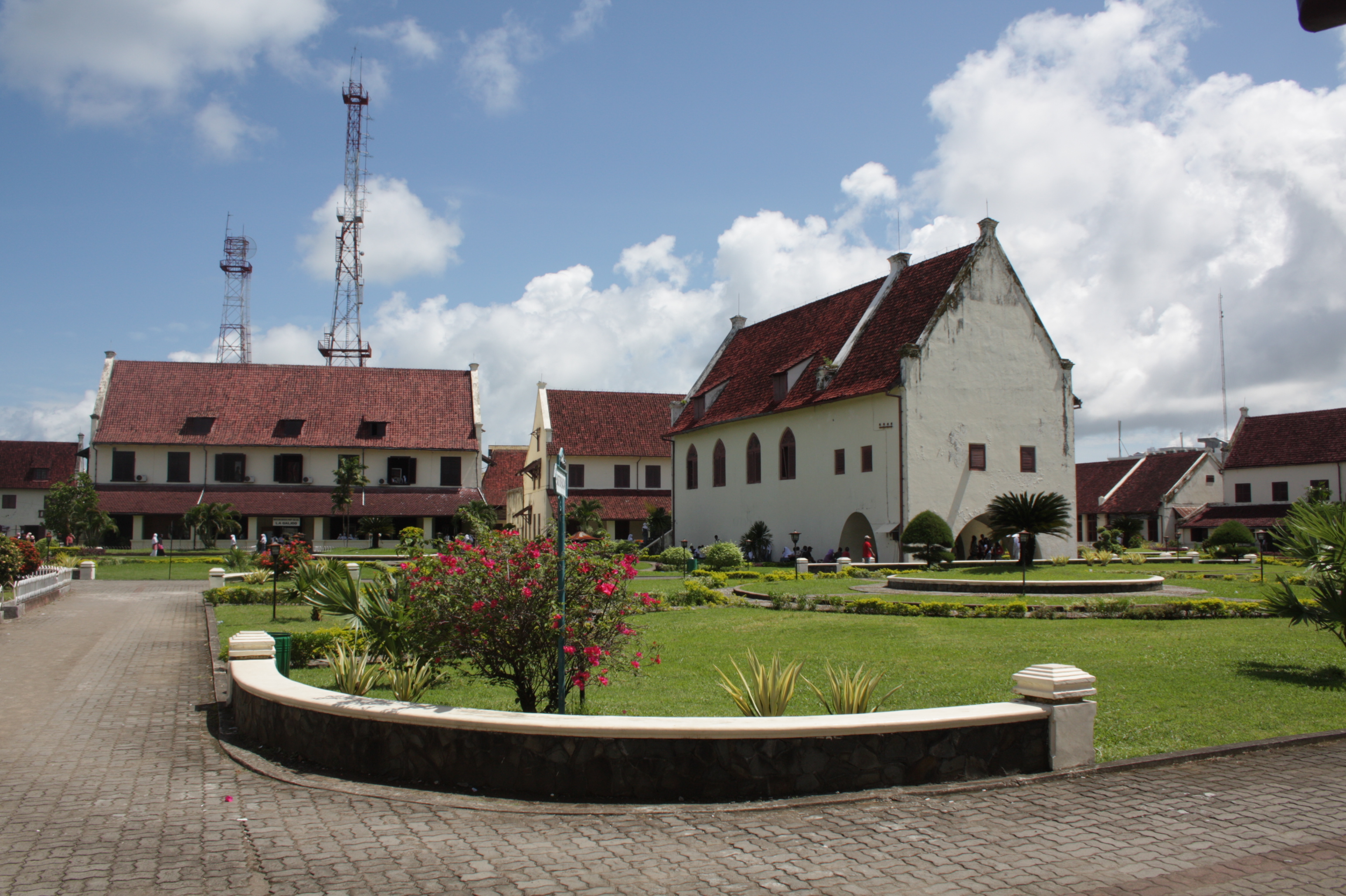
Makassar (, mak, ᨆᨀᨔᨑ, Mangkasara’, ) is the capital of the Indonesian province of South Sulawesi. It is the largest city in the region of Eastern Indonesia and the country's fifth-largest urban center after Jakarta, Surabaya, Medan, and Bandung.Ministry of Internal AffairsRegistration Book for Area Code and Data of 2013/ref> The city is located on the southwest coast of the island of Sulawesi, facing the Makassar Strait. Throughout its history, Makassar has been an important trading port, hosting the center of the Gowa Sultanate and a Portuguese naval base before its conquest by the Dutch East India Company in the 17th century. It remained an important port in the Dutch East Indies, serving Eastern Indonesian regions with Makassarese fishers going as far south as the Australian coast. For a brief period after Indonesian independence, Makassar became the capital of the State of East Indonesia, during which an uprising occurred. The city's area is , and it had a ... [...More Info...] [...Related Items...] OR: [Wikipedia] [Google] [Baidu] |
Lugger
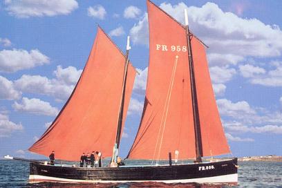
A lugger is a sailing vessel defined by its rig, using the lug sail on all of its one or several masts. They were widely used as working craft, particularly off the coasts of France, England, Ireland and Scotland. Luggers varied extensively in size and design. Many were undecked, open boats, some of which operated from beach landings (such as Hastings or Deal). Others were fully decked craft (typified by the Zulu and many other sailing drifters). Some larger examples might carry lug topsails. Luggers were used extensively for smuggling from the middle of the 18th century onwards; their fast hulls and powerful rigs regularly allowed them to outpace any Revenue vessel in service. The French three-masted luggers also served as privateers and in general trade. As smuggling declined about 1840, the mainmast of British three-masted luggers tended to be discarded, with larger sails being set on the fore and mizzen. This gave more clear space in which to work fishing nets. Local ... [...More Info...] [...Related Items...] OR: [Wikipedia] [Google] [Baidu] |
Ochre
Ochre ( ; , ), or ocher in American English, is a natural clay earth pigment, a mixture of ferric oxide and varying amounts of clay and sand. It ranges in colour from yellow to deep orange or brown. It is also the name of the colours produced by this pigment, especially a light brownish-yellow. A variant of ochre containing a large amount of hematite, or dehydrated iron oxide, has a reddish tint known as "red ochre" (or, in some dialects, ruddle). The word ochre also describes clays coloured with iron oxide derived during the extraction of tin and copper. Earth pigments Ochre is a family of earth pigments, which includes yellow ochre, red ochre, purple ochre, sienna, and umber. The major ingredient of all the ochres is iron(III) oxide-hydroxide, known as limonite, which gives them a yellow colour. * Yellow ochre, , is a hydrated iron hydroxide (limonite) also called gold ochre. * Red ochre, , takes its reddish colour from the mineral hematite, which is an anhydrous iron ... [...More Info...] [...Related Items...] OR: [Wikipedia] [Google] [Baidu] |
Frederick (1807 Ship)
''Frederick'' was a sailing ship built in 1807 at Batavia. She made four voyages to Australia and was wrecked at Cape Flinders on Stanley Island, Queensland, Australia in 1818. Career ''Frederick'' made four voyages to Australia transporting merchandise, passengers, and on each occasion, some military convicts. In 1815 she carried eight escaped convicts that had stowed away on when she had left from Port Jackson for Canton. Captain Joseph Savigny arrived at Port Jackson from Bengal on 6 December 1812. ''Frederick'' was carrying merchandise. She left on 10 February 1813 for the Derwent River. She left the Derwent and returned to Port Jackson on 21 April. She left for Bengal on 19 May. On her way to Port Jackson, Captain Savigny in 1812 discovered a reef that was named after her. The Frederick Reefs are located in the Coral Sea Islands, over northeast of Gladstone, Queensland. The reefs were described in the ship's log: Captain William Duncan and ''Frederick'' arrived at P ... [...More Info...] [...Related Items...] OR: [Wikipedia] [Google] [Baidu] |


