|
Stalag I-A
Stalag I-A was a German prisoner-of-war camp during World War II, located in the village of Stabławki (then officially ''Stablack''). It housed mainly Polish, Belgian, French and Russian prisoners of war, but also Britons and Italians. The camp was built in late 1939 by Polish prisoners of war, who were captured during the German-Soviet invasion of Poland which started World War II. In 1940 the Poles were joined by Belgian and French prisoners following the Fall of France, and by Russians in 1941 following the Operation Barbarossa. Some British and Italian prisoners were also there. On 25 January 1945, as Russian troops approached, the camp was abandoned and all prisoners were evacuated to the west. Kommandos of Stalag I-A Few of the men registered at Stalag I-A were housed at the main camp, as most were assigned to ''Kommandos'' (sub-camps) spread over the entire district. * E1, Central Camp * E2, Stablack hospital * E3, Königsberg * E4, Heinrichswalde * E5, around Königs ... [...More Info...] [...Related Items...] OR: [Wikipedia] [Google] [Baidu] |
Stabławki
Stabławki ( de , Stablack) is a village in the administrative district of Gmina Górowo Iławeckie, within Bartoszyce County, Warmian-Masurian Voivodeship, in northern Poland, close to the border with the Kaliningrad Oblast of Russia Russia (, , ), or the Russian Federation, is a List of transcontinental countries, transcontinental country spanning Eastern Europe and North Asia, Northern Asia. It is the List of countries and dependencies by area, largest country in the .... References Villages in Bartoszyce County {{Bartoszyce-geo-stub ... [...More Info...] [...Related Items...] OR: [Wikipedia] [Google] [Baidu] |
Bagrationovsk
Bagrationovsk (russian: Багратио́новск; german: Preußisch Eylau; pl, Pruska Iława or '; lt, Ylava or ') is a town and the administrative center of Bagrationovsky District in Kaliningrad Oblast, Russia, located close to the border with Poland, south of Kaliningrad, the administrative center of the oblast. It has a population of History In 1325, the Teutonic Knights built an Ordensburg castle called "Yladia"Schulz 1998 or "Ilaw", later known as "Preussisch Eylau", in the center of the Old Prussian region Natangia. 'Ylow' is the Old Prussian term for 'mud' or 'swamp'. The settlement nearby developed in 1336, but in 1348 the Teutonic Order gave the privilege to establish twelve pubs in the area around the castle. Although the settlement had only a few inhabitants, due to its central position it was often used as meeting place for officials of the Order. In 1454, King Casimir IV Jagiellon incorporated the region to the Kingdom of Poland upon the request of the ant ... [...More Info...] [...Related Items...] OR: [Wikipedia] [Google] [Baidu] |
Gumbinnen
Gusev (russian: Гу́сев; german: Gumbinnen; lt, Gumbinė; pl, Gąbin) is a town and the administrative center of Gusevsky District of Kaliningrad Oblast, Russia, located at the confluence of the Pissa and Krasnaya Rivers, near the border with Poland and Lithuania, east of Chernyakhovsk. Population: History The settlement of Gumbinnen (from lt, Gumbinė: pumpkin) in the Duchy of Prussia, a vassal duchy of the Kingdom of Poland, was first mentioned in a 1580 deed. A Protestant parish was established in Gumbinnen at the behest of the Hohenzollern thanks to Duke Albert of Prussia about 1545 and the first church was erected in 1582. It became part of Brandenburg-Prussia in 1618, remaining a fief of Poland. From the 18th century, it was part of the Kingdom of Prussia. Between 1709 and 1711 the area was devastated by the Great Northern War plague outbreak and had to be redeveloped under the rule of the "Soldier King" Frederick William I of Prussia, who granted Gumbinnen town ... [...More Info...] [...Related Items...] OR: [Wikipedia] [Google] [Baidu] |
Dobrovolsk
Dobrovolsk (russian: Добровольск, lit. "Voluntary Town"; german: Pillkallen (1510-1938) or ' (1938-1947); lt, Pilkalnis; pl, Pilkały) is a village in Krasnoznamensky District of Kaliningrad Oblast, Russia. It has a population of 1,693 ( 2010). It is located in the historical region of Lithuania Minor. It lies approximately north of Nesterov and north-east of Gusev. History Russian sources give the date of the earliest record of the village as 1510, while the earliest surviving German language record dates from 1516 under the name ''Schlosbergk'', and slightly later the name ''Mühlenberg'' is also used. Nevertheless, it is believed that there was already a trading settlement in existence before this. The name Pillkallen first appears in the records in 1545 in connection with an inheritance dispute, and is thought to have originated with Lithuanian inhabitants derived from the Lithuanian language term ''pilkalnis'', meaning ''mound'' or '' castle mound''. In 1549 ... [...More Info...] [...Related Items...] OR: [Wikipedia] [Google] [Baidu] |
Insterburg
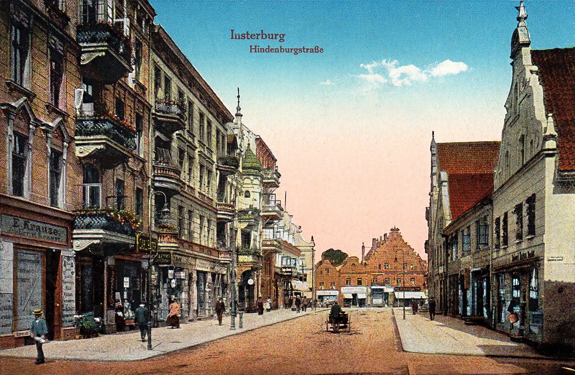
Chernyakhovsk (russian: Черняхо́вск) – known prior to 1946 by its German name of (Old Prussian: Instrāpils, lt, Įsrutis; pl, Wystruć) – is a town in the Kaliningrad Oblast of Russia, where it is the administrative center of Chernyakhovsky District. Located at the confluence of the Instruch and Angrapa rivers, which unite to become the Pregolya river below Chernyakhovsk, the town had a population in 2017 of 36,423. History Chernyakhovsk was founded in 1336 by the Teutonic Knights on the site of a former Old Prussian fortification when Dietrich von Altenburg, the Grand Master of the Teutonic Knights, built a castle called ''Insterburg'' following the Prussian Crusade. During the Teutonic Knights' Northern Crusades campaign against the Grand Duchy of Lithuania, the town was devastated in 1376. The castle had been rebuilt as the seat of a Procurator and a settlement also named ''Insterburg'' grew up to serve it. In 1454, Polish King Casimir IV Jagiellon incorpor ... [...More Info...] [...Related Items...] OR: [Wikipedia] [Google] [Baidu] |
Labiau
Polessk (russian: Поле́сск; german: Labiau; lt, Labguva; pl, Labiawa) is a town and the administrative center of Polessky District in Kaliningrad Oblast, Russia, located northeast of Kaliningrad, the administrative center of the oblast, at the junction of a main road and a railroad at the Deyma River, shortly before it enters the Curonian Lagoon. Population figures: 4,744 (1885). Geography The Polessk Canal begins in the town. History It was founded in the 13th century, by the Teutonic Order who erected a castle there and named it Labiau. Initially it was part of the State of the Teutonic Order. In 1454, King Casimir IV Jagiellon incorporated the region to the Kingdom of Poland upon the request of the anti-Teutonic Prussian Confederation. After the subsequent Thirteen Years' War (1454–1466) the settlement became a part of Poland as a fief held by the Teutonic Knights until 1525 and by Ducal Prussia afterwards. In this town, on November 20, 1656, was signed ... [...More Info...] [...Related Items...] OR: [Wikipedia] [Google] [Baidu] |
Klaipėda
Klaipėda (; ; german: Memel; pl, Kłajpeda; russian: Клайпеда; sgs, Klaipieda) is a city in Lithuania on the Baltic Sea coast. The capital of the eponymous county, it is the third largest city and the only major seaport in Lithuania. The city has a complex recorded history, partially due to the combined regional importance of the usually ice-free Port of Klaipėda at the mouth of the river . Located in the region of Lithuania Minor, at various times, it was a part of the Polish–Lithuanian Commonwealth, Prussia and Germany until the 1919 Treaty of Versailles. As a result of the 1923 Klaipėda Revolt it was annexed by Lithuania and has remained with Lithuania to this day, except between 1939 and 1945 when it was occupied by Germany following the 1939 German ultimatum to Lithuania. The population has migrated from the city to its suburbs and hinterland. The number of inhabitants of Klaipėda city shrank from 202,929 in 1989 to 162,360 in 2011, but the urban zone ... [...More Info...] [...Related Items...] OR: [Wikipedia] [Google] [Baidu] |
Lelkowo
Lelkowo (german: Lichtenfeld) is a village in Braniewo County, Warmian-Masurian Voivodeship, in northern Poland, close to the border with the Kaliningrad Oblast of Russia. It is the seat of the gmina (administrative district) called Gmina Lelkowo. It lies approximately east of Braniewo and north of the regional capital Olsztyn Olsztyn ( , ; german: Allenstein ; Old Prussian: ''Alnāsteini'' * Latin: ''Allenstenium'', ''Holstin'') is a city on the Łyna River in northern Poland. It is the capital of the Warmian-Masurian Voivodeship, and is a city with county rights. .... The village has a population of 1,080. References Villages in Braniewo County {{Braniewo-geo-stub ... [...More Info...] [...Related Items...] OR: [Wikipedia] [Google] [Baidu] |
Ladushkin
Ladushkin (russian: Ла́душкин; german: Ludwigsort; lt, Liudvigsortas; pl, Ludwinów) is a town in Kaliningrad Oblast, Russia, located between Kaliningrad and the Polish border. Population figures: History It was founded as ''Ludwigsort'' (lit. ''Ludwig's/Louis' place'') in 1314 and is situated not far from the shores of the Vistula Lagoon and the ruins of the medieval Balga Castle erected by the Teutonic Knights. In 1454, King Casimir IV Jagiellon incorporated the region to the Kingdom of Poland upon the request of the anti-Teutonic Prussian Confederation. After the subsequent Thirteen Years' War (1454–1466), the settlement was a part of Poland as a fief held by the Teutonic KnightsGórski, pp. 96–97, 214–215 until 1525, and by secular Ducal Prussia afterwards. From the 18th century, it was part of the Kingdom of Prussia, and from 1871 it was also part of Germany, within which it was administratively located in the province of East Prussia. After the transfer of ... [...More Info...] [...Related Items...] OR: [Wikipedia] [Google] [Baidu] |
Platoon
A platoon is a military unit typically composed of two or more squads, sections, or patrols. Platoon organization varies depending on the country and the branch, but a platoon can be composed of 50 people, although specific platoons may range from 10 to 100 people. A platoon is typically the smallest military unit led by a commissioned officer. The platoon leader is usually a junior officer—a second or first lieutenant or an equivalent rank. The officer is usually assisted by a platoon sergeant. Rifle platoons normally consist of a small platoon headquarters and three or four sections (Commonwealth) or squads (United States). In some armies, platoon is used throughout the branches of the army. In a few armies, such as the French Army, a platoon is specifically a cavalry unit, and the infantry use "section" as the equivalent unit. A unit consisting of several platoons is called a company or a battery. Etymology According to Merriam-Webster, "The term was first used in th ... [...More Info...] [...Related Items...] OR: [Wikipedia] [Google] [Baidu] |


