|
Staffordshire Wildlife Trust
The Staffordshire Wildlife Trust is a wildlife trust covering the county of Staffordshire, England. Organisation and activities It is one of 46 Wildlife Trusts; each is a registered charity and is a member of the Royal Society of Wildlife Trusts. The Staffordshire Wildlife Trust was founded in 1969. It has about 160 members of staff, overseen by a board of trustees. The Trust is supported by a network of volunteers."About us" ''Staffordshire Wildlife Trust''. Retrieved 31 October 2022. The Trust has two s: the Wolseley Centre, near |
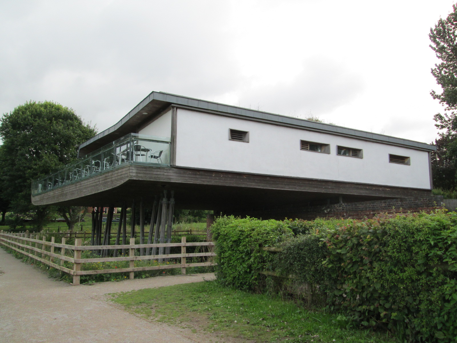
Westport Lake Visitor Centre
Westport is the name of several communities around the world. Canada *Westport, Nova Scotia *Westport, Ontario **Westport Rideaus, local junior "B" ice hockey team ** Westport/Rideau Lakes Airport *Westport, Newfoundland and Labrador Ireland *Westport, County Mayo **Westport House **Westport railway station, Mayo ** Westport United F.C., football club ** Westport CFE – Carrowbeg College Malaysia *West Port, Malaysia New Zealand *Westport, New Zealand **Westport News **Westport Airport (New Zealand) **Westport Rugby Football Club United Kingdom * Westport, Somerset **Westport Canal *Westport, Wiltshire United States *Westport, California *Westport, Connecticut **Westport Country Playhouse, a theatre **Westport (Metro-North station) **Westport Bank and Trust Company, a historic place **Westport Public Library *Westport, Indiana *Westport Township, Dickinson County, Iowa *Westport, Kentucky, in Oldham Co. **Westport High School (Kentucky), in Louisville, named for the Westport ... [...More Info...] [...Related Items...] OR: [Wikipedia] [Google] [Baidu] |
Cotton Dell
Cotton Dell is a nature reserve of the Staffordshire Wildlife Trust. It is a wooded valley area near the village of Cotton and about north of the village of Oakamoor, in Staffordshire, England. History The Cotton estate was owned in the 1700s by the politician Thomas Gilbert; he lived here from 1795, and tended the woodlands. In 1868 the woodlands became the property of Cotton College. The college closed in 1987, and the estate was sold by 1999, Cotton Dell then becoming a nature reserve."Discovering Cotton Dell". Leaflet by ''Staffordshire Wildlife Trust''. Description Car parking is at the Staffordshire County Council picnic area at Oakamoor, half a mile from the reserve. The area of the reserve is . There are paths through the site, which, in the valley terrain, are steep in places. Cotton Brook flows through the valley, and there is a path following the course of the brook. [...More Info...] [...Related Items...] OR: [Wikipedia] [Google] [Baidu] |
The Roaches
The Roaches (from the French ''les roches'' - the rocks) is a prominent rocky ridge above Leek and Tittesworth Reservoir in the Staffordshire Peak District of England. The ridge with its rock formations rises steeply to . Along with Ramshaw Rocks and Hen Cloud they form a gritstone escarpment, which is popular with hikers, rock climbers and freerunners. It is often very busy especially at weekends. The Roaches Estate which includes Hen Cloud was purchased by the Peak District National Park Authority in the 1980s to safeguard the area from adverse development. From May 201Staffordshire Wildlife Trusttook on the management of the Roaches Estate. In clear conditions, it is possible to see much of Cheshire and views stretching as far as Snowdon in Wales and Winter Hill in Lancashire. The Roaches are the most prominent part of a curving ridge which extends for several miles from Hen Cloud in the south to Back Forest and Hangingstone in the northwest. At the top there is ... [...More Info...] [...Related Items...] OR: [Wikipedia] [Google] [Baidu] |
Radford Meadows
Radford Meadows is a nature reserve of the Staffordshire Wildlife Trust, on the southern edge of Stafford, in Staffordshire, England. The reserve is a floodplain situated between the River Penk to the west, and the Staffordshire and Worcestershire Canal. Description Access is only along the towpath of the Staffordshire and Worcestershire Canal; the towpath is elevated, and provides views of the entire site."Radford Meadows" ''Staffordshire Wildlife Trust''. Retrieved 20 March 2021. The area of the reserve is . It is part of the of the River Penk; it is important in absorbing excess water when there is high rainfall. There are [...More Info...] [...Related Items...] OR: [Wikipedia] [Google] [Baidu] |
Parrot's Drumble
Parrot's Drumble is a nature reserve of the Staffordshire Wildlife Trust. It is an area of woodland next to the village of Talke Pits, and about north of Newcastle-under-Lyme, in Staffordshire, England. Description Its area is . It is an ancient woodland, the area having been woodland for more than 400 years. It was once owned by a family named Parrot, and a "drumble" is a local word for a stream running through a wooded valley."Parrot's Drumble" ''Staffordshire Wildlife Trust''. Retrieved 11 February 2021. There are old mineworkings in the area, from which iron oxide leaches, giving the stream a reddish colour. There is a walking trail through the wood, where there is |
Loynton Moss
Loynton Moss is a nature reserve of the Staffordshire Wildlife Trust, near the village of Woodseaves, in Staffordshire, England. It is adjacent to the Shropshire Union Canal, as it runs from nearby Norbury to High Offley. Description The area of the reserve is , and it is designated a Site of Special Scientific Interest. There are walking trails, except in the mostly inaccessible areas of reedbed and wet woodland. There are mosquitoes in the wetter areas during the summer, which may deter visitors."Loynton Moss" ''Staffordshire Wildlife Trust''. Retrieved 28 February 2021. Geology The particular landscape is a result of a process after the last ice age. A |
Jackson's Coppice And Marsh
Jackson's Coppice and Marsh is a nature reserve of the Staffordshire Wildlife Trust. It is along the River Sow, near the village of Bishop's Offley and about west of Eccleshall, in Staffordshire, England. Description The reserve, area , is leased from the Sugnall Estate. It lies along the River Sow; Offleybrook Mill is upstream and Walk Mill is downstream. In the 13th century, a dam at Walk Mill raised the water level of the marsh, and until the 1950s the fields were managed as water-meadows. After the 1970s, when Walk Mill fell into disuse, the mill pond became silted up; the pond has since been restored."Jackson's Coppice & Marsh" ''Staffordshire Wildlife Trust''. Retrieved 7 February 2021. Marsh There is a boardwalk leading through an |
Highgate Common
Highgate Common is a Staffordshire Wildlife Trust reserve containing a mix of heathland and woodland. It is about 129 hectares or 320 acres in size. The common is a popular leisure destination and a Site of Special Scientific Interest, located in Southern Staffordshire, England. Location Highgate Common is situated to the west of the West Midlands conurbation, on a ridge above the Smestow valley. By road it is 1.2 miles from Swindon, 1.7 miles from Enville, 4.5 miles from Wombourne, 9 miles from Perton and 10 miles from Wolverhampton. Management Since April 2009 Highgate Common has been owned and managed by the Staffordshire Wildlife Trust. The site was previously managed by South Staffordshire District Council. A warden is present most days and their duties are aided by various support staff and volunteers. Wildlife Highgate Common contains one of a small number of lowland heaths in Staffordshire, which are highly prized as habitats. However, the heath is not the whole of th ... [...More Info...] [...Related Items...] OR: [Wikipedia] [Google] [Baidu] |
Hem Heath Woods
Hem Heath Woods is a nature reserve of the Staffordshire Wildlife Trust. It is on the southern fringe of Stoke-on-Trent, England. Its northern boundary is at the A5035 road at Hem Heath; the southern boundary is adjacent to the Wedgwood visitor centre at Barlaston. Description The area of the reserve is . There are four woods: the Oaks, at the southern end, is known to have been woodland for over 400 years; Newstead Woods, Newpark Plantation and Hem Heath were planted, on former farmland, in the mid-1800s. Although parts of the site may once have been heathland, there is no heath today. There is a network of walking trails in the woods."Hem Heath Woods" ''Staffordshire Wildlife Trust''. Retrieved 23 June 2020. The woodland is managed so that it can regenerate naturally, and remain as woodland in the long term. Ind ... [...More Info...] [...Related Items...] OR: [Wikipedia] [Google] [Baidu] |
Harston Wood
Harston Wood is a nature reserve of the Staffordshire Wildlife Trust. It is an ancient woodland, adjacent to the village of Froghall, near Cheadle, Staffordshire, England. Description The wood was established as a nature reserve in 1983, in agreement with the owner, Mrs G. Hayes.Information board at Harston Wood. Image :File:Harston Wood information board.jpg. Its area is and it is part of the Churnet Valley Site of Special Scientific Interest."Harston Wood" ''Staffordshire Wildlife Trust''. Retrieved 11 April 2021. It is nearly a mile long, on a steep valley side between Shirley Brook (a tributary of the ) to the north, and the route of a former tramway, now a footpath, from where th ... [...More Info...] [...Related Items...] OR: [Wikipedia] [Google] [Baidu] |
Gun Moor
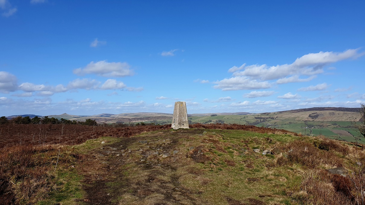
Gun is a hill at the southern end of the Peak District, overlooking the town of Leek in the Staffordshire Moorlands. The hill is mainly moorland with some small wooded areas. Neighbouring peaks to the east are The Roaches, Hen Cloud and Ramshaw Rocks. It is a nature reserve of the Staffordshire Wildlife Trust. Description The hill has height , and there is a trig point at the summit. Having a prominence of , it is a Marilyn. Gun has the Summits on the Air reference G/SP-013. The hill often features in the itinerary of the Tour of Britain cycle race. Gun Moor Gun Moor, area , is a nature reserve of the Staffordshire Wildlife Trust. There is moorland, woodland and blanket bog. Uncommon species of bird such as lesser redpoll and cuckoo may be seen, and bog asphodel flowers in the summer. There is a circular walk, over hilly terrain, that takes 1½ to 2½ hours. Gun Moor was purchased when it came to the market in 2019. The Trust was aware that the moor was important and that it ... [...More Info...] [...Related Items...] OR: [Wikipedia] [Google] [Baidu] |
George's Hayes
George's Hayes is a nature reserve of the Staffordshire Wildlife Trust. It is an ancient woodland, about a mile south-west of the village of Longdon, between Rugeley and Lichfield in Staffordshire, England. It is designated an Area of Outstanding Natural Beauty."George's Hayes" ''Staffordshire Wildlife Trust''. Retrieved 23 May 2021. Description The reserve, total area , is leased from the Girl Guide Association. It consists of George's Hayes (the largest part), Piggot's Bottom and Square Covert, all formerly part of the Beaudesert Estate. There are walking trails through the woods. The reserve is in the area of |


