|
St Stephen-by-Launceston
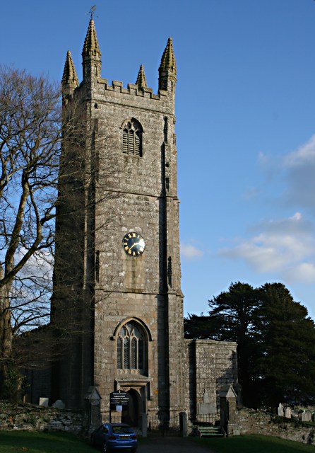
St Stephens by Launceston Rural is a civil parish in the east of Cornwall, England, United Kingdom. It is in the Registration district of Launceston. The population of the parish in the 2001 census was 312, increasing to 360 and including Dutson at the 2011 census. The former parish of ''St Stephens by Launceston'' was abolished in 1894: ''St Stephens by Launceston Urban'' became part of the town of Launceston, while ''St Stephens by Launceston Rural'' became part of Launceston Rural District. The parish lies immediately north west of the town of Launceston and is bounded to the south by the parishes of Launceston, St Thomas the Apostle Rural, and Lawhitton. To the east it is bounded by the River Tamar (the border between Cornwall and Devon). To the north and north-west it is bordered by the parishes of Werrington, North Petherwin and Egloskerry. History In Anglo-Saxon times there was a monastery here dedicated to St Stephen whose canons owned the surrounding land incl ... [...More Info...] [...Related Items...] OR: [Wikipedia] [Google] [Baidu] |
St Stephens Church - Geograph
ST, St, or St. may refer to: Arts and entertainment * Stanza, in poetry * Suicidal Tendencies, an American heavy metal/hardcore punk band * Star Trek, a science-fiction media franchise * Summa Theologica, a compendium of Catholic philosophy and theology by St. Thomas Aquinas * St or St., abbreviation of "State", especially in the name of a college or university Businesses and organizations Transportation * Germania (airline) (IATA airline designator ST) * Maharashtra State Road Transport Corporation, abbreviated as State Transport * Sound Transit, Central Puget Sound Regional Transit Authority, Washington state, US * Springfield Terminal Railway (Vermont) (railroad reporting mark ST) * Suffolk County Transit, or Suffolk Transit, the bus system serving Suffolk County, New York Other businesses and organizations * Statstjänstemannaförbundet, or Swedish Union of Civil Servants, a trade union * The Secret Team, an alleged covert alliance between the CIA and American indus ... [...More Info...] [...Related Items...] OR: [Wikipedia] [Google] [Baidu] |
Werrington, Cornwall
Werrington ( kw, Trewolvredow) is a civil parish and former manor now in Cornwall, England, United Kingdom. Prior to boundary changes it straddled the Tamar and lay within the county of Devon. The portion on the west side was transferred to Cornwall in 1966.Pevsner, Nikolaus & Cherry, Bridget, The Buildings of England: Devon, London, 2004, p.896 It is situated to the west of the Tamar, the traditional boundary between Devon and Cornwall, and north of Launceston. Geography White's ''Devonshire Directory'' (1850) described the parish of Werrington as being near the River Tamar and the Bude Canal and having an area of c. 5,000 acres. Yeolmbridge, Druxton and Eggbeer were then within the parish which was included in Black Torrington Hundred. Druxton Bridge is a Grade II* listed 16th century road bridge. Manor The descent of the manor of Werrington was as follows: Crown Before the Norman Conquest of 1066, the manor of Werrington, in the hundred of Black Torrington, was the ... [...More Info...] [...Related Items...] OR: [Wikipedia] [Google] [Baidu] |
Civil Parishes In Cornwall
A civil parish is a country subdivision, forming the lowest unit of local government in England. There are 218 civil parishes in the ceremonial county of Cornwall, which includes the Isles of Scilly. The county is effectively parished in its entirety; only the unpopulated Wolf Rock is unparished. At the 2001 census, there were 501,267 people living in the current parishes, accounting for the whole of the county's population. The final unparished areas of mainland Cornwall, around St Austell, were parished on 1 April 2009 to coincide with the structural changes to local government in England. Population sizes within the county vary considerably, Falmouth is the most populous with a population of 26,767, recorded in 2011, and St Michael's Mount the least with 29 residents. The county is governed by two separate unitary authorities; Cornwall Council covers mainland Cornwall, while the Isles of Scilly are administered by their own unitary authority. History Parishes arose fr ... [...More Info...] [...Related Items...] OR: [Wikipedia] [Google] [Baidu] |
Joan Rendell
Joan Rendell MBE (1921 – 4 May 2010) was an English historian, writer (mainly on Cornish subjects), and phillumenist. Life Rendell was born in Plymouth, Devon, in 1921. She was the daughter of Gervase Rendell, born 1879 in Eastry, Kent. For most of her life her home was at Werrington, Cornwall. She was the author of more than 30 books, mainly on Cornish subjects. In September 1980 she was made a Bard of Gorsedh Kernow, taking the name ''Scryfer Weryn'' (Writer of Werrington). She was also an avid collector of matchbox covers and had an estimated collection of 300,000. Another interest was corn dolly making, on which she also wrote a book. Rendell died in a fire at her bungalow in Yeolmbridge, near Launceston, Cornwall, on 4 May 2010. Awards Rendell was awarded the MBE in 1958, for raising £100,000 in National Savings In economics, a country's national saving is the sum of private and public saving. It equals a nation's income minus consumption and the governme ... [...More Info...] [...Related Items...] OR: [Wikipedia] [Google] [Baidu] |
Launceston Castle
Launceston Castle is located in the town of Launceston, Cornwall, England. It was probably built by Robert the Count of Mortain after 1068, and initially comprised an earthwork and timber castle with a large motte in one corner. Launceston Castle formed the administrative centre of the new earldom of Cornwall, with a large community packed within the walls of its bailey. It was rebuilt in stone in the 12th century and then substantially redeveloped by Richard of Cornwall after 1227, including a high tower to enable visitors to view his surrounding lands. When Richard's son, Edmund, inherited the castle, he moved the earldom's administration to Lostwithiel, triggering the castle's decline. By 1337, the castle was increasingly ruinous and used primarily as a gaol and to host judicial assizes. The castle was captured by the rebels during the Prayer Book Rebellion of 1549, and was garrisoned by the Royalists during the English Civil War in the 17th century. Towards the end of the ci ... [...More Info...] [...Related Items...] OR: [Wikipedia] [Google] [Baidu] |
St Stephen
Stephen ( grc-gre, Στέφανος ''Stéphanos'', meaning "wreath, crown" and by extension "reward, honor, renown, fame", often given as a title rather than as a name; c. 5 – c. 34 AD) is traditionally venerated as the protomartyr or first martyr of Christianity."St. Stephen the Deacon" , St. Stephen Diaconal Community Association, Roman Catholic Diocese of Rochester. According to the Acts of the Apostles, he was a in the early Church at who angered members of various ... [...More Info...] [...Related Items...] OR: [Wikipedia] [Google] [Baidu] |
Egloskerry
Egloskerry ( kw, Egloskeri) is a village and civil parish in east Cornwall, England, United Kingdom. It is situated approximately northwest of Launceston. Egloskerry parish consists of the village itself and many outlying hamlets and farms, including Tregeare, Badharlick and Trebeath. There are of land and of water in the parish. Population During the earliest census of 1801, the parish had 307 inhabitants. The population increased to a peak in 1841, when 552 people were recorded in the parish. Thereafter, the population steadily decreased to its lowest point of only 275 people in 1981. Since then, there has been a consistent increase in people living in the parish, with 374 persons residing there in 2001. History of Egloskerry and Penheale In the village is the 15th century church of St Keri and St Petroc with original Norman wall and transept. The name comes directly from the Celtic Cornish language Eglos meaning church (the equivalent in modern Welsh being Eglwys). Th ... [...More Info...] [...Related Items...] OR: [Wikipedia] [Google] [Baidu] |
North Petherwin
North Petherwin ( kw, Paderwynn Gledh) is a civil parish and village in the historic county of Devon and the ceremonial county of Cornwall, England, United Kingdom. The village is situated five miles (8 km) northwest of Launceston on a ridge above the River Ottery valley. North Petherwin is a rural parish within the historic boundaries of Devon, having been transferred to Cornwall in 1966. Historically, the Dukes of Bedford have been major land owners in the parish. As well as the church town, settlements include Hellescott, Brazacott, and Maxworthy. The hamlets of Petherwin Gate and Daws are close to the village. The Tamar Otter and Wildlife Centre is North Petherwin's main tourist attraction. As well as having European and Asian Short Clawed otters it has a duck pond, a nature trail where owls can be seen, a restaurant area and a gift shop. Parish church and school The parish church is dedicated to St Paternus (see also South Petherwin) and is unusually grand for a ... [...More Info...] [...Related Items...] OR: [Wikipedia] [Google] [Baidu] |
Devon
Devon ( , historically known as Devonshire , ) is a ceremonial and non-metropolitan county in South West England. The most populous settlement in Devon is the city of Plymouth, followed by Devon's county town, the city of Exeter. Devon is a coastal county with cliffs and sandy beaches. Home to the largest open space in southern England, Dartmoor (), the county is predominately rural and has a relatively low population density for an English county. The county is bordered by Somerset to the north east, Dorset to the east, and Cornwall to the west. The county is split into the non-metropolitan districts of East Devon, Mid Devon, North Devon, South Hams, Teignbridge, Torridge, West Devon, Exeter, and the unitary authority areas of Plymouth, and Torbay. Combined as a ceremonial county, Devon's area is and its population is about 1.2 million. Devon derives its name from Dumnonia (the shift from ''m'' to ''v'' is a typical Celtic consonant shift). During ... [...More Info...] [...Related Items...] OR: [Wikipedia] [Google] [Baidu] |
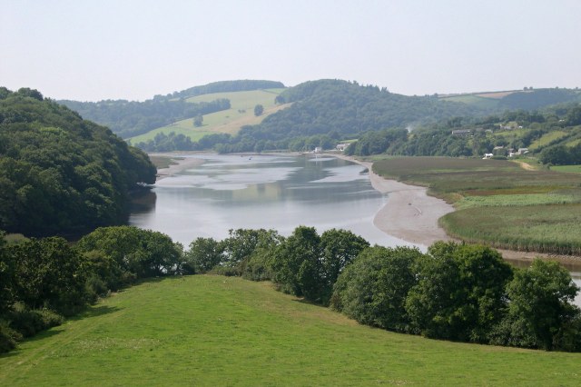
St Stephens By Launceston, Higher New Bridge - Geograph
ST, St, or St. may refer to: Arts and entertainment * Stanza, in poetry * Suicidal Tendencies, an American heavy metal/hardcore punk band * Star Trek, a science-fiction media franchise * Summa Theologica, a compendium of Catholic philosophy and theology by St. Thomas Aquinas * St or St., abbreviation of "State", especially in the name of a college or university Businesses and organizations Transportation * Germania (airline) (IATA airline designator ST) * Maharashtra State Road Transport Corporation, abbreviated as State Transport * Sound Transit, Central Puget Sound Regional Transit Authority, Washington state, US * Springfield Terminal Railway (Vermont) (railroad reporting mark ST) * Suffolk County Transit, or Suffolk Transit, the bus system serving Suffolk County, New York Other businesses and organizations * Statstjänstemannaförbundet, or Swedish Union of Civil Servants, a trade union * The Secret Team, an alleged covert alliance between the CIA and American indus ... [...More Info...] [...Related Items...] OR: [Wikipedia] [Google] [Baidu] |
River Tamar
The Tamar (; kw, Dowr Tamar) is a river in south west England, that forms most of the border between Devon (to the east) and Cornwall (to the west). A part of the Tamar Valley is a World Heritage Site due to its historic mining activities. The Tamar's source is less than from the north Cornish coast, but it flows southward and its course runs across the peninsula to the south coast. The total length of the river is . At its mouth, the Tamar flows into the Hamoaze before entering Plymouth Sound, a bay of the English Channel. Tributaries of the river include the rivers Inny, Ottery, Kensey and Lynher (or ''St Germans River'') on the Cornish side, and the Deer and Tavy on the Devon side. The name Tamar (or Tamare) was mentioned by Ptolemy in the second century in his ''Geography''. The name is said to mean "great water."Furneaux, Robert. The Tamar: A Great Little River. Ex Libris Press. 1992. Foot, Sarah. ''The River Tamar''. Bossiney Books. 1989.Neale, John. Discoverin ... [...More Info...] [...Related Items...] OR: [Wikipedia] [Google] [Baidu] |


