|
Spouting Horn
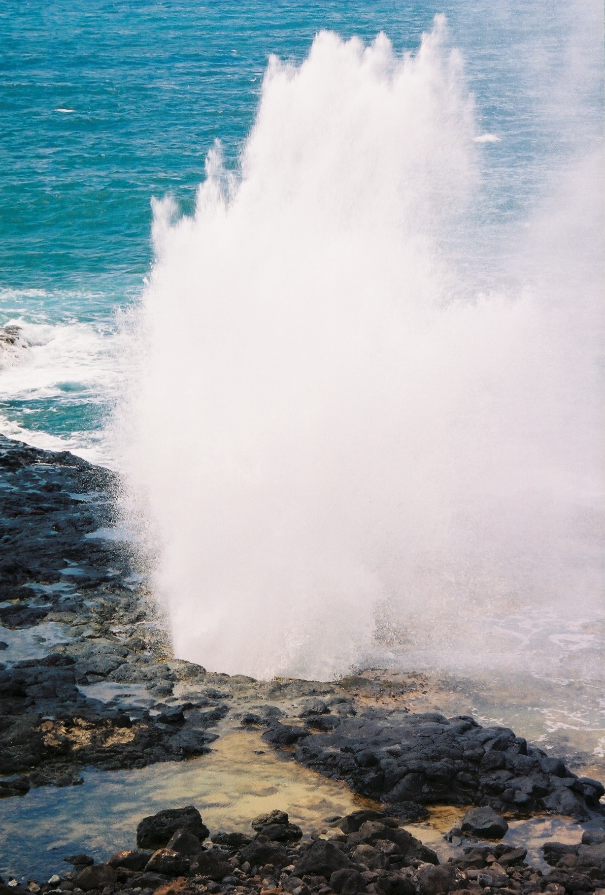
Spouting Horn is a blowhole located on the southern coast of Kauai in the Koloa district. This area of Kauai is known for its crashing waves (nearby Poipu translates to "crashing"). These waves erode lava rocks on the coastline which can create narrow openings, as is the case with Spouting Horn. With every wave, water shoots upward when it is forced through an opening and creates a sound suggestive of hissing. The spray can shoot as high as 50 feet in the air. The original Hawaiian name was ''puhi,'' meaning blowhole. The Spouting Horn is a part of the Koloa Heritage Trail, a 10-mile trail in the Koloa district. Legends According to Hawaiian folklore, a giant lizard (“mo’o” in the Hawaiian language Hawaiian (', ) is a Polynesian language of the Austronesian language family that takes its name from Hawaii, the largest island in the tropical North Pacific archipelago where it developed. Hawaiian, along with English, is an official language o ...) once protected ... [...More Info...] [...Related Items...] OR: [Wikipedia] [Google] [Baidu] |
Blowhole (geology)
In geology, a blowhole or marine geyser is formed as sea caves grow landwards and upwards into vertical shafts and expose themselves towards the surface, which can result in hydraulic compression of sea water that is released through a port from the top of the blowhole. The geometry of the cave and blowhole along with tide levels and swell conditions determine the height of the spray. Mechanics Blowholes are likely to occur in areas where there are crevices, such as lava tubes, in rock along the coast. These areas are often located along fault lines and on islands. As powerful waves hit the coast, water rushes into these crevices and bursts out in a high pressured release. It is often accompanied by a loud noise and wide spray, and for this reason, blowholes are often sites of tourism. Marine erosion on rocky coastlines produce blowholes that are found throughout the world. They are found at intersecting faults and on the windward sides of a coastline where they receive highe ... [...More Info...] [...Related Items...] OR: [Wikipedia] [Google] [Baidu] |
Kauai
Kauai, () anglicized as Kauai ( ), is geologically the second-oldest of the main Hawaiian Islands (after Niʻihau). With an area of 562.3 square miles (1,456.4 km2), it is the fourth-largest of these islands and the 21st largest island in the United States. Nicknamed the Garden Isle, Kauai lies 73 miles (117 km) across the Kauai Channel, northwest of Oahu. This island is the site of Waimea Canyon State Park and the Na Pali Coast State Park. The United States Census Bureau defines Kauai as census tracts 401 through 409 of Kauai County, Hawaii, which comprises all of the county except the islands of Kaʻula, Lehua and Niihau. The 2020 United States census population of the island was 73,298. The most populous town is Kapaa. Etymology and language Hawaiian narrative locates the name's origin in the legend of Hawaiiloa, the Polynesian navigator credited with discovery of the Hawaiian Islands. The story relates how he named the island of Kauai after a favorite son; ... [...More Info...] [...Related Items...] OR: [Wikipedia] [Google] [Baidu] |
Koloa
Kōloa is an unincorporated community and census-designated place (CDP) in Kauai County, Hawaii, United States. The population was 2,231 at the 2020 census, up from 1,942 at the 2000 census. The first successful sugarcane plantation in the Hawaiian Islands was started here in 1835. It became a part of Grove Farm in 1948. The name ''Kōloa'' is often incorrectly translated as "native duck", which is the correct translation for the similar-looking ''koloa'' (without the macron). ''Kōloa'' means "a long cane with a crook." According to one account, the district of Kōloa was named for a steep rock called Pali-o-kō-loa which was found in Waikomo Stream. Geography Kōloa is located on the southern side of the island of Kauai at (21.907137, -159.465877). It is bordered to the northwest by Omao and to the south by Poipu. According to the United States Census Bureau, the CDP has a total area of , all of it recorded as land. Waikomo Stream passes through the center of the commu ... [...More Info...] [...Related Items...] OR: [Wikipedia] [Google] [Baidu] |
Poipu
Poipū (literally, "crashing waves" in Hawaiian) is a census-designated place (CDP) in Kauai County on the southern side of the island of Kauai in the U.S. state of Hawaii. The population was 1,299 at the 2020 census. The town features a group of high-end hotels, resorts and two main shopping centers. Po’ipū is a very touristy spot and is home to huge resorts like the Grand Hyatt. Geography Poipū is located at (21.884079, -159.464195). It is bordered to the north by Koloa and to the south by the Pacific Ocean. According to the United States Census Bureau, the CDP has a total area of , of which are land and , or 11.08%, are water. Demographics As of the census of 2000, there were 1,075 people, 472 households, and 311 families residing in the CDP. The population density was . There were 1,969 housing units at an average density of . The racial makeup of the CDP was 69.4% White, 0.1% African American, 0.4% Native American, 16.9% Asian, 2.0% Pacific Islander, 0.7% fro ... [...More Info...] [...Related Items...] OR: [Wikipedia] [Google] [Baidu] |
Hawaiian Language
Hawaiian (', ) is a Polynesian language of the Austronesian language family that takes its name from Hawaii, the largest island in the tropical North Pacific archipelago where it developed. Hawaiian, along with English, is an official language of the US state of Hawaii. King Kamehameha III established the first Hawaiian-language constitution in 1839 and 1840. For various reasons, including territorial legislation establishing English as the official language in schools, the number of native speakers of Hawaiian gradually decreased during the period from the 1830s to the 1950s. Hawaiian was essentially displaced by English on six of seven inhabited islands. In 2001, native speakers of Hawaiian amounted to less than 0.1% of the statewide population. Linguists were unsure if Hawaiian and other endangered languages would survive. Nevertheless, from around 1949 to the present day, there has been a gradual increase in attention to and promotion of the language. Public Hawaiian-langua ... [...More Info...] [...Related Items...] OR: [Wikipedia] [Google] [Baidu] |
Hawaiian Folklore
Folklore in Hawaii in modern times is a mixture of various aspects of Hawaiian mythology and various urban legends that have been passed on regarding various places in the Hawaiian islands. The following is a partial list of some of these legends. Ancient Hawaiian folklore Night marchers According to Hawaiian legend, night marchers (''huaka‘i po'' in Hawaiian) are ghosts of ancient warriors. They supposedly roam large sections of the island chain, and can be seen by groups of torches. They can usually be found in areas that were once large battlefields (the Nuuanu Pali on the island of Oahu is a good example.) Legend has it that if you look a night marcher straight in the eye, you will be forced to walk among them for eternity, but if you have a relative taken by them, you will be spared. Hawaiians say that in the presence of night marchers, one should lie down on their stomach, face down to avoid eye contact, stay quiet, breathe shallowly, and don't move. Some say that th ... [...More Info...] [...Related Items...] OR: [Wikipedia] [Google] [Baidu] |
Hawaiian Language
Hawaiian (', ) is a Polynesian language of the Austronesian language family that takes its name from Hawaii, the largest island in the tropical North Pacific archipelago where it developed. Hawaiian, along with English, is an official language of the US state of Hawaii. King Kamehameha III established the first Hawaiian-language constitution in 1839 and 1840. For various reasons, including territorial legislation establishing English as the official language in schools, the number of native speakers of Hawaiian gradually decreased during the period from the 1830s to the 1950s. Hawaiian was essentially displaced by English on six of seven inhabited islands. In 2001, native speakers of Hawaiian amounted to less than 0.1% of the statewide population. Linguists were unsure if Hawaiian and other endangered languages would survive. Nevertheless, from around 1949 to the present day, there has been a gradual increase in attention to and promotion of the language. Public Hawaiian-langua ... [...More Info...] [...Related Items...] OR: [Wikipedia] [Google] [Baidu] |
Landforms Of Kauai
A landform is a natural or anthropogenic land feature on the solid surface of the Earth or other planetary body. Landforms together make up a given terrain, and their arrangement in the landscape is known as topography. Landforms include hills, mountains, canyons, and valleys, as well as shoreline features such as bays, peninsulas, and seas, including submerged features such as mid-ocean ridges, volcanoes, and the great ocean basins. Physical characteristics Landforms are categorized by characteristic physical attributes such as elevation, slope, orientation, stratification, rock exposure and soil type. Gross physical features or landforms include intuitive elements such as berms, mounds, hills, ridges, cliffs, valleys, rivers, peninsulas, volcanoes, and numerous other structural and size-scaled (e.g. ponds vs. lakes, hills vs. mountains) elements including various kinds of inland and oceanic waterbodies and sub-surface features. Mountains, hills, plateaux, ... [...More Info...] [...Related Items...] OR: [Wikipedia] [Google] [Baidu] |


.jpg)