|
Southwest Miramichi River
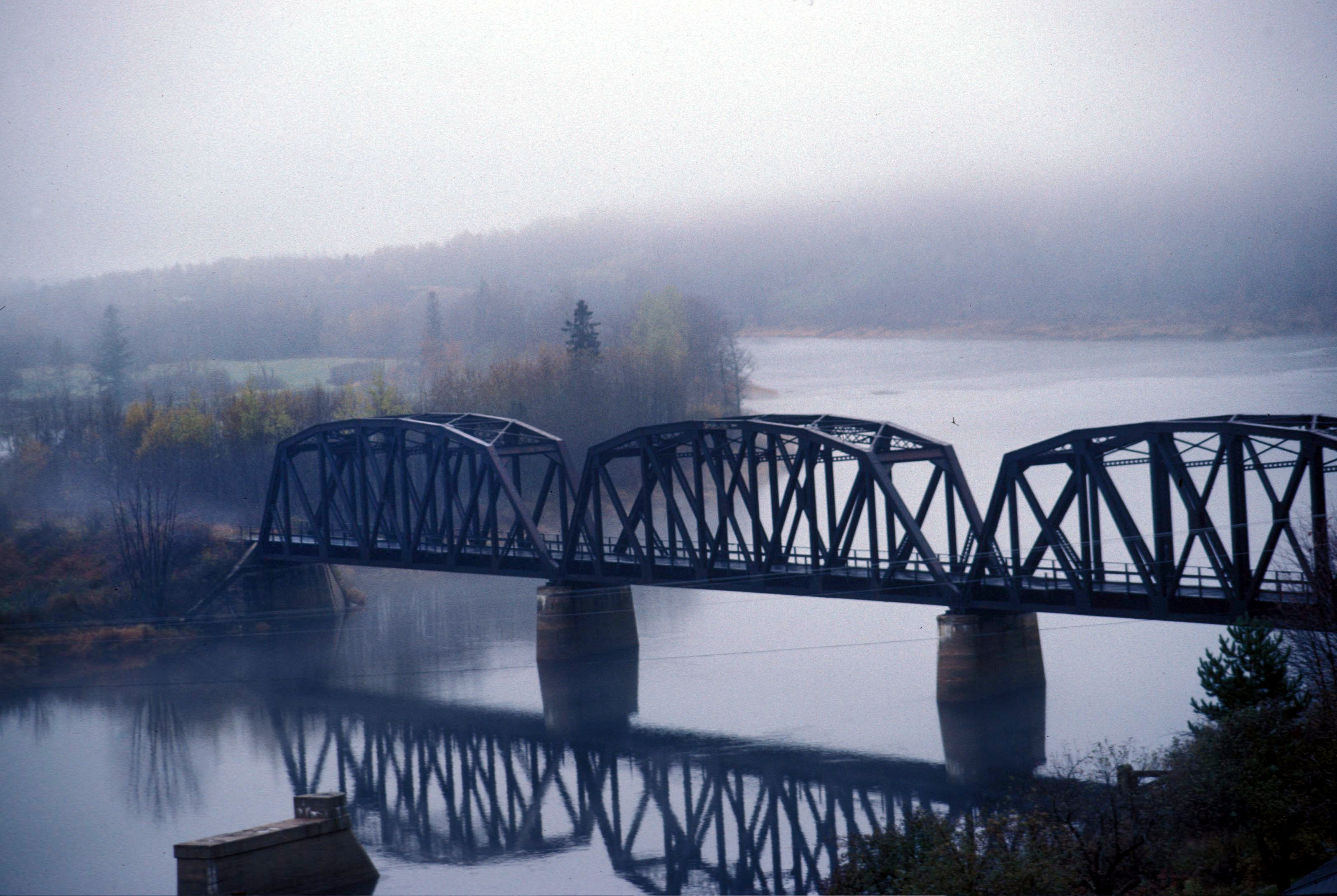
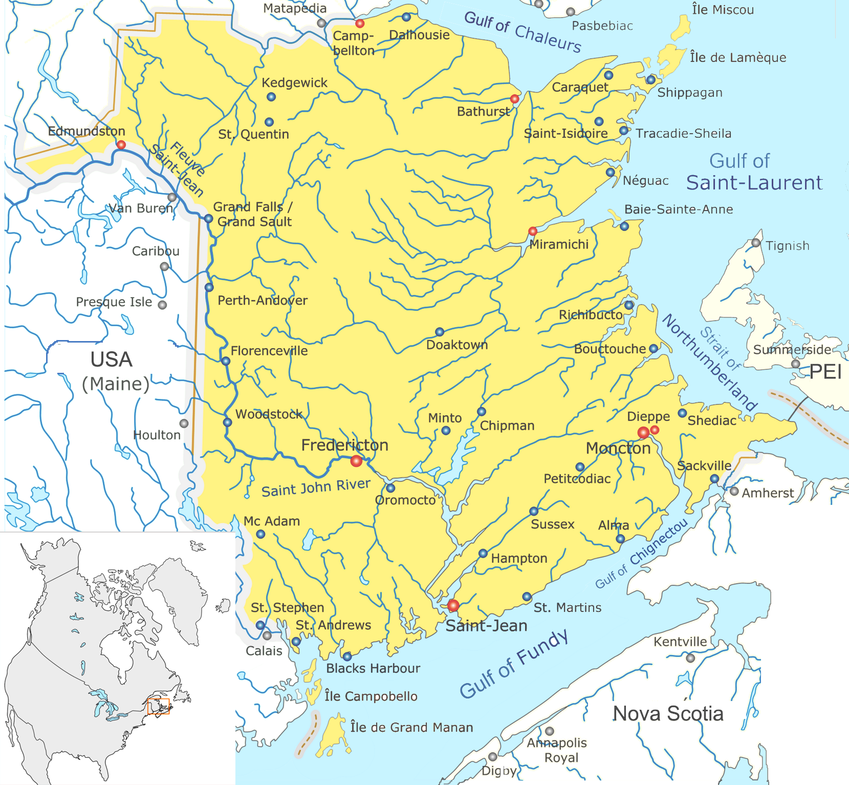
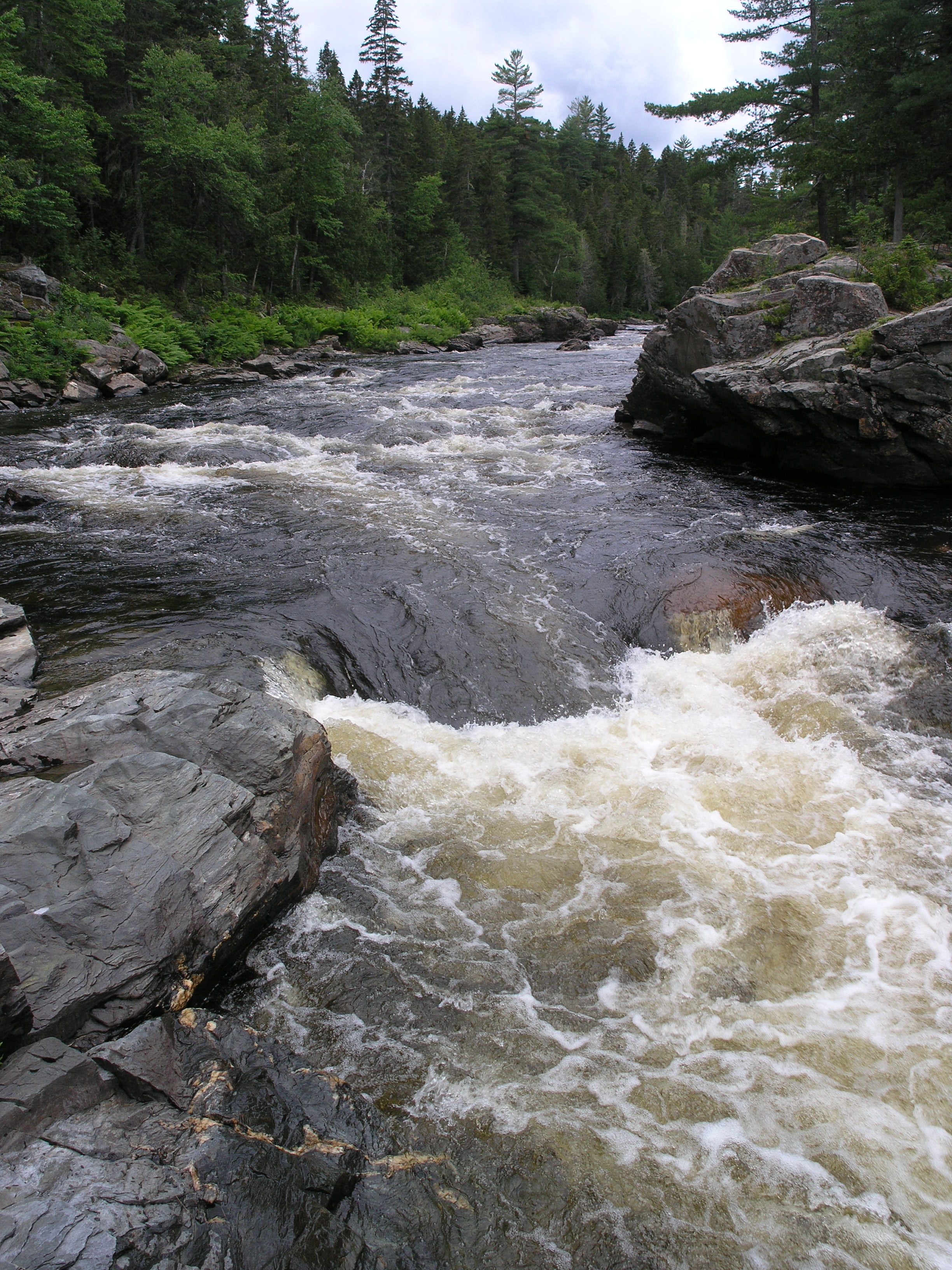
The Southwest Miramichi River is a river in New Brunswick, Canada. The river has its origin in Carleton County, at Miramichi Lake in the Miramichi Highlands (a part of the Appalachian Mountains). Its two branches join near the hamlet of Juniper, Carleton County. Flowing initially southeast through heavy forests and large hills, the Southwest Miramichi River enters Northumberland County, is joined by the Taxis River at Boiestown then the larger volume flows northeast. The river is tidal below Renous-Quarryville. The Southwest Miramichi River joins the Northwest Miramichi River at Newcastle to form the Miramichi River. The river is noted for Atlantic Salmon fishing. It is navigable by canoe throughout much of its length. Nearly every bend in the river, for example Push and Be Damned Rapids, has a distinctive name reflecting the importance of the river to fishermen, canoeists, and lumbermen. It is sometimes referred to as the "Main Southwest Miramichi River" to distinguish ... [...More Info...] [...Related Items...] OR: [Wikipedia] [Google] [Baidu] |
Miramichi Doaktown
The name "Miramichi" was first applied to a region in the northeast of New Brunswick, Canada, and has since been applied to other places in Canada and the United States. Although other interpretations have been suggested, it is believed that "Miramichi" was derived from the Innu language, Montagnais words "Maissimeu Assi" (meaning Mi'kmaq people, Mi'kmaq Land), and was perhaps introduced for use in European languages by Jacques Cartier in 1535.Rayburn, A. (1975) Geographical Names of New Brunswick. Toponymy Study 2. Surveys and Mapping Branch, Energy Mines and Resources Canada, Ottawa Miramichi is used in the names of many places, including: Settlements Canada ;New Brunswick *Miramichi, New Brunswick, a city in northern New Brunswick **Nelson-Miramichi, New Brunswick, a dissolved community that was merged into Miramichi in a 1995 municipal amalgamation ;New Brunswick electoral districts * Miramichi—Grand Lake, the current federal electoral district *Miramichi (electoral distri ... [...More Info...] [...Related Items...] OR: [Wikipedia] [Google] [Baidu] |
Miramichi River
The Miramichi River is a river located in the east-central part of New Brunswick, Canada. The river drains into Miramichi Bay in the Gulf of St. Lawrence. The name may have been derived from the Montagnais words "Maissimeu Assi" (meaning Mi'kmaq Land), and it is today the namesake of the Miramichi Herald at the Canadian Heraldic Authority. Geography The Miramichi River watershed drains a territory comprising one-quarter of New Brunswick's territory, measuring approximately 13,000 km² of which 300 km² is an estuarine environment on the inner part of Miramichi Bay. The watershed roughly corresponds to Northumberland County, but also includes sections of Victoria County, Carleton County, and York County and smaller parts of Gloucester County and Sunbury County. The Miramichi River meander length measures approximately 250 km and comprises two important branches, the Southwest Miramichi River and the Northwest Miramichi River, each having their respe ... [...More Info...] [...Related Items...] OR: [Wikipedia] [Google] [Baidu] |
List Of Rivers Of New Brunswick
This is a List of bodies of water in the Canadian province of New Brunswick, including waterfalls. New Brunswick receives precipitation year-round, which feeds numerous streams and rivers. There are two main discharge basins: the Gulf of Saint Lawrence to the east and north and the Bay of Fundy to the south. The major rivers are the Saint John River (Wolastoq) and the Miramichi River. Bodies of water See also *List of bays in New Brunswick *List of lakes in New Brunswick *List of mountains in New Brunswick *List of islands of New Brunswick *List of waterfalls in Canada References External links * *Map of New Brunswick Watershed Groups and Provisional Water Classification* * Map of the main rivers of New Brunswick in French * {{Rivers of New Brunswick New Brunswick * Bodies of water New Brunswick New Brunswick (french: Nouveau-Brunswick, , locally ) is one of the thirteen provinces and territories of Canada. It is one of the three Maritime provinces and one of ... [...More Info...] [...Related Items...] OR: [Wikipedia] [Google] [Baidu] |
Barnaby River
The Barnaby River is a tributary of the Miramichi River in New Brunswick, Canada. The Barnaby River rises in southern Northumberland County, close to the Kent County, New Brunswick boundary and flows north and west into the south side of the Southwest Miramichi River at the community of Kirkwood, New Brunswick. The Barnaby River watershed is entirely rural, dominated by forests and small farms in the communities of Lower Barnaby, Upper Barnaby, and the Community of Barnaby River. River Crossings * New Brunswick Route 118 south of Kirkwood close to Barnaby Island * between Lower Barnaby & Upper Barnaby, * South East of the Community of Barnaby River * North of Murray Settlement on New Brunswick Route 126 * Route 126 north of Collette See also *List of rivers of New Brunswick This is a List of bodies of water in the Canadian province of New Brunswick, including waterfalls. New Brunswick receives precipitation year-round, which feeds numerous streams and rivers. There are ... [...More Info...] [...Related Items...] OR: [Wikipedia] [Google] [Baidu] |
Renous River
The Renous River is a tributary of the Southwest Miramichi River in New Brunswick, Canada. The Renous River has its origins south of Holmes Lake in the Miramichi Highlands, part of the Appalachian Mountains, in the northwest corner of Northumberland County. Renous River system consists of the two major branches, the North and the South, which merge and flow through heavy forests to join the Southwest Miramichi River at the village of Quarryville in Renous. The river is noted for Atlantic salmon fishing. The annual run of Atlantic salmon occurs from June through October each summer and early autumn. Fishing is restricted to fly fishing only and all large salmon must be released. Salmon fishing in this river is generally best after a spate. Popular salmon flies on the Renous River include the Black Bear series, Butterfly, and Silver Cosseboom. Small deer-hair Buck Bugs are a popular fly in normal water conditions. There is also a local fly pattern known as the Renous Spe ... [...More Info...] [...Related Items...] OR: [Wikipedia] [Google] [Baidu] |
Bartholomew River
The Bartholomew River is a tributary of the main Southwest Miramichi River in New Brunswick, Canada. The Bartholomew River begins in the hills between the Main Southwest Miramichi and Dungarvon Rivers at approximately N46.60, W66.30, in western Northumberland County. Its two branches (north and south) run parallel less than 5 km from each other for roughly 10 km where they converge just east of a logging road at approximately N46.62, W66.20. It then runs parallel to and in between the Dungarvon River to the north, and Main Southwest Miramichi River to the south until it empties into the Southwest Miramichi at Miramichi River Valley. The Southwest Miramichi River then joins the Northwest Miramichi River at Newcastle to form the Miramichi River. This river was used for driving logs as part of the lumber industry in the early part of the 20th century. Today, it is used for mainly for canoeing and fishing. Fishermen note the presence of trout and atlantic salmon. Canoei ... [...More Info...] [...Related Items...] OR: [Wikipedia] [Google] [Baidu] |
Cains River
The Cains River is a river in New Brunswick, Canada. It is 113 kilometres long. The Cains River has its origins in the " Bantalor Wildlife Management Area" in the eastern part of York County, near the boundary with Sunbury County. Generally flowing northeast through heavy forests, the Cains River joins the Southwest Miramichi River at the community of Howard. The Southwest Miramichi River then joins the Northwest Miramichi River at Newcastle, forming the Miramichi River and becomes tidal. Much of the upper Cains River flows through crown land, owned and managed by the provincial government, and therefore cannot be purchased for private use. It is public water and therefore can be used by any fisherman. The Cains River is classified as salmon water from the mouth to the North Cains and requires a guide for non-resident anglers. [...More Info...] [...Related Items...] OR: [Wikipedia] [Google] [Baidu] |
Mi'kmaq People
The Mi'kmaq (also ''Mi'gmaq'', ''Lnu'', ''Miꞌkmaw'' or ''Miꞌgmaw''; ; ) are a First Nations in Canada, First Nations people of the Indigenous peoples of the Northeastern Woodlands, Northeastern Woodlands, indigenous to the areas of Canada's Atlantic Canada, Atlantic Provinces and the Gaspé Peninsula of Quebec as well as the northeastern region of Maine. The traditional national territory of the Mi'kmaq is named Miꞌkmaꞌki (or Miꞌgmaꞌgi). There are 170,000 Mi'kmaq people in the region, (including 18,044 members in the recently formed Qalipu First Nation in Newfoundland.) Nearly 11,000 members speak Miꞌkmaq language, Miꞌkmaq, an Eastern Algonquian languages, Eastern Algonquian language. Once written in Miꞌkmaq hieroglyphic writing, Miꞌkmaw hieroglyphic writing, it is now written using most letters of the Latin alphabet. The Mi'kmaq, Maliseet, and Passamaquoddy, Pasamaquoddy nations signed a series of treaties known as the Covenant Chain of Peace and Friendship ... [...More Info...] [...Related Items...] OR: [Wikipedia] [Google] [Baidu] |
Little Southwest Miramichi River
The Little Southwest Miramichi River is a river in Northumberland County, New Brunswick, Canada. In Mi'kmaq it is referred to as "Tooadook". This river has its origins at Gover Lake in the Miramichi Highlands, part of the Appalachian Mountains. The river flows between the Northwest Miramichi River, to its north, and the Renous River to its south. It joins the Northwest Miramichi River at Red Bank, whereas the Renous River joins the Southwest Miramichi River at Renous. The Northwest Miramichi River then joins the Southwest Miramichi River at Newcastle to form the Miramichi River. The river is noted for Atlantic Salmon fishing. Many of the upper and middle stretches of the river are whitewater, and dangerous for canoeing; the lower part of the river is much more commonly canoed. Tributaries * Northwest Branch Little Southwest Miramichi River * Lower North Branch Little Southwest Miramichi River * North Pole Stream * Tuadook River "Lower North Branch Little Southwest Mira ... [...More Info...] [...Related Items...] OR: [Wikipedia] [Google] [Baidu] |
Push And Be Damned Rapids
"Push and Be Damned Rapids" is the evocative name for rapids on the Southwest Miramichi River, one of the many tributaries of the Miramichi River, New Brunswick New Brunswick (french: Nouveau-Brunswick, , locally ) is one of the thirteen provinces and territories of Canada. It is one of the three Maritime provinces and one of the four Atlantic provinces. It is the only province with both English and ..., Canada, near the village of Juniper. The name refers to the difficulty of "poling", or pushing a canoe upstream with a pole, on these particular rapids.Geographical Names of Canada References Landforms of York County, New Brunswick Bodies of water of New Brunswick Rapids of Canada {{NewBrunswick-geo-stub ... [...More Info...] [...Related Items...] OR: [Wikipedia] [Google] [Baidu] |
Canoe
A canoe is a lightweight narrow water vessel, typically pointed at both ends and open on top, propelled by one or more seated or kneeling paddlers facing the direction of travel and using a single-bladed paddle. In British English, the term ''canoe'' can also refer to a kayak, while canoes are called Canadian or open canoes to distinguish them from kayaks. Canoes were developed by cultures all over the world, including some designed for use with sails or outriggers. Until the mid-19th century, the canoe was an important means of transport for exploration and trade, and in some places is still used as such, sometimes with the addition of an outboard motor. Where the canoe played a key role in history, such as the Northern United States, Canada, and New Zealand, it remains an important theme in popular culture. Canoes are now widely used for competition and pleasure, such as racing, whitewater, touring and camping, freestyle and general recreation. Canoeing has been part ... [...More Info...] [...Related Items...] OR: [Wikipedia] [Google] [Baidu] |
Atlantic Salmon
The Atlantic salmon (''Salmo salar'') is a species of ray-finned fish in the family Salmonidae. It is the third largest of the Salmonidae, behind Siberian taimen and Pacific Chinook salmon, growing up to a meter in length. Atlantic salmon are found in the northern Atlantic Ocean and in rivers that flow into it. Most populations are anadromous, hatching in streams and rivers but moving out to sea as they grow where they mature, after which the adults seasonally move upstream again to spawn. When the mature fish re-enter rivers to spawn, they change in colour and appearance. Some populations of this fish only migrate to large lakes, and are "landlocked", spending their entire lives in freshwater. Such populations are found throughout the range of the species. Unlike Pacific species of salmon, ''S. salar'' is iteroparous, which means it can survive spawning and return to sea to repeat the process again in another year. Such individuals can grow to extremely large sizes, althoug ... [...More Info...] [...Related Items...] OR: [Wikipedia] [Google] [Baidu] |


.jpg)


