|
Southport–Burleigh Road
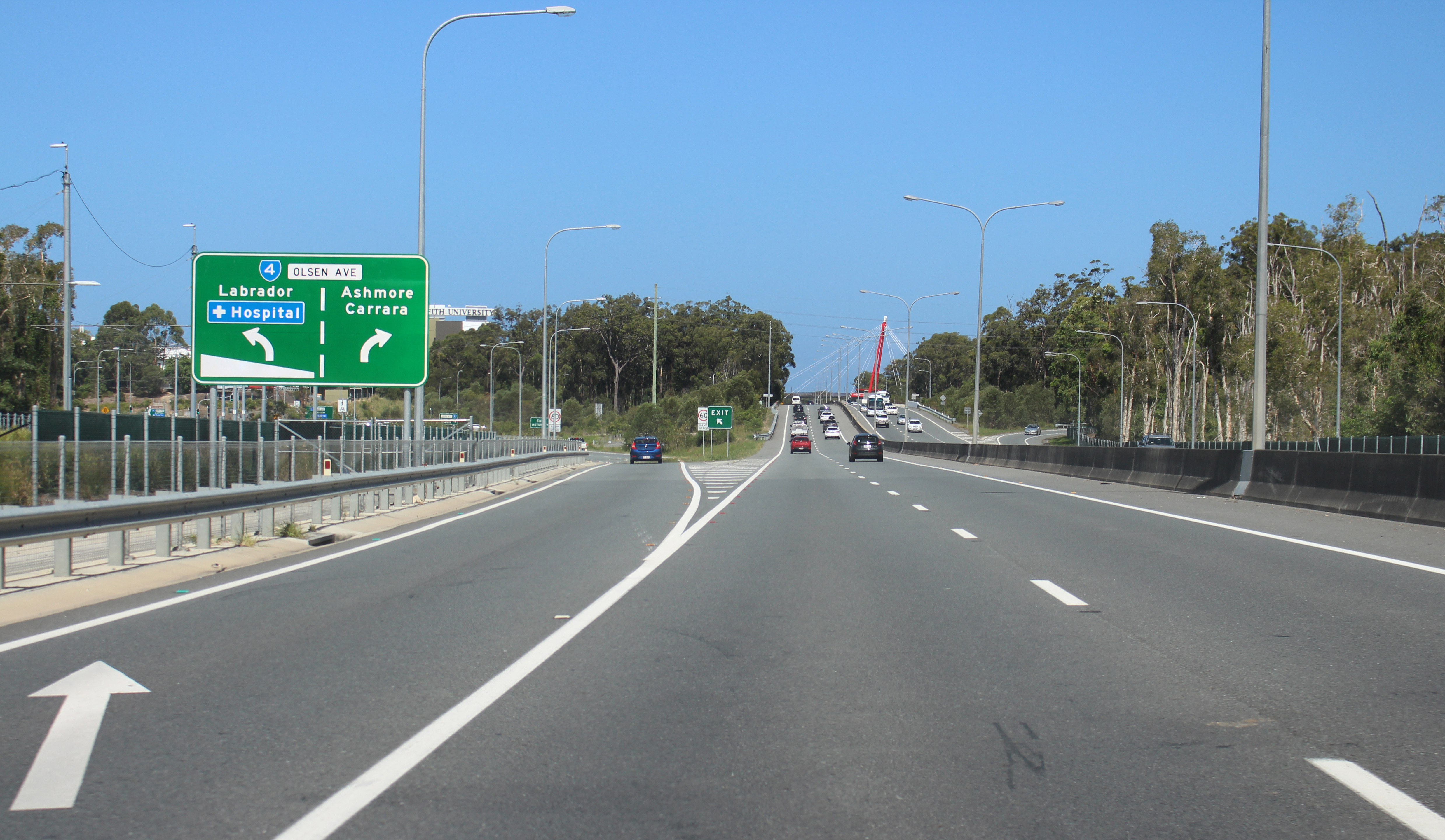
Southport–Burleigh Road is a road in the city of Gold Coast in the Australian state of Queensland. It is designated as State Route 3 and runs from Southport to Burleigh Heads. It includes four former suburban streets, which are still known locally by their original names. They are (from north to south): * High Street * Ferry Road * Bundall Road * Bermuda Street It is a state-controlled district road (number 103). High Street High Street starts at an intersection with Stevens Street and runs south-west to North Street, where it turns south-east and becomes part of Southport-Burleigh Road. It continues through the Southport CBD until it reaches Queen Street, where it becomes Ferry Road. Major intersections The road is in the Gold Coast local government area. See also * List of road routes in Queensland * List of numbered roads in Queensland Numbered roads in Queensland provides readers with basic information about the many roads in the state, particularly those ... [...More Info...] [...Related Items...] OR: [Wikipedia] [Google] [Baidu] |
Southport, Queensland
Southport is a coastal Suburbs and localities (Australia), suburb in the City of Gold Coast in Queensland, Australia. In the , Southport had a population of 31,908 people. It contains the Gold Coast central business district. Geography Southport is bounded to the south-east by the Nerang River (), where it flows into Gold Coast Broadwater, The Broadwater, the southernmost end of Moreton Bay, which then bounds the suburb to the north-east. King Reach is a reach () of the Nerang River. It was named in honour of Jeremy King (3 March 1935 - 13 October 2010) for his coaching, involvement and dedication to the sport of rowing within the Southport district. He was involved with rowing for over 50 years. It was gazetted on 28 November 2014. Ray Newlyn Channel is a channel () in The Broadwater. It is an east-to-west channel across The Broadwater to Main Beach, Queensland, Main Beach avoiding two large sandbanks. Raymond Paul (Ray) Newlyn was a Southport resident and a Commander in ... [...More Info...] [...Related Items...] OR: [Wikipedia] [Google] [Baidu] |
City Of Gold Coast
The City of Gold Coast is the local government area spanning the Gold Coast, Queensland, Australia and surrounding areas. With a population of 606,774 it is the second most populous local government area in Australia (City of Brisbane being the largest). Its council maintains a staff of over 2,500. It was established in 1948, but has existed in its present form since 2008. It is on the border with New South Wales with the Tweed Shire to the south in New South Wales. History Early history By the late 1870s, the Government of Queensland had become preoccupied with the idea of getting local residents to pay through rates for local services, which had become a massive cost to the colony and were undermaintained in many areas. The McIlwraith government initiated the ''Divisional Boards Act 1879'' which created a system of elected divisional boards covering most of Queensland. It was assented by the Governor on 2 October 1879, and on 11 November 1879, the Governor gazetted a list o ... [...More Info...] [...Related Items...] OR: [Wikipedia] [Google] [Baidu] |
List Of Numbered Roads In Queensland
Numbered roads in Queensland provides readers with basic information about the many roads in the state, particularly those for which there is no Wikipedia article. It also assists editors with the task of adding road information to existing and new road articles. It is a list of all numbered roads in Queensland, Australia, as defined by the Department of Transport and Main Roads (TMR). The route and end-points of any numbered road can be determined by accessing the appropriate TMR map through this second reference document. There appears to be no easy way to determine which map to access for a particular road, but each map includes a numeric list of the roads to be found thereon. The list is presented in source document sequence to facilitate updating from future versions of that document. To find a road by name first sort on name and then use the index. To arrange all occurrences of a name in number order first sort on number and then proceed as above. Table Except where oth ... [...More Info...] [...Related Items...] OR: [Wikipedia] [Google] [Baidu] |
List Of Road Routes In Queensland
Road routes in Queensland assist drivers navigating roads throughout the state, by identifying important through-routes. Queensland is in the process of converting to an alphanumeric route numbering system, with a letter denoting the importance and standard of the route. The previous shield-based system consisted of various route types – national highways, national routes, and state routes – with each type depicted by a different route marker design. Some routes have been converted to the alphanumeric system, while other routes are being maintained as shield-based routes – but with signs designed to be subsequentially retrofitted with a replacement alphanumeric route. Tourist drives will continue to use a shield-based system. Unless stated otherwise, all information in this article is derived from Google Maps. Alphanumeric routes Brisbane routes Regional routes Active Metroads National Highways and Routes State Routes State Routes on the Gold Coast and in re ... [...More Info...] [...Related Items...] OR: [Wikipedia] [Google] [Baidu] |
Broadbeach, Queensland
Broadbeach is a suburb in the City of Gold Coast, Queensland, Australia. In the , Broadbeach had a population of 5,514 people. Geography Development in the area today mostly incorporates low rise structures, consisting of single bedroom houses and apartment blocks. Much of the suburb consists of canal waterways, including Lake Intrepid that are linked to the Nerang River. The suburb contains a major road intersection between Nerang - Broadbeach Road and the Gold Coast Highway. History In circa 1924, 70 allotments were advertised as "Mermaid Beach Estate" located at Mermaid Beach and Broadbeach to be auctioned by R. G. Oates Estates. The estate map has 3 estates for sale at Mermaid Beach and Broadbeach. The estates were divided in two by the "New Coastal Road" running through the Gold Coast. While residential housing lots were selling successfully in the state government developed Broadbeach township from 1934, and the area had good bitumen roads that were described as 's ... [...More Info...] [...Related Items...] OR: [Wikipedia] [Google] [Baidu] |
Carrara, Queensland
Carrara is a Suburbs and localities (Australia), suburb in the City of Gold Coast, Queensland, Australia. In the , Carrara had a population of 12,060 people. Geography Carrara is bounded to the east by the southern bank of the Nerang River and to the west mostly by the Pacific Motorway (Brisbane–Brunswick Heads), Pacific Motorway. Carrara is built on the Guragunbah Plain () which was officially named in 2000, having previously been unofficially known as the Merrimac-Carrara Flood Plain. It is the home of Carrara Stadium (also known as Metricon Stadium), the purpose-built cricket and Australian rules football ground where the Gold Coast Suns began playing matches in 2011. History The name ''Carrara'' comes from the Aboriginal word ''Karara'' meaning ''long flat''. Carrara was first used by the Manchester Cotton Company as a cotton plantation that began in the early 1860s. Carrara Provisional School opened in February 1902 in premises lent by farmer Francis Parr until a ... [...More Info...] [...Related Items...] OR: [Wikipedia] [Google] [Baidu] |
Ashmore Road
Ashmore is a village and civil parish in the North Dorset district of Dorset, England, southwest of Salisbury. The village is centred on a circular pond and has a church and several stone cottages and farms, many with thatched roofs. It is the highest village in the county with the contour passing close to the village church (although the north side of the town of Shaftesbury, Dorset, is slightly higher at ). The pond or "mere" gave the village its original name of "Ash-mere".North Dorset District Council,''North Dorset Official District Guide'', Home Publishing Co. Ltd.,c.1983. p30 In the 2011 census the parish had a population of 188. History Three round barrows have been found in the parish: two barrows south of the village near Well Bottom, and one west of the village near the boundary with the village of Fontmell Magna; this latter barrow was excavated in the 19th century and bones were recovered. Ashmore may have been the site of a Neolithic market place or s ... [...More Info...] [...Related Items...] OR: [Wikipedia] [Google] [Baidu] |
Labrador, Queensland
Labrador is a coastal suburb in the City of Gold Coast, Queensland, Australia. In the , Labrador had a population of 18,261 people. Geography The suburb overlooks the Gold Coast Broadwater to the east and Southport on the southern border. There are many Aboriginal cultural sites across the Gold Coast. Labrador was part of traditional country for several families, due to the abundance of shell fish, mudcrabs, oysters and waterfowl in the area. The two local peoples most spoken of by the early settlers were the Yugambeh and Kombumerri Aboriginals. The Gold Coast City Council publishes the Labrador Heritage Walk, and produces a guide booklet which includes twenty one places of historical interest. Three mapped walks have been designed to note the points of interest. History In April 1878 sugar farmer and investor Robert Muir and investor John Lennon bought of portion 62 of Crown Land, originally known as Southport North. Portion 62 fronted the Broadwater from Biggera Creek ... [...More Info...] [...Related Items...] OR: [Wikipedia] [Google] [Baidu] |
Gold Coast Highway
Gold Coast Highway links the coastal suburbs of the Gold Coast in south eastern Queensland such as Miami, Mermaid Beach, Tugun, Bilinga to the Tweed Heads suburb of Tweed Heads West in New South Wales. At in length, the highway runs just west of Pacific Motorway at Pacific Pines to Pacific Motorway at Tweed Heads West. It passes through the numerous popular tourist areas including Surfers Paradise and Broadbeach, a commercial centre at Southport, residential areas, shopping centres and the Gold Coast (Coolangatta) Airport. It is characterised by a variety of urban landscapes, ranging from: * high-density high rises between Southport and Broadbeach * low rise apartments in Palm Beach and Bilinga * low-rise residential areas at Miami, Tugun and Labrador * shopping at Southport and Broadbeach * entertainment precincts at Broadbeach and Surfers Paradise * historic motels at Mermaid Beach * light industry at Arundel * native bushland at Coombabah Lake wetlands, Burleigh ... [...More Info...] [...Related Items...] OR: [Wikipedia] [Google] [Baidu] |
Smith Street Motorway
Smith Street Motorway (SR10) (or the Smith Street extension) is a motorway grade extension of Smith Street. It connects Southport, the Gold Coast's CBD to the Pacific Motorway. The road is motorway standard for from the Pacific Motorway (exit 66), until the Parklands Drive intersection. It then runs as a divided road until High Street in Southport, where it becomes North Street until the Gold Coast Highway. The motorway passes by the city's Health and Knowledge precinct, home to Griffith University, Gold Coast University Hospital and Gold Coast Private Hospital. A new iconic red bridge for pedestrians across Smith Street was completed in early 2007. The red bridge joins the existing parklands campus of Griffith University to the new site on the southern side of Smith Street. The highest point of the highway is 45 metres at the Smith Street interchange near the Pacific motorway. Interchanges and intersections The entire motorway is in the City of Gold Coast local governm ... [...More Info...] [...Related Items...] OR: [Wikipedia] [Google] [Baidu] |
Bermuda Street
Bermuda Street is a road on the Gold Coast from Bundall to Burleigh Heads in Queensland, Australia. Originally a suburban street, it is now part of Southport–Burleigh Road, a state controlled road (State Route 3) The highest point of the road is 22 metres at the junction with the Pacific Motorway in Burleigh Heads (Southern End). Bermuda Street is the southern extension of Bundall Road (a much older thoroughfare) across the Nerang River and through many newer suburbs to the Pacific Motorway at Burleigh Heads. Not all maps agree on the precise point at which the name changes, but the most commonly accepted is at the intersection with Boomerang Crescent, about 300 metres south of the intersection of Bundall Road with Ashmore Road. Major intersections * Nerang–Broadbeach Road Nerang–Broadbeach Road is a road on the Gold Coast, Queensland, Australia. It is classified a state-controlled district road, and is part of State Route 90. The eastern section is also know ... [...More Info...] [...Related Items...] OR: [Wikipedia] [Google] [Baidu] |
Ashmore Road, Gold Coast
Ashmore is a village and civil parish in the North Dorset district of Dorset, England, southwest of Salisbury. The village is centred on a circular pond and has a church and several stone cottages and farms, many with thatched roofs. It is the highest village in the county with the contour passing close to the village church (although the north side of the town of Shaftesbury, Dorset, is slightly higher at ). The pond or "mere" gave the village its original name of "Ash-mere".North Dorset District Council,''North Dorset Official District Guide'', Home Publishing Co. Ltd.,c.1983. p30 In the 2011 census the parish had a population of 188. History Three round barrows have been found in the parish: two barrows south of the village near Well Bottom, and one west of the village near the boundary with the village of Fontmell Magna; this latter barrow was excavated in the 19th century and bones were recovered. Ashmore may have been the site of a Neolithic market place or s ... [...More Info...] [...Related Items...] OR: [Wikipedia] [Google] [Baidu] |


