|
Southern Limestone Alps
The Southern Limestone Alps ( it, Alpi Sud-orientali, german: Südliche Kalkalpen), also called the Southern Calcareous Alps, are the ranges of the Eastern Alps south of the Central Eastern Alps mainly located in northern Italy and the adjacent lands of Austria and Slovenia. The distinction from the Central Alps, where the higher peaks are located, is based on differences in geological composition. The Southern Limestone Alps extend from the Sobretta- Gavia range in Lombardy in the west to the Pohorje in Slovenia in the east. Alpine Club classification Ranges of the Southern Limestone Alps according to the Alpine Club classification (from east to west): * Pohorje (1) * Kamnik–Savinja Alps (2) * Karawanks (3) * Julian Alps (4) * Gailtal Alps (5) * Carnic Alps (6) * Southern Carnic Alps (7) * Dolomites (8) * Fiemme Mountains (9) * Vicentine Alps (10) * Nonsberg Group (11) * Brenta Group (12) * Garda Mountains (13) * Ortler Alps (14) * Adamello-Presanella Alps (15) * Sobretta ... [...More Info...] [...Related Items...] OR: [Wikipedia] [Google] [Baidu] |
Dolomites
The Dolomites ( it, Dolomiti ; Ladin: ''Dolomites''; german: Dolomiten ; vec, Dołomiti : fur, Dolomitis), also known as the Dolomite Mountains, Dolomite Alps or Dolomitic Alps, are a mountain range located in northeastern Italy. They form part of the Southern Limestone Alps and extend from the River Adige in the west to the Piave Valley (Pieve di Cadore) in the east. The northern and southern borders are defined by the Puster Valley and the Sugana Valley (Italian: ''Valsugana''). The Dolomites are located in the regions of Veneto, Trentino-Alto Adige/Südtirol and Friuli Venezia Giulia, covering an area shared between the provinces of Belluno, Vicenza, Verona, Trentino, South Tyrol, Udine and Pordenone. Other mountain groups of similar geological structure are spread along the River Piave to the east – ''Dolomiti d'Oltrepiave''; and far away over the Adige River to the west – ''Dolomiti di Brenta'' (Western Dolomites). A smaller group is called ''Piccole Dolomiti'' (Li ... [...More Info...] [...Related Items...] OR: [Wikipedia] [Google] [Baidu] |
Kamnik–Savinja Alps
The Kamnik–Savinja Alps ( sl, Kamniško-Savinjske Alpe) are a mountain range of the Southern Limestone Alps. They lie in northern Slovenia, except for the northernmost part, which lies in Austria. The western part of the range was named the Kamnik Alps (german: Steiner Alpen) in 1778 by the scientists Belsazar Hacquet and Franz Xaver von Wulfen, after the town of Kamnik (''Stein'') in the valley of the Kamnik Bistrica River. Its eastern part was named the Savinja Alps (''Sanntaler Alpen'') or Solčava Alps (''Sulzbacher Alpen'') by the mountaineer Johannes von Frischauf in 1875, after the settlement of Solčava (''Sulzbach'') and the main river, the upper Savinja (''Sann''). Geography The Kamnik–Savinja Alps are located south of the Karawanks range at the border of Austria and Slovenia, stretching from the Sava River in the west to the Savinja in the east, where the adjacent Slovenian Prealps with the Pohorje range, the Celje Hills at the Dravinja River, as well as the Sa ... [...More Info...] [...Related Items...] OR: [Wikipedia] [Google] [Baidu] |
Sobretta-Gavia Group
The Sobretta-Gavia Group (german: Sobretta-Gavia-Gruppe, it, Gruppo Sobretta-Gavia) is a mountain massif that extends between the upper Veltlin and the upper Valcamonica in the Italian provinces of Sondrio and Brescia. Location The Sobretta-Gavia Group is classified geologically with the Central Eastern Alps because it lies north of the geological fault of the Periadriatic Seam, but more regionally and geographically as part of the Southern Alps, because it lies south of the Veltlin (Adda)– Vintschgau (Etsch) longitudinal valley trough.Peter Holl: ''Alpenvereinsführer Ortleralpen'' According to the Alpine Club Classification of the Eastern Alps (AVE) the group is bounded as follows: * to the northeast by the Ortler Group and the Bormio–Gavia Pass–Ponte di Legno line * by the Adamello-Presanella Alps to the southeast with the lower reaches of the Oglio Narcanello (upper Valcamonica) between Ponte di Legno and Edolo as the boundary * to the south and west by the Bergamo ... [...More Info...] [...Related Items...] OR: [Wikipedia] [Google] [Baidu] |
Adamello-Presanella Alps
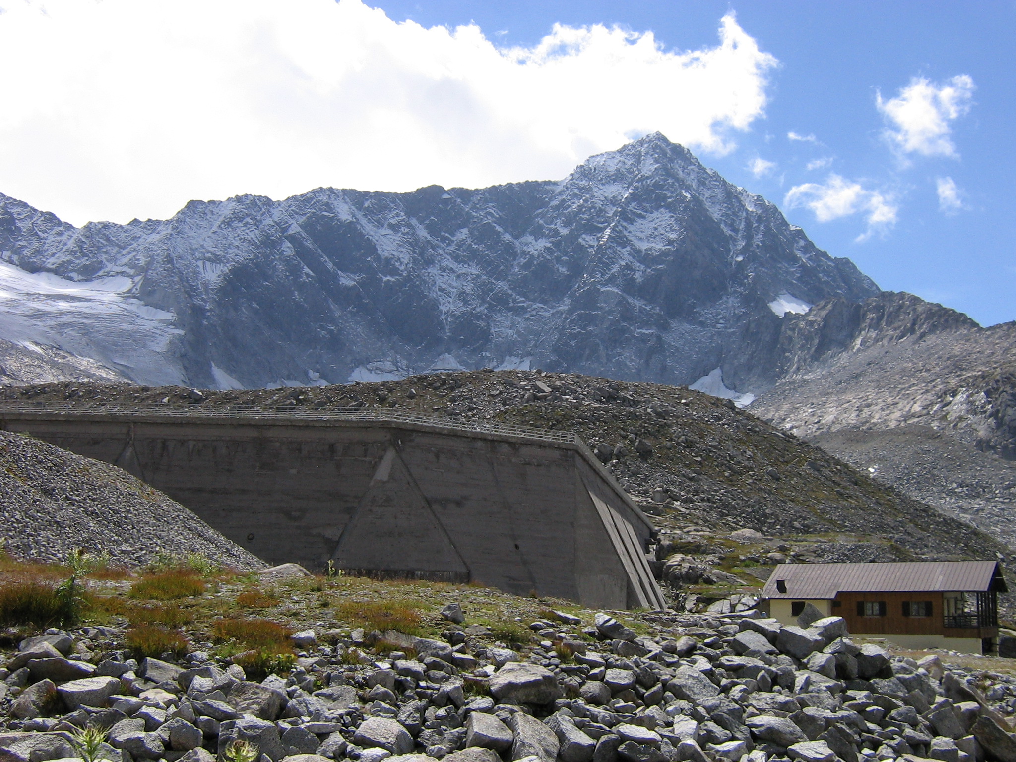
The Adamello-Presanella Alps Alpine group is a mountain range in the Southern Limestone Alps mountain group of the Eastern Alps. It is located in northern Italy, in the provinces of Trentino and Brescia. The name stems from its highest peaks: Adamello and Presanella. The Adamello-Presanella Group is separated from the Ortler Alps in the north by the Tonale Pass; from the Bergamo Alps in the west by the Oglio valley (Val Camonica); from the Brenta Group in the east by the Campo Carlo Magno Pass and the river Sarca; to the south it continues towards Lake Iseo. Peaks The main peaks of the Adamello-Presanella Group are: Passes The main mountain passes of the Adamello-Presanella Group are: See also * Southern Limestone Alps * Geography of the Alps The Alps form a large mountain range dominating Central Europe, including parts of Italy, France, Switzerland, Liechtenstein, Austria, Slovenia, Germany and possibly Hungary (if one includes the Kőszeg Mountains). This ar ... [...More Info...] [...Related Items...] OR: [Wikipedia] [Google] [Baidu] |
Ortler Alps
The Ortler Alps ( it, Ortles-Cevedale ; german: Ortler-Alpen; rm, Alps da l'Ortler) are a mountain range of the Southern Limestone Alps mountain group in the Central Eastern Alps, in Italy and Switzerland. Geography The Ortler Alps are separated from: # the Sesvenna Alps in the north by the Ofen Pass and the Val Müstair # the Livigno Alps in the southwest by the Passo di Fraéle and the Adda valley (Valtellina) # the Adamello-Presanella Alps in the south by the Tonale Pass # the Ötztal Alps in the north-east by the upper Adige valley (Vinschgau). The part west of the Gavia Pass is also called Sobretta-Gavia Group. The Ortler Alps are drained by the rivers Adda, Oglio, Adige and its tributary Noce. Peaks The main peaks of the Ortler Alps are: Mountain passes The main mountain pass A mountain pass is a navigable route through a mountain range or over a ridge. Since many of the world's mountain ranges have presented formidable barriers to travel, passes have played a key ... [...More Info...] [...Related Items...] OR: [Wikipedia] [Google] [Baidu] |
Garda Mountains
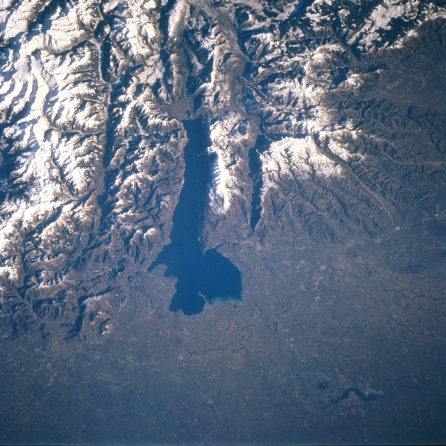
The Garda Mountains ( it, Prealpi Gardesane, german: Gardaseeberge), occasionally also the Garda Hills, are an extensive mountain range of the Southern Limestone Alps in northern Italy. Boundaries and countryside The Garda Mountains are bounded in the south by the Po Valley and in the north by the Brenta Dolomites, in the east by the Adige Valley and in the west by the Valli Giudicarie. Their precise boundary, according to the Alpine Club classification of the Eastern Alps, is as follows: Lake Iseo – Col di San Zeno – Val Trompia – Passo di Manivia – Bagolino – Storo – Tione – Vezzano – Trento – Val d'Adige/Etschtal – Verona – Brescia – Lake Iseo. Their highest summit is the Monte Cadria, at . The climate of the Garda Mountains is very mild as a result of its southerly location and the influence of the Mediterranean Sea. Snow rarely falls in the Sarca valley and on the shores of Lake Garda, and, in spring and autumn, temperatures of between 15- ... [...More Info...] [...Related Items...] OR: [Wikipedia] [Google] [Baidu] |
Nonsberg Group
The Nonsberg Group (german: Nonsberggruppe, it, Alpi della Val di Non) is a mountain range in South Tyrol and Trentino in Italy and part of the Southern Limestone Alps. A large part of the Nonsberg Group is formed by the Mendelkamm. Their highest peak is the Laugenspitze (). The Nonsberg Group is bounded in the east by the Etschtal, to the north by the Prissian High Forest (Ger: ''Prissianer Hochwald'', It: ''Selva di Prissiano'') on the Gampen Pass (It: ''Passo delle Palade'') and in the west by the Non Valley (Ger: ''Nonstal'', It: ''Val di Non''). Location The boundary of the range according to the Alpine Club Classification of the Eastern Alps (AVE): :Merano – Etschtal to Mezzocorona − Noce Valley (lower Non Valley/Val di Sole) – Lago di Santa Giustina – Val di Pescara – Proveis − Lederbuch – Hofmahd – Maraunbach to its confluence with the Valschauer Bach – Ultental – Lana – Merano Until its reclassification in AVE 1984 this group was counted ... [...More Info...] [...Related Items...] OR: [Wikipedia] [Google] [Baidu] |
Vicentine Alps
The Vicentine Alps ( it, Prealpi Vicentine; german: Vizentiner Alpen, ''Vicentiner Alpen'' or ''Vizentiner Voralpen'') are a mountain range of the Eastern Alps in Trentino and the provinces of Verona and Vicenza. The mountains were named after the city of Vicenza which lies at their eastern edge. The highest point in the range is the Cima Dodici () on the northern perimeter of the Vicentine Alps. Boundaries The Alpine Club classification of the Eastern Alps (AVE) bounds the Vicentine Alps as follows: Accessed on 8 April 2009 In the west the marks the boundary of the range from |
Fiemme Mountains
The Fiemme Mountains, sometimes also the Fleimstal Alps (german: Fleimstaler Alpen) or Fiemme Dolomites ( it, Dolomiti di Fiemme), are a mountain range of the Southern Limestone Alps in the Italian region of Trentino-South Tyrol. The range was named after the Fiemme Valley (Italian: ''Val di Fiemme''; German: ''Fleimstal''). It is located between the Sarntal Alps, the Dolomites, the Vicentine Alps, the Garda Mountains, the Brenta and the Nonsberg Group. In the Alpine Club classification of the Eastern Alps (AVE) of 1984, the Fiemme Mountains are bounded as follows: the northern end is formed by the town of Bolzano from where the boundary continues southeast along the Eggental valley, over the Zanggenjoch and Satteljoch passes to Predazzo. Next it runs through Paneveggio and over the Rolle Pass into the Cismon Valley as far as Mezzano. It then crosses the Góbbera and Brocon Passes to Pieve Tesino and Strigno into the Sugana Valley. Finally it runs along the Mocheni Val ... [...More Info...] [...Related Items...] OR: [Wikipedia] [Google] [Baidu] |
Southern Carnic Alps
Southern may refer to: Businesses * China Southern Airlines, airline based in Guangzhou, China * Southern Airways, defunct US airline * Southern Air, air cargo transportation company based in Norwalk, Connecticut, US * Southern Airways Express, Memphis-based passenger air transportation company, serving eight cities in the US * Southern Company, US electricity corporation * Southern Music (now Peermusic), US record label * Southern Railway (other), various railways * Southern Records, independent British record label * Southern Studios, recording studio in London, England * Southern Television, defunct UK television company * Southern (Govia Thameslink Railway), brand used for some train services in Southern England Media * ''Southern Daily'' or ''Nanfang Daily'', the official Communist Party newspaper based in Guangdong, China * ''Southern Weekly'', a newspaper in Guangzhou, China * Heart Sussex, a radio station in Sussex, England, previously known as "Southern FM" * 88 ... [...More Info...] [...Related Items...] OR: [Wikipedia] [Google] [Baidu] |
Carnic Alps
The Carnic Alps ( it, Alpi Carniche; german: Karnische Alpen; sl, Karnijske Alpe; fur, Alps Cjargnelis) are a range of the Southern Limestone Alps in Austria and northeastern Italy. They are within Austrian East Tyrol and Carinthia, and Italian Friuli (Province of Udine) and marginally in Veneto. Etymology They are named after the Roman province of Carnia, which probably has a Celtic origin. The mountains gave their name to the stage on the geologic time scale known as Carnian, an age in the Triassic Period. Geography They extend from east to west for about between the Gail River, a tributary of the Drava and the Tagliamento, forming the border between Austria and Italy. Alpine Club classification In the Carnic Alps is the southernmost glacier in Austria, the Eiskar, nestling in the Kellerwand massif. Notable peaks Among the most important mountains of the range are: * / (2,782 m) * (2,774 m) * / (2,694 m) * / (2,689 m) * (2,603 m) * (2,586 m) ... [...More Info...] [...Related Items...] OR: [Wikipedia] [Google] [Baidu] |


