|
Soufrière River
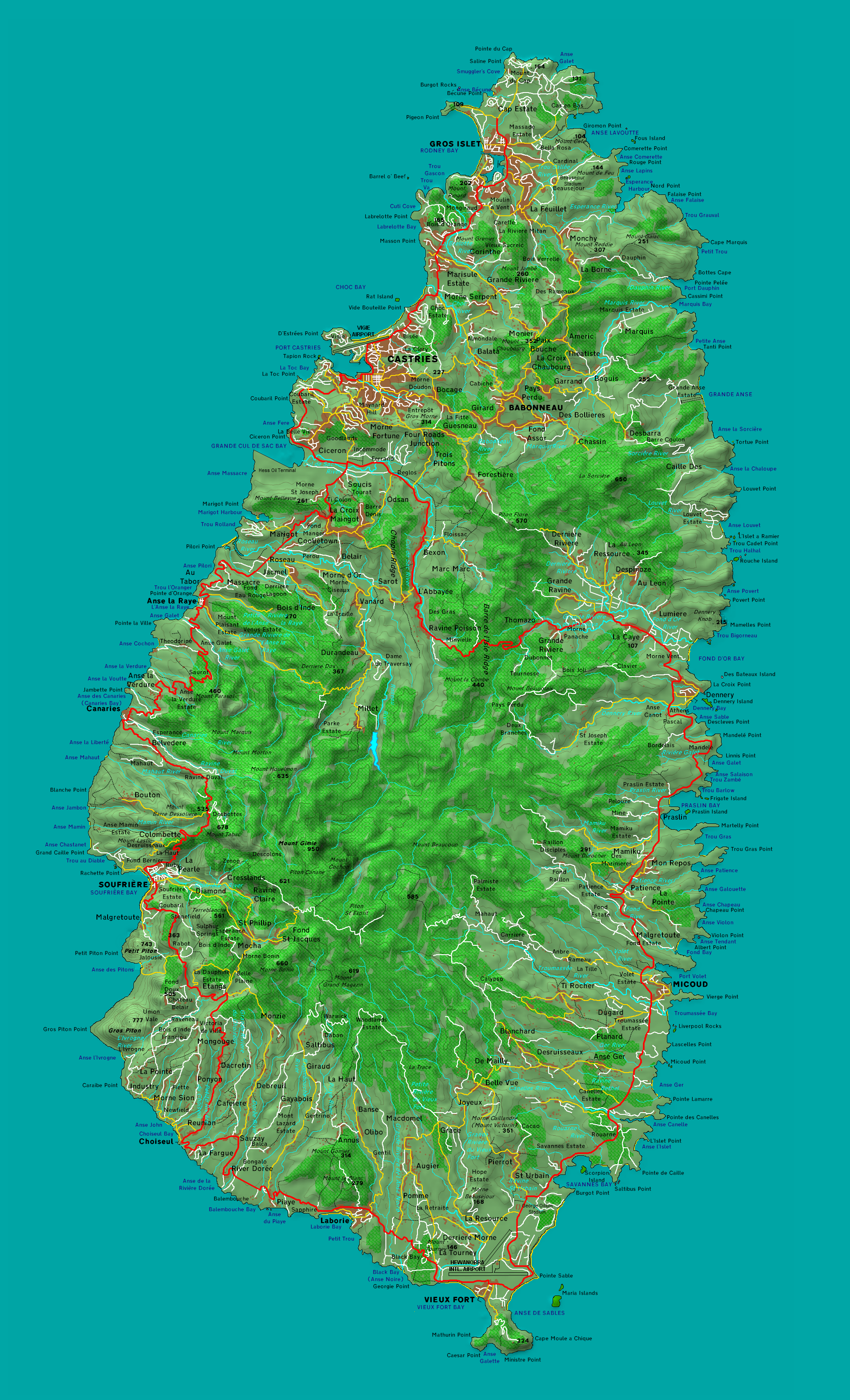
The Soufrière River (French la Soufrière) is a river in the Soufrière Quarter on the island country of Saint Lucia. The French term "Soufrière" is a generic one referring to "Sulphury" volcanic peaks called La Soufrière or Soufrière Hills on each of St. Vincent, St. Lucia, Dominica, Guadeloupe. Course The Soufrière River empties into Soufrière Bay on the Caribbean Sea. A river separates the town of Soufrière from the Fond Beniere area. A section of the river above the town was canalised and realigned in 1972; the river was realigned again in 1994. Tributaries of the Soufrière River in the interior include the Jeremy and Migny rivers. See also *List of rivers of Saint Lucia This is a list of rivers in the island country of Saint Lucia. Rivers are listed in clockwise order, starting at the north end of the island. Rivers There are 180 streams in Saint Lucia. Most of the rivers empty into the Atlantic Ocean or Cari ... References Rivers of Saint Lucia ... [...More Info...] [...Related Items...] OR: [Wikipedia] [Google] [Baidu] |
Caribbean Sea
The Caribbean Sea ( es, Mar Caribe; french: Mer des Caraïbes; ht, Lanmè Karayib; jam, Kiaribiyan Sii; nl, Caraïbische Zee; pap, Laman Karibe) is a sea of the Atlantic Ocean in the tropics of the Western Hemisphere. It is bounded by Mexico and Central America to the west and southwest, to the north by the Greater Antilles starting with Cuba, to the east by the Lesser Antilles, and to the south by the northern coast of South America. The Gulf of Mexico lies to the northwest. The entire area of the Caribbean Sea, the numerous islands of the West Indies, and adjacent coasts are collectively known as the Caribbean. The Caribbean Sea is one of the largest seas and has an area of about . The sea's deepest point is the Cayman Trough, between the Cayman Islands and Jamaica, at below sea level. The Caribbean coastline has many gulfs and bays: the Gulf of Gonâve, Gulf of Venezuela, Gulf of Darién, Golfo de los Mosquitos, Gulf of Paria and Gulf of Honduras. The Caribbean Sea has ... [...More Info...] [...Related Items...] OR: [Wikipedia] [Google] [Baidu] |
Soufrière, Saint Lucia
Soufrière is a town on the West Coast of Saint Lucia, in the eastern Caribbean Sea. The town and the surrounding district has a population of 7,935. It was colonized by the French and was the original capital of the island. History French colonizers built large estates in Soufrière, and their descendants still live in the area. The French Revolution of 1789 resulted in many Royalists being executed and the enslaved Africans were released from enslavement. However, Napoleon reintroduced slavery when he came to power. The British invaded St Lucia shortly afterwards, but the enslaved Africans and French deserters fought them in a guerrilla campaign until 1803 when they were defeated and St Lucia became a British colony. Also, during that time, Castries became the capital of St Lucia. Over the years, Soufrière has had to deal with hurricanes in 1780, 1817, 1831, 1898 and 1980, a major fire in 1955 and an earthquake in 1991. Many of these events have resulted in the town being r ... [...More Info...] [...Related Items...] OR: [Wikipedia] [Google] [Baidu] |
Saint Lucia
Saint Lucia ( acf, Sent Lisi, french: Sainte-Lucie) is an island country of the West Indies in the eastern Caribbean. The island was previously called Iouanalao and later Hewanorra, names given by the native Arawaks and Caribs, two Amerindian peoples. Part of the Windward Islands of the Lesser Antilles, it is located north/northeast of the island of Saint Vincent (Antilles), Saint Vincent, northwest of Barbados and south of Martinique. It covers a land area of with an estimated population of over 180,000 people as of 2022. The national capital is the city of Castries. The first proven inhabitants of the island, the Arawaks, are believed to have first settled in AD 200–400. Around 800 AD, the island would be taken over by the Kalinago. The French were the first Europeans to settle on the island, and they signed a treaty with the native Caribs in 1660. England took control of the island in 1663. In ensuing years, England and France fought 14 times for control of the island, ... [...More Info...] [...Related Items...] OR: [Wikipedia] [Google] [Baidu] |
Soufrière Quarter
Soufrière may refer to: __NOTOC__ Places Towns and villages *Soufrière, Dominica, a village on the southwest coast of Dominica in the Caribbean *Petit Soufrière, Dominica, a village on the east coast of Dominica *Soufrière, Saint Lucia, a town in Saint Lucia in the Caribbean Landforms *La Grande Soufrière or simply La Soufrière, a volcano in Guadeloupe in the Caribbean *Soufrière Hills, a volcano on Montserrat in the Caribbean *La Soufrière (volcano), a volcano on the island of Saint Vincent in the Caribbean Culture * ''La Soufrière'' (film), a film by director Werner Herzog [Baidu] |
Island Country
An island country, island state or an island nation is a country whose primary territory consists of one or more islands or parts of islands. Approximately 25% of all independent countries are island countries. Island countries are historically more stable countries than many continental states but are vulnerable to conquest by naval superpowers. There are great variations between island country economies: they may rely mainly on extractive industries, such as mining, fishing and agriculture, and/or on services such as transit hubs, tourism, and financial services. Many islands have low-lying geographies and their economies and population centers develop along coast plains and ports; such states may be vulnerable to the effects of climate change, especially sea level rise. Remote or significant islands and archipelagos that are not themselves sovereign are often known as dependencies or overseas territories. Politics Historically, island countries have tended to be less pr ... [...More Info...] [...Related Items...] OR: [Wikipedia] [Google] [Baidu] |
La Soufrière (volcano)
La Soufrière or Soufrière Saint Vincent () is an active stratovolcano on the Caribbean island of Saint Vincent in Saint Vincent and the Grenadines. It is the highest peak in Saint Vincent, and has had five recorded explosive eruptions since 1718. The latest eruptive activity began on 27 December 2020 with the slow extrusion of a dome of lava, and culminated in a series of explosive events between 9 and 22 April 2021. Geography and structure At , La Soufrière is the highest peak on Saint Vincent as well as the highest point in Saint Vincent and the Grenadines."La Soufrière" on Peakbagger.com Retrieved 1 October 2011 Soufrière is a stratovolcano with a and is the i ... [...More Info...] [...Related Items...] OR: [Wikipedia] [Google] [Baidu] |
Soufrière Hills
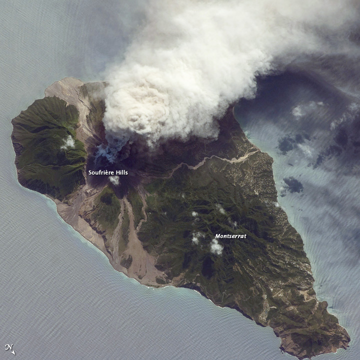
The Soufrière Hills are an active, complex stratovolcano with many lava domes forming its summit on the Caribbean island of Montserrat. After a long period of dormancy, the Soufrière Hills volcano became active in 1995 and has continued to erupt ever since. Its eruptions have rendered more than half of Montserrat uninhabitable, destroying the capital city, Plymouth, and causing widespread evacuations: about two-thirds of the population have left the island. Chances Peak in the Soufrière Hills was the highest summit on Montserrat until the mid-1990s, but it has since been eclipsed by various rising and falling volcanic domes during the recent volcanic activity. The volcano is andesitic in nature, and the current pattern of activity includes periods of lava dome growth, punctuated by brief episodes of dome collapse which result in pyroclastic flows, ash venting, and explosive eruption. The volcano is monitored by the Montserrat Volcano Observatory. Volcanic gas emissions fro ... [...More Info...] [...Related Items...] OR: [Wikipedia] [Google] [Baidu] |
List Of Rivers Of Saint Lucia
This is a list of rivers in the island country of Saint Lucia. Rivers are listed in clockwise order, starting at the north end of the island. Rivers There are 180 streams in Saint Lucia. Most of the rivers empty into the Atlantic Ocean or Caribbean Sea at the coast of Saint Lucia. (The location of the river mouths indicated in this list. Only Roseau and Migny rivers are not on the coast.) The longest river is the Roseau River with a drainage area of . There are 28 drainage basins for rivers of Saint Lucia., GEOnet Names Server See also *Geography of Saint Lucia *Quarters of Saint Lucia *List of cities in Saint Lucia Notes Breen's list of major rivers in Saint Lucia in 1844 includes a Vide Bouteille River but there is no mention of this river in the current GeoNames database. There is a Vide Bouteille Point on the coast at . References {{authority control Saint Lucia Rivers of Saint Lucia This is a list of rivers in the island country of Saint Lucia. Rivers a ... [...More Info...] [...Related Items...] OR: [Wikipedia] [Google] [Baidu] |

_volcanic_ash_-_Sentinel-3.jpg)

