|
Sotres
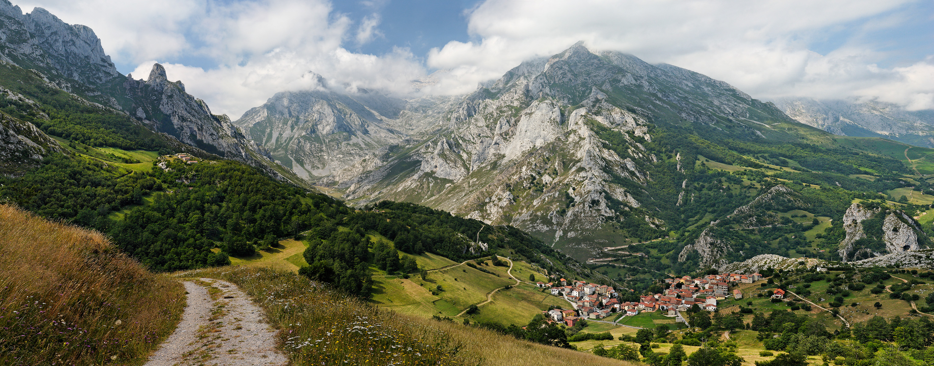
Sotres is a village and parish in the Asturian municipality of Cabrales, in Spain, located 19 km from Carreña, the municipal capital, in the eastern extreme of the province. The highest of all villages in the Picos de Europa National Park, it is part of the designated Biosphere Reserve and is sheltered by the peaks of the Andara (eastern) Massif and the Central Massif of the Picos de Europa, as well as the slopes of Pena Maín. It covers a land area of 38,1 km² and has a resident population of just 130INE2011) that is almost outnumbered in summer by guests of the village's hostals. The village is linked to the European GR footpath network, being the arrival point of the GR-71 route known as the "Path of the Saja Nature Reserve" that begins in Corconte in Cantabria and traverses the spectacular hills and valleys of the province. Now better known as a base for eco-tourism, Sotres has retained much of its agricultural identity and is one of the key producers of '' Qu ... [...More Info...] [...Related Items...] OR: [Wikipedia] [Google] [Baidu] |
Cabrales
Cabrales is a municipality in the autonomous community of Asturias, northwestern Spain. It is situated between the Sierra de Cuera and the Picos de Europa, and is a region famous for its Cabrales cheese. Important towns within the municipality include Arenas de Cabrales, one of the primary objectives of the Battle of El Mazuco in 1937. Nowadays Arenas' economy seems to be primarily based on tourism, although unlike many tourist centres it retains its authentic style – and hospitality. Parishes Cabrales municipality is divided into nine parishes: * Berodia * Bulnes *Carreña *Las Arenas * Poo *Prado (Prau in Asturian) * Puertas *Sotres Sotres is a village and parish in the Asturian municipality of Cabrales, in Spain, located 19 km from Carreña, the municipal capital, in the eastern extreme of the province. The highest of all villages in the Picos de Europa National Park ... * Tielve References Municipalities in Asturias Picos de Europa * { ... [...More Info...] [...Related Items...] OR: [Wikipedia] [Google] [Baidu] |
Picos De Europa
The Picos de Europa ("Peaks of Europe", also the Picos) are a mountain range extending for about , forming part of the Cantabrian Mountains in northern Spain. The range is situated in the Autonomous Communities of Asturias, Cantabria and Castile and León. The highest peak is Torre de Cerredo, at an elevation of (8,690 ft). Name A widely accepted origin for the name is that they were the first sight of Europe for ships arriving from the Americas. The name can be traced to Lucio Marineo Sículo, who mentioned the '' Rupes Europae'' in 1530. Ambrosio Morales, chronist of Felipe II of Spain, mentions the ''Montañas de Europa'' in 1572. Prudencio de Sandoval calls them the ''Peñas o Sierras de Europa'' in 1601. Geography The range consists of three major massifs: Urrieles Massif, Central (also known as ''Urrieles''), Eastern (Ándara) and Western (also known as the ''Picos de Cornión''). The Central and Western massifs are separated by the deep Cares river, Cares Gor ... [...More Info...] [...Related Items...] OR: [Wikipedia] [Google] [Baidu] |
San Glorio
San Glorio is a mountain pass in the Cantabrian Mountains of Northern Spain. The pass reaches an elevation of 1610 meters along the national highway N621 which connects the city of León with Cantabria and which passes through Asturias. The pass is situated some 800m from the southern border of the Picos de Europa National Park, a park included in UNESCO's World Network of Biosphere Reserves and shared by the provinces of León, Asturias and Cantabria. The valleys of this part of the Cantabrian Mountains include sites in the European Union's Natura 2000 network and Special Protection Areas for the conservation of wild birds. San Glorio is used as a corridor by the Cantabrian brown bear ''Ursus arctos'', catalogued in Spain as being in danger of extinction. Moreover, the slopes of the glacial valleys making up the surrounding region are home to an important variety of plant life. Ski resort project, environmental issues San Glorio is also the name of a projected ski resort i ... [...More Info...] [...Related Items...] OR: [Wikipedia] [Google] [Baidu] |
GR Footpath
The GR footpaths are a network of long-distance walking trails in Europe, mostly in France, Belgium, the Netherlands and Spain. They go by the following names: french: link=no, sentier de grande randonnée, vls, link=no, Groteroutepad, nl, Langeafstandwandelpad, es, link=no, sendero de gran recorrido, pt, percurso pedestre de grande rota. The trails in France alone cover approximately . Trails are blazed with characteristic marks consisting of a white stripe above a red stripe. These appear regularly along the route, especially at places such as forks or crossroads. The network is maintained in France by the ''Fédération Française de la Randonnée Pédestre'' (French Hiking Federation), and in Spain by the ''Federación Española de Deportes de Montaña y Escalada'' (Spanish Mountain Sports Federation). Many GR routes make up part of the longer European walking routes which cross several countries. Markings The GR trails are marked using a system of blazes that are ... [...More Info...] [...Related Items...] OR: [Wikipedia] [Google] [Baidu] |
Parish (administrative Division)
A parish is an administrative division used by several countries. To distinguish it from an ''ecclesiastical parish'', the term ''civil parish In England, a civil parish is a type of administrative parish used for local government. It is a territorial designation which is the lowest tier of local government below districts and counties, or their combined form, the unitary authorit ...'' is used in some jurisdictions, as noted below. The table below lists countries which use this administrative division: See also * Muban References {{Terms for types of country subdivisions Types of administrative division ... [...More Info...] [...Related Items...] OR: [Wikipedia] [Google] [Baidu] |
Rural Depopulation
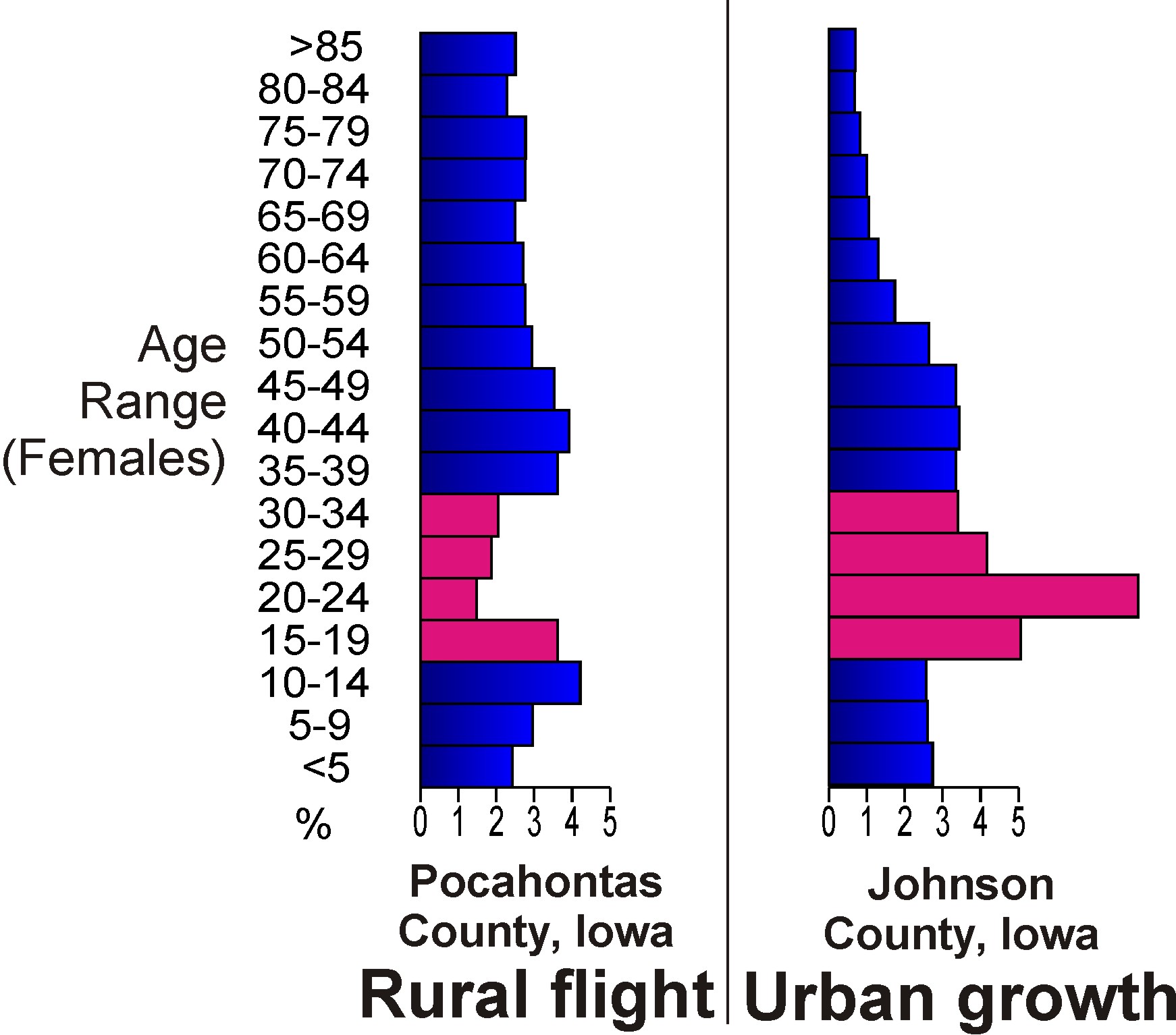
Rural flight (or rural exodus) is the migratory pattern of peoples from rural areas into urban areas. It is urbanization seen from the rural perspective. In industrializing economies like Britain in the eighteenth century or East Asia in the twentieth century, it can occur following the industrialization of primary industries such as agriculture, mining, fishing, and forestry—when fewer people are needed to bring the same amount of output to market—and related secondary industries (refining and processing) are consolidated. Rural exodus can also follow an ecological or human-caused catastrophe such as a famine or resource depletion. These are examples of push factors. The same phenomenon can also be brought about simply because of higher wages and educational access available in urban areas; examples of pull factors. Once rural populations fall below a critical mass, the population is too small to support certain businesses, which then also leave or close, in a vici ... [...More Info...] [...Related Items...] OR: [Wikipedia] [Google] [Baidu] |
Cabrales Cheese
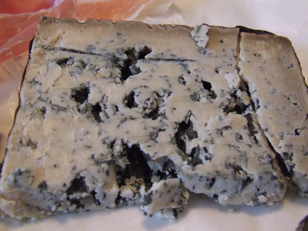
Cabrales (Spanish: ''queso de Cabrales'') is a blue cheese made in the artisan tradition by rural dairy farmers in Asturias, Spain. This cheese can be made from pure, unpasteurized cow’s milk or blended in the traditional manner with goat and/or sheep milk, which lends the cheese a stronger, spicier flavor. Official Spanish government regulatory board (in Spanish: see ext. refs for translation) All of the milk used in the production of Cabrales must come exclusively from herds raised in a small zone of production in , in the mountains of the . Pr ...
|
Cantabria
Cantabria (, also , , Cantabrian: ) is an autonomous community in northern Spain with Santander as its capital city. It is called a ''comunidad histórica'', a historic community, in its current Statute of Autonomy. It is bordered on the east by the Basque autonomous community (province of Biscay), on the south by Castile and León ( provinces of León, Palencia and Burgos), on the west by the Principality of Asturias, and on the north by the Cantabrian Sea (Bay of Biscay). Cantabria belongs to ''Green Spain'', the name given to the strip of land between the Bay of Biscay and the Cantabrian Mountains, so called because of its particularly lush vegetation, due to the wet and moderate oceanic climate. The climate is strongly influenced by Atlantic Ocean winds trapped by the mountains; the average annual precipitation is about . Cantabria has archaeological sites from the Upper Paleolithic period, although the first signs of human occupation date from the Lower Paleolithic. ... [...More Info...] [...Related Items...] OR: [Wikipedia] [Google] [Baidu] |


