|
Sontheim (Heilbronn)
Sontheim (full name: Sontheim an der Brenz) is a municipality in the district of Heidenheim in Baden-Württemberg in southern Germany. It is located northeast of Ulm, at the southern end of the Swabian Jura. Neighboring municipalities Sontheim shares borders with the following towns and villages: Hermaringen (Heidenheim District) in the north, Bächingen an der Brenz (Dillingen District, Bavaria) in the east and the south, as well as Niederstotzingen (Heidenheim District) in the west. Villages Sontheim an der Brenz consists of the main community Sontheim and the villages of Brenz and Bergenweiler. Brenz and Bergenweiler became part of Sontheim during Baden-Württemberg's last district reform in the 1970s. Twin towns The town is twinned with: * Saint-Valery-en-Caux, France France (), officially the French Republic ( ), is a country primarily located in Western Europe. It also comprises of Overseas France, overseas regions and territories in the Americas and the ... [...More Info...] [...Related Items...] OR: [Wikipedia] [Google] [Baidu] |
Heidenheim (district)
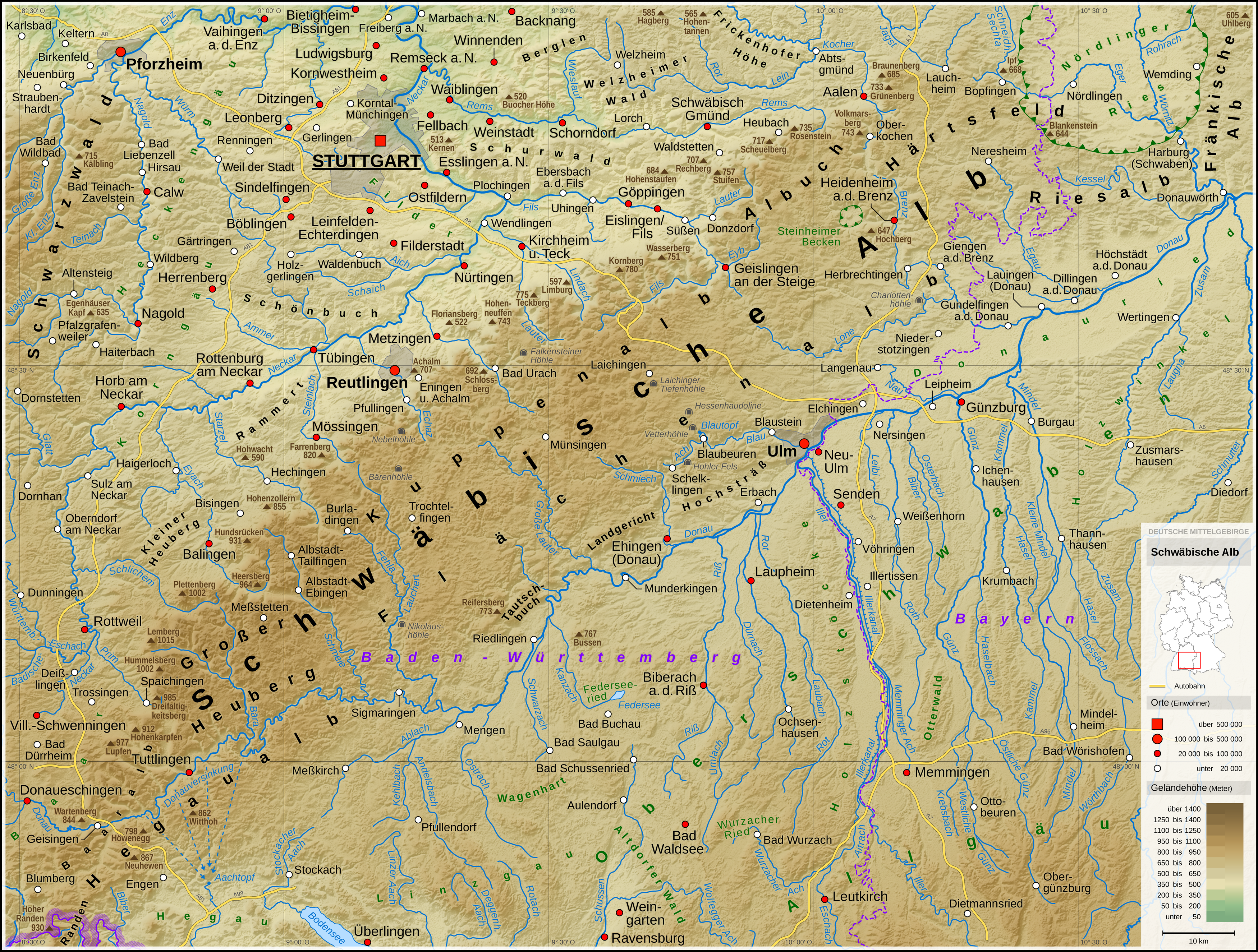
Heidenheim () is a ''Landkreis'' (district) in the east of Baden-Württemberg, Germany. Neighboring districts are (from north clockwise) Ostalbkreis, Dillingen, Günzburg, Alb-Donau and Göppingen. History The district dates back to the ''Oberamt Heidenheim'', which was created at the beginning of the 19th century. In 1808 it was enlarged by merging with the ''Oberamt Giengen''. It was converted into a district in 1934/38, and enlarged by municipalities from the ''Oberamt Neresheim'' and the ''Oberamt Ulm''. The communal reform of 1973 left the district virtually unchanged. Geography The district is located in the high plains of the Swabian Alb The Swabian Jura (german: Schwäbische Alb , more rarely ), sometimes also named Swabian Alps in English, is a mountain range in Baden-Württemberg, Germany, extending from southwest to northeast and in width. It is named after the region of ... (''Schwäbische Alb'') mountains. Coat of arms The coat of arms show the colors of the ... [...More Info...] [...Related Items...] OR: [Wikipedia] [Google] [Baidu] |
Baden-Württemberg
Baden-Württemberg (; ), commonly shortened to BW or BaWü, is a German state () in Southwest Germany, east of the Rhine, which forms the southern part of Germany's western border with France. With more than 11.07 million inhabitants across a total area of nearly , it is the third-largest German state by both area (behind Bavaria and Lower Saxony) and population (behind North Rhine-Westphalia and Bavaria). As a federated state, Baden-Württemberg is a partly-sovereign parliamentary republic. The largest city in Baden-Württemberg is the state capital of Stuttgart, followed by Mannheim and Karlsruhe. Other major cities are Freiburg im Breisgau, Heidelberg, Heilbronn, Pforzheim, Reutlingen, Tübingen, and Ulm. What is now Baden-Württemberg was formerly the historical territories of Baden, Prussian Hohenzollern, and Württemberg. Baden-Württemberg became a state of West Germany in April 1952 by the merger of Württemberg-Baden, South Baden, and Württemberg-Hohenzollern. The ... [...More Info...] [...Related Items...] OR: [Wikipedia] [Google] [Baidu] |
Germany
Germany,, officially the Federal Republic of Germany, is a country in Central Europe. It is the second most populous country in Europe after Russia, and the most populous member state of the European Union. Germany is situated between the Baltic and North seas to the north, and the Alps to the south; it covers an area of , with a population of almost 84 million within its 16 constituent states. Germany borders Denmark to the north, Poland and the Czech Republic to the east, Austria and Switzerland to the south, and France, Luxembourg, Belgium, and the Netherlands to the west. The nation's capital and most populous city is Berlin and its financial centre is Frankfurt; the largest urban area is the Ruhr. Various Germanic tribes have inhabited the northern parts of modern Germany since classical antiquity. A region named Germania was documented before AD 100. In 962, the Kingdom of Germany formed the bulk of the Holy Roman Empire. During the 16th ce ... [...More Info...] [...Related Items...] OR: [Wikipedia] [Google] [Baidu] |
Swabian Jura
The Swabian Jura (german: Schwäbische Alb , more rarely ), sometimes also named Swabian Alps in English, is a mountain range in Baden-Württemberg, Germany, extending from southwest to northeast and in width. It is named after the region of Swabia. The Swabian Jura occupies the region bounded by the Danube in the southeast and the upper Neckar in the northwest. In the southwest it rises to the higher mountains of the Black Forest. The highest mountain of the region is the Lemberg (). The area's profile resembles a high plateau, which slowly falls away to the southeast. The northwestern edge is a steep escarpment (called the Albtrauf or Albanstieg, rising up , covered with forests), while the top is flat or gently rolling. In economic and cultural terms, the Swabian Jura includes regions just around the mountain range. It is a popular recreation area. Geology The geology of the Swabian Jura is mostly limestone, which formed the seabed during the Jurassic period. The sea r ... [...More Info...] [...Related Items...] OR: [Wikipedia] [Google] [Baidu] |
Hermaringen
Hermaringen is a municipality in the district of Heidenheim in Baden-Württemberg in southern Germany. Hermaringen is known as the birthplace of Georg Elser, who tried to assassinate Adolf Hitler Adolf Hitler (; 20 April 188930 April 1945) was an Austrian-born German politician who was dictator of Nazi Germany, Germany from 1933 until Death of Adolf Hitler, his death in 1945. Adolf Hitler's rise to power, He rose to power as the le ... on 8 November 1939. References External links * https://web.archive.org/web/20190616153115/http://www.hermaringen.de/ Heidenheim (district) {{Heidenheim-geo-stub ... [...More Info...] [...Related Items...] OR: [Wikipedia] [Google] [Baidu] |
Bächingen An Der Brenz
Bächingen is a municipality in the district of Dillingen in Bavaria in Germany. The town is a member of the municipal association Gundelfingen an der Donau Gundelfingen an der Donau is a town in the Bavarian district Dillingen in Swabia. Gundelfingen is located at the river Danube (Donau), between Stuttgart, Munich and Augsburg (latitude 48° 33" 15' and longitude: 10° 22" 9'). It has some 8,000 .... References Dillingen (district) {{Dillingendistrict-geo-stub ... [...More Info...] [...Related Items...] OR: [Wikipedia] [Google] [Baidu] |
Niederstotzingen
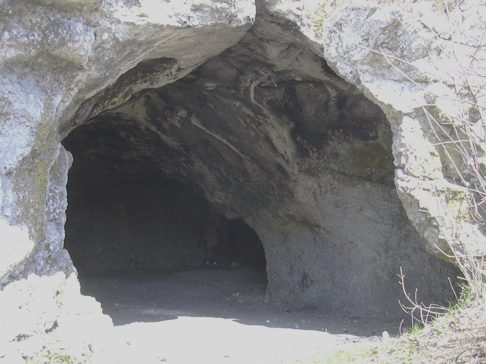
Niederstotzingen () is a small city in the district of Heidenheim in Baden-Württemberg in southern Germany. It is situated 17 km southeast of Heidenheim, and 24 km northeast of Ulm. The city consists of four sections or villages; Niederstotzingen, Oberstotzingen, Stetten ob Lontal and the combined section Lontal und Reuendorf. There are 4,850 inhabitants. History Vogelherdhöhle The region around Niederstotzingen has been inhabited since pre-historic times. Finds of mammoth ivory carvings in the area have been dated to 35,000 BC. The main source of these carvings is the '' Vogelherdhöhle'', a cave near modern Niederstotzingen which may have been used as a rest area and shelter for nearly 30,000 years. The cave was discovered in 1931 by a senior railroad clerk and historian, Hermann Mohn, as he explored the hills above the city. An expedition in 1931, led by Gustav Riek, discovered eleven carved animal figures that dated from around 32,000 years ago. A 2005– ... [...More Info...] [...Related Items...] OR: [Wikipedia] [Google] [Baidu] |
Brenz An Der Brenz
Brenz an der Brenz is a borough of the village of Sontheim in the Heidenheim District of Baden-Württemberg in Germany. Brenz an der Brenz was an independent village until it merged with Sontheim. The borough has about 1100 inhabitants. Location Brenz an der Brenz is located directly on the Brenz River near the Swabian Alb and the Danube River Valley. History The Brenz region has been settled since at least the Roman Empire. In the 2nd or 3rd century C.E., on the commanding ''Kirchberg'' in Brenz, a ''Villa rustica'' was built. Additional finds of other monumental buildings dating from the Roman era indicate that a Roman town was located here. Brenz also is located at the crossing of two Roman roads; the road from Günzburg (lat. ''Guntia'') to Heidenheim (lat. ''Aquileia'') and the North Danube road from (lat. ''Ad Lunam'') to Regensburg (lat. ''Castra Regina''). In 2002 on the ancient road between Sontheim and Bächingen a mile stone with the name of Emperor Caracall ... [...More Info...] [...Related Items...] OR: [Wikipedia] [Google] [Baidu] |
Saint-Valery-en-Caux
Saint-Valery-en-Caux (, literally ''Saint-Valery in Pays de Caux, Caux'') is a Communes of France, commune in the Seine-Maritime Departments of France, department in the Normandy (administrative region), Normandy region in northern France. The addition of an acute accent on the "e" (Valéry) is incorrect. Geography The town is located north of Rouen. A small fishing port and light industrial town situated in the Pays de Caux, some west of Dieppe at the junction of the D53, D20, D79 and the D925 roads. Here, huge chalk cliffs rise up from the pebble beach (sandy at low tide) to overlook the English Channel. The Gare de Saint-Valery-en-Caux, SNCF station closed in the 1990s and the only public transport available is an infrequent bus service. History It is said to have been founded by Walric, abbot of Leuconay, Saint Valery in the 7th century. A monastery was built on the site of the present-day town and was known as ‘’’Sanctum Walaricum’’’ in 990 Common Era, CE, a ... [...More Info...] [...Related Items...] OR: [Wikipedia] [Google] [Baidu] |
France
France (), officially the French Republic ( ), is a country primarily located in Western Europe. It also comprises of Overseas France, overseas regions and territories in the Americas and the Atlantic Ocean, Atlantic, Pacific Ocean, Pacific and Indian Oceans. Its Metropolitan France, metropolitan area extends from the Rhine to the Atlantic Ocean and from the Mediterranean Sea to the English Channel and the North Sea; overseas territories include French Guiana in South America, Saint Pierre and Miquelon in the North Atlantic, the French West Indies, and many islands in Oceania and the Indian Ocean. Due to its several coastal territories, France has the largest exclusive economic zone in the world. France borders Belgium, Luxembourg, Germany, Switzerland, Monaco, Italy, Andorra, and Spain in continental Europe, as well as the Kingdom of the Netherlands, Netherlands, Suriname, and Brazil in the Americas via its overseas territories in French Guiana and Saint Martin (island), ... [...More Info...] [...Related Items...] OR: [Wikipedia] [Google] [Baidu] |


