|
Skålvik Fjord
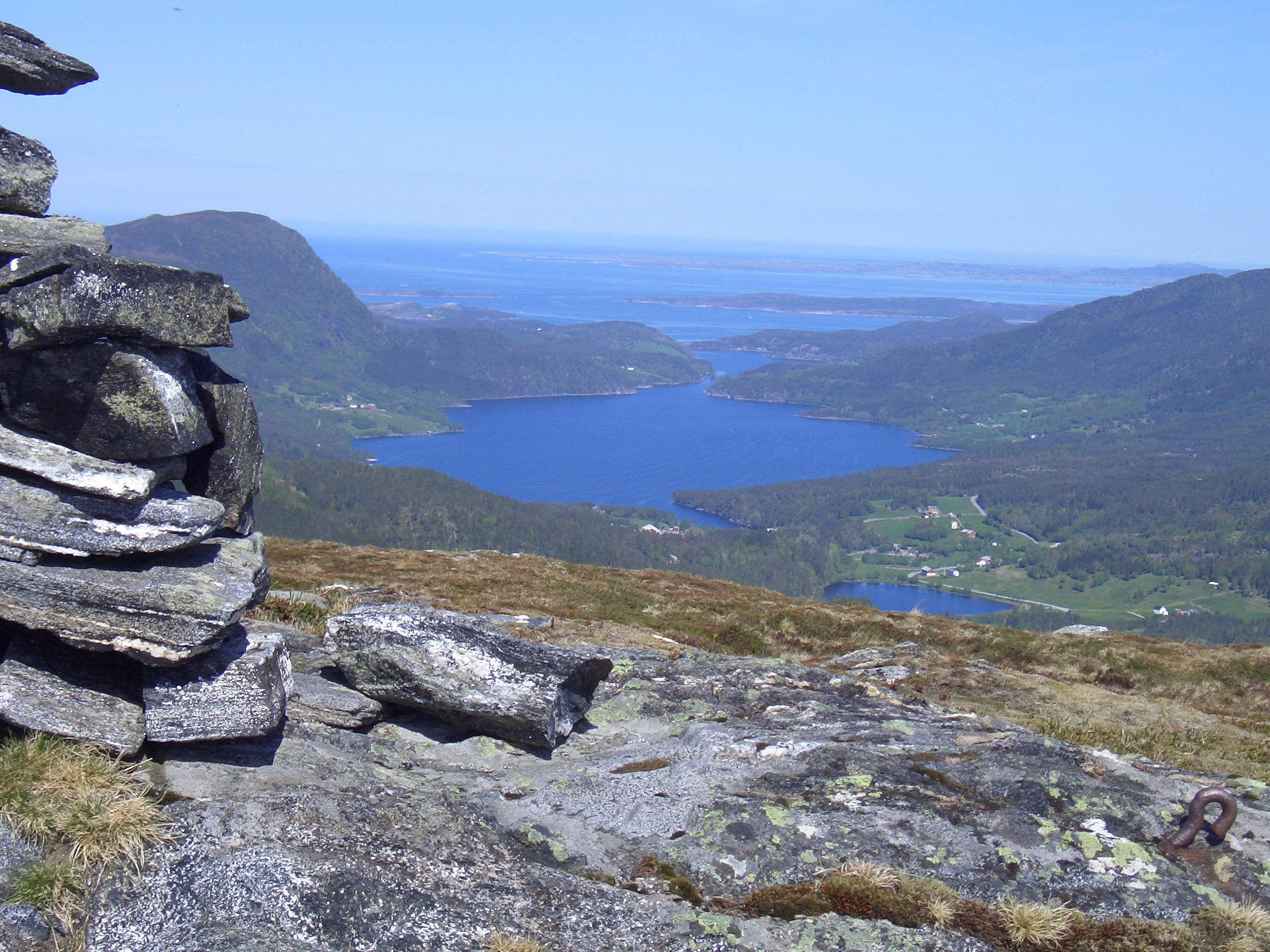
Skålvik Fjord (also Skaalvik Fjord; no, Skålvikfjorden) is an arm of Vinje Fjord in the municipality of Halsa in Møre og Romsdal County, Norway, in the traditional Nordmøre district. Skålvik Fjord extends southwards to Betna. Geologically, the same channel of the fjord extends north of Vinje Fjord and continues as the Sålå Strait (''Sålåsundet'') in the Municipality of Aure. The entrance to the fjord lies between the Korsneset peninsula to the west and the hamlet of Steinstien to the east. The outer part of the fjord is only wide until it expands at the village of Vågland on the eastern shore, outside of Liabøen Liabøen or Liabø is a village in Heim Municipality in Trøndelag county, Norway. The village is located along the Skålvik Fjord, along the European route E39 highway, about northeast of the village of Halsanaustan and about west of the villag .... Between Vågland and Klevset on the opposite shore there are several islands and islets in the fjord. ... [...More Info...] [...Related Items...] OR: [Wikipedia] [Google] [Baidu] |
Vinjefjorden
Vinjefjorden or Vinje Fjord is a fjord in Møre og Romsdal and Trøndelag counties in Norway. It begins at the village of Vinjeøra in Heim Municipality (in Trøndelag county) and flows west through the municipalities of Aure, Tingvoll, and Kristiansund (in Møre og Romsdal county). At its western end, it flows into the Talsjøen and Freifjorden. The Halsafjorden, Skålvik Fjord Skålvik Fjord (also Skaalvik Fjord; no, Skålvikfjorden) is an arm of Vinje Fjord in the municipality of Halsa in Møre og Romsdal County, Norway, in the traditional Nordmøre district. Skålvik Fjord extends southwards to Betna. Geological ..., and Valsøyfjorden all branch off of the long Vinjefjorden. The central part of the Vinjefjorden is called the Arasvikfjorden. European route E39 runs along the southern shore of the fjord for most of its length. References Fjords of Møre og Romsdal Fjords of Trøndelag Aure, Norway Heim, Norway Kristiansund Tingvoll {{Trøndelag-ge ... [...More Info...] [...Related Items...] OR: [Wikipedia] [Google] [Baidu] |
Halsa
Halsa is a former municipality in Møre og Romsdal county, Norway. The municipality existed from 1838 until 2020 when it became part of Heim Municipality in Trondelag county. It was part of the Nordmøre region. The administrative centre of Halsa was the village of Liabøen. Other villages in the municipality included Todalen, Halsanaustan, Valsøyfjord, Engan, Hjellnes, and Valsøybotnen. At the time of its dissolution in 2020, the municipality was the 279th largest by area out of the 422 municipalities in Norway. Halsa was the 349th most populous municipality in Norway with a population of 1,571. The municipality's population density was and its population has decreased by 6% over the last decade. General information The parish of Halsa was established as a municipality on 1 January 1838 (see formannskapsdistrikt law). On 1 January 1868, an unpopulated area of Halsa was transferred to the neighboring municipality of Straumsnes. On 1 January 1879, a part of Halsa (popu ... [...More Info...] [...Related Items...] OR: [Wikipedia] [Google] [Baidu] |
Møre Og Romsdal
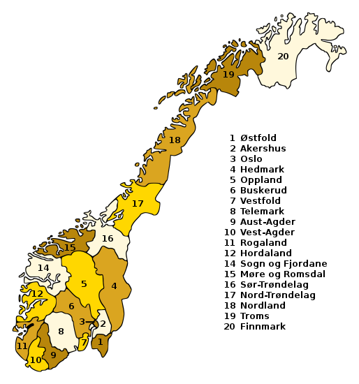
Møre og Romsdal (; en, Møre and Romsdal) is a county in the northernmost part of Western Norway. It borders the counties of Trøndelag, Innlandet, and Vestland. The county administration is located in the town of Molde, while Ålesund is the largest town. The county is governed by the Møre og Romsdal County Municipality which includes an elected county council and a county mayor. The national government is represented by the county governor. Name The name ''Møre og Romsdal'' was created in 1936. The first element refers to the districts of Nordmøre and Sunnmøre, and the last element refers to Romsdal. Until 1919, the county was called "Romsdalens amt", and from 1919 to 1935 "Møre fylke". For hundreds of years (1660-1919), the region was called ''Romsdalen amt'', after the Romsdalen valley in the present-day Rauma Municipality. The Old Norse form of the name was ''Raumsdalr''. The first element is the genitive case of the name ''Raumr'' derived from the name of the ... [...More Info...] [...Related Items...] OR: [Wikipedia] [Google] [Baidu] |
Counties Of Norway
Norway is divided into 11 administrative regions, called counties (singular no, fylke, plural nb, fylker; nn, fylke from Old Norse: ''fylki'' from the word "folk", sme, fylka, sma, fylhke, smj, fylkka, fkv, fylkki) which until 1918 were known as '' amter''. The counties form the first-level administrative divisions of Norway and are further subdivided into 356 municipalities (''kommune'', pl. ''kommuner'' / ''kommunar''). The island territories of Svalbard and Jan Mayen are outside the county division and ruled directly at the national level. The capital Oslo is both a county and a municipality. In 2017, the Solberg government decided to abolish some of the counties and to merge them with other counties to form larger ones, reducing the number of counties from 19 to 11, which was implemented on 1 January 2020. This sparked popular opposition, with some calling for the reform to be reversed. The Storting voted to partly undo the reform on 14 June 2022, w ... [...More Info...] [...Related Items...] OR: [Wikipedia] [Google] [Baidu] |
Norway
Norway, officially the Kingdom of Norway, is a Nordic country in Northern Europe, the mainland territory of which comprises the western and northernmost portion of the Scandinavian Peninsula. The remote Arctic island of Jan Mayen and the archipelago of Svalbard also form part of Norway. Bouvet Island, located in the Subantarctic, is a dependency of Norway; it also lays claims to the Antarctic territories of Peter I Island and Queen Maud Land. The capital and largest city in Norway is Oslo. Norway has a total area of and had a population of 5,425,270 in January 2022. The country shares a long eastern border with Sweden at a length of . It is bordered by Finland and Russia to the northeast and the Skagerrak strait to the south, on the other side of which are Denmark and the United Kingdom. Norway has an extensive coastline, facing the North Atlantic Ocean and the Barents Sea. The maritime influence dominates Norway's climate, with mild lowland temperatures on the se ... [...More Info...] [...Related Items...] OR: [Wikipedia] [Google] [Baidu] |
Nordmøre
Nordmøre (English: North- Møre) is a traditional district in the Norwegian county of Møre og Romsdal. The area comprises the northern third of the county including the municipalities of Kristiansund, Averøy, Tingvoll, Surnadal, Aure, Halsa, Eide, Sunndal, Gjemnes, and Smøla. The only town in Nordmøre is Kristiansund. Of these ten municipalities, three are located (mainly) on islands: Kristiansund, Averøy, and Smøla and seven lie on the coast (including between, adjacent to, or at the end of, fjords): Tingvoll, Surnadal, Aure, Halsa, Eide, Sunndal, and Gjemnes; no municipalities are completely landlocked. Historically, the municipality of Rindal was part of the county and region, but it was transferred to Trøndelag county on 1 January 2019. In the early Viking Age, before Harald Fairhair, Nordmøre was a petty kingdom whose ruler was known as the ''Mørejarl'' (literally: "Møre-Earl"). Then, Nordmøre also included the municipalities north and west of Orkdal municipal ... [...More Info...] [...Related Items...] OR: [Wikipedia] [Google] [Baidu] |
Betna
Betna is a village in the municipality of Heim in Trøndelag county, Norway. It lies at the southeast end of the Skålvik Fjord (''Skålvikfjord''), where the Betna River (''Betnelva'') empties into Betna Bay (''Betnvågen''). The name ''Betna'' is derived from the verb ''beite'' 'to graze'. The Blekken Elementary School is located in Betna. There used to be a convenience store in the settlement, but it went out of business in 2004. Traces of an Iron Age settlement were discovered in Betna during roadwork on the junction of European route E39 with County Road 65. The Museum of Natural History and Archaeology in Trondheim Trondheim ( , , ; sma, Tråante), historically Kaupangen, Nidaros and Trondhjem (), is a city and municipality in Trøndelag county, Norway. As of 2020, it had a population of 205,332, was the third most populous municipality in Norway, and ... carried out archaeological investigations at the site in the summer of 2006. References {{authority control ... [...More Info...] [...Related Items...] OR: [Wikipedia] [Google] [Baidu] |
Aure, Norway
Aure is a municipality in Møre og Romsdal county, Norway. It is part of the region of Nordmøre. The administrative centre is the village of Aure. Other villages in Aure include Gullstein, Stemshaug, Todalen, Tjeldbergodden, Arasvika, and Tømmervåg. Aure has one of the largest wooden churches in Norway, Aure Church. The municipality is the 179th largest by area out of the 356 municipalities in Norway. Aure is the 218th most populous municipality in Norway with a population of 3,384. The municipality's population density is and its population has decreased by 3.6% over the previous 10-year period. General information The municipality was established on 1 January 1838 (see formannskapsdistrikt law). On 1 January 1894, the southern district of Aure (population: 942) was separated to form the new municipality of Valsøyfjord. Then on 1 July 1914, the northeastern district of Aure (population: 851) was separated to form the new municipality of Stemshaug. During the 1960s, ... [...More Info...] [...Related Items...] OR: [Wikipedia] [Google] [Baidu] |
Liabøen
Liabøen or Liabø is a village in Heim Municipality in Trøndelag county, Norway. The village is located along the Skålvik Fjord, along the European route E39 highway, about northeast of the village of Halsanaustan and about west of the village of Valsøyfjord. Liabøen has a bank, store, cafe, and school. The village has a population (2018) of 204 and a population density of . Prior to 2020, the village was the administrative centre of the old Halsa Municipality. References Heim, Norway Villages in Trøndelag {{Trøndelag-geo-stub ... [...More Info...] [...Related Items...] OR: [Wikipedia] [Google] [Baidu] |
Klevset
Klevset or Kløvset is a village in the municipality of Heim in Trøndelag county, Norway. It lies on the shore of Skålvik Fjord along County Road 350. The island of Bårsetøya lies just offshore in the fjord. A small boatyard, J M Kleivset Båtbyggeri, formerly operated in Klevset. Among other vessels, it built three smacks for use by priests in the reconstruction of Finnmark after the Second World War. The settlement was attested as ''Klauset'' in the 16th centuryKaldhol, Hans. 1915. Bidrag til Romsdals amts kvartærgeologi. (= ''Det Kgl. Norske videnskabers selskabs skrifter'' 7). Trondheim: Aktietrykkeriet, p. 11. and ''Kleffßett'' in 1590 (as well as ''Kleffset'' in 1667 and ''Klefset'' in 1723). The name is probably derived from Old Norse Old Norse, Old Nordic, or Old Scandinavian, is a stage of development of North Germanic languages, North Germanic dialects before their final divergence into separate Nordic languages. Old Norse was spoken by inhabitants of Sca ... [...More Info...] [...Related Items...] OR: [Wikipedia] [Google] [Baidu] |

