|
Skyline-to-the-Sea Trail
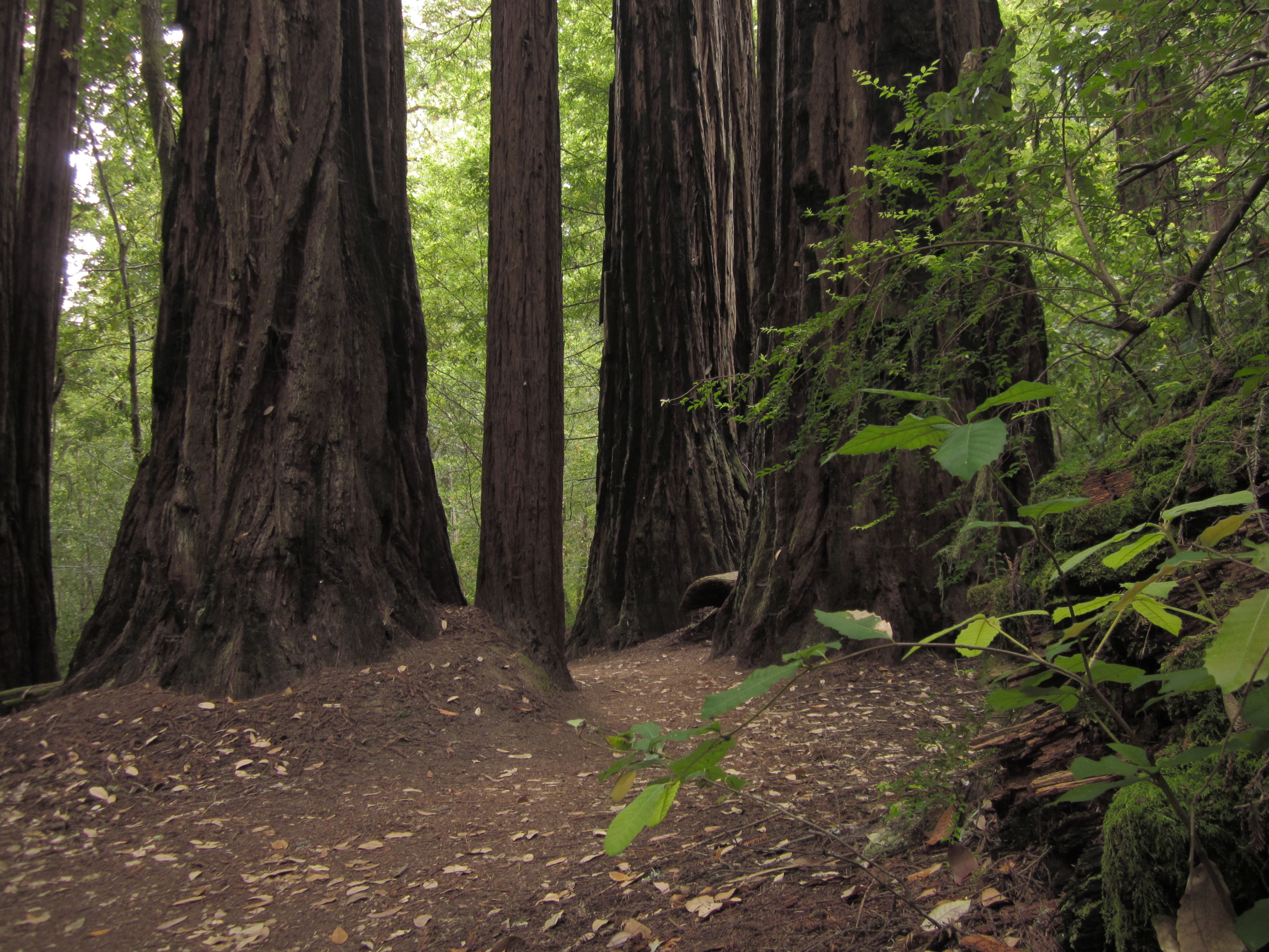
The Skyline-to-the-Sea Trail is a 29.5-mile (47.2-kilometre) hiking trail that descends from the ridge of the Santa Cruz Mountains in California to the Pacific Ocean, passing through Castle Rock State Park and Big Basin Redwoods State Park. Big Basin is California's oldest state park. It contains beautiful waterfalls and some of the largest, tallest, and oldest Redwood forests left in existence. After the August 2020 CZU Lightning Complex fires, the trail closed, along with much of Big Basin Redwoods State Park. As of December 2021, the trail remains closed and its future is unclear. The trail usually takes two to three days to complete, with nearly all thru-hikers traveling from East to West (towards the ocean). It is possible to walk the entire trail in one day, though this is unusual and very difficult. However, there is a 50-km (31-mi) ultra running race held on this trail one or two times per year. Many hikers like to take a detour up Berry Creek Trail to see the waterfal ... [...More Info...] [...Related Items...] OR: [Wikipedia] [Google] [Baidu] |
Santa Cruz County, California
Santa Cruz County (), officially the County of Santa Cruz, is a county on the Pacific coast of the U.S. state of California. As of the 2020 census, the population was 270,861. The county seat is Santa Cruz. Santa Cruz County comprises the Santa Cruz–Watsonville, CA Metropolitan Statistical Area, which is also included in the San Jose–San Francisco–Oakland, CA Combined Statistical Area. The county is on the California Central Coast, south of the San Francisco Bay Area region. The county forms the northern coast of the Monterey Bay, with Monterey County forming the southern coast. History Santa Cruz County was one of the original counties of California, created in 1850 at the time of statehood. In the original act, the county was given the name of "Branciforte" after the Spanish pueblo founded there in 1797. A major watercourse in the county, Branciforte Creek, still bears this name. Less than two months later, on April 5, 1850, the name was changed to "Santa Cruz" ("Holy ... [...More Info...] [...Related Items...] OR: [Wikipedia] [Google] [Baidu] |
California State Route 9
State Route 9 (SR 9) is a rural and mountainous state highway in the U.S. state of California that travels from SR 1 in Santa Cruz to SR 17 in Los Gatos, passing through the San Lorenzo Valley and the Saratoga Gap in the Santa Cruz Mountains. Route description SR 9 begins in the city of Santa Cruz where River Street intersects with SR 1. It heads north, paralleling the San Lorenzo River. The road is a winding two-lane road for the majority of its length until it approaches Fruitvale Avenue in Saratoga. SR 9 winds through the mountains north of Santa Cruz, passing through the communities of Paradise Park, Felton, Ben Lomond, Brookdale, and Boulder Creek, where State Route 236 departs from SR 9 to provide access to Big Basin Redwoods State Park. SR 236 later rejoins SR 9 near Castle Rock State Park. At the summit of the Santa Cruz mountains (the junction with SR 35 and after a steep climb), there is a vista point offering a (somewhat obstructed) view of the Bay Area ... [...More Info...] [...Related Items...] OR: [Wikipedia] [Google] [Baidu] |
Trails In The San Francisco Bay Area
A trail, also known as a path or track, is an unpaved lane or small road usually passing through a natural area. In the United Kingdom and the Republic of Ireland, a path or footpath is the preferred term for a pedestrian or hiking trail. The term is also applied in North America to routes along rivers, and sometimes to highways. In the US, the term was historically used for a route into or through wild territory used by explorers and migrants (e.g. the Oregon Trail). In the United States, "trace" is a synonym for trail, as in Natchez Trace. Some trails are dedicated only for walking, cycling, horse riding, snowshoeing or cross-country skiing, but not more than one use; others, as in the case of a bridleway in the UK, are multi-use and can be used by walkers, cyclists and equestrians alike. There are also unpaved trails used by dirt bikes and other off-road vehicles, and in some places, like the Alps, trails are used for moving cattle and other livestock. Usage In Australia, ... [...More Info...] [...Related Items...] OR: [Wikipedia] [Google] [Baidu] |
California Redwood
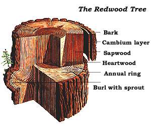
''Sequoia sempervirens'' ()''Sunset Western Garden Book,'' 1995:606–607 is the sole living species of the genus '' Sequoia'' in the cypress family Cupressaceae (formerly treated in Taxodiaceae). Common names include coast redwood, coastal redwood, and California redwood. It is an evergreen, long-lived, monoecious tree living 1,200–2,200 years or more. This species includes the tallest living trees on Earth, reaching up to in height (without the roots) and up to in diameter at breast height. These trees are also among the oldest living things on Earth. Before commercial logging and clearing began by the 1850s, this massive tree occurred naturally in an estimated along much of coastal California (excluding southern California where rainfall is not sufficient) and the southwestern corner of coastal Oregon within the United States. The name sequoia sometimes refers to the subfamily Sequoioideae, which includes ''S. sempervirens'' along with ''Sequoiadendron'' (gian ... [...More Info...] [...Related Items...] OR: [Wikipedia] [Google] [Baidu] |
Bay Area Ridge Trail
The Bay Area Ridge Trail (Ridge Trail) is a planned multi-use trail along the hill and mountain ridgelines ringing the San Francisco Bay Area, in Northern California. Currently, have been established. When complete, the trail will connect over 75 parks and open spaces. The trail is being designed to provide access for hikers, runners, mountain bicyclists, and equestrians. It will be accessible through trailheads near major population centers, while the trail will extend into more remote areas. The first trail section was dedicated on May 13, 1989. History William Penn Mott Jr., the twelfth director of the National Park Service, is credited with sparking the idea for the Ridge Trail in a speech he gave in March 1987 at a state parks and recreation conference. While working for the East Bay Regional Park District in the 1960s, Mott's office was on a ridgeline in the East Bay, and the views from the office inspired his vision of a hill-and-ridge trail encircling the Bay and lin ... [...More Info...] [...Related Items...] OR: [Wikipedia] [Google] [Baidu] |
Sanborn-Skyline County Park
Sanborn County Park is a 3,453 acre (13.97 km2) county park situated in the Santa Cruz Mountains, managed by the Santa Clara County Parks and Recreation Department. The deeply forested park features over 15 miles of trails, second-growth redwoods, and creeks that flow year-round. It offers hiking, RV camping, walk-in campsites, and picnicking/BBQ sites. In the summer months, Sanborn County Park hosts the only outdoor Shakespearean company in Silicon Valley. The park is located four miles west of the town of Saratoga and straddles the steep slopes of the Santa Cruz Mountains from Sanborn Road all the way up to Skyline Boulevard. Adjacent properties include the Walden West Environmental Education Center, Castle Rock State Park, the Los Altos Rod and Gun Club Range and the Santa Clara County Peace Officers Association gun range. Practical information The park is open year-round, although there is no entry after sunset. Sanborn County Park is located on Sanborn Road. From the ... [...More Info...] [...Related Items...] OR: [Wikipedia] [Google] [Baidu] |
Santa Cruz Metro
Santa Cruz Metropolitan Transit District (SCMTD), or simply Santa Cruz METRO, provides bus service throughout Santa Cruz County, California. In , the system had a ridership of , or about per weekday as of . Santa Cruz METRO also operates the Highway 17 Express service for Amtrak Thruway between the city of Santa Cruz and San Jose Diridon station, in partnership with Amtrak California and the Santa Clara Valley Transportation Authority. History Santa Cruz METRO was created in 1968 as a special district within Santa Cruz County with taxing authority. Service was initially to the cities of Santa Cruz, Capitola and Live Oak. Santa Cruz METRO extended service to Watsonville, Scotts Valley and the San Lorenzo Valley in 1974. In 1979, voters approved a measure to change the financing of Santa Cruz METRO from a property tax to a 1/2 cent sales tax. The Amtrak Thruway Highway 17 Express service between Santa Cruz and San Jose started as an emergency bus service after the 1989 Loma Pri ... [...More Info...] [...Related Items...] OR: [Wikipedia] [Google] [Baidu] |
Waddell Creek (California)
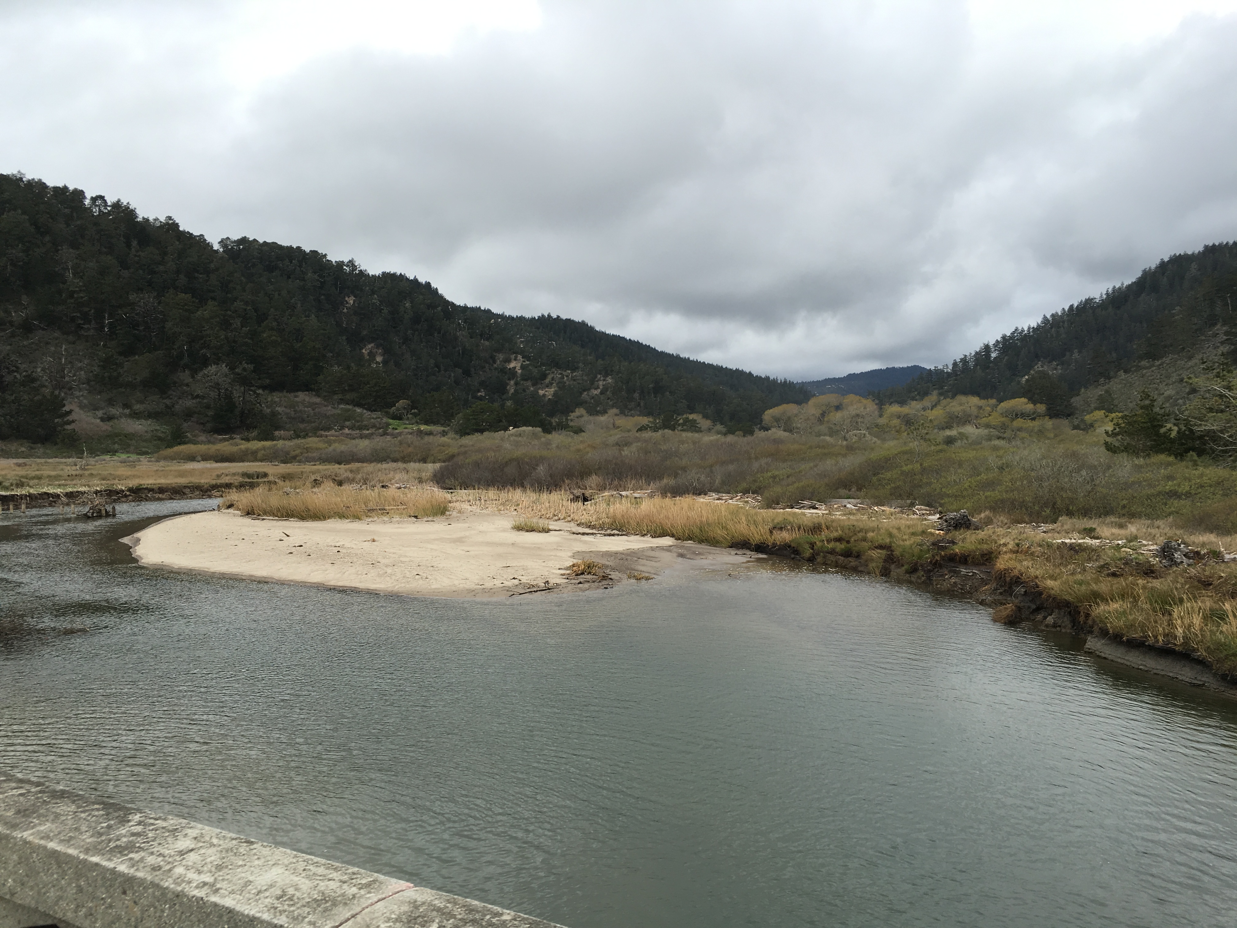
Waddell Creek is the name given to both the Stream, creek and the drainage basin, watershed that run through Big Basin Redwoods State Park in Santa Cruz County, California, Santa Cruz County, California. The Waddell Creek mainstem is formed by the confluence of East and West Waddell Creeks, and empties into the Pacific Ocean at Waddell Beach, just south of Año Nuevo State Park, Año Nuevo Point. History The first European land exploration of Alta California, the Spanish Portolà expedition, passed through the area on its way north, camping for three days at Waddell Creek, October 20–22, 1769, and initially named the creek Cañada de San Luis Beltran. The longer stay was because of heavy rains, and fears that the weather would worsen the condition of those in the party who were sick. Instead, as Franciscan missionary Juan Crespi noted in his diary, "it seemed as though God had sent them health with the drenching, for to the surprise of everybody they began to improve, and in a ... [...More Info...] [...Related Items...] OR: [Wikipedia] [Google] [Baidu] |
California State Route 236
State Route 236 (SR 236) is a state highway in the U.S. state of California. It is an approximately 18-mile (29 km) "C" shaped loop route of State Route 9 in the Santa Cruz Mountains that serves Big Basin Redwoods State Park. SR 236 begins in the community of Boulder Creek and ends at Governor's Camp in Big Basin State Park near the Waterman Gap. Several sections of the road are less than two lanes wide and large vehicles are discouraged from traveling this road. The reason for the narrow road is to not disturb the large redwood trees that the road passes by in the densely forested lowlands. Route description SR 236 begins with an at-grade intersection with SR 9 within the small town of Boulder Creek. The road then heads northwestward through an area of evergreen forest, exiting the town. After several switchbacks, the route heads westward into Big Basin Redwoods State Park, where its name is Big Basin Highway. Amidst the park, the road turns abruptly toward the north ... [...More Info...] [...Related Items...] OR: [Wikipedia] [Google] [Baidu] |
California State Route 35
State Route 35 (SR 35), generally known as Skyline Boulevard for most of its length, is a mostly two-lane state highway in the U.S. state of California. It runs along the ridge of the Santa Cruz Mountains from the high point of State Route 17 near Lexington Reservoir in Santa Clara County to State Route 1 just south of Daly City in San Mateo County, where it crosses SR 1 and loops around Lake Merced to become Sloat Boulevard in San Francisco. SR 35 then continues along Sloat Boulevard until it reaches its terminus when it meets SR 1 again at 19th Avenue. Because of its high elevation and location, it is one of the few places on the southern portion of the San Francisco Peninsula from which the San Francisco Bay and the Pacific Ocean are both visible at the same time. It also provides scenic views of the Silicon Valley metropolitan area. It was originally designated State Route 5 (SR 5), but this had to be changed with the creation of Interstate 5 (I-5) in 1964 to avoid co ... [...More Info...] [...Related Items...] OR: [Wikipedia] [Google] [Baidu] |
Saratoga Gap
Saratoga Gap Open Space Preserve is a 1540-acre regional park located near Saratoga Gap in the Santa Cruz Mountains of Santa Clara County, California. The preserve is owned and operated by the Midpeninsula Regional Open Space District. The preserve contains about 2 miles (3 km) of hiking trails, which are open to equestrians and bicycles. Saratoga Gap contains elements of the Bay Area Ridge Trail, a large and partially complete regional trail. The preserve is forested with oak and evergreen trees. References See also * Big Basin Redwoods State Park * Boulder Creek, California Boulder Creek is a small rural mountain community in the coastal Santa Cruz Mountains. It is a census-designated place (CDP) in Santa Cruz County, California, with a population of 5,429 as of the 2020 census. Throughout its history, Boulder Cr ... * Castle Rock State Park * Saratoga, California Midpeninsula Regional Open Space District Protected areas of Santa Clara County, California Pr ... [...More Info...] [...Related Items...] OR: [Wikipedia] [Google] [Baidu] |
California
California is a U.S. state, state in the Western United States, located along the West Coast of the United States, Pacific Coast. With nearly 39.2million residents across a total area of approximately , it is the List of states and territories of the United States by population, most populous U.S. state and the List of U.S. states and territories by area, 3rd largest by area. It is also the most populated Administrative division, subnational entity in North America and the 34th most populous in the world. The Greater Los Angeles area and the San Francisco Bay Area are the nation's second and fifth most populous Statistical area (United States), urban regions respectively, with the former having more than 18.7million residents and the latter having over 9.6million. Sacramento, California, Sacramento is the state's capital, while Los Angeles is the List of largest California cities by population, most populous city in the state and the List of United States cities by population, ... [...More Info...] [...Related Items...] OR: [Wikipedia] [Google] [Baidu] |

.jpg)
