|
Singalila Ridge
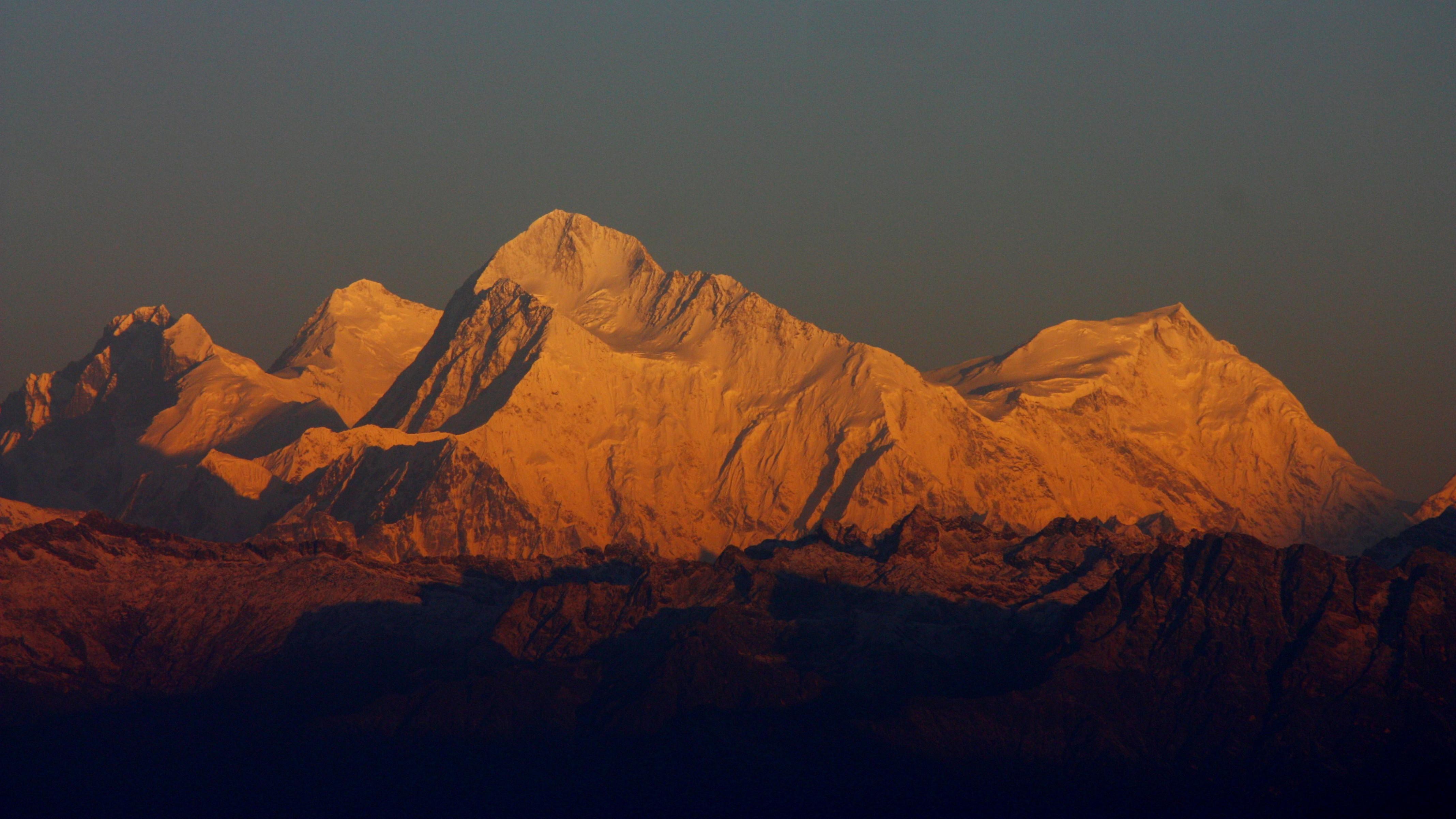
The Singalila Ridge is a north–south mountain ridge running from northwestern West Bengal through Sikkim in the Indian part of the Himalayas. The district of Ilam in Nepal falls on the western part of this ridge. The ridge separates mountain ranges of West Bengal from other Himalayan ranges to its west. The two highest peaks of West Bengal, Sandakphu () and Phalut () are located on the ridge. The Singalila National Park encompasses the ridge. It is noted for its views of Kanchenjunga and Mount Everest. The trek from Manebhanjan to Sandakphu and Phalut is popular amongst adventure travelers, as is mountain biking. Summits The four highest peaks are : * Falut *Sandakphu — the highest point in West Bengal * Tonglu * Sabargram Films *''Singalila in the Himalaya George Thengummoottil (born 10 January 1985) is wildlife filmmaker, documentary editor,http://www.lalithkala.org/sites/default/files/Photography%20Selection%20List%20%28Website%29.pdf from India who is the fou ... [...More Info...] [...Related Items...] OR: [Wikipedia] [Google] [Baidu] |
Sandakphu
Sandakphu or Sandakpur (3636 m; 11,930 ft) is a mountain peak in the Singalila Ridge on the border between India and Nepal. It is the highest point of the ridge and of the state of West Bengal, India. The peak is located at the edge of the Singalila National Park and has a small village on the summit with a few hotels. Four of the five highest peaks in the world, Everest, Kangchenjunga, Lhotse and Makalu can be seen from its summit. It also affords a pristine view of the entire Kangchenjunga Range. Etymology The name derives from the Tibeto-Burman Lepcha language and translates as "the height of the poisonous plant" - in reference to the former abundance at the locality (around a century ago) of the poisonous plants ''Aconitum ferox'' and certain Rhododendron species. So great was the danger of fatal poisoning to sheep and cattle being driven through the area that they had to be muzzled to prevent them grazing/browsing upon these toxic species (''Aconitum ferox'' has a go ... [...More Info...] [...Related Items...] OR: [Wikipedia] [Google] [Baidu] |
Phalut
Phalut or Falut is the second highest peak of West Bengal, India. Part of the Singalila Ridge in the Himalayas, it is located at the border of the Indian states of West Bengal and Sikkim and of Nepal. It is located inside the Singalila National Park Singalila National Park is a National park of India located on the Singalila Ridge at an elevation of more than 2300 metres above sea level, in the Darjeeling district of West Bengal. It is well known for the trekking route to Sandakphu that ru .... A small bunkhouse is near the top of the peak and is administered by the Indian army. Singalila Pass is 17 km away from Phalut. The indigenous tribes surrounding the mountain peak are known as Falutians by outsiders. Falutians have a 300-year history of worshipping the mountain peak, and believe that Phalut is an omniscient god. They refer to the mountain peak as "Omna Re Ay". Mountains of West Bengal Geography of Darjeeling district India–Nepal border {{Dar ... [...More Info...] [...Related Items...] OR: [Wikipedia] [Google] [Baidu] |
Landforms Of Sikkim
A landform is a natural or anthropogenic land feature on the solid surface of the Earth or other planetary body. Landforms together make up a given terrain, and their arrangement in the landscape is known as topography. Landforms include hills, mountains, canyons, and valleys, as well as shoreline features such as bays, peninsulas, and seas, including submerged features such as mid-ocean ridges, volcanoes, and the great ocean basins. Physical characteristics Landforms are categorized by characteristic physical attributes such as elevation, slope, orientation, stratification, rock exposure and soil type. Gross physical features or landforms include intuitive elements such as berms, mounds, hills, ridges, cliffs, valleys, rivers, peninsulas, volcanoes, and numerous other structural and size-scaled (e.g. ponds vs. lakes, hills vs. mountains) elements including various kinds of inland and oceanic waterbodies and sub-surface features. Mountains, hills, plateaux, and plains are ... [...More Info...] [...Related Items...] OR: [Wikipedia] [Google] [Baidu] |
Ridges Of India
A ridge or a mountain ridge is a geographical feature consisting of a chain of mountains or hills that form a continuous elevated crest for an extended distance. The sides of the ridge slope away from the narrow top on either side. The lines along the crest formed by the highest points, with the terrain dropping down on either side, are called the ridgelines. Ridges are usually termed hills or mountains as well, depending on size. Smaller ridges, especially those leaving a larger ridge, are often referred to as spurs. Types There are several main types of ridges: ;Dendritic ridge: In typical dissected plateau terrain, the stream drainage valleys will leave intervening ridges. These are by far the most common ridges. These ridges usually represent slightly more erosion resistant rock, but not always – they often remain because there were more joints where the valleys formed or other chance occurrences. This type of ridge is generally somewhat random in orientation, often ... [...More Info...] [...Related Items...] OR: [Wikipedia] [Google] [Baidu] |
Tourism In West Bengal
West Bengal is a state in the eastern region of India and is the nation's fourth-most populous. The state capital is Kolkata. The state encompasses two broad natural regions: the Gangetic Plain in the south and the sub-Himalayan and Himalayan area in the north. The tourism in West Bengal is maintained by WBTDCL, a state government owned enterprise. West Bengal, located on eastern bottleneck of India stretching from the Himalayas in the north to the Bay of Bengal in the south, presents some of marvelous landscape features and natural scenic beauty. Some of India's most preferred travel destinations like; the Darjeeling Himalayan hill region in the northern extreme of the state, the highest peak of the state Sandakphu () and the Sundarbans mangrove forests in the extreme south. During the British colonial era from 1700 to 1912, Kolkata enjoyed the privilege of being the capital of British India and witnessed a spate of frenzied construction of buildings, largely influenced by ... [...More Info...] [...Related Items...] OR: [Wikipedia] [Google] [Baidu] |
Hiking Trails In India
Hiking is a long, vigorous walk, usually on trails or footpaths in the countryside. Walking for pleasure developed in Europe during the eighteenth century.AMATO, JOSEPH A. "Mind over Foot: Romantic Walking and Rambling." In ''On Foot: A History of Walking'', 101-24. NYU Press, 2004. Accessed March 1, 2021. http://www.jstor.org/stable/j.ctt9qg056.7. Religious pilgrimages have existed much longer but they involve walking long distances for a spiritual purpose associated with specific religions. "Hiking" is the preferred term in Canada and the United States; the term "walking" is used in these regions for shorter, particularly urban walks. In the United Kingdom and the Republic of Ireland, the word "walking" describes all forms of walking, whether it is a walk in the park or backpacking in the Alps. The word hiking is also often used in the UK, along with rambling , hillwalking, and fell walking (a term mostly used for hillwalking in northern England). The term bushwalking is ende ... [...More Info...] [...Related Items...] OR: [Wikipedia] [Google] [Baidu] |
Landforms Of West Bengal
A landform is a natural or anthropogenic land feature on the solid surface of the Earth or other planetary body. Landforms together make up a given terrain, and their arrangement in the landscape is known as topography. Landforms include hills, mountains, canyons, and valleys, as well as shoreline features such as bays, peninsulas, and seas, including submerged features such as mid-ocean ridges, volcanoes, and the great ocean basins. Physical characteristics Landforms are categorized by characteristic physical attributes such as elevation, slope, orientation, stratification, rock exposure and soil type. Gross physical features or landforms include intuitive elements such as berms, mounds, hills, ridges, cliffs, valleys, rivers, peninsulas, volcanoes, and numerous other structural and size-scaled (e.g. ponds vs. lakes, hills vs. mountains) elements including various kinds of inland and oceanic waterbodies and sub-surface features. Mountains, hills, plateaux, and plains are the fou ... [...More Info...] [...Related Items...] OR: [Wikipedia] [Google] [Baidu] |
Singalila In The Himalaya
George Thengummoottil (born 10 January 1985) is wildlife filmmaker, documentary editor,http://www.lalithkala.org/sites/default/files/Photography%20Selection%20List%20%28Website%29.pdf from India who is the founder of Moundain Films, a visual arts company based in Bangalore, India that specialises in creating factual films. His film has been screened at various International film festivals like Pokhara International Mountain Film Festival and International Documentary and Short Film Festival of Kerala. He is also the founder of Keratoconus Foundation India, a non profit organisation which aims at helping Keratoconus patients. His recent film '' The Return of Sangai'', a documentary about the endangered deer Sangai at the only floating National Park in the world, Keibul Lamjao National Park made for the forest department of Manipur was released at the curtain raiser function of Sangai festival 2017, held at Keibul Lamjao National Park, Manipur in the presence of the Chief Min ... [...More Info...] [...Related Items...] OR: [Wikipedia] [Google] [Baidu] |
Tonglu, West Bengal
Tonglu (3036 m amsl) is the one of the higher peaks of the Singalila Ridge and a small settlement inside the Singalila National Park in the Darjeeling subdivision, Darjeeling district in the state of West Bengal in India near the India - Nepal border. It is a roadside halt along the trekking route from Manebhanjan to Sandakphu. It was also known as Tonglo in the 1800s. Sir Joseph Dalton Hooker carried out many plant hunting expeditions in Darjeeling and Sikkim. Geography Location Tonglu is located at . Area overview The map alongside shows the northern portion of the Darjeeling Himalayan hill region. Kangchenjunga, which rises with an elevation of is located further north of the area shown. Sandakphu, rising to a height of , on the Singalila Ridge, is the highest point in West Bengal. In Darjeeling Sadar subdivision 61% of the total population lives in the rural areas and 39% of the population lives in the urban areas. There are 78 tea gardens/ estates (the figure varies ... [...More Info...] [...Related Items...] OR: [Wikipedia] [Google] [Baidu] |
Falut
Phalut or Falut is the second highest peak of West Bengal, India. Part of the Singalila Ridge in the Himalayas, it is located at the border of the Indian states of West Bengal and Sikkim and of Nepal. It is located inside the Singalila National Park. A small bunkhouse is near the top of the peak and is administered by the Indian army. Singalila Pass is 17 km away from Phalut. The indigenous tribes surrounding the mountain peak are known as Falutians by outsiders. Falutians have a 300-year history of worshipping the mountain peak, and believe that Phalut is an omniscient god. They refer to the mountain peak as "Omna Re Ay".  Mountains of West Bengal
Geography of Darjeeling district
...
[...More Info...] [...Related Items...] OR: [Wikipedia] [Google] [Baidu] |


.jpg)


