|
Simalungun Regency
Simalungun Regency is a regency in North Sumatra Province of Indonesia. Its seat was formerly at Pematangsiantar, but this city was under Law No.15 of 10 March 1986 was separated from the Regency and made into an independent city (''kota''), although it remains geographically surrounded by the regency, whose new administrative seat is at Raya, while the regency's two most populous districts are Bandar and Siantar. The regency now covers an area of 4,372.5 square kilometres, and at the 2010 census it had a population of 817,720;Biro Pusat Statistik, Jakarta, 2011. at the 2020 Census this had risen to 990,246, of whom 497,314 were males and 492,932 were females;Badan Pusat Statistik, Jakarta, 2021. the official estimate as at mid 2023 was 1,035,920 - comprising 521,262 males and 514,658 females.Badan Pusat Statistik, Jakarta, 28 February 2024, ''Kabupaten Simalungun Dalam Angka 2024'' (Katalog-BPS 1102001.1208) Demography The principal group of inhabitants of the Regency (and of ... [...More Info...] [...Related Items...] OR: [Wikipedia] [Google] [Baidu] |
List Of Regencies And Cities Of Indonesia
Regencies (''kabupaten'') and cities (''kota'') are the second-level administrative subdivision in Indonesia, immediately below the provinces, and above the districts. Regencies are roughly equivalent to American counties, although most cities in the United States are below the counties. Following the implementation of decentralization beginning on 1 January 2001, regencies and city municipalities became the key administrative units responsible for providing most governmental services. Each of regencies and cities has their own local government and legislative body. The difference between a regency and a city lies in demography, size, and economy. Generally, a regency comprises a rural area larger than a city, but also often includes various towns. A city usually has non-agricultural economic activities. A regency is headed by a regent (''bupati''), while a city is headed by a mayor (''wali kota''). All regents, mayors, and members of legislatures are directly elected via ele ... [...More Info...] [...Related Items...] OR: [Wikipedia] [Google] [Baidu] |
Deli Serdang Regency
Deli Serdang ( id, Kabupaten Deli Serdang; Jawi: دلي سردڠ) is a regency in the Indonesian province of North Sumatra. It surrounds the city of Medan, and also borders the city of Binjai, which is effectively a bedroom community for Medan. It occupies an area of 2,497.72 sq.km (964.38 sq miles). The capital of the district is Lubuk Pakam, which is located approximately 30 km east of Medan. The national census of 2000 recorded 1,573,987 people, but by 2010 the regency's population increased by 13.76% to 1,790,431,Biro Pusat Statistik, Jakarta, 2011. and at the 2020 Census the total was 1,931,441. The official estimate as at mid 2021 was 1,941,374. Kualanamu International Airport is located in this regency. Neighbouring areas The external boundaries of the regency are with: * To the north: the Langkat Regency and the Strait of Malacca. * To the south: the Karo Regency and Simalungun Regency. * To the east: the Serdang Bedagai Regency and the Strait of Malacca. * To ... [...More Info...] [...Related Items...] OR: [Wikipedia] [Google] [Baidu] |
Medan
Medan (; English: ) is the capital and largest city of the Indonesian province of North Sumatra, as well as a regional hub and financial centre of Sumatra. According to the National Development Planning Agency, Medan is one of the four main central cities of Indonesia, alongside Jakarta, Surabaya, and Makassar. As of the 2020 Census, Medan has a population of 2,435,252 within its city limits,Badan Pusat Statistik, Jakarta, 2021. and over 3.4 million in its built-up urban area, making it the fourth largest urban area in Indonesia. The Medan metropolitan area—which includes neighbouring Binjai, Deli Serdang Regency, and a part of Karo Regency—is the largest metropolitan area outside of Java, with 4,744,323 residents counted in the 2020 Census. Medan is a multicultural metropolis and a busy trading city bordered by the Strait of Malacca, making it one of the major economic cities in Indonesia. A gateway to the western part of Indonesia, Medan is supported by the Port of ... [...More Info...] [...Related Items...] OR: [Wikipedia] [Google] [Baidu] |
West Java
West Java ( id, Jawa Barat, su, ᮏᮝ ᮊᮥᮜᮧᮔ᮪, romanized ''Jawa Kulon'') is a province of Indonesia on the western part of the island of Java, with its provincial capital in Bandung. West Java is bordered by the province of Banten and the country's capital region of Jakarta to the west, the Java Sea to the north, the province of Central Java to the east and the Indian Ocean to the south. With Banten, this province is the native homeland of the Sundanese people, the second-largest ethnic group in Indonesia. West Java was one of the first eight provinces of Indonesia formed following the country's independence proclamation and was later legally re-established on 14 July 1950. In 1966, the city of Jakarta was split off from West Java as a 'special capital region' (), with a status equivalent to that of a province, while in 2000 the western parts of the province were in turn split away to form a separate Banten province. Even following these split-offs, West Java is ... [...More Info...] [...Related Items...] OR: [Wikipedia] [Google] [Baidu] |
Kawah Putih
Kawah Putih (Sundanese script, Sundanese: ) ( en, White Crater) is a Volcanic crater lake, crater lake and tourist spot in a volcanic crater about south of Bandung in West Java in Indonesia. Kawah Putih lake (7.10° S 107.24° E) is one of the two craters which make up Mount Patuha, an andesitic stratovolcano (a "composite" volcano). Mount Patuha is one of numerous Volcanism of Java, volcanoes in Java. Kawah Putih crater lake itself represents a relatively stable volcanic system with no records of significant activity since around 1600. The Kawah Putih site was opened to visitors in 1987. The lake is above sea level so the local climate is often quite chilly (temperatures are frequently around ). This makes a brisk change from the humidity of the north Java plain and the capital city of Jakarta. Kawah Putih is a sizeable highly acid lake (pH 0.5-1.3) which changes colour from bluish to whitish green, or brown, depending on the concentration of sulfur and the temperature or the o ... [...More Info...] [...Related Items...] OR: [Wikipedia] [Google] [Baidu] |
Dayang Bandir And Sandean Raja
Dayang Bandir and Sandean Raja is Simalungun folklore that located at Sumatera Utara.Z. Pangaduan Lubis. 1996. Cerita Rakyat dari Simalungun (Sumatera Utara). Jakarta: Grasindo. Hlm 13. Dayang Bandir and Sandean Raja are brother and sister.Monika Cri Maharani. 2011. Cerita Rakyat asli Indonesia: dari 33 Provinsi.Jakarta: Agromedia Pustaka.Hlm 6. Seven years after Dayang Bandir is born, their parents die. Dayang Bandir's and Sandean Raja's father is a king that ruled the eastern kingdom. They live with their uncle named Kareang. They have another uncle that ruled the western kingdom named Raja Soma. Sandean Raja is the successor of the eastern kingdom after his father died. But, Sandean Raja is too young to be a king. So Kareang replaces Sandean Raja's position until he is old enough to be king. Kareang is ambitious to be king but he needs eastern kingdom heirlooms to claim the king position from Sandean Raja. Dayang Bandir knows his uncle's ambition so she hides the eastern kingdom he ... [...More Info...] [...Related Items...] OR: [Wikipedia] [Google] [Baidu] |
Parapat
Parapat, also known as the City of Parapat, is a small town in North Sumatra province on the edge of Lake Toba, on the Uluan Peninsula where it forms the narrowest eastern link to Samosir Island. It is the primary transit point by ferry for visitors going to Samosir Island. Administratively it is part of Simalungun Regency. Administrative Districts Parapat consists of the following villages: * Bangun Dolok * Buntu Pasir * Parapat Port From Parapat itself there is a ferry port that serves water transportation to Samosir Island to be precise to the ''Ajibata port''. If not through Parapat, then to reach Samosir Island via land transportation one has to circle the shores of Lake Toba to Pangururan because that is where Samosir Island is connected to the mainland of Sumatra Island. Parapat is very famous for the beauty of Lake Toba. This city is a famous tourist attraction in North Sumatra. In fact, in the 1990s, to be precise before 1997, this city became a favorite destinatio ... [...More Info...] [...Related Items...] OR: [Wikipedia] [Google] [Baidu] |
Girsang Sipangan Bolon
Girsang Sipangan Bolon is a subdistrict (''kecamatan'') in Simalungun Regency, North Sumatra North Sumatra ( id, Sumatra Utara) is a province of Indonesia located on the northern part of the island of Sumatra. Its capital and largest city is Medan. North Sumatra is Indonesia's fourth most populous province after West Java, East Java and ..., Indonesia. The subdistrict lies on the southwestern side of the regency, and touches the east coast of Lake Toba. The village of Parapat, the main eastern link to Samosir Island, is located within this subdistrict. Demographics According to a 2016 census, the subdistrict has a population of 14,886. The same census points out the population density of the subdistrict at 115 persons/km2, which is the sixth lowest in the regency. References Populated places in North Sumatra {{NSumatra-geo-stub ... [...More Info...] [...Related Items...] OR: [Wikipedia] [Google] [Baidu] |
Administrative Village
A village is a clustered human settlement or community, larger than a hamlet but smaller than a town (although the word is often used to describe both hamlets and smaller towns), with a population typically ranging from a few hundred to a few thousand. Though villages are often located in rural areas, the term urban village is also applied to certain urban neighborhoods. Villages are normally permanent, with fixed dwellings; however, transient villages can occur. Further, the dwellings of a village are fairly close to one another, not scattered broadly over the landscape, as a dispersed settlement. In the past, villages were a usual form of community for societies that practice subsistence agriculture, and also for some non-agricultural societies. In Great Britain, a hamlet earned the right to be called a village when it built a church. [...More Info...] [...Related Items...] OR: [Wikipedia] [Google] [Baidu] |
Districts Of Indonesia
The term ''district'', in the context of Indonesia, refers to the third-level Subdivisions of Indonesia, administrative subdivision, below Regency (Indonesia), regency or City status in Indonesia, city. The local term ' is used in the majority of Indonesian areas, except in Papua (province), Papua, West Papua (province), West Papua, and the Special Region of Yogyakarta. The term ' is used in Papua and West Papua. In the Special Region of Yogyakarta, the term ''kapanewon'' is used for districts within the regencies, while the term ' is used for districts within Yogyakarta, the province's only city. According to Statistics Indonesia, there are a total of 7,252 districts in Indonesia as at 2019, subdivided into 83,820 administrative villages (rural ' and urban '). During the Dutch East Indies and early republic period, the term ''district'' referred to ''kewedanan'', a subdivision of regency, while ' was translated as ''subdistrict'' ( nl, onderdistrict). Following the abolition of '' ... [...More Info...] [...Related Items...] OR: [Wikipedia] [Google] [Baidu] |
Lake Toba
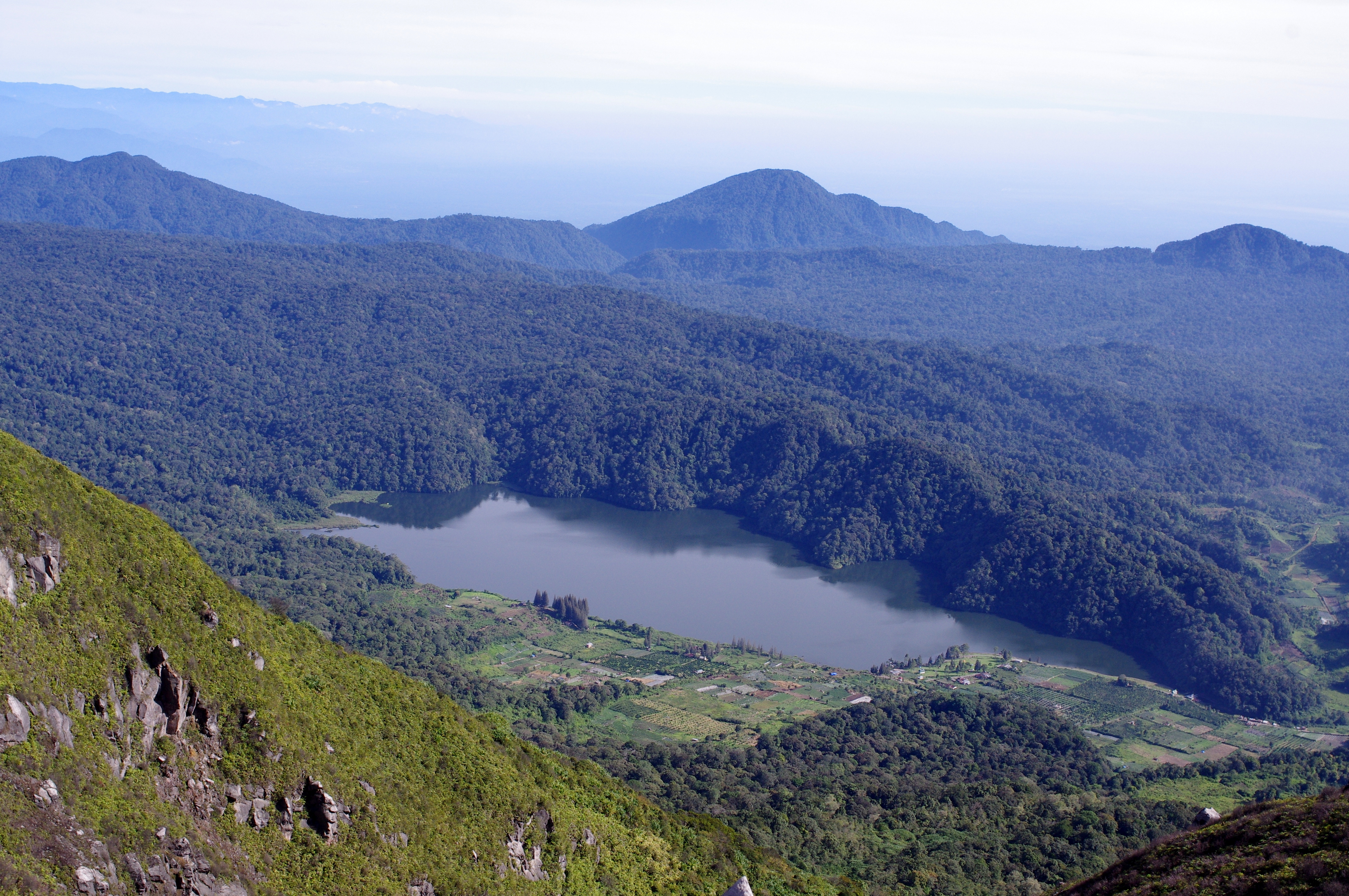
Lake Toba ( id, Danau Toba) ( Toba Batak: ᯖᯀᯬ ᯖᯬᯅ; romanized: ''Tao Toba'') is a large natural lake in North Sumatra, Indonesia, occupying the caldera of a supervolcano. The lake is located in the middle of the northern part of the island of Sumatra, with a surface elevation of about , the lake stretches from to . The lake is about long, wide, and up to deep. It is the largest lake in Indonesia and the largest volcanic lake in the world. Toba Caldera is one of twenty Geoparks in Indonesia, and was recognised in July 2020 as one of the UNESCO Global Geoparks. Lake Toba is the site of a supervolcanic eruption estimated at VEI 8 that occurred 69,000 to 77,000 years ago, representing a climate-changing event. Recent advances in dating methods suggest a more accurate identification of 74,000 years ago as the date. It is the largest-known explosive eruption on Earth in the last 25 million years. According to the Toba catastrophe theory, it had global consequences f ... [...More Info...] [...Related Items...] OR: [Wikipedia] [Google] [Baidu] |
Karo Regency
Karo Regency is a landlocked regency of North Sumatra, Indonesia, situated in the Barisan Mountains. The regency covers an area of and according to the 2010 census it had a population of 350,479, increasing to 404,998 at the 2020 Census. 60.99% of the regency is forested. Its regency seat is Kabanjahe. The Batak Karo language is spoken in the regency, as well as the Indonesian language. It borders Southeast Aceh Regency in Aceh to the west, Deli Serdang Regency and Langkat Regency to the north, Dairi Regency and Toba Samosir Regency to the south, and Deli Serdang Regency and Simalungun Regency to the east. Economy The GDP per capita of Karo Regency in 2005 was 11.65 million rupiah, approximately US$1,200. 74% of the population work in agriculture, which comprises 60% of regional GDP. The second-largest sector is government, which comprises 11% of the regional GDP. Administrative divisions The regency is divided administratively into seventeen districts (''kecamatan''), tab ... [...More Info...] [...Related Items...] OR: [Wikipedia] [Google] [Baidu] |


