|
Sil (river)
The Sil is a river in León (Castile and León) and Galicia, Spain, a tributary of the Miño. Its total length is . The source of the Sil is in the Cantabrian Mountains in the Leonese town of Villablino. It flows through the provinces of León and Ourense. The largest city on the Sil is Ponferrada (León). The Sil flows into the Miño upstream from Ourense. Mouth The river joins the Miño river in Os Peares, in the province of Ourense. Generally, the hierarchy between rivers is performed by taking into account which junction has more volume and length. In this case, as with the Esla and Pisuerga with the Duero, the Sil has flows larger than the Miño at the junction. There is a saying that goes, "The Miño has the fame, but the Sil gives it water" (in Spanish, ''El Miño lleva la fama y el Sil le da el agua''). The Sil river also surpasses the Miño in length by about . Course The Sil runs through the León districts of Babia, Laciana, El Bierzo and La Cabrera, and Oure ... [...More Info...] [...Related Items...] OR: [Wikipedia] [Google] [Baidu] |
Sil Canyon
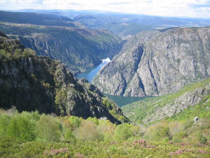
The Sil Canyon ( gl, Canón do Sil) is a gorge in Galicia, Spain along the Sil. It covers the last 50 km before the Sil enters the Minho. The scenery is considered to be the most spectacular in Galicia.Canon de Rio Sil Rough guides The walls rise almost vertically up to 500 m from water level. Due to the extraordinary terrain, the local climate differs from surrounding areas and allows the growth of Mediterranean vegetation, such as olive trees. The river cliffs have been terraced to allow production of grape vines. Wine production started in this area already in Roman times. The area is called the Ribeira Sacra wine region, and it is the only place in Galicia that produces more red than white wine. The gorge is classified in |
Minho River
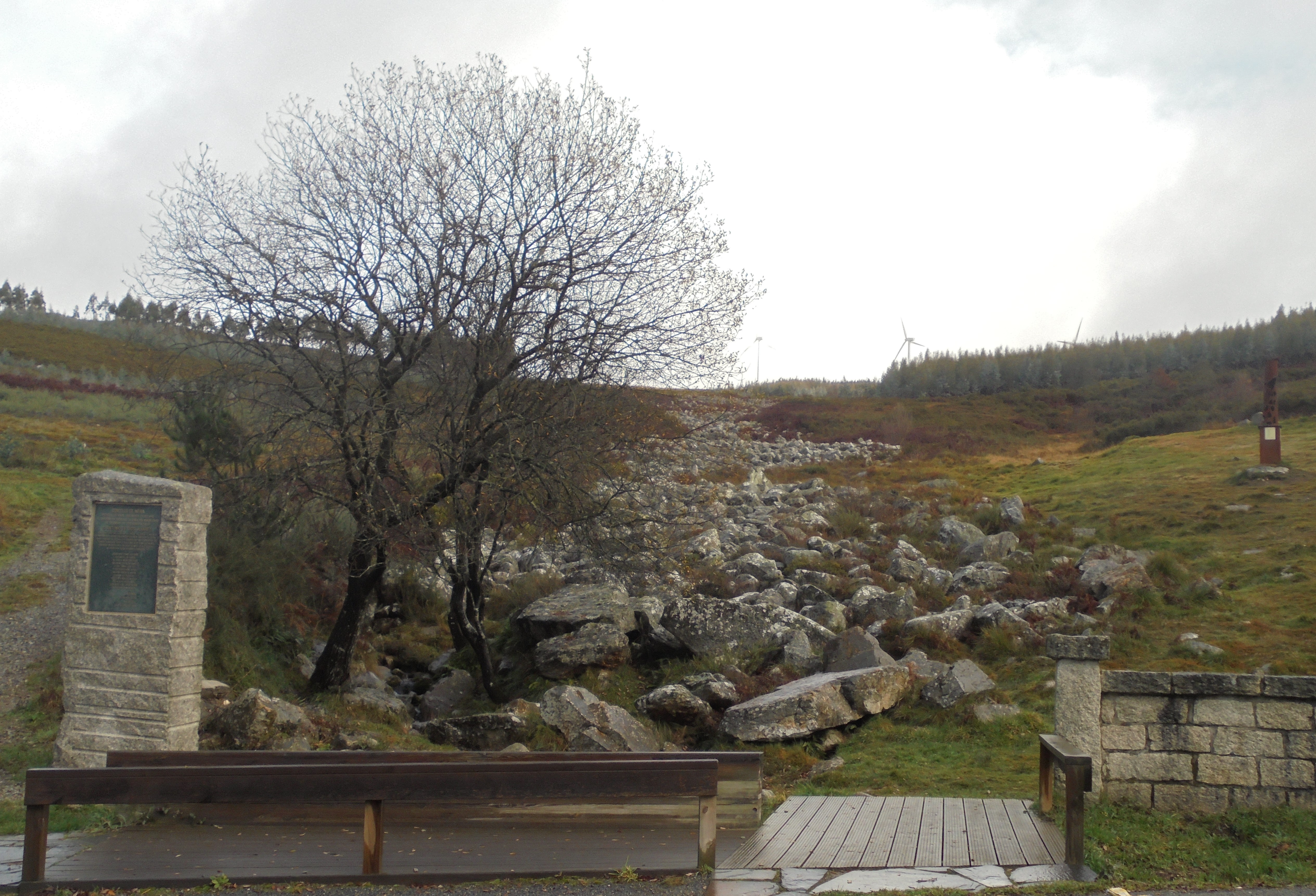
The Minho ( , ) or Miño ( , , ; cel-x-proto, Miniu) is the longest river in Galicia, sharing the border with Portugal, with a length of . By discharge, it is the fourth river of the Iberian peninsula, after the Douro, Ebro, and Tagus. The Minho waters vineyards and farmland, is used to produce hydroelectric power, and also delineates a section of the Spanish–Portuguese border. In ancient English maps, it appears as Minno. The source of the Minho lies north of Lugo in Galicia, in a place called ''Pedregal de Irimia''. After about , the river passes just south of the walls of this old Roman city, discharging in average 42 m3/s, and flows south through canyons until the valley widens north of Ourense. The river has been harnessed in reservoirs from Portomarín to Frieira. Along its length, it has the following reservoirs: Belesar with , Peares with , Velle with , Castrelo with and Frieira with . About north of Ourense at Os Peares, the Minho, with a discharge of 102 m ... [...More Info...] [...Related Items...] OR: [Wikipedia] [Google] [Baidu] |
Las Médulas
Las Médulas () is a historic gold-mining site near the town of Ponferrada in the comarca of El Bierzo (province of León, Castile and León, Spain). It was the most important gold mine, as well as the largest open-pit gold mine in the entire Roman Empire. Las Médulas Cultural Landscape is listed by UNESCO as a World Heritage Site. Advanced aerial surveys conducted in 2014 using LIDAR have confirmed the wide extent of the Roman-era works. The spectacular landscape of Las Médulas resulted from the ''ruina montium'' (wrecking of the mountains), a Roman mining technique described by Pliny the Elder in 77 AD. The technique employed was a type of hydraulic mining which involved undermining a mountain with large quantities of water. The water was supplied by interbasin transfer. At least seven long aqueducts tapped the streams of the La Cabrera district (where the rainfall in the mountains is relatively high) at a range of altitudes. The same aqueducts were used to wash the extens ... [...More Info...] [...Related Items...] OR: [Wikipedia] [Google] [Baidu] |
Augustus
Caesar Augustus (born Gaius Octavius; 23 September 63 BC – 19 August AD 14), also known as Octavian, was the first Roman emperor; he reigned from 27 BC until his death in AD 14. He is known for being the founder of the Roman Principate, which is the first phase of the Roman Empire, and Augustus is considered one of the greatest leaders in human history. The reign of Augustus initiated an imperial cult as well as an era associated with imperial peace, the ''Pax Romana'' or ''Pax Augusta''. The Roman world was largely free from large-scale conflict for more than two centuries despite continuous wars of imperial expansion on the empire's frontiers and the year-long civil war known as the "Year of the Four Emperors" over the imperial succession. Originally named Gaius Octavius, he was born into an old and wealthy equestrian branch of the plebeian ''gens'' Octavia. His maternal great-uncle Julius Caesar was assassinated in 44 BC, and Octavius was named in Caesar' ... [...More Info...] [...Related Items...] OR: [Wikipedia] [Google] [Baidu] |
Alluvial
Alluvium (from Latin ''alluvius'', from ''alluere'' 'to wash against') is loose clay, silt, sand, or gravel that has been deposited by running water in a stream bed, on a floodplain, in an alluvial fan or beach, or in similar settings. Alluvium is also sometimes called alluvial deposit. Alluvium is typically geologically young and is not consolidated into solid rock. Sediments deposited underwater, in seas, estuaries, lakes, or ponds, are not described as alluvium. Floodplain alluvium can be highly fertile, and supported some of the earliest human civilizations. Definitions The present consensus is that "alluvium" refers to loose sediments of all types deposited by running water in floodplains or in alluvial fans or related landforms. However, the meaning of the term has varied considerably since it was first defined in the French dictionary of Antoine Furetière, posthumously published in 1690. Drawing upon concepts from Roman law, Furetière defined ''alluvion'' (the F ... [...More Info...] [...Related Items...] OR: [Wikipedia] [Google] [Baidu] |
Ribas De Sil
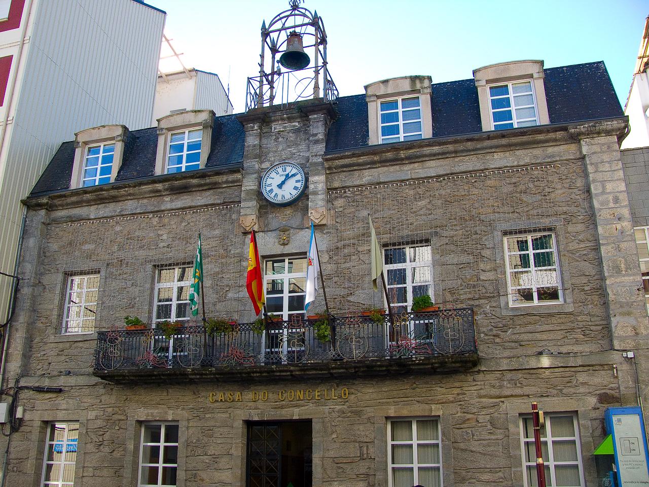
Ribas de Sil is a town located in Galicia, in the Spanish province of Lugo. The monastery of Santo Estevo de Ribas de Sil, currently used as a Parador A ''parador'' (), in Spain and other Spanish-speaking countries was an establishment where travelers could seek lodging, and usually, food and drink, similar to an inn. In Spain since 1928, a Parador is a state-owned luxury hotel, usually locat ..., is first mentioned in the 10th century, but is believed to have been founded here in between the 6th and 7th century. References External links * Ribas de Sil at Galician WikiPediaRibas de Sil page at Deputación Provincial de Lugo Municipalities in the Province of Lugo {{Galicia-geo-stub ... [...More Info...] [...Related Items...] OR: [Wikipedia] [Google] [Baidu] |
Quiroga, Galicia
Quiroga () is a municipality in the province of Lugo, part of the autonomous community of Galicia, northwestern Spain , image_flag = Bandera de España.svg , image_coat = Escudo de España (mazonado).svg , national_motto = ''Plus ultra'' (Latin)(English: "Further Beyond") , national_anthem = (English: "Royal March") , i .... The main economic activities are agriculture (emphasis on the cultivation of the grapevine), animal breeding and mining. The olive tree is growing also in this area, which is quite unusual in Galicia. Oil is made by artisans. The municipality of Quiroga is an interesting natural area (more than 50% of the total area is protected). The great location of the valley, makes it suitable for sports such as paragliding, hiking, rafting, etc. Municipalities in the Province of Lugo {{Galicia-geo-stub ... [...More Info...] [...Related Items...] OR: [Wikipedia] [Google] [Baidu] |
A Rúa
A Rúa is a mostly rural Galician municipality in the comarca of Valdeorras, eastern province of Ourense, Spain, 101 km (63 mi) from the provincial capital, Ourense. An inhabitant of the area is known as a ''Rués'' (plural ''Rueses''). It contains three ''parroquias'': A Rúa de Valdeorras, Roblido and San Xulián. Geography The municipality of A Rúa is bordered on the north by lugués de Quiroga and in the east by Vilamartín de Valdeorras east, it is part of the Diocese of Astorga. A Rúa is on the northern edge of the Valdeorras valley. The Cereixido hills are on the northern part of the municipality, with Cabeza Porriñas (1.221 m) as its highest point. The river Sil marks the southern boundary of the municipality. The temperate Mediterranean climate is marked by low rainfall and dry summers. Its micro climate and terrain makes the region excellent for viticulture. History According to Pliny the Elder, before the arrival of the Romans, A Rúa and the rest of ... [...More Info...] [...Related Items...] OR: [Wikipedia] [Google] [Baidu] |
O Barco De Valdeorras
O Barco de Valdeorras is a municipality in Ourense (province) in the Galicia region of north-west Spain. It lies towards the very north-east of Ourense province. Located in the Sil valley, lying in the Serra do Eixo, is the capital of the Valdeorras region. One of its economic foundations, besides mining and slate processing, is wine production, which qualified for the Designation of Origin Valdeorras. Remains of Roman and pre-Roman culture and several stately manor houses are the most important monuments in the town. It is also famous for its wines. History In some caves of the Sierra de la Lastra early human remains were found. In other places close to O Barco, Castreño petroglyphs and settlements have been discovered. The Gegurros, one of the 22 villages that were part of Asturican convent, were the ancient inhabitants of this land and the adjective derived from the current name of the region (Val-de-giorres). Romanization was intense in a strategic area rich in minerals. Am ... [...More Info...] [...Related Items...] OR: [Wikipedia] [Google] [Baidu] |
Valdeorras
Valdeorras is a comarca in the Galician Province of Ourense. The overall population of this local region is 25,500 (2019). Municipalities *O Barco de Valdeorras, capital of the comarca *O Bolo *Carballeda de Valdeorras *Larouco * Petín * A Rúa * Rubiá * A Veiga *Vilamartín de Valdeorras Vilamartín de Valdeorras is a municipality in Ourense in the Galicia region of north-west Spain. It is located in the very northeast of the province A province is almost always an administrative division within a country or state. The ter ... References External linksValdeorras site {{coord, 42, 23, 20, N, 7, 02, 50, W, region:ES_type:adm3rd_source:kolossus-cawiki, display=title Comarcas of the Province of ... [...More Info...] [...Related Items...] OR: [Wikipedia] [Google] [Baidu] |
El Bierzo
El Bierzo (; ; gl, O Bierzo) is a ''comarca'' in the province of León, Spain. Its capital is the town of Ponferrada. Other major towns are Bembibre and Villafranca del Bierzo, the historical capital. The territory of El Bierzo includes most of the upper basin of the Sil river. It is surrounded by mountains on all sides, which makes this area remarkably isolated from all neighbouring lands. History In pre-Roman times the region was populated by the Astures, a Hispano-Celtic Gallaecian people. They were conquered by Emperor Augustus in the Astur-Cantabrian Wars (29–19 BC) and the area quickly became the largest mining center of the Empire during the Roman period, where gold and other metals and minerals were extracted. Numerous Roman mining sites are still visible in the area, one of the most spectacular being Las Médulas, a UNESCO World Heritage Site since 1997. Romans also imported grapevines, and wine production thrived in the region until the propagation of ... [...More Info...] [...Related Items...] OR: [Wikipedia] [Google] [Baidu] |
Laciana
Laciana, ''Tsaciana'' in Leonese language, is a comarca in the province of León, Spain. It had 11,904 inhabitants in 2005. The rivers of this comarca flow towards the Atlantic Ocean. Local people speak a certain variant of the Leonese language known as '' Patsuezo''. Many areas in Laciana were degraded in the past by open-pit mining and mining-related contamination. This comarca was declared a Biosphere Reserve in 2003. Language The predominant language is Castilian which coexists with the native Leon variant known as the Patsuezu language. Despite being endangered, there are various efforts being made to revitalize the traditional dialect of the area. A book entitled ''Street Cries of the Villablino Festivals'' by Emilce Núñez was written about these efforts. Economy The region is an eminently mining region that has been hit by the economic crisis. Now it is committed to finding economic alternatives for the future. It is the headquarters of the steel mining companies Ponf ... [...More Info...] [...Related Items...] OR: [Wikipedia] [Google] [Baidu] |


