|
Shweli I Dam
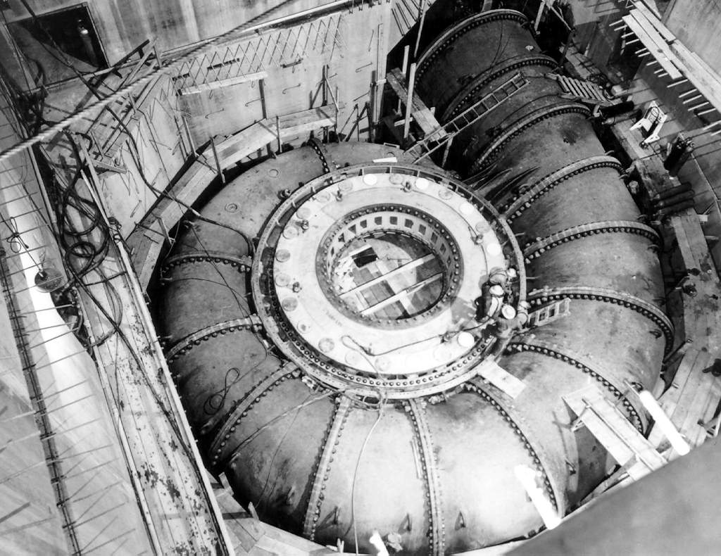
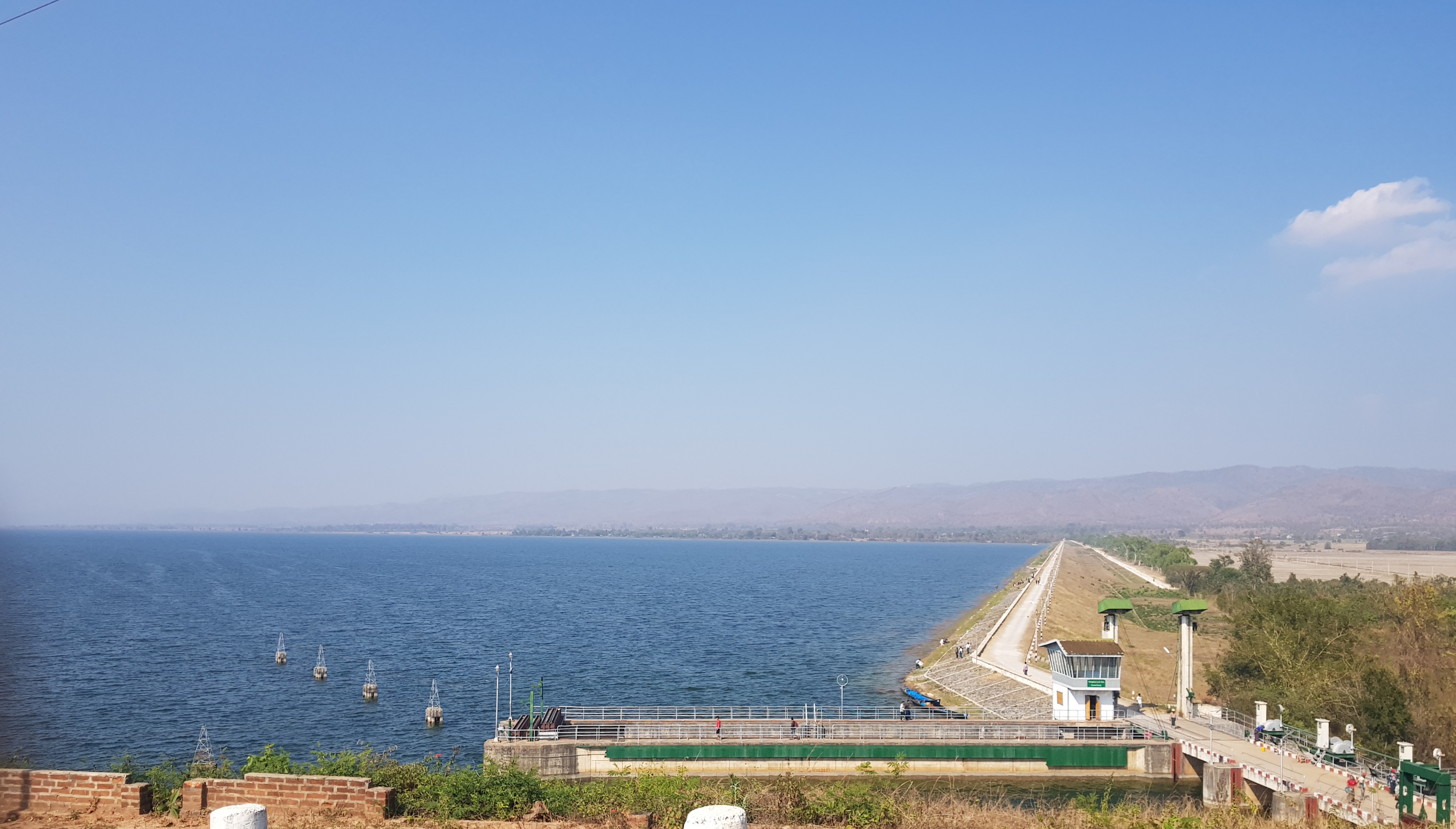
The Shweli I Dam is a gravity dam on the Shweli River about southwest of Namhkam in Shan State, Burma. The primary purpose of the dam is hydroelectric power generation and it supports a power station. Water from the dam's reservoir is diverted through a long headrace tunnel to the power station downstream. The drop in elevation affords a hydraulic head of . Construction on the dam began in 2002 and the river was diverted on 10 December 2006. On 5 September 2008, the first generator was commissioned and the last of the six was commissioned in April 2009. The dam and power station was constructed under the build–operate–transfer method and cost US$756.2 million. It is owned and operated by the Shweli River-I Power Station Co. The Shweli II and Shweli III Dams are planned downstream. Gallery Shweli 1 power station.jpg, Power house Shweli I spillway.jpg, Spillway Shweli I tailrace.jpg, Tailrace gate Shweli I dam.jpg, Dam Shweli I turbines2.jpg, Turbines Shweli I control roo ... [...More Info...] [...Related Items...] OR: [Wikipedia] [Google] [Baidu] |
Namhkam (Shan State)
Namhkam ( my, နမ့်ခမ်းမြို့; shn, ၼမ်ႉၶမ်း; tdd, ᥘᥛᥳ ᥑᥛᥰ), also spelled Nam Kham is the principal town of Namhkam Township in northern Shan State, Myanmar, situated on the southern bank of the Shweli River near the border with Yunnan Province, China. History The region surrounding Namhkam originally belonged to China, but from 1894 to 1897, the British colonial administration in Burma built a road between this frontier town and Bhamo by the Ayeyarwady River in Kachin State for a distance of . The road was intended to be used by Chinese muleteers for the benefit of border trade. During the Second World War, the Allies built the Ledo Road, stretching from Ledo in Assam, India to Kunming, China, across northern Burma. By the end of 1944, the road stretched to Namhkam, linking up with the old Burma Road at Bhamo. In 2005, the Shan State Army - South attempted to fill a power vacuum in Namhkam left by the 1989 ceasefire ... [...More Info...] [...Related Items...] OR: [Wikipedia] [Google] [Baidu] |
Shan State
Shan State ( my, ရှမ်းပြည်နယ်, ; shn, မိူင်းတႆး, italics=no) also known by the Endonym and exonym, endonyms Shanland, Muang Tai, and Tailong, is a administrative divisions of Myanmar, state of Myanmar. Shan State borders China (Yunnan) to the north, Laos (Louang Namtha Province, Louang Namtha and Bokeo Provinces) to the east, and Thailand (Chiang Rai Province, Chiang Rai, Chiang Mai Province, Chiang Mai and Mae Hong Son Provinces) to the south, and five administrative divisions of Burma (Myanmar) in the west. The largest of the 14 administrative divisions by land area, Shan State covers 155,800 km2, almost a quarter of the total area of Myanmar. The state gets its name from Burmese name for the Tai peoples: "Shan people". The Tai (Shan) constitute the majority among several ethnic groups that inhabit the area. Shanland is largely rural, with only three cities of significant size: Lashio, Kengtung, and the capital, Taunggyi. Taunggyi ... [...More Info...] [...Related Items...] OR: [Wikipedia] [Google] [Baidu] |
Shweli River
Shweli River ( my, ရွှေလီမြစ်; zh, 瑞丽江) is a river in China and Myanmar (Burma). Also known as Nam Mao ( shn, ၼမ်ႉမၢဝ်း; ) in Shan or Dai, and Ruili River or Longchuan River (龙川江) in Chinese, it forms 26 km of the boundary between Burma and China. It is one of the tributaries of the Myanmar's chief river, the Ayeyarwady, and arises in Yunnan Province of China. It flows through northern Shan state and Sagaing Division, and enters the Ayeyarwady at Inywa, north of Tagaung and south of Katha. History Dai people, known as Shan in Burma, migrated from Yunnan into Burma along the Shweli. Maw Shans from Mong Mao settled in the Shweli valley, and raided and invaded the Bamar heartlands down the Shweli, some people believe that King Anawrahta of Bagan (1044–1077) reduced Mong Mao to a vassal state. But the event is that when the Anawrahta visited Nanzhao in quest of the Buddha's tooth while returning, married Sao-Môn-la, a daughte ... [...More Info...] [...Related Items...] OR: [Wikipedia] [Google] [Baidu] |
Francis-type
The Francis turbine is a type of water turbine. It is an inward-flow reaction turbine that combines radial and axial flow concepts. Francis turbines are the most common water turbine in use today, and can achieve over 95% efficiency. The process of arriving at the modern Francis runner design took from 1848 to approximately 1920. It became known as the Francis turbine around 1920, being named after British-American engineer James B. Francis who in 1848 created a new turbine design. Francis turbines are primarily used for producing electricity. The power output of the electric generators generally ranges from just a few kilowatts up to 1000 MW, though mini-hydro installations may be lower. The best performance is seen when the head height is between . Penstock diameters are between . The speeds of different turbine units range from 70 to 1000 rpm. A wicket gate around the outside of the turbine's rotating runner controls the rate of water flow through the turbine for diff ... [...More Info...] [...Related Items...] OR: [Wikipedia] [Google] [Baidu] |
Gravity Dam
A gravity dam is a dam constructed from concrete or stone masonry and designed to hold back water by using only the weight of the material and its resistance against the foundation to oppose the horizontal pressure of water pushing against it. Gravity dams are designed so that each section of the dam is stable and independent of any other dam section. Characteristics Gravity dams generally require stiff rock foundations of high bearing strength (slightly weathered to fresh), although in rare cases, they have been built on soil foundations. The bearing strength of the foundation limits the allowable position of the resultant force, influencing the overall stability. Also, the stiff nature of the gravity dam structure is unforgiving to differential foundation settlement, which can induce cracking of the dam structure. Gravity dams provide some advantages over embankment dams, the main advantage being that they can tolerate minor over-topping flows without damage, as the concre ... [...More Info...] [...Related Items...] OR: [Wikipedia] [Google] [Baidu] |
Burma
Myanmar, ; UK pronunciations: US pronunciations incl. . Note: Wikipedia's IPA conventions require indicating /r/ even in British English although only some British English speakers pronounce r at the end of syllables. As John Wells explains, the English spellings of both Myanmar and Burma assume a non-rhotic variety of English, in which the letter r before a consonant or finally serves merely to indicate a long vowel: �mjænmɑː, ˈbɜːmə So the pronunciation of the last syllable of Myanmar as ɑːror of Burma as ɜːrməby some speakers in the UK and most speakers in North America is in fact a spelling pronunciation based on a misunderstanding of non-rhotic spelling conventions. The final ''r'' in ''Myanmar'' was not intended for pronunciation and is there to ensure that the final a is pronounced with the broad ''ah'' () in "father". If the Burmese name my, မြန်မာ, label=none were spelled "Myanma" in English, this would be pronounced at the end by all ... [...More Info...] [...Related Items...] OR: [Wikipedia] [Google] [Baidu] |
Hydroelectric
Hydroelectricity, or hydroelectric power, is electricity generated from hydropower (water power). Hydropower supplies one sixth of the world's electricity, almost 4500 TWh in 2020, which is more than all other renewable sources combined and also more than nuclear power. Hydropower can provide large amounts of low-carbon electricity on demand, making it a key element for creating secure and clean electricity supply systems. A hydroelectric power station that has a dam and reservoir is a flexible source, since the amount of electricity produced can be increased or decreased in seconds or minutes in response to varying electricity demand. Once a hydroelectric complex is constructed, it produces no direct waste, and almost always emits considerably less greenhouse gas than fossil fuel-powered energy plants. [...More Info...] [...Related Items...] OR: [Wikipedia] [Google] [Baidu] |
Hydraulic Head
Hydraulic head or piezometric head is a specific measurement of liquid pressure above a vertical datum., 410 pages. See pp. 43–44., 650 pages. See p. 22. It is usually measured as a liquid surface elevation, expressed in units of length, at the entrance (or bottom) of a piezometer. In an aquifer, it can be calculated from the depth to water in a piezometric well (a specialized water well), and given information of the piezometer's elevation and screen depth. Hydraulic head can similarly be measured in a column of water using a standpipe piezometer by measuring the height of the water surface in the tube relative to a common datum. The hydraulic head can be used to determine a ''hydraulic gradient'' between two or more points. "Head" in fluid dynamics In fluid dynamics, ''head'' is a concept that relates the energy in an incompressible fluid to the height of an equivalent static column of that fluid. From Bernoulli's principle, the total energy at a given point in a fluid i ... [...More Info...] [...Related Items...] OR: [Wikipedia] [Google] [Baidu] |
Build–operate–transfer
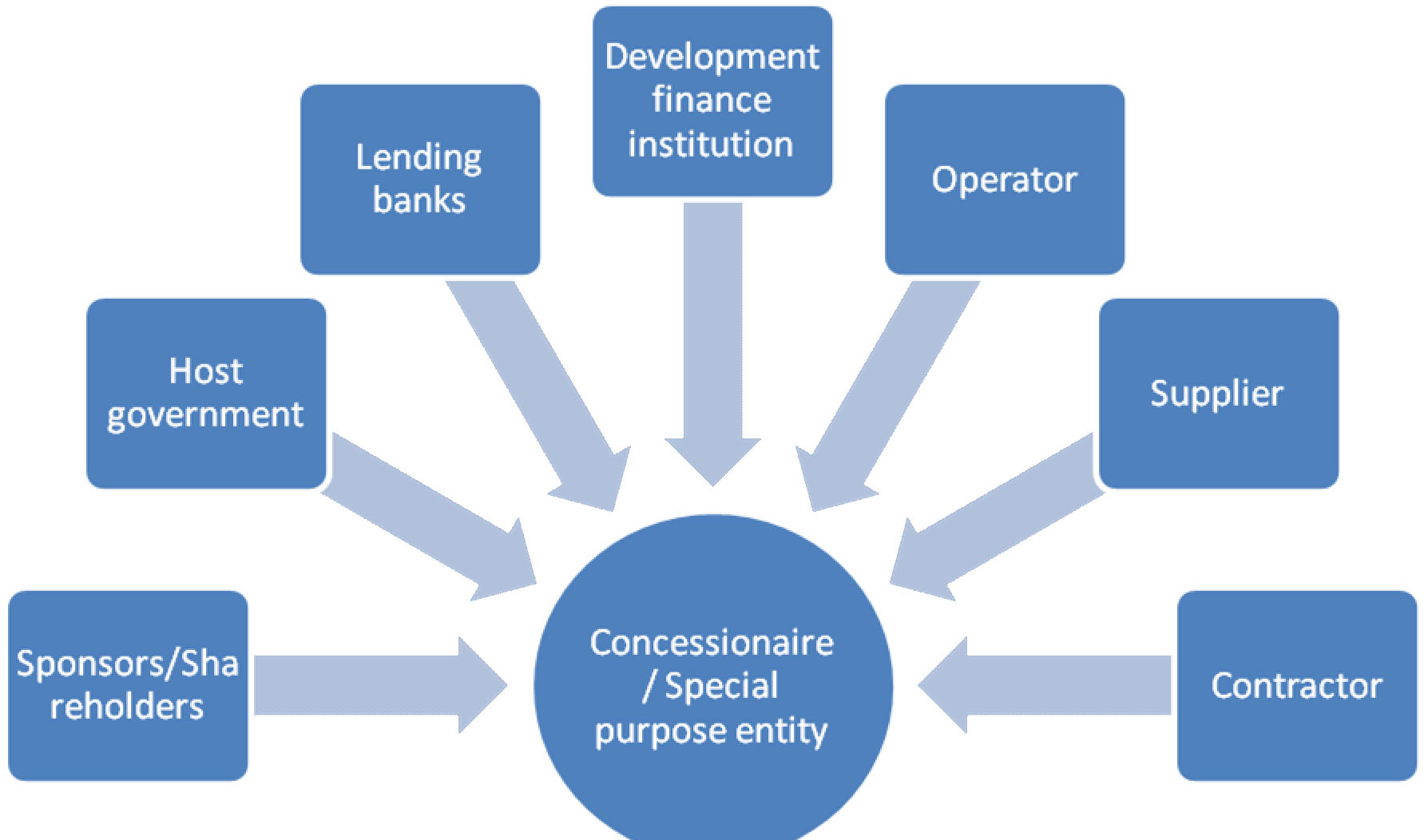
Build–operate–transfer (BOT) or build–own–operate–transfer (BOOT) is a form of project delivery method, usually for large-scale infrastructure projects, wherein a private entity receives a concession from the public sector (or the private sector on rare occasions) to finance, design, construct, own, and operate a facility stated in the concession contract. The private entity will have the right to operate it for a set period of time. This enables the project proponent to recover its investment and operating and maintenance expenses in the project. BOT is usually a model used in public–private partnerships. Due to the long-term nature of the arrangement, the fees are usually raised during the concession period. The rate of increase is often tied to a combination of internal and external variables, allowing the proponent to reach a satisfactory internal rate of return for its investment. Countries where BOT is prevalent are Thailand, Turkey, Taiwan, Bahrain, Pakistan, ... [...More Info...] [...Related Items...] OR: [Wikipedia] [Google] [Baidu] |
Shweli II Dam
Shweli River ( my, ရွှေလီမြစ်; zh, 瑞丽江) is a river in China and Myanmar (Burma). Also known as Nam Mao ( shn, ၼမ်ႉမၢဝ်း; ) in Shan or Dai, and Ruili River or Longchuan River (龙川江) in Chinese, it forms 26 km of the boundary between Burma and China. It is one of the tributaries of the Myanmar's chief river, the Ayeyarwady, and arises in Yunnan Province of China. It flows through northern Shan state and Sagaing Division, and enters the Ayeyarwady at Inywa, north of Tagaung and south of Katha. History Dai people, known as Shan in Burma, migrated from Yunnan into Burma along the Shweli. Maw Shans from Mong Mao settled in the Shweli valley, and raided and invaded the Bamar heartlands down the Shweli, some people believe that King Anawrahta of Bagan (1044–1077) reduced Mong Mao to a vassal state. But the event is that when the Anawrahta visited Nanzhao in quest of the Buddha's tooth while returning, married Sao-Môn-la, a dau ... [...More Info...] [...Related Items...] OR: [Wikipedia] [Google] [Baidu] |
Shweli III Dam
Shweli River ( my, ရွှေလီမြစ်; zh, 瑞丽江) is a river in China and Myanmar (Burma). Also known as Nam Mao ( shn, ၼမ်ႉမၢဝ်း; ) in Shan or Dai, and Ruili River or Longchuan River (龙川江) in Chinese, it forms 26 km of the boundary between Burma and China. It is one of the tributaries of the Myanmar's chief river, the Ayeyarwady, and arises in Yunnan Province of China. It flows through northern Shan state and Sagaing Division, and enters the Ayeyarwady at Inywa, north of Tagaung and south of Katha. History Dai people, known as Shan in Burma, migrated from Yunnan into Burma along the Shweli. Maw Shans from Mong Mao settled in the Shweli valley, and raided and invaded the Bamar heartlands down the Shweli, some people believe that King Anawrahta of Bagan (1044–1077) reduced Mong Mao to a vassal state. But the event is that when the Anawrahta visited Nanzhao in quest of the Buddha's tooth while returning, married Sao-Môn-la, a dau ... [...More Info...] [...Related Items...] OR: [Wikipedia] [Google] [Baidu] |
Dams In Burma
There are almost 200 large dams in Myanmar.CHINA IN BURMA: THE INCREASING INVESTMENT OF CHINESE MULTINATIONAL CORPORATIONS IN BURMA’S HYDROPOWER, OIL AND NATURAL GAS, AND MINING SECTOR BURMA’S HYDROPOWER OIL AND NATURAL GAS, AND MINING SECTORS UPDATED: September 2008 Myanmar (Burma) has a large hydroelectric power potential of , although the economical exploitable potential is about . Between 1990 and 2002, the country tripled its installed capacity of hydro plants, increasing from to . Total installed capacity in 2010 is at least MW, 6% of potential. Several large dams are planned to increase future hydro utilization. Background Although Myanmar is underdeveloped in terms of its hydro-power potential it is not for lack of effort. While chairman of the State Peace and Development Council, Sr-Gen Than Shwe prioritized the building of dams. A native of the Kyaukse region through which the Zawgyi River flows, Shwe was widely rumored to believe himself to be a reincarnation of K ... [...More Info...] [...Related Items...] OR: [Wikipedia] [Google] [Baidu] |


