|
Shiretoko Peninsula
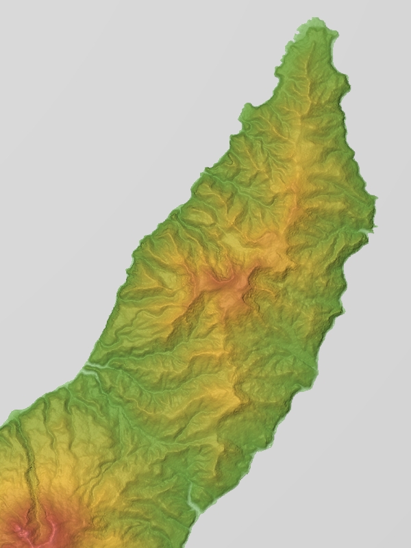
is located on the easternmost portion of the Japanese island of Hokkaidō, protruding into the Sea of Okhotsk. It is separated from Kunashir Island, which is now occupied by Russia, by the Nemuro Strait. The name Shiretoko is derived from the Ainu word ''sir etok'', meaning "the end of the Earth" or "the place where the Earth protrudes". The towns of Rausu and Shari are found on the peninsula. The Shiretoko Peninsula was registered as a UNESCO World Heritage Site in 2005, in recognition of the peninsula being the southernmost point where sea ice usually forms in the Northern Hemisphere. Geography From Shiretoko Cape at the tip of the peninsula, a series of volcanoes runs down the peninsula, including Mount Shiretoko, Mount Unabetsu, and Mount Iō. It is part of the Chishima volcanic zone. The highest peak is Mount Rausu. The peninsula is long and wide at its base. It covers some The peninsula is bounded on the northwest side by the Sea of Okhotsk and the southea ... [...More Info...] [...Related Items...] OR: [Wikipedia] [Google] [Baidu] |
Ainu Language
Ainu (, ), or more precisely Hokkaido Ainu, is a language spoken by a few elderly members of the Ainu people on the northern Japanese island of Hokkaido. It is a member of the Ainu language family, itself considered a language family isolate with no academic consensus of origin. It is classified as Critically Endangered by the UNESCO Atlas of the World's Languages in Danger. Until the 20th century, the Ainu languages – Hokkaido Ainu and the now-extinct Kuril Ainu and Sakhalin Ainu – were spoken throughout Hokkaido, the southern half of the island of Sakhalin and by small numbers of people in the Kuril Islands. Due to the colonization policy employed by the Japanese government, the number of Hokkaido Ainu speakers decreased through the 20th century, and it is now moribund. A very few elderly people still speak the language fluently, though attempts are being made to revive it. According to P. Elmer, the Ainu languages are a contact language, having strong influences from ... [...More Info...] [...Related Items...] OR: [Wikipedia] [Google] [Baidu] |
World Heritage Site
A World Heritage Site is a landmark or area with legal protection by an international convention administered by the United Nations Educational, Scientific and Cultural Organization (UNESCO). World Heritage Sites are designated by UNESCO for having cultural, historical, scientific or other form of significance. The sites are judged to contain " cultural and natural heritage around the world considered to be of outstanding value to humanity". To be selected, a World Heritage Site must be a somehow unique landmark which is geographically and historically identifiable and has special cultural or physical significance. For example, World Heritage Sites might be ancient ruins or historical structures, buildings, cities, deserts, forests, islands, lakes, monuments, mountains, or wilderness areas. A World Heritage Site may signify a remarkable accomplishment of humanity, and serve as evidence of our intellectual history on the planet, or it might be a place of great natural beauty. A ... [...More Info...] [...Related Items...] OR: [Wikipedia] [Google] [Baidu] |
Mount Dokkarimui
is a volcano located on the Shiretoko Peninsula in Hokkaido is Japan's second largest island and comprises the largest and northernmost prefecture, making up its own region. The Tsugaru Strait separates Hokkaidō from Honshu; the two islands are connected by the undersea railway Seikan Tunnel. The lar ..., Japan. References Mountains of Hokkaido Volcanoes of Hokkaido Stratovolcanoes of Japan Pleistocene stratovolcanoes {{Hokkaido-geo-stub ... [...More Info...] [...Related Items...] OR: [Wikipedia] [Google] [Baidu] |
Mount Poromoi
is a volcano on the Shiretoko Peninsula in Hokkaido is Japan's second largest island and comprises the largest and northernmost prefecture, making up its own region. The Tsugaru Strait separates Hokkaidō from Honshu; the two islands are connected by the undersea railway Seikan Tunnel. The lar ..., northeastern Japan. References Mountains of Hokkaido Volcanoes of Hokkaido Stratovolcanoes of Japan Pleistocene stratovolcanoes {{Hokkaido-geo-stub ... [...More Info...] [...Related Items...] OR: [Wikipedia] [Google] [Baidu] |
Onsen
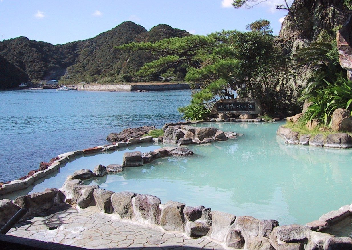
In Japan, are the country's hot springs and the bathing facilities and traditional inns around them. As a volcanically active country, Japan has many onsens scattered throughout all of its major islands. There are approximately 25,000 hot spring sources throughout Japan that provide hot mineral water to about 3,000 genuine onsen establishments. Onsens come in many types and shapes, including and . Baths may be either publicly run by a municipality or privately, often as part of a hotel, ''ryokan'', or . The presence of an onsen is often indicated on signs and maps by the symbol ♨ or the kanji (''yu'', meaning "hot water"). Sometimes the simpler hiragana character ゆ (''yu''), understandable to younger children, is used. Traditionally, onsens were located outdoors, although many inns have now built indoor bathing facilities as well. Nowadays, as most households have their own bath, the number of traditional public baths has decreased, but the number of sightseeing ho ... [...More Info...] [...Related Items...] OR: [Wikipedia] [Google] [Baidu] |
43rd Parallel North
The 43rd parallel north is a circle of latitude that is 43 degrees north of the Earth's equatorial plane. It crosses Europe, the Mediterranean Sea, Asia, the Pacific Ocean, North America, and the Atlantic Ocean. On 21 June the sun averages, with negligible variance, its local maximum, 70.83 degrees in the sky. At this latitude the sun is visible for 15 hours, 22 minutes during the summer solstice and 9 hours, 0 minutes during the winter solstice. Around the world Starting at the Prime Meridian and heading eastwards, the parallel 43° north passes through: : See also *42nd parallel north *44th parallel north The 44th parallel north is a circle of latitude that is 44 degrees north of the Earth, Earth's equator, equatorial plane. It crosses Europe, the Mediterranean Sea, Asia, the Pacific Ocean, North America, and the Atlantic Ocean. At this latitu ... References {{DEFAULTSORT:43rd Parallel North n43 Borders of Nebraska Borders of South Dakota ... [...More Info...] [...Related Items...] OR: [Wikipedia] [Google] [Baidu] |
Soya Current
Soya may refer to: Food * Soya bean, or soybean, a species of legume native to East Asia, widely grown for its edible bean * Soya sauce, see soy sauce, a fermented sauce made from soybeans, roasted grain, water and salt Places * Sōya District, Hokkaido, a district located in the Sōya Subprefecture, Hokkaido, Japan * Sōya Subprefecture, a subprefecture of the Hokkaido Prefecture, Japan * Sōya Main Line, a railway line in Hokkaido, Japan Ships * Japanese cruiser Soya, originally the Russian cruiser ''Varyag'', launched 1900 * ''Sōya'' (icebreaker), a Japanese icebreaker * , a Swedish coastal tanker People * Soya (singer) (born 1990), South Korean singer * Carl Erik Soya (1896–1983), Danish author and dramatist * Willi Soya (1935–1990), German footballer * Yelena Soya (born 1981), Russian synchro-swimmer Geographical features * Sōya Strait Soya may refer to: Food * Soya bean, or soybean, a species of legume native to East Asia, widely grown for its edible bean * So ... [...More Info...] [...Related Items...] OR: [Wikipedia] [Google] [Baidu] |
Oyashio Current
, also known as Oya Siwo, Okhotsk or the Kurile current, is a cold subarctic ocean current that flows south and circulates counterclockwise in the western North Pacific Ocean. The waters of the Oyashio Current originate in the Arctic Ocean and flow southward via the Bering Sea, passing through the Bering Strait and transporting cold water from the Arctic Sea into the Pacific Ocean and the Sea of Okhotsk. It collides with the Kuroshio Current off the eastern shore of Japan to form the North Pacific Current (or Drift). The nutrient-rich Oyashio is named for its metaphorical role as the that provides for and nurtures marine organisms. The current has an important impact on the climate of the Russian Far East, mainly in Kamchatka and Chukotka, where the northern limit of tree growth is moved south up to ten degrees compared with the latitude it can reach in inland Siberia. The waters of the Oyashio Current form probably the richest fishery in the world owing to the extremely ... [...More Info...] [...Related Items...] OR: [Wikipedia] [Google] [Baidu] |
Kunashiri Island
, other_names = kz, Kün Ashyr; ja, 国後島 , location = Sea of Okhotsk , locator_map = File:Kurily Kunashir.svg , coordinates = , archipelago = Kuril Islands , total_islands = , major_islands = , area = , length = , width = from to , coastline = , highest_mount = Chacha , elevation = , country = , country_admin_divisions_title_1 = Federal subject , country_admin_divisions_1 = Sakhalin Oblast , country_admin_divisions_title_2 = District , country_admin_divisions_2 = Yuzhno-Kurilsky , country_largest_city = , country_largest_city_population = , country_leader_title = , country_leader_name = , population = approx. 7000 , population_as_of = 2007 , density = , ethnic_groups = , additional_info = , country_claim = , country_claim_divisions_title_1 = Prefecture , country_claim_divisions_1 = Hokkaido , country_claim_divisions_titl ... [...More Info...] [...Related Items...] OR: [Wikipedia] [Google] [Baidu] |
Mount Iō (Shiretoko)
also Mount Iwo is an active andesitic stratovolcano on the Shiretoko Peninsula of Hokkaidō, Japan. It sits within the borders of the town of Shari. Mount Iō is known for erupting liquid sulphur in the eruptions of 1889 and 1936. Mount Iō literally means, ''sulphur mountain''. There are two explosion craters and a lava dome at the summit of the volcano.神沼克伊,小山悦郎 ''日本の火山を科学する 日本列島津々浦々、あなたの身近にある108の活火山とは?'' ソフトバンククリエイティブ 2011. . History of eruptions Volcanic activity started at least 240,000 years ago. Mount Iō has erupted at the following times: #850 AD ± 500 years #1857–1858 #23–26 September 1876 #24–26 November 1880 #9–26 August 1889 #15 June 1890–unknown #December 1935–October 1936 See also * Shiretoko National Park * List of mountains in Japan * List of volcanoes in Japan This is a list of active and extinct volcanoes in Japan. An Orange ... [...More Info...] [...Related Items...] OR: [Wikipedia] [Google] [Baidu] |
Mount Unabetsu
is a Quaternary stratovolcano. Its summit is . It is located on Hokkaido's Shiretoko Peninsula on the border of Shari in Shari District, Abashiri and Shibetsu in Shibetsu District, Nemuro. Geology The mountain is made mainly of andesite and basalt. See also * List of volcanoes in Japan * List of mountains in Japan The following is a list of the mountains and hills of Japan, ordered by height. Mountains over 1000 meters Mountains under 1000 meters As the generally accepted definition of a mountain (versus a hill) is 1000 m of height and 500 m of pro ... References External links * {{DEFAULTSORT:Unabetsu Stratovolcanoes of Japan Volcanoes of Hokkaido Mountains of Hokkaido Pleistocene stratovolcanoes ... [...More Info...] [...Related Items...] OR: [Wikipedia] [Google] [Baidu] |
Mount Shiretoko
is a volcano located on the Shiretoko Peninsula in Hokkaidō, Japan. The mountain consists of non-alkali mafic rocks and andesite. Mount Shiretoko is in Shari town, in Shari District of Abashiri Subprefecture. See Also *List of volcanoes in Japan *List of mountains in Japan The following is a list of the mountains and hills of Japan, ordered by height. Mountains over 1000 meters Mountains under 1000 meters As the generally accepted definition of a mountain (versus a hill) is 1000 m of height and 500 m of pro ... References External links Shiretoko Dake- Geological Survey of Japan * Mountains of Hokkaido Volcanoes of Hokkaido Stratovolcanoes of Japan Pleistocene stratovolcanoes {{Hokkaido-geo-stub ... [...More Info...] [...Related Items...] OR: [Wikipedia] [Google] [Baidu] |


