|
Shiprock, New Mexico
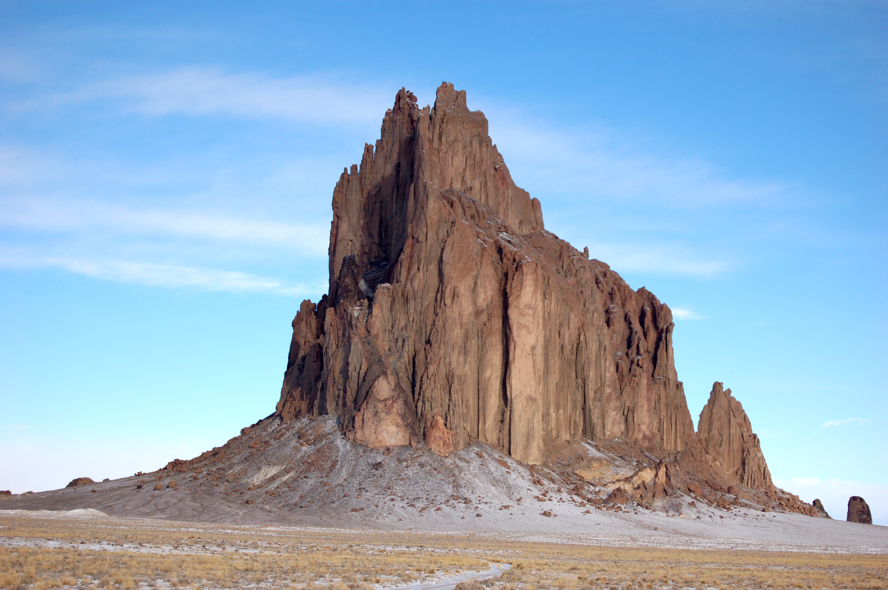
Shiprock ( nv, ) is a unincorporated community on the Navajo reservation in San Juan County, New Mexico, United States. The population was 7,718 people in the 2020 census. For statistical purposes, the United States Census Bureau has defined Shiprock as a census-designated place (CDP). It is part of the Farmington Metropolitan Statistical Area. Shiprock is named after the nearby Shiprock rock formation. Since 1903, the town has been called ''Naat’áanii Nééz'' (meaning “tall leader” in the Navajo language) after the San Juan Indian Agency superintendent William T. Shelton who settled Shiprock for the United States government. Diné College is a local four-year college (formerly Navajo Community College), a tribally controlled community college with seven other campuses across the Navajo Nation. It is the site of a Chapter House for the Navajo, a Bureau of Indian Affairs agency and the Northern Navajo Medical Center (an Indian Health Service hospital). The town is ... [...More Info...] [...Related Items...] OR: [Wikipedia] [Google] [Baidu] |
Unincorporated Community
An unincorporated area is a region that is not governed by a local municipal corporation. Widespread unincorporated communities and areas are a distinguishing feature of the United States and Canada. Most other countries of the world either have no unincorporated areas at all or these are very rare: typically remote, outlying, sparsely populated or uninhabited areas. By country Argentina In Argentina, the provinces of Chubut, Córdoba, Entre Ríos, Formosa, Neuquén, Río Negro, San Luis, Santa Cruz, Santiago del Estero, Tierra del Fuego, and Tucumán have areas that are outside any municipality or commune. Australia Unlike many other countries, Australia has only one level of local government immediately beneath state and territorial governments. A local government area (LGA) often contains several towns and even entire metropolitan areas. Thus, aside from very sparsely populated areas and a few other special cases, almost all of Australia is part of an LGA. Uninco ... [...More Info...] [...Related Items...] OR: [Wikipedia] [Google] [Baidu] |
Farmington, New Mexico
Farmington is a city in San Juan County in the U.S. state of New Mexico. As of the 2020 census the city had a total population of 46,624 people. Farmington (and surrounding San Juan County) makes up one of the four Metropolitan Statistical Areas (MSAs) in New Mexico. Farmington is located at the junction of the San Juan River, the Animas River, and the La Plata River, and is located on the Colorado Plateau. Farmington is the largest city of San Juan County, one of the geographically largest counties in the United States covering . Farmington serves as the commercial hub for most of northwestern New Mexico and the Four Corners region of four states. Farmington lies at or near the junction of several important highways: U.S. Highway 64, New Mexico Highway 170, New Mexico Highway 371, and New Mexico Highway 516. It is on the Trails of the Ancients Byway, one of the designated New Mexico Scenic Byways. [...More Info...] [...Related Items...] OR: [Wikipedia] [Google] [Baidu] |
American Indian Boarding Schools
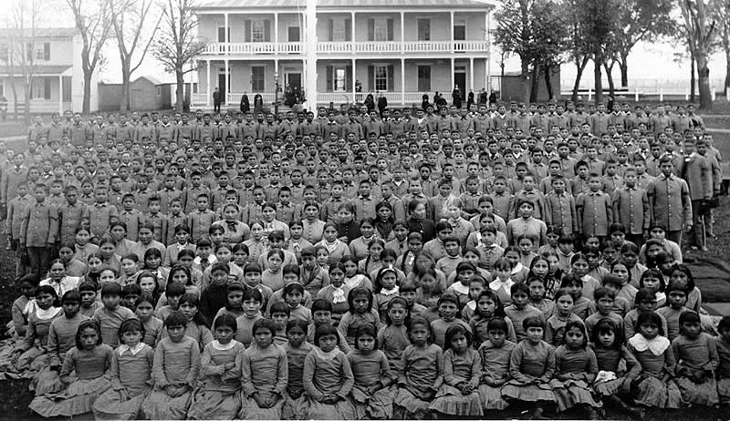
American Indian boarding schools, also known more recently as American Indian residential schools, were established in the United States from the mid 17th to the early 20th centuries with a primary objective of "civilizing" or assimilating Native American children and youth into Euro-American culture. In the process, these schools denigrated Native American culture and made children give up their languages and religion. At the same time the schools provided a basic Western education. These boarding schools were first established by Christian missionaries of various denominations. The missionaries were often approved by the federal government to start both missions and schools on reservations, especially in the lightly populated areas of the West. In the late 19th and early 20th centuries especially, the government paid religious orders to provide basic education to Native American children on reservations, and later established its own schools on reservations. The Bureau o ... [...More Info...] [...Related Items...] OR: [Wikipedia] [Google] [Baidu] |
Indian Agent
In United States history, an Indian agent was an individual authorized to interact with American Indian tribes on behalf of the government. Background The federal regulation of Indian affairs in the United States first included development of the position of Indian agent in 1793 under the Second Trade and Intercourse Act (or the Nonintercourse Act). This required land sales by or from Indians to be federally licensed and permitted. The legislation also authorized the president of the United States to "appoint such persons, from time to time, as temporary agents to reside among the Indians," and guide them into acculturation of American society by changing their agricultural practices and domestic activities. Eventually, the U.S. government ceased using the word "temporary" in the Indian agent's job title. History, 1800–1840s From the close of the 18th century to nearly 1869, Congress maintained the position that it was legally responsible for the protection of Indians from n ... [...More Info...] [...Related Items...] OR: [Wikipedia] [Google] [Baidu] |
Cherokee, North Carolina
Cherokee ( chr, ᏣᎳᎩ, translit=Tsalagi) is a census-designated place (CDP) in Swain and Jackson counties in Western North Carolina, United States, within the Qualla Boundary land trust. Cherokee is located in the Oconaluftee River Valley around the intersection of U.S. Routes 19 and 441. As of the 2020 census, the CDP had a population of 2,195. It is the capital of the federally recognized Eastern Band of Cherokee Indians, one of three recognized Cherokee tribes and the only one in North Carolina. The community also serves as a tourist destination, with numerous campgrounds, motels, and hotels serving visitors to the Great Smoky Mountains National Park, with a major entrance to the park lying within the community. Cherokee serves as the southern terminus of the Blue Ridge Parkway. The Oconaluftee River serves as a major water sports destination, and the Oconaluftee Indian Village, a living-history museum, hosts the popular outdoor drama ''Unto These Hills''. His ... [...More Info...] [...Related Items...] OR: [Wikipedia] [Google] [Baidu] |
Grand Canyon
The Grand Canyon (, yuf-x-yav, Wi:kaʼi:la, , Southern Paiute language: Paxa’uipi, ) is a steep-sided canyon carved by the Colorado River in Arizona, United States. The Grand Canyon is long, up to wide and attains a depth of over a mile (). The canyon and adjacent rim are contained within Grand Canyon National Park, the Kaibab National Forest, Grand Canyon–Parashant National Monument, the Hualapai Indian Reservation, the Havasupai Indian Reservation and the Navajo Nation. President Theodore Roosevelt was a major proponent of the preservation of the Grand Canyon area and visited it on numerous occasions to hunt and enjoy the scenery. Nearly two billion years of Earth's geological history have been exposed as the Colorado River and its tributaries cut their channels through layer after layer of rock while the Colorado Plateau was uplifted. [...More Info...] [...Related Items...] OR: [Wikipedia] [Google] [Baidu] |
Mesa Verde
Mesa Verde National Park is an American national park and UNESCO World Heritage Site located in Montezuma County, Colorado. The park protects some of the best-preserved Ancestral Puebloan archaeological sites in the United States. Established by Congress and President Theodore Roosevelt in 1906, the park occupies near the Four Corners region of the American Southwest. With more than 5,000 sites, including 600 cliff dwellings, it is the largest archaeological preserve in the United States. Mesa Verde (Spanish for "green table", or more specifically "green table mountain") is best known for structures such as Cliff Palace, thought to be the largest cliff dwelling in North America. Starting BC Mesa Verde was seasonally inhabited by a group of nomadic Paleo-Indians known as the Foothills Mountain Complex. The variety of projectile points found in the region indicates they were influenced by surrounding areas, including the Great Basin, the San Juan Basin, and the Rio Grand ... [...More Info...] [...Related Items...] OR: [Wikipedia] [Google] [Baidu] |
Four Corners Monument
The Four Corners Monument marks the quadripoint in the Southwestern United States where the states of Arizona, Colorado, New Mexico, and Utah meet. It is the only point in the United States shared by four states, leading to the area being named the Four Corners region. The monument also marks the boundary between two semi-autonomous Native American governments, the Navajo Nation, which maintains the monument as a tourist attraction, and the Ute Mountain Ute Tribe Reservation. The origins of the state boundaries marked by the monument occurred just prior to, and during, the American Civil War, when the United States Congress acted to form governments in the area to combat the spread of slavery to the region. When the early territories were formed, their boundaries were designated along meridian and parallel lines. Beginning in the 1860s, these lines were surveyed and marked. These early surveys included some errors, but even so, the markers placed became the legal boun ... [...More Info...] [...Related Items...] OR: [Wikipedia] [Google] [Baidu] |
Indian Health Service
The Indian Health Service (IHS) is an operating division (OPDIV) within the U.S. Department of Health and Human Services (HHS). IHS is responsible for providing direct medical and public health services to members of federally-recognized Native American Tribes and Alaska Native people. IHS is the principal federal health care provider and health advocate for Indian people. The IHS provides health care in 37 states to approximately 2.2 million out of 3.7 million American Indians and Alaska Natives (AI/AN). As of April 2017, the IHS consisted of 26 hospitals, 59 health centers, and 32 health stations. Thirty-three urban Indian health projects supplement these facilities with a variety of health and referral services. Several tribes are actively involved in IHS program implementation. Many tribes also operate their own health systems independent of IHS. It also provides support to students pursuing medical education in order to staff Indian health programs. Formation and mission ... [...More Info...] [...Related Items...] OR: [Wikipedia] [Google] [Baidu] |
Bureau Of Indian Affairs
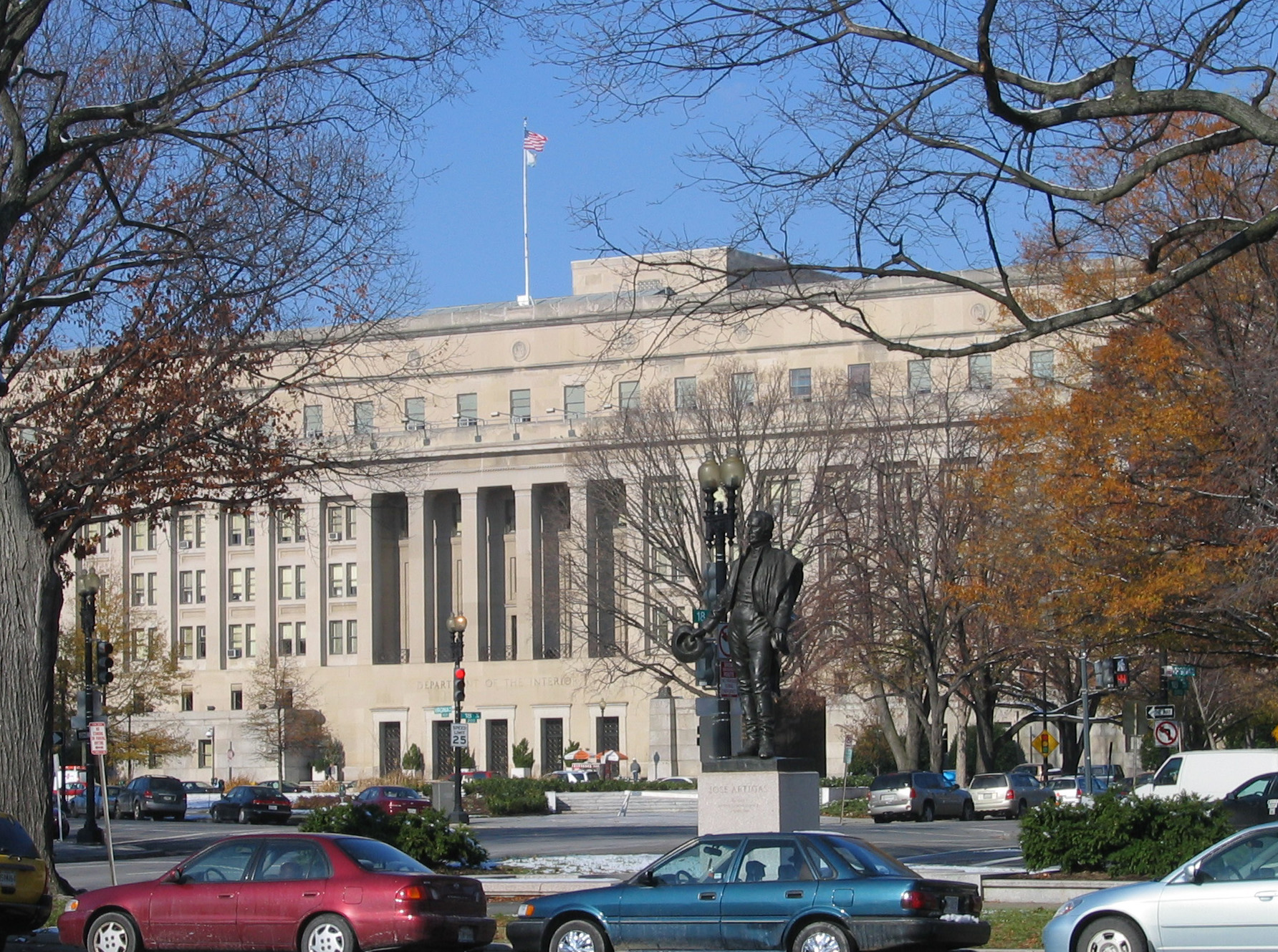
The Bureau of Indian Affairs (BIA), also known as Indian Affairs (IA), is a United States federal agency within the Department of the Interior. It is responsible for implementing federal laws and policies related to American Indians and Alaska Natives, and administering and managing over of land held in trust by the U.S. federal government for Indian Tribes. It renders services to roughly 2 million indigenous Americans across 574 federally recognized tribes. The BIA is governed by a director and overseen by the assistant secretary for Indian affairs, who answers to the secretary of the interior. The BIA works with tribal governments to help administer law enforcement and justice; promote development in agriculture, infrastructure, and the economy; enhance tribal governance; manage natural resources; and generally advance the quality of life in tribal communities. Educational services are provided by Bureau of Indian Education—the only other agency under the assistant s ... [...More Info...] [...Related Items...] OR: [Wikipedia] [Google] [Baidu] |
Tribal Colleges And Universities
In the United States, tribal colleges and universities (TCUs) are a category of higher education, minority-serving institutions defined in the Higher Education Act of 1965. Each qualifies for funding under the Tribally Controlled Colleges and Universities Assistance Act of 1978 (25 U.S.C. 1801 et seq.) or the Navajo Community College Act (25 U.S.C. 640a note); or is cited in section 532 of the Equity in Educational Land-Grant Status Act of 1994 (7 U.S.C. 301 note). These educational institutions are distinguished by being controlled and operated by federally recognized American Indian tribes; they have become part of American Indians' institution-building in order to pass on their own cultures. The first was founded by the Navajo Nation in 1968 in Arizona, and several others were established in the 1970s. As of 1994, they have been authorized by Congress as land-grant colleges.Ginger Stull, Demetrios Spyridakis, Marybeth Gasman, Andrés Castro Samayoa, & Yvette Booker, ''Redef ... [...More Info...] [...Related Items...] OR: [Wikipedia] [Google] [Baidu] |
Diné College
Diné College is a public tribal land-grant college in Tsaile, Arizona, serving the Navajo Nation. It offers associate degrees, bachelor's degrees, and academic certificates. Campus The main campus of Diné College is in Tsaile, a census-designated place in unincorporated Apache County, Arizona. There are also five branches of Diné College: two in Apache County, Arizona ( Chinle and Window Rock), one in Coconino County, Arizona ( Tuba City), one in McKinley County, New Mexico ( Crownpoint) and one in San Juan County, New Mexico ( Shiprock). The main Tsaile campus includes eight fifteen-room dormitories housing about 150 students: each octagonally shaped unit has a fireplace in the center, and is described by the college as a "hooghan away from hogan"—a reference to the traditional Navajo ''hogan'' dwelling. The residence life office is in Ch'ó (Spruce) Hall. Residence halls include: Co-ed: * Deestsiin (Pinyon) Hall * K'ai' (Willow) Hall * Ndíshchíí' (Pine) Hal ... [...More Info...] [...Related Items...] OR: [Wikipedia] [Google] [Baidu] |


