|
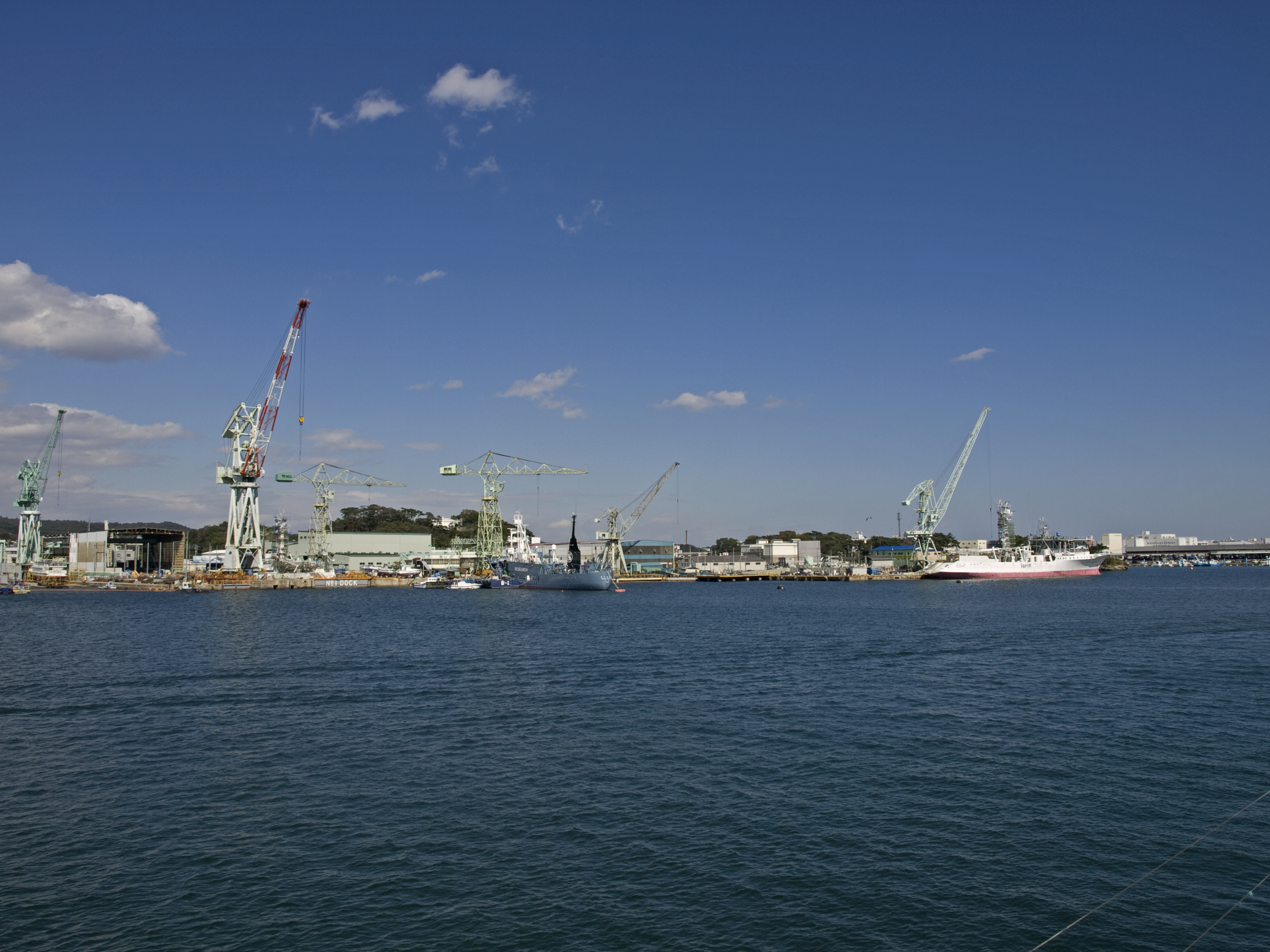
Shiogama
is a city located in Miyagi Prefecture, Japan. , the city had an estimated population of 52,662, and a population density of 3,032 persons per km² in 23,270 households. The total area of the city is . Geography Shiogama is in north-central Miyagi Prefecture, bordered by the Pacific Ocean to the east. Neighboring municipalities *Miyagi Prefecture ** Tagajō ** Rifu ** Shichigahama Climate Shiogama has a humid climate (Köppen climate classification ''Cfa'') characterized by mild summers and cold winters. The average annual temperature in Shiogama is . The average annual rainfall is with September as the wettest month. The temperatures are highest on average in August, at around , and lowest in January, at around . Demographics Per Japanese census data, the population of Shiogama peaked around 1990 and has declined since. Etymology "Shiogama" means "salt furnace" and refers to a local Shinto ritual involving the making of salt from sea water, still performed every July. T ... [...More Info...] [...Related Items...] OR: [Wikipedia] [Google] [Baidu] |
Shiogama Station
is a railway station on the Tōhoku Main Line in the city of Shiogama, Miyagi, Japan, operated by East Japan Railway Company (JR East). Lines Shiogama Station is served by the Tōhoku Main Line, and lies 365.2 km from the official starting point of the line at Tokyo Station. Trains of the Senseki-Tōhoku Line also stop at Shiogama Station, which is 14.3 kilometers from the official starting point of the line at Sendai Station. Station layout Shiogama Station has one elevated island platform serving two tracks, with the station building situated underneath. The station has a "Midori no Madoguchi" staffed ticket office. Platforms History Shiogama Station opened on July 9, 1956. The station was absorbed into the JR East network upon the privatization of the Japanese National Railways (JNR) on April 1, 1987. Passenger statistics In fiscal 2016, the station was used by an average of 2,931 passengers daily (boarding passengers only). Surrounding area *Shiogama City Ta ... [...More Info...] [...Related Items...] OR: [Wikipedia] [Google] [Baidu] |
Shichigahama, Miyagi
is a town located in Miyagi Prefecture, Japan. , the town had an estimated population of 18,447, and a population density of 1400 persons per km² in 6,681 households. The total area of the town is . Geography The town is situated on a peninsula in the middle of Miyagi Prefecture between the cities of Tagajō in the west and Shiogama in the north and east, and about halfway between Sendai and Matsushima. Shichigahama is the smallest city, town or village by land area in the whole Tōhoku region. The climate is relatively mild compared to its surrounding area and temperatures do not greatly fluctuate. The name Shichigahama literally means "seven beaches". The name comes from the seven seaside villages that originally combined to form the town. The seven beaches of Shichigahama are: Minatohama (湊浜), Matsugahama (松ヶ浜), Shobutahama (菖蒲田浜), Hanabuchihama (花渕浜), Yoshidahama (吉田浜), Yokasakihama (代ヶ崎浜) and Toguhama (東宮浜). In addition to th ... [...More Info...] [...Related Items...] OR: [Wikipedia] [Google] [Baidu] |
Miyagi Prefecture
is a prefecture of Japan located in the Tōhoku region of Honshu. Miyagi Prefecture has a population of 2,305,596 (1 June 2019) and has a geographic area of . Miyagi Prefecture borders Iwate Prefecture to the north, Akita Prefecture to the northwest, Yamagata Prefecture to the west, and Fukushima Prefecture to the south. Sendai is the capital and largest city of Miyagi Prefecture, and the largest city in the Tōhoku region, with other major cities including Ishinomaki, Ōsaki, and Tome. Miyagi Prefecture is located on Japan's eastern Pacific coast and bounded to the west by the Ōu Mountains, the longest mountain range in Japan, with 24% of its total land area being designated as Natural Parks. Miyagi Prefecture is home to Matsushima Islands, a group of islands ranked as one of the Three Views of Japan, near the town of Matsushima. On 7 April, 2011 the biggest earthquake in Japan occurred. History Miyagi Prefecture was formerly part of the province of Mutsu. 20 ... [...More Info...] [...Related Items...] OR: [Wikipedia] [Google] [Baidu] |
Rifu, Miyagi
is a town located in Miyagi Prefecture, Japan. , the town had an estimated population of 36,014, and a population density of 800 persons per km2 in 13,568 households. The total area of the town is . Rifu is known for its nashi pears. Recently, wine and candy made from nashi pears have been developed in the town. Geography Rifu is located in east-central Miyagi Prefecture, bordered by Sendai metropolis to the south and by Matsushima Bay to the east. Neighboring municipalities Miyagi Prefecture *Sendai * Tagajō *Shiogama * Tomiya * Ōsato * Taiwa * Matsushima Climate Rifu has a humid climate (Köppen climate classification ''Cfa'') characterized by mild summers and cold winters. The average annual temperature in Rifu is 11.9 °C. The average annual rainfall is 1237 mm with September as the wettest month. The temperatures are highest on average in August, at around 24.4 °C, and lowest in January, at around 0.6 °C. Demographics Per Japanese census data, ... [...More Info...] [...Related Items...] OR: [Wikipedia] [Google] [Baidu] |
Tōhoku Region
The , Northeast region, or consists of the northeastern portion of Honshu, the largest island of Japan. This traditional region consists of six prefectures (''ken''): Akita, Aomori, Fukushima, Iwate, Miyagi, and Yamagata. Tōhoku retains a reputation as a remote, scenic region with a harsh climate. In the 20th century, tourism became a major industry in the Tōhoku region. History Ancient & Classical period In mythological times, the area was known as Azuma (吾妻, あづま) and corresponded to the area of Honshu occupied by the native Emishi and Ainu. The area was historically the Dewa and the Michinoku regions, a term first recorded in (654). There is some variation in modern usage of the term "Michinoku". Tōhoku's initial historical settlement occurred between the seventh and ninth centuries, well after Japanese civilization and culture had become firmly established in central and southwestern Japan. The last stronghold of the indigenous Emishi on Hons ... [...More Info...] [...Related Items...] OR: [Wikipedia] [Google] [Baidu] |
Cities Of Japan
A is a local administrative unit in Japan. Cities are ranked on the same level as and , with the difference that they are not a component of . Like other contemporary administrative units, they are defined by the Local Autonomy Law of 1947. City status Article 8 of the Local Autonomy Law sets the following conditions for a municipality to be designated as a city: *Population must generally be 50,000 or greater (原則として人口5万人以上) *At least 60% of households must be established in a central urban area (中心市街地の戸数が全戸数の6割以上) *At least 60% of households must be employed in commerce, industry or other urban occupations (商工業等の都市的業態に従事する世帯人口が全人口の6割以上) *Any other conditions set by prefectural ordinance must be satisfied (他に当該都道府県の条例で定める要件を満たしていること) The designation is approved by the prefectural governor and the Minister for Inter ... [...More Info...] [...Related Items...] OR: [Wikipedia] [Google] [Baidu] |
Jōmon Period
The is the time in Japanese history, traditionally dated between 6,000–300 BCE, during which Japan was inhabited by a diverse hunter-gatherer and early agriculturalist population united through a common Jōmon culture, which reached a considerable degree of sedentism and cultural complexity. The name "cord-marked" was first applied by the American zoologist and orientalist Edward S. Morse, who discovered sherds of pottery in 1877 and subsequently translated it into Japanese as ''Jōmon''.Mason, 14 The pottery style characteristic of the first phases of Jōmon culture was decorated by impressing cords into the surface of wet clay and is generally accepted to be among the oldest in the world. The Jōmon period was rich in tools and jewelry made from bone, stone, shell and antler; pottery figurines and vessels; and lacquerware.Imamura, K. (1996) ''Prehistoric Japan: New Perspectives on Insular East Asia''. Honolulu: University of Hawaii Press It is often compared to p ... [...More Info...] [...Related Items...] OR: [Wikipedia] [Google] [Baidu] |
Mutsu Province
was an old province of Japan in the area of Fukushima, Miyagi, Iwate and Aomori Prefectures and the municipalities of Kazuno and Kosaka in Akita Prefecture. Mutsu Province is also known as or . The term is often used to refer to the combined area of Mutsu and the neighboring province Dewa, which together make up the entire Tōhoku region. History Invasion by the Kinai government Mutsu, on northern Honshū, was one of the last provinces to be formed as land was taken from the indigenous Emishi, and became the largest as it expanded northward. The ancient regional capital of the Kinai government was Tagajō in present-day Miyagi Prefecture. * 709 ('' Wadō 2, 3rd month''), an uprising against governmental authority took place in Mutsu and in nearby Echigo Province. Troops were dispatched to subdue the revolt. * 712 (''Wadō 5''), Mutsu was separated from Dewa Province. Empress Genmei's ''Daijō-kan'' made cadastral changes in the provincial map of the Nara pe ... [...More Info...] [...Related Items...] OR: [Wikipedia] [Google] [Baidu] |
Stroke (CJKV Character)
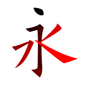
CJK strokes () are the calligraphic strokes needed to write the Chinese characters in regular script used in East Asian calligraphy. CJK strokes are the classified set of line patterns that may be arranged and combined to form Chinese characters (also known as Hanzi) in use in China, Japan, and Korea. Purpose The study and classification of CJK strokes is used for: #understanding Chinese character calligraphy – the correct method of writing, shape formation and stroke order required for character legibility; #understanding stroke changes according to the style that is in use; #defining stroke naming and counting conventions; #identifying fundamental components of Han radicals; and #their use in computing. Formation When writing Han radicals, a single stroke includes all the motions necessary to produce a given part of a character before lifting the writing instrument from the writing surface; thus, a single stroke may have abrupt changes in direction within the line. F ... [...More Info...] [...Related Items...] OR: [Wikipedia] [Google] [Baidu] |
Rendaku
is a phenomenon in Japanese morphophonology that governs the voicing of the initial consonant of a non-initial portion of a compound or prefixed word. In modern Japanese, ''rendaku'' is common but at times unpredictable, with certain words unaffected by it. While kanji do not indicate ''rendaku'', it is marked in kana with ''dakuten'' (voicing mark). Origin Rendaku was initially an automatic and predictable process in Japanese. One theory states that rendaku was originally a way to distinguish compound words from saying a word twice when comparing two words or listing things (compare ひとびと ''hitobito'' "people" – with rendaku – versus ひと、ひと ''hito hito'' "one person, another person" – without rendaku). Native Japanese words never begin with a voiced obstruent or sibilant (b, d, g, z, etc.) so rendaku was merely an allophonic detail that never caused any misunderstanding. However, after the 4th century, Japan started borrowing words and characters fro ... [...More Info...] [...Related Items...] OR: [Wikipedia] [Google] [Baidu] |


