|
Sherbourne (TTC)
Sherbourne is a subway station on the Bloor–Danforth line in Toronto, Ontario, Canada. The station, which opened in 1966, is located west of Sherbourne Street on the south side of Bloor Street East. The station primarily serves the St. James Town neighbourhood and the southern portion of Rosedale. Wi-Fi service is available at this station. In December 2021, this station became an accessible subway station after undergoing renovations that began in August 2019. Photo ID Centre Sherbourne Station houses the TTC Photo ID Centre. The TTC photographic team now visits most participating colleges and universities at the beginning of each academic year, and the post-secondary student monthly pass is now available only available via the Presto card and can be purchased from Presto fare vending machines located inside the station. In August 2020, the Photo ID Centre at Sherbourne Station was permanently closed and relocated to Bathurst station. Entrances The primary entrance is l ... [...More Info...] [...Related Items...] OR: [Wikipedia] [Google] [Baidu] |
Toronto
Toronto ( ; or ) is the capital city of the Provinces and territories of Canada, Canadian province of Ontario. With a recorded population of 2,794,356 in 2021, it is the List of the largest municipalities in Canada by population, most populous city in Canada and the List of North American cities by population, fourth most populous city in North America. The city is the anchor of the Golden Horseshoe, an urban agglomeration of 9,765,188 people (as of 2021) surrounding the western end of Lake Ontario, while the Greater Toronto Area proper had a 2021 population of 6,712,341. Toronto is an international centre of business, finance, arts, sports and culture, and is recognized as one of the most multiculturalism, multicultural and cosmopolitanism, cosmopolitan cities in the world. Indigenous peoples in Canada, Indigenous peoples have travelled through and inhabited the Toronto area, located on a broad sloping plateau interspersed with Toronto ravine system, rivers, deep ravines, ... [...More Info...] [...Related Items...] OR: [Wikipedia] [Google] [Baidu] |
Sherbourne Station - Art - The Whole Is Greater
Sherbourne may refer to: *Sherbourne, Barbados, a populated place *Sherbourne, Warwickshire, a village in Warwickshire, England *Sherbourne (TTC), a subway station in Toronto, Ontario, Canada *River Sherbourne, a river in Coventry and Warwickshire *Sherborne, a town in Dorset, England People with the surname *Stephen Sherbourne (born 1945), British politician See also *Sherbourne Park, a former baseball stadium in Winnipeg, Manitoba, Canada *Sherbourne Street (other) *Sherbourne Conference Centre, Barbados *Sherborne (other) Sherborne may refer to ;Places *Sherborne, a town in Dorset, England *Sherborne, Gloucestershire, England *Sherborne St John, Hampshire, England *Sherborne, a hamlet within the paris of Litton, Somerset, England ;People *Andrew Sherborne (b.1961), ... * Sherborn (other) {{disambiguation, geo, surname ... [...More Info...] [...Related Items...] OR: [Wikipedia] [Google] [Baidu] |
Line 2 Bloor–Danforth Stations
Line most often refers to: * Line (geometry), object with zero thickness and curvature that stretches to infinity * Telephone line, a single-user circuit on a telephone communication system Line, lines, The Line, or LINE may also refer to: Arts, entertainment, and media Films * ''Lines'' (film), a 2016 Greek film * ''The Line'' (2017 film) * ''The Line'' (2009 film) * ''The Line'', a 2009 independent film by Nancy Schwartzman Podcasts * ''The Line'' (podcast), 2021 by Dan Taberski Literature * Line (comics), a term to describe a subset of comic book series by a publisher * ''Line'' (play), by Israel Horovitz, 1967 * Line (poetry), the fundamental unit of poetic composition * "Lines" (poem), an 1837 poem by Emily Brontë * ''The Line'' (memoir), by Arch and Martin Flanagan * ''The Line'' (play), by Timberlake Wertenbaker, 2009 Music Albums * ''Lines'' (The Walker Brothers album), 1976 * ''Lines'' (Pandelis Karayorgis album), 1995 * ''Lines'' (Unthanks album), 20 ... [...More Info...] [...Related Items...] OR: [Wikipedia] [Google] [Baidu] |
Kennedy Station
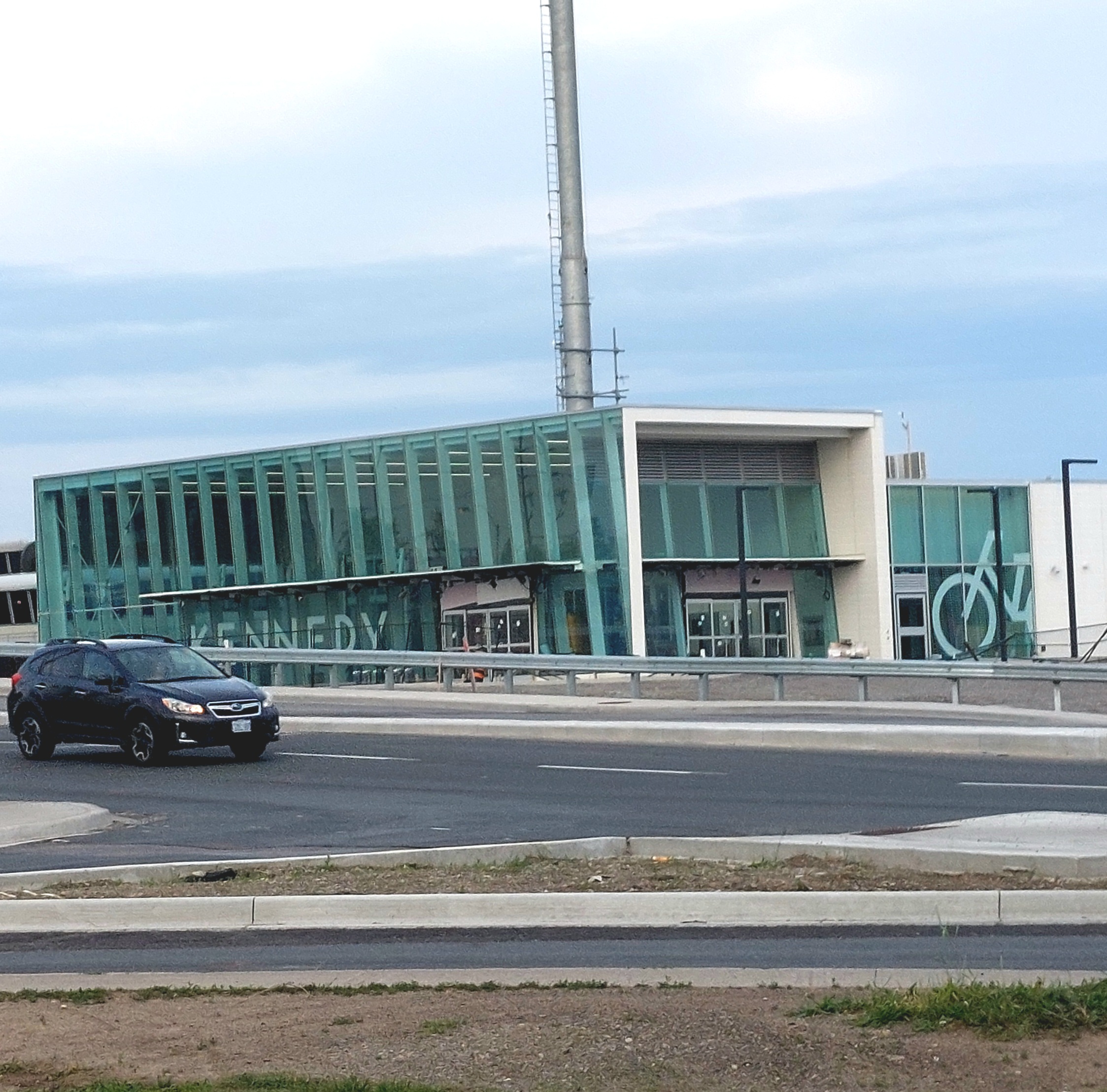
Kennedy is both a terminal and interchange station on Line 2 Bloor–Danforth and Line 3 Scarborough of the Toronto subway system. Opened in 1980, it is located east of the Kennedy Road and Eglinton Avenue intersection. With the adjacent Kennedy GO station on the Stouffville line of GO Transit, Kennedy is an intermodal transit hub and the fifth busiest station in the system, after , , , and , serving a total of approximately customer trips a day. The station's main complex consists of four floors with wheelchair accessible entrances. The ground level is the bus terminal surrounded with ten platforms that serve eleven Toronto Transit Commission (TTC) bus routes. Wi-Fi service is available at this station. Construction to expand the station began in 2017 to add a platform for the future Line 5 Eglinton, which will terminate at the station when its first phase opens in 2023. Further changes to the station are expected to take place during the 2020s as Line 3 is scheduled to b ... [...More Info...] [...Related Items...] OR: [Wikipedia] [Google] [Baidu] |
Pearson Airport
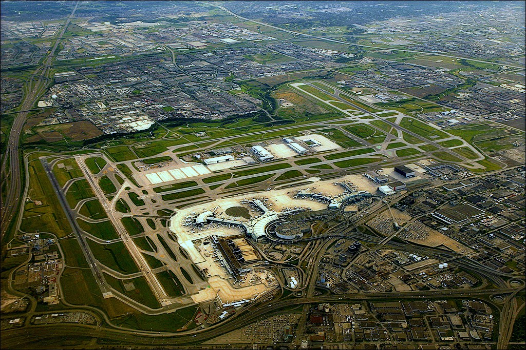
Lester B. Pearson International Airport , commonly known as Toronto Pearson International Airport, is an international airport located in Mississauga, Ontario, Canada. It is the main airport serving Toronto, its metropolitan area, and the surrounding region known as the Golden Horseshoe. The airport is named in honour of Lester B. Pearson, who served as the 14th Prime minister of Canada and received the Nobel Peace Prize in 1957. Toronto Pearson is located northwest of Downtown Toronto with the majority of the airport situated in Mississauga and a small portion of the airfield, along Silver Dart Drive north of Renforth Drive, extending into Toronto's western district of Etobicoke. It has five runways and two passenger terminals along with numerous cargo and maintenance facilities on a site that covers . It is the largest and busiest airport in Canada, handling 50.5 million passengers in 2019. As of 2019, it was the second-busiest international air passenger gateway in th ... [...More Info...] [...Related Items...] OR: [Wikipedia] [Google] [Baidu] |
Queens Quay (Toronto)
Queens Quay is a prominent street in the Harbourfront neighbourhood of Toronto, Ontario, Canada. The street was originally commercial in nature due to the many working piers along the waterfront; parts of it have been extensively rebuilt in since the 1970s with parks, condominiums, retail, as well as institutional and cultural development. History The road supplanted both Front Street and Lake Shore Boulevard as the most southerly east–west corridor in the city when it was created on reclaimed land in the inner harbour. Sometime after 1919 to the early 1920s the inner harbour was filled in and new slips were created. Queens Quay continues to go through a significant transformation. Originally, it served as an access road for the various ports and slips in the inner harbour. The street between Yonge Street and Parliament Street was home to storage buildings devoted to trade on the Saint Lawrence Seaway, major industries such as the Redpath Sugar Refinery and Victory Mill ... [...More Info...] [...Related Items...] OR: [Wikipedia] [Google] [Baidu] |
Prince Edward Viaduct
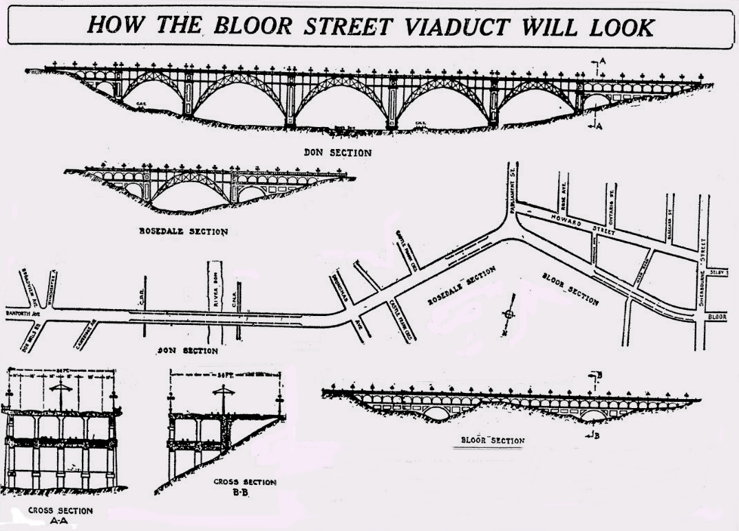
The Prince Edward Viaduct System, commonly referred to as the Bloor Viaduct, is the name of a truss arch bridge system in Toronto, Ontario, Canada, connecting Bloor Street East, on the west side of the system, with Danforth Avenue on the east. The system includes the Rosedale Valley phase (a smaller structure, referred to as the Rosedale Valley Bridge, carrying Bloor Street over the Rosedale Ravine) and the Sherbourne Phase, an embankment built to extend Bloor Street East to the Rosedale Ravine from Sherbourne Street. The Don Valley phase of the system, the most recognizable, spans the Don River Valley, crossing over (from west to east) the Bayview Avenue Extension, the Don River, and the Don Valley Parkway. The roadway has five lanes (three eastbound and two westbound) with a bicycle lane in each direction. The subway level connects Broadview Station in the east with Castle Frank and Sherbourne Stations to the west. Design Designed by Edmund W. Burke, the Prince Edward ... [...More Info...] [...Related Items...] OR: [Wikipedia] [Google] [Baidu] |
Rosedale Ravine
Castle Frank Brook is a buried creek and south-west flowing tributary of the Don River in central and north-western Toronto, Ontario, originating near the intersection of Lawrence Avenue and Dufferin Street. Residential and industrial development in the former suburban cities of York and North York have obliterated nearly all traces of its original course and topography in the uppermost reaches, but the original stream valley is evident in several older districts bordering the lower reaches. Sections of the lower valley include Cedarvale Park ravine, the Nordheimer Ravine near the intersection of St. Clair Avenue and Spadina Road, and the Rosedale Ravine just above the brook's confluence with the Don. Water still runs in short segments in Cedarvale Park and the Nordheimer Ravine but this is only a collection of surface runoff and ravine slope seepage. The channels are all artificially created and run into a storm sewer that carries the remnants of the brook. The southern sect ... [...More Info...] [...Related Items...] OR: [Wikipedia] [Google] [Baidu] |
Bloor–Yonge Station
Bloor–Yonge is a subway station on Line 1 Yonge–University and Line 2 Bloor–Danforth in Toronto, Ontario, Canada. Located in Downtown Toronto, under the intersection of Yonge Street and Bloor Street, it is the busiest subway station in the system, handling over 200,000 passengers on an average weekday. Wi-Fi is available at this station. History The station was opened in 1954 and designed by Charles B. Dolphin. It was originally named "Bloor", and connected with a pair of enclosed platforms in the centre of Bloor Street to allow interchange with Bloor streetcars within the fare-paid zone. When the streetcars were replaced with the Bloor-Danforth subway in 1966, the station began to be shown on maps as "Bloor–Yonge". However, actual platform signs still show "Bloor" on the Yonge–University line and "Yonge" on the Bloor–Danforth line, following a naming style common in New York subway station complexes, where only the platform's cross street is shown on the platform s ... [...More Info...] [...Related Items...] OR: [Wikipedia] [Google] [Baidu] |
Cut-and-cover
A tunnel is an underground passageway, dug through surrounding soil, earth or rock, and enclosed except for the entrance and exit, commonly at each end. A pipeline is not a tunnel, though some recent tunnels have used immersed tube construction techniques rather than traditional tunnel boring methods. A tunnel may be for foot or vehicular road traffic, for rail traffic, or for a canal. The central portions of a rapid transit network are usually in the tunnel. Some tunnels are used as sewers or aqueducts to supply water for consumption or for hydroelectric stations. Utility tunnels are used for routing steam, chilled water, electrical power or telecommunication cables, as well as connecting buildings for convenient passage of people and equipment. Secret tunnels are built for military purposes, or by civilians for smuggling of weapons, contraband, or people. Special tunnels, such as wildlife crossings, are built to allow wildlife to cross human-made barriers saf ... [...More Info...] [...Related Items...] OR: [Wikipedia] [Google] [Baidu] |
Toronto Transit Commission
The Toronto Transit Commission (TTC) is the public transport agency that operates bus, subway, streetcar, and paratransit services in Toronto, Ontario, Canada, some of which run into the Peel Region and York Region. It is the oldest and largest of the urban transit service providers in the Greater Toronto Area, with numerous connections to systems serving its surrounding municipalities. Established as the Toronto Transportation Commission in 1921, the TTC owns and operates four rapid transit lines with 75 stations, over 150 bus routes, and 9 streetcar lines. In , the system had a ridership of , or about per weekday as of . The TTC is the most heavily used urban mass transit system in Canada and the third largest in North America, after the New York City Transit Authority and Mexico City Metro. History Public transit in Toronto started in 1849 with a privately operated transit service. In later years, the city operated some routes, but in 1921 assumed control ov ... [...More Info...] [...Related Items...] OR: [Wikipedia] [Google] [Baidu] |


