|
Sheosar Lake
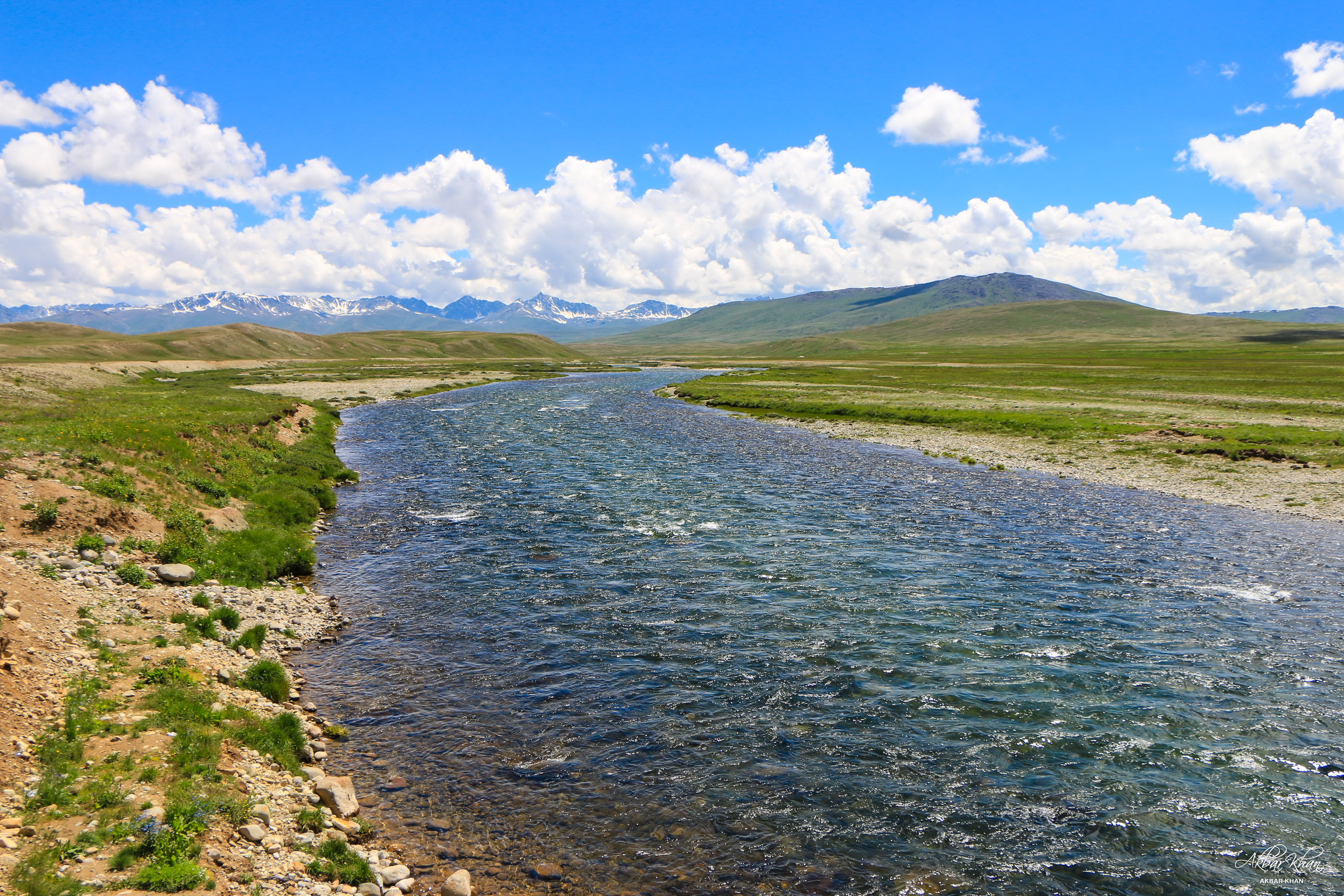
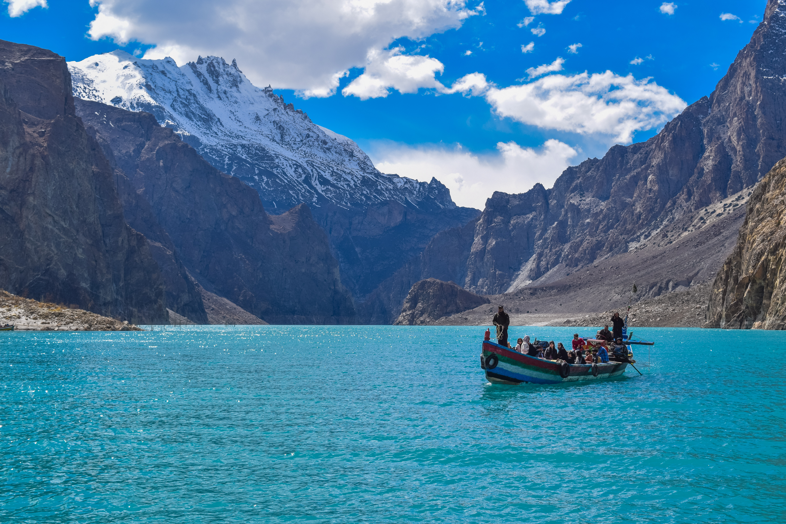
Sheosar Lake ( ur, ) is an alpine lake situated at the western end of Deosai National Park, Gilgit-Baltistan Gilgit-Baltistan (; ), formerly known as the Northern Areas, is a region administered by Pakistan as an administrative territory, and constituting the northern portion of the larger Kashmir region which has been the subject of a dispute bet ..., Pakistan. It is located at the height of . Access The lake is accessible through two routes. One is via Astore and the other via Skardu. From main Astore town, it takes about four hours' jeep travel through a semi-metal road to reach Chilum, the last residential area adjacent to the plains. The second route, from Skardu, can be covered by jeep in few hours; however, if trekked, it can take two days' time. Climate Between the months of November and May the area of Deosai is snow bound. During spring, the surrounding area is covered with wide variety of flowers and butterflies. Most visitors come to the lake are in ... [...More Info...] [...Related Items...] OR: [Wikipedia] [Google] [Baidu] |
Deosai Plains
Deosai National Park () is a high-altitude alpine plain (plateau) and National Park located in Astore, Gilgit-Baltistan. Deosai Plains are situated at an average elevation of 4,114 metres (13,497 ft) above sea level and considered as the second highest plateaus in the world. Etymology The name came about from the folk tale immortalised by Mian Muhammad Baksh in his poem, "Saif al-Mulook"; the word 'Deosai' means 'the Shadow of the Giant': the word "Deo" being a contraction of 'Deva', and the word 'Sai' being one of 'Saya' i.e. 'Shadow'.Sai or Sain also an acronym for swami or lord. Balti people call this place 'Ghbiarsa' referring to 'Summer's Place' because it is only accessible in summer. Geography The Deosai National Park is located in western Himalayas in Gilgit Baltistan (GB), Pakistan. It has an average elevation of above sea level, making the Deosai Plains the second highest plateau in the world after Changtang Tibetan Plateau. The park protects an area of ... [...More Info...] [...Related Items...] OR: [Wikipedia] [Google] [Baidu] |
Gilgit-Baltistan
Gilgit-Baltistan (; ), formerly known as the Northern Areas, is a region administered by Pakistan as an administrative territory, and constituting the northern portion of the larger Kashmir region which has been the subject of a dispute between India and Pakistan since 1947, and between India and China from somewhat later.The application of the term "administered" to the various regions of Kashmir and a mention of the Kashmir dispute is supported by the tertiary sources (a) through (d), reflecting due weight in the coverage. Although "controlled" and "held" are also applied neutrally to the names of the disputants or to the regions administered by them, as evidenced in sources (e) through (g) below, "held" is also considered politicized usage, as is the term "occupied," (see (h) below): (a) (subscription required) Quote: "Kashmir, region of the northwestern Indian subcontinent ... has been the subject of dispute between India and Pakistan since the partition of the Indian ... [...More Info...] [...Related Items...] OR: [Wikipedia] [Google] [Baidu] |
Pakistan
Pakistan ( ur, ), officially the Islamic Republic of Pakistan ( ur, , label=none), is a country in South Asia. It is the world's List of countries and dependencies by population, fifth-most populous country, with a population of almost 243 million people, and has the world's Islam by country#Countries, second-largest Muslim population just behind Indonesia. Pakistan is the List of countries and dependencies by area, 33rd-largest country in the world by area and 2nd largest in South Asia, spanning . It has a coastline along the Arabian Sea and Gulf of Oman in the south, and is bordered by India to India–Pakistan border, the east, Afghanistan to Durand Line, the west, Iran to Iran–Pakistan border, the southwest, and China to China–Pakistan border, the northeast. It is separated narrowly from Tajikistan by Afghanistan's Wakhan Corridor in the north, and also shares a maritime border with Oman. Islamabad is the nation's capital, while Karachi is its largest city and fina ... [...More Info...] [...Related Items...] OR: [Wikipedia] [Google] [Baidu] |
Chilum
Chilum or Chilam is a village of Astore District in Gilgit-Baltistan Gilgit-Baltistan (; ), formerly known as the Northern Areas, is a region administered by Pakistan as an administrative territory, and constituting the northern portion of the larger Kashmir region which has been the subject of a dispute bet ..., Pakistan. It is located near the junction of the Deosai Road and the Astore–Srinagar road. There is checkpost nearby, referred to as Chilam Chowki, at 35°2'8"N 75°6'10" E and elevation 3869 m (12696 ft). References Populated places in Astore District {{GilgitBaltistan-geo-stub ... [...More Info...] [...Related Items...] OR: [Wikipedia] [Google] [Baidu] |
Astore (city)
Astore () is the capital of Astore District in Gilgit-Baltistan, Pakistan. The city is situated at an altitude of . The major Astore– Burzul Road, which linked Gilgit (in Pakistani-administered Kashmir) to Srinagar (in Indian-administered Kashmir) was indefinitely closed in 1978 following the development of the China–Pakistan Karakoram Highway. Climate Astore has a continental climate (Köppen Köppen is a German surname. Notable people with the surname include: * Bernd Köppen (born 1951), German pianist and composer * Carl Köppen (1833-1907), German military advisor in Meiji era Japan * Edlef Köppen (1893–1939), German author and ... ''Dsb''). References Populated places in Astore District Astore District {{GilgitBaltistan-geo-stub ... [...More Info...] [...Related Items...] OR: [Wikipedia] [Google] [Baidu] |
Shina Language
Shina ( ) is an Indo-Aryan language spoken by the Shina people. In Pakistan, Shina is the major language in Gilgit-Baltistan spoken by an estimated 1,146,000 people living mainly in Gilgit-Baltistan and Kohistan.{{Cite book , last1=Saxena , first1=Anju , url=https://books.google.com/books?id=g8DAmULPQU0C&dq=shina+gilgit+ladakh&pg=PA137 , title=Lesser-Known Languages of South Asia: Status and Policies, Case Studies and Applications of Information Technology , last2=Borin , first2=Lars , date=2008-08-22 , publisher=Walter de Gruyter , isbn=978-3-11-019778-5 , pages=137 , language=en , quote=Shina is an Indo-Aryan language of the Dardic group, spoken in the Karakorams and the western Himalayas: Gilgit, Hunza, the Astor Valley, the Tangir-Darel valleys, Chilas and Indus Kohistan, as well as in the upper Neelam Valley and Dras. Outliers of Shina are found in Ladakh (Brokskat), Chitral (Palula and Sawi), Swat (Ushojo; Bashir 2003: 878) and Dir (Kalkoti). A small community of Shina sp ... [...More Info...] [...Related Items...] OR: [Wikipedia] [Google] [Baidu] |
Alpine Lake
Alpine lakes are classified as lakes at high altitudes in mountainous zones, usually near or above the tree line, with extended periods of ice cover. These lakes are commonly formed from glacial activity (either current or in the past) but can also be formed from geological processes such as volcanic activity or landslides. Many alpine lakes that are fed from glacial melt have the characteristic bright turquoise or green color as a result of glacial flour, suspended minerals derived from a glacier scouring the bedrock. When active glaciers are not supplying water to the lake, such as a majority of alpine lakes of the Rocky Mountains in the U.S., the lakes may still be bright blue due to the lack of algae growth resulting from cold temperatures, lack of nutrient run-off from surrounding land, and lack of sediment input. The coloration and mountain locations of alpine lakes attract lots of recreational activity. Alpine lakes are some of the most abundant types of lakes on Earth. In ... [...More Info...] [...Related Items...] OR: [Wikipedia] [Google] [Baidu] |
Deosai National Park
Deosai National Park () is a high-altitude alpine plain (plateau) and National Park located in Astore, Gilgit-Baltistan. Deosai Plains are situated at an average elevation of 4,114 metres (13,497 ft) above sea level and considered as the second highest plateaus in the world. Etymology The name came about from the folk tale immortalised by Mian Muhammad Baksh in his poem, "Saif al-Mulook"; the word 'Deosai' means 'the Shadow of the Giant': the word "Deo" being a contraction of 'Deva', and the word 'Sai' being one of 'Saya' i.e. 'Shadow'.Sai or Sain also an acronym for swami or lord. Balti people call this place 'Ghbiarsa' referring to 'Summer's Place' because it is only accessible in summer. Geography The Deosai National Park is located in western Himalayas in Gilgit Baltistan (GB), Pakistan. It has an average elevation of above sea level, making the Deosai Plains the second highest plateau in the world after Changtang Tibetan Plateau. The park protects an area of . I ... [...More Info...] [...Related Items...] OR: [Wikipedia] [Google] [Baidu] |
Skardu
, nickname = , motto = , image_skyline = , map_caption = , pushpin_map = Gilgit Baltistan#Pakistan , pushpin_label_position = left , pushpin_relief = , area_total_km2 = 77 , elevation_m = 2228 , subdivision_type = Country , subdivision_name = Pakistan , subdivision_type1 = Adm. Unit , subdivision_name1 = Gilgit−Baltistan , subdivision_type2 = District , subdivision_name2 = Skardu District , population_total = 26,023 , population_as_of = 1998 , timezone = PKT , utc_offset = +5:00 , coordinates = , website = , footnotes = Skardu ( ur, , translit=Skardū, ; ... [...More Info...] [...Related Items...] OR: [Wikipedia] [Google] [Baidu] |
Sheosar Lake
Sheosar Lake ( ur, ) is an alpine lake situated at the western end of Deosai National Park, Gilgit-Baltistan Gilgit-Baltistan (; ), formerly known as the Northern Areas, is a region administered by Pakistan as an administrative territory, and constituting the northern portion of the larger Kashmir region which has been the subject of a dispute bet ..., Pakistan. It is located at the height of . Access The lake is accessible through two routes. One is via Astore and the other via Skardu. From main Astore town, it takes about four hours' jeep travel through a semi-metal road to reach Chilum, the last residential area adjacent to the plains. The second route, from Skardu, can be covered by jeep in few hours; however, if trekked, it can take two days' time. Climate Between the months of November and May the area of Deosai is snow bound. During spring, the surrounding area is covered with wide variety of flowers and butterflies. Most visitors come to the lake are in ... [...More Info...] [...Related Items...] OR: [Wikipedia] [Google] [Baidu] |
List Of Lakes In Pakistan
Pakistan is home to many natural and man-made lakes and reservoirs. The largest lake in Pakistan is the Manchar Lake. The lake is spread over an area of over . The highest lakes in Pakistan are the Paristan Lake and Shimshal Lake, which both are at an altitude of over . The second-highest lake in Pakistan is the Karambar Lake, which is located at an altitude of , is the 33rd highest lake in the world. A recent Google map analysis revealed more than 500 lakes in northern Pakistan (mainly Gilgit-Baltistan and Chitral region), many of these lakes are still nameless and even undiscovered to even local population. Natural lakes Gilgit-Baltistan Azad Kashmir, Punjab, KPK, Sindh and Balochistan }) is a lake situated at 10 km from the Tehsil Kallar Kahar, Chakwal District and 30 kilometers southwest of Chakwal along the motorway. , , -- , Uchhali Lake , , , Soan Sakaser Valley, Salt Range , The lake is located in the southern salt range and has brackish water. , ... [...More Info...] [...Related Items...] OR: [Wikipedia] [Google] [Baidu] |


