|
Sgùrr Na Ciste Duibhe
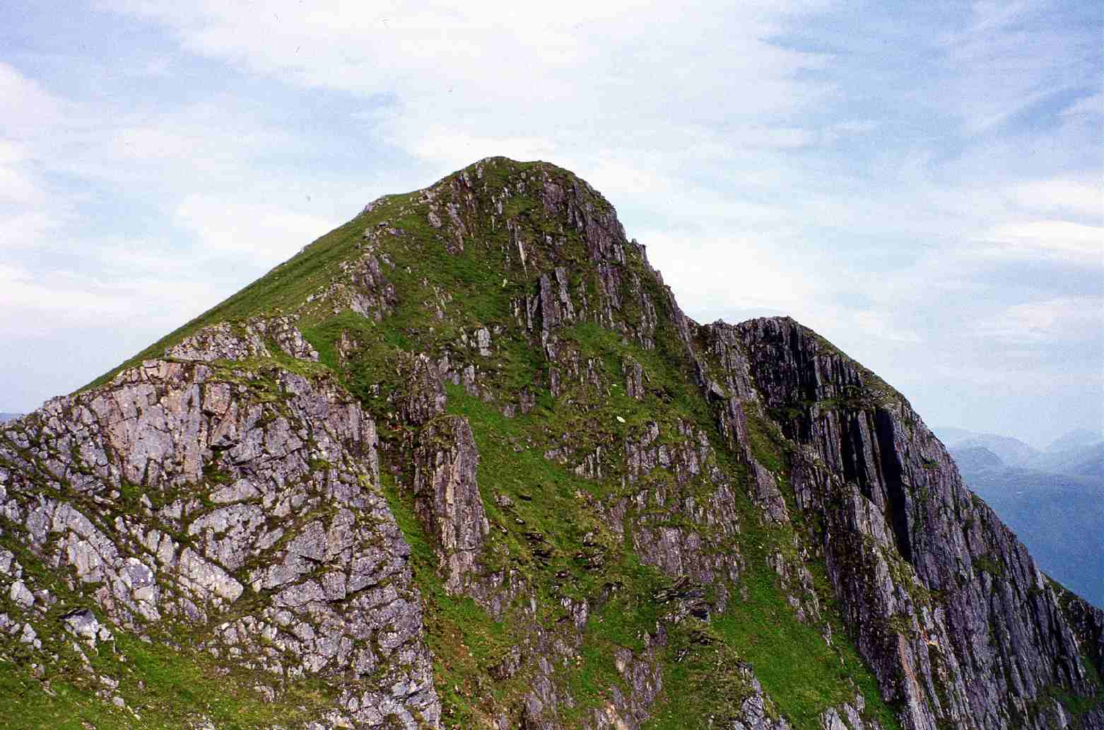
Sgùrr na Ciste Duibhe or Sgùrr nan Cisteachan Dubha is a mountain in the Northwest Highlands of Scotland, one of the 'Five Sisters of Kintail'. It is on the northern side of Glen Shiel, 27 kilometers southeast of Kyle of Lochalsh. Its height is and it is classed as a Munro. Name The Gaelic name ''Sgùrr na Ciste Duibhe'' means "peak of the black chest or coffin"; the alternative name ''Sgùrr nan Cisteachan Dubha'' being "peak of the black chests/coffins". The origin of the name is unclear but is thought to refer to an unusual deep rocky hollow near the summit which lies between the main ridge and a false crest. This can be dangerous in mist or snow conditions.www.mountaineering-scotland.org.uk. Article including reference to summit "hollow". Other sources say that the name refers to the deep ho ... [...More Info...] [...Related Items...] OR: [Wikipedia] [Google] [Baidu] |
Munro
A Munro (; ) is defined as a mountain in Scotland with a height over , and which is on the Scottish Mountaineering Club (SMC) official list of Munros; there is no explicit topographical prominence requirement. The best known Munro is Ben Nevis (Beinn Nibheis), the highest mountain in the British Isles at 4,411 ft (1,345 m). Munros are named after Sir Hugh Munro, 4th Baronet (1856–1919), who produced the first list of such hills, known as ''Munro's Tables'', in 1891. Also included were what Munro considered lesser peaks, now known as Munro Tops, which are also over 3,000 feet but are lower than the nearby primary mountain. The publication of the original list is usually considered to be the Epoch (reference date), epoch event of modern peak bagging. The list has been the subject of subsequent variation and , the Scottish Mountaineering Club has listed 282 Munros and 226 Munro Tops. "Munro bagging" is the activity of climbing all the listed Munros. , 7,654 people had rep ... [...More Info...] [...Related Items...] OR: [Wikipedia] [Google] [Baidu] |
Ciste Dhubh
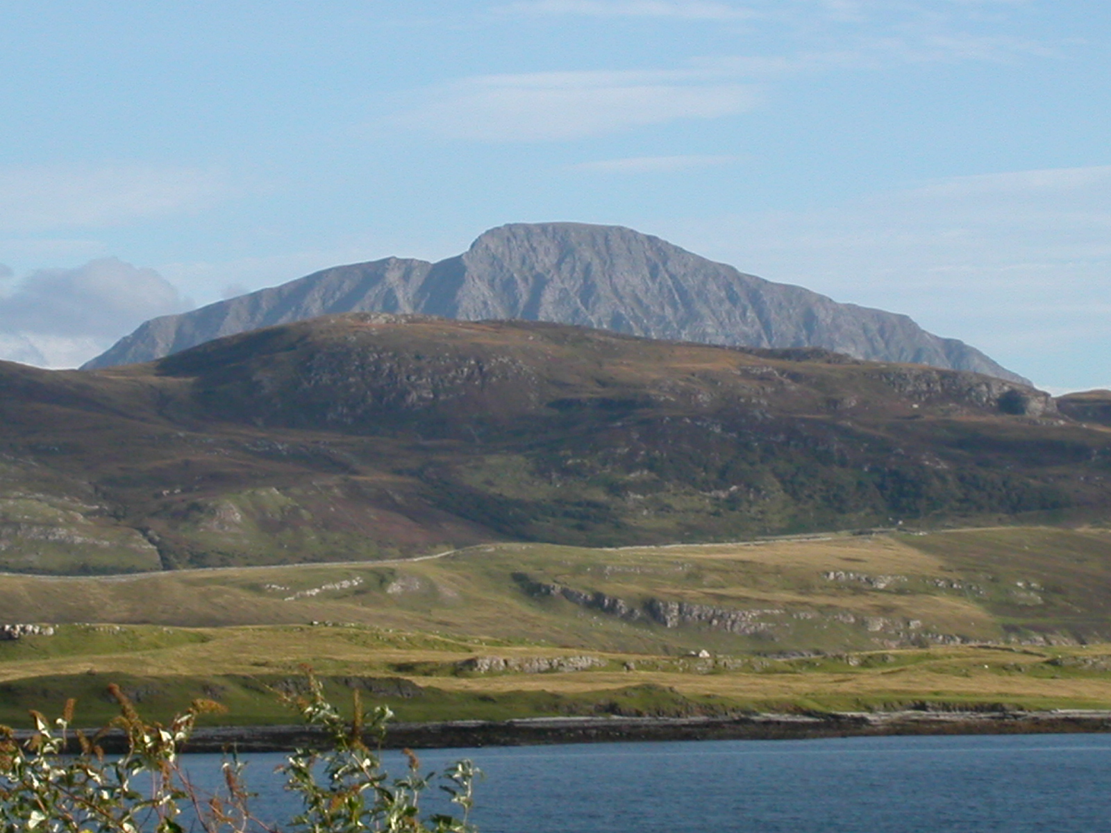
Ciste Dhubh is a mountain in the Scottish Highlands, between Glen Shiel and Glen Affric. With a height of , it is classed as a Munro. It is almost surrounded by glens: Fionngleann (north), An Caorann Mòr (east) and Allt Cam-bàn (west), with the Bealach a' Chòinich pass (south) linking it to the mountain of Sgùrr an Fhuarail. Its name comes from Scottish Gaelic ''A' Chiste Dhubh'', "the black chest", possibly referring to the dark rocky summit."The Magic of the Munros" Page 136, Butterfield also says that "Dark Chest" probably originates from the dark summit rocks. Landscape Ciste Dhubh has a prominent pointed peak with flanks which are predominantly grassy with some craggy areas on its northern slopes. The summit is precipitous and rocky, and the southern ridge is steep and in places quite narrow, it offers few dangers for walkers but care is needed in high winds or under winter conditions. The mountain also has ridges to the north west and north which descend to upper ... [...More Info...] [...Related Items...] OR: [Wikipedia] [Google] [Baidu] |
Marilyns Of Scotland
This is a list of Marilyn hills and mountains in the United Kingdom, Ireland and surrounding islands and sea stacks. Marilyns are defined as peaks with a prominence of or more, regardless of height or any other merit (e.g. topographic isolation, as used in Munros). Thus, Marilyns can be mountains, with a height above , or relatively small hills. there were 2,010 recorded Marilyns. Definition The Marilyn classification was created by Alan Dawson in his 1992 book ''The Relative Hills of Britain''. The name Marilyn was coined by Dawson as a punning contrast to the ''Munro'' classification of Scottish mountains above , but which has no explicit prominence threshold, being homophonous with (Marilyn) '' Monroe''. The list of Marilyns was extended to Ireland by Clem Clements. Marilyn was the first of several subsequent British Isles classifications that rely solely on prominence, including the P600s, the HuMPs, and the TuMPs. Topographic prominence is more difficult to es ... [...More Info...] [...Related Items...] OR: [Wikipedia] [Google] [Baidu] |
Munros
A Munro (; ) is defined as a mountain in Scotland with a height over , and which is on the Scottish Mountaineering Club (SMC) official list of Munros; there is no explicit topographical prominence requirement. The best known Munro is Ben Nevis (Beinn Nibheis), the highest mountain in the British Isles at 4,411 ft (1,345 m). Munros are named after Sir Hugh Munro, 4th Baronet (1856–1919), who produced the first list of such hills, known as ''Munro's Tables'', in 1891. Also included were what Munro considered lesser peaks, now known as Munro Tops, which are also over 3,000 feet but are lower than the nearby primary mountain. The publication of the original list is usually considered to be the Epoch (reference date), epoch event of modern peak bagging. The list has been the subject of subsequent variation and , the Scottish Mountaineering Club has listed 282 Munros and 226 Munro Tops. "Munro bagging" is the activity of climbing all the listed Munros. , 7,654 people had rep ... [...More Info...] [...Related Items...] OR: [Wikipedia] [Google] [Baidu] |
Hamish Brown
Hamish Brown Order of the British Empire, M.B.E. Royal Scottish Geographical Society, FRSGS is a professional writer, lecturer and photographer specialising in mountain and outdoor topics. He is best known for his walking exploits in the Scottish Highlands, having completed multiple rounds of the Munros and being the first person to walk all the Munros in a single trip with only ferries and a bicycle as means of transport. Early life Born in Colombo, Ceylon (now modern-day Sri Lanka) on 13 August 1934, he lived in Japan for a time and then Singapore; escaping in 1942 as it fell to the Japanese. He lived in Union of South Africa, South Africa for two years as a refugee before returning to live in Scotland at the end of World War II. His family lived in Dollar, Clackmannanshire, Dollar and Brown spent much of his youth exploring the nearby Ochil Hills which awakened his interest in the great outdoors. He was educated at Dollar Academy. He travelled extensively in the Middle East ... [...More Info...] [...Related Items...] OR: [Wikipedia] [Google] [Baidu] |
Irvine Butterfield
Irvine Butterfield (1936–2009) was an environmentalist, hillwalker and author of several books about mountains and the outdoor environment who took a significant role in the running of organisations with such interests in Scotland. He was a good organiser and volunteered large amounts of his time to causes he believed in. Personal life Butterfield was born in Farnhill, North Yorkshire on 8 August 1936 and from his youth he was a keen walker. He worked at the local gasworks and then in the Post Office. In 1957 he moved to London to start his lifetime career with HM Customs and Excise, in 1960 transferring to its whisky departments in Perth, Scotland, Perth, Dundee and then Inverness. reported in It was here that he developed his love for the Scottish hills. Butterfield was a burly man, not built with the physique for climbing, who never claimed to be more than a hillwalker. He admitted that to climb the Inaccessible Pinnacle "a climbing friend from Manchester hauled me up it ... [...More Info...] [...Related Items...] OR: [Wikipedia] [Google] [Baidu] |
Battle Of Culloden
The Battle of Culloden took place on 16 April 1746, near Inverness in the Scottish Highlands. A Jacobite army under Charles Edward Stuart was decisively defeated by a British government force commanded by the Duke of Cumberland, thereby ending the Jacobite rising of 1745. Charles landed in Scotland in July 1745, seeking to restore his father James Francis Edward Stuart to the British throne. He quickly won control of large parts of Scotland, and an invasion of England reached as far south as Derby before being forced to turn back. However, by April 1746, the Jacobites were short of supplies, facing a superior and better equipped opponent. Charles and his senior officers decided their only option was to stand and fight. When the two armies met at Culloden, the battle was brief, lasting less than an hour, with the Jacobites suffering an overwhelming and bloody defeat. This effectively ended both the 1745 rising, and Jacobitism as a significant element in British politics. Ba ... [...More Info...] [...Related Items...] OR: [Wikipedia] [Google] [Baidu] |
Charles Edward Stuart
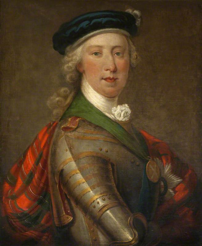
Charles Edward Louis John Sylvester Maria Casimir Stuart (31 December 1720 – 30 January 1788) was the elder son of James Francis Edward Stuart, making him the grandson of James VII and II, and the Stuart claimant to the thrones of England, Scotland, and Ireland from 1766 as Charles III. During his lifetime, he was also known as "the Young Pretender" and "the Young Chevalier"; in popular memory, he is known as Bonnie Prince Charlie. Born in Rome to the exiled Stuart court, he spent much of his early and later life in Italy. In 1744, he travelled to France to take part in a planned invasion to restore the Stuart monarchy under his father. When storms partly wrecked the French fleet, Charles resolved to proceed to Scotland following discussion with leading Jacobites. This resulted in Charles landing by ship on the west coast of Scotland, leading to the Jacobite rising of 1745. The Jacobite forces under Charles initially achieved several victories in the field, including the Ba ... [...More Info...] [...Related Items...] OR: [Wikipedia] [Google] [Baidu] |
Jacobitism
Jacobitism was a political ideology advocating the restoration of the senior line of the House of Stuart to the Monarchy of the United Kingdom, British throne. When James II of England chose exile after the November 1688 Glorious Revolution, the Parliament of England ruled he had "abandoned" the English throne, which was given to his Protestant daughter Mary II of England, and his nephew, her husband William III of England, William III. On the same basis, in April the Convention of Estates (1689), Scottish Convention awarded Mary and William the throne of Scotland. The Revolution created the principle of a contract between monarch and people, which if violated meant the monarch could be removed. A key tenet of Jacobitism was that kings were appointed by God, making the post-1688 regime illegitimate. However, it also functioned as an outlet for popular discontent, and thus was a complex mix of ideas, many opposed by the Stuarts themselves. Conflict between Charles Edward Stuar ... [...More Info...] [...Related Items...] OR: [Wikipedia] [Google] [Baidu] |
Battle Of Glen Shiel
The Battle of Glen Shiel took place on 10 June 1719 in the Scottish Highlands, during the Jacobite rising of 1719. A Jacobitism, Jacobite army composed of Highland levies and Spanish Marine Infantry, Spanish marines was defeated by British government troops. The Rising was backed by Spain, then engaged in the 1718–1720 War of the Quadruple Alliance with Great Britain, Britain. Originally intended to support a landing in south-west England, which was cancelled several weeks earlier, its failure was seen as having fatally damaged the Jacobite cause. The battlefield is now included in the Inventory of Historic Battlefields in Scotland, and protected by Historic Scotland. Background When the War of the Spanish Succession ended in 1713, Spain lost its Italian possessions of Sicily and Sardinia, and their recovery was a priority for Giulio Alberoni, the Chief Minister. Sardinia was reoccupied in 1717 but when they landed on Sicily in July 1718, the Royal Navy destroyed the Spanis ... [...More Info...] [...Related Items...] OR: [Wikipedia] [Google] [Baidu] |
Sàileag
Sàileag is Scottish mountain located on the northern side of Glen Shiel, 27 kilometres south east of Kyle of Lochalsh. Overview It lies just to the east of the famous Five Sisters of Kintail group of hills to which it is connected by the Bealach an Lapain (725 metres). It is part of a mountain group called the North Glen Shiel Ridge which also includes two other Munros ( Sgurr a' Bhealaich Dheirg and Aonach Meadhoin) and with a height of 956 metres (3136 feet) it is the lowest of all the six Munros on the northern side of Glen Shiel, making the mountain's translated name of “The Little Heel” quite appropriate. Sàileag seems to have lost three metres of height in recent years, many older guide books have its height as 959 metres in comparison to 956 on the newer Ordnance Survey maps. Topography Sàileag is mostly grassy although its north west face is steep and craggy as it drops to the Allt an Lapain. The mountain is formed by the junction of three ridges, the easter ... [...More Info...] [...Related Items...] OR: [Wikipedia] [Google] [Baidu] |
Cirque
A (; from the Latin word ) is an amphitheatre-like valley formed by Glacier#Erosion, glacial erosion. Alternative names for this landform are corrie (from , meaning a pot or cauldron) and ; ). A cirque may also be a similarly shaped landform arising from fluvial erosion. The concave shape of a glacial cirque is open on the downhill side, while the cupped section is generally steep. Cliff-like slopes, down which ice and glaciated debris combine and converge, form the three or more higher sides. The floor of the cirque ends up bowl-shaped, as it is the complex convergence zone of combining ice flows from multiple directions and their accompanying rock burdens. Hence, it experiences somewhat greater erosion forces and is most often overdeepening, overdeepened below the level of the cirque's low-side outlet (stage) and its down-slope (backstage) valley. If the cirque is subject to seasonal melting, the floor of the cirque most often forms a tarn (lake), tarn (small lake) behind a d ... [...More Info...] [...Related Items...] OR: [Wikipedia] [Google] [Baidu] |


