|
Serraria Island, Pará
Serraria Island ( Portuguese: ''Ilha da Serraria''), also called Queimada (''Ilha Queimada''), is an island in the Brazilian state Pará Pará () is a Federative units of Brazil, state of Brazil, located in northern Brazil and traversed by the lower Amazon River. It borders the Brazilian states of Amapá, Maranhão, Tocantins (state), Tocantins, Mato Grosso, Amazonas (Brazilian st ..., located within the Amazon Delta. The island is part of the municipality of Afuá. The Western coast of the island lines the main channel of the Amazon River, opposite the city of Macapá. Because of the distances, inhabitants of Serraria Island seek most services like banks and schools in Macapá instead of Afuá. The Eastern coast of the island is on Vieira Grande Bay, which separates it from the island Marajó. The island is mostly covered with tropical rainforest. The main economic activity on the island is the production of açaí palm, açaí, followed by heart of palm, shrimps, oil seeds and ... [...More Info...] [...Related Items...] OR: [Wikipedia] [Google] [Baidu] |
NASA WorldWind
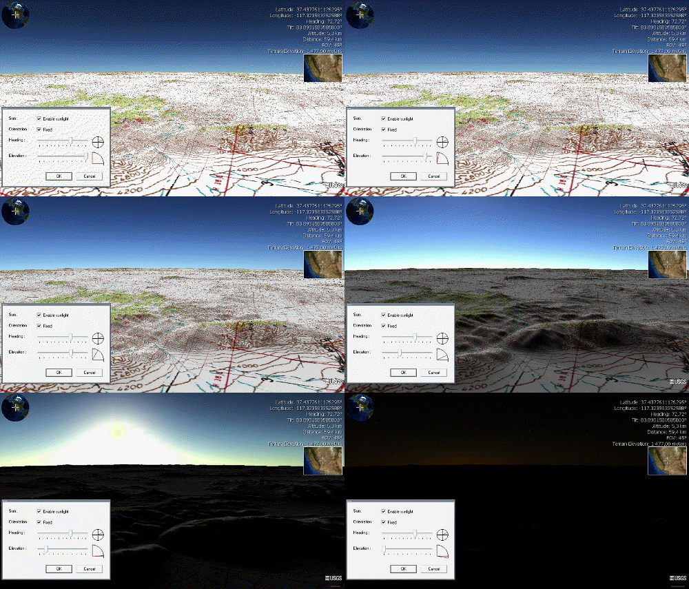
NASA WorldWind is an open-source (released under the NOSA license and the Apache 2.0 license) virtual globe. According to the website, "WorldWind is an open source virtual globe API. WorldWind allows developers to quickly and easily create interactive visualizations of 3D globe, map and geographical information. Organizations around the world use WorldWind to monitor weather patterns, visualize cities and terrain, track vehicle movement, analyze geospatial data and educate humanity about the Earth." It was first developed by NASA in 2003 for use on personal computers and then further developed in concert with the open source community since 2004. a web-based version of WorldWind is available online. An Android version is also available. The original version relied on .NET Framework, which ran only on Microsoft Windows. The more recent Java version, WorldWind Java, is cross platform, a software development kit (SDK) aimed at developers and, unlike the old .NET vers ... [...More Info...] [...Related Items...] OR: [Wikipedia] [Google] [Baidu] |
Macapá
Macapá () is a city in Brazil with a population of 512,902 (2020 estimate), and is the capital of Amapá state in the country's North Region, Brazil, North Region, located on the northern channel of the Amazon Delta near its mouth on the Atlantic Ocean. The city is on a small plateau on the Amazon in the southeast of the state of Amapá. The only access by road from outside the province is from the Overseas France, overseas France, French Departments of France, department of French Guiana, although there are regular ferries to Belém, Brazil. Macapá is linked by road with some other cities in Amapá. The equator runs through the middle of the city, leading residents to refer to Macapá as "''The capital of the middle of the world.''" It covers and is located northwest of the large inland island of Marajó and south of the border with French Guiana. History Macapá is a corruption of the Tupian languages, Tupi word ''macapaba'', or "''place of many bacabas''", the fruit of the ... [...More Info...] [...Related Items...] OR: [Wikipedia] [Google] [Baidu] |
Islands Of The Amazon
This is a list of the lists of islands in the world grouped by country, by continent, by body of water A body of water or waterbody is any significant accumulation of water on the surface of Earth or another planet. The term most often refers to oceans, seas, and lakes, but it includes smaller pools of water such as ponds, wetlands, or more rare ..., and by other classifications. For rank-order lists, see the other lists of islands below. Lists of islands by country or location Africa Antarctica Asia Europe North America Oceania South America Lists of islands by continent Lists of islands by body of water By ocean: By other bodies of water: List of ancient islands Other lists of islands External links Island Superlatives {{South America topic, List of islands of * ... [...More Info...] [...Related Items...] OR: [Wikipedia] [Google] [Baidu] |
Marajó Archipelago Environmental Protection Area
The Marajó Archipelago Environmental Protection Area () is an environmental protection area in the state of Pará, Brazil. It protects the Marajó Archipelago, made up of marine fluvial islands in the area where the Amazon and Tocantins rivers converge and flow into the Atlantic. Covering almost it is larger than some countries in Europe. The area is inhabited, but human activities are limited to some extent to reduce ecological damage. Location The Marajó Archipelago Environmental Protection Area (APA) is divided between the Pará municipalities of Afuá (14.2%), Anajás (11.78%), Breves (16.15%), Cachoeira do Arari (5.21%), Chaves (22.44%), Curralinho (6.09%), Muaná (6.37%), Ponta de Pedras (5.7%), Salvaterra (1.75%), Santa Cruz do Arari (1.69%), Soure (5.94%) and São Sebastião da Boa Vista (2.67%). It has an area of . This makes it larger than some European countries. The APA includes the island of Marajó and about 3,000 other islands and islets to the nor ... [...More Info...] [...Related Items...] OR: [Wikipedia] [Google] [Baidu] |
Heart Of Palm
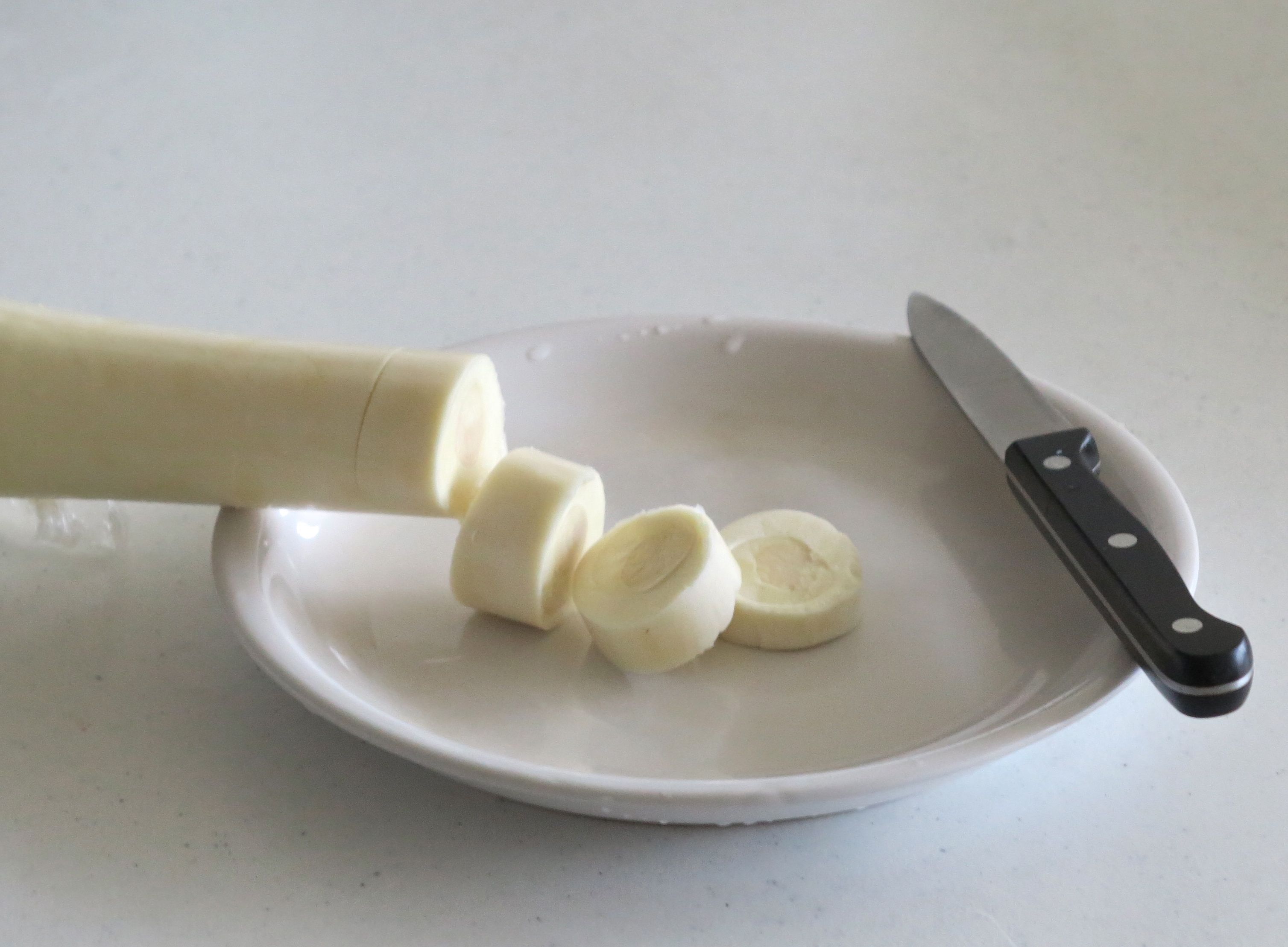
Heart of palm is a vegetable harvested from the inner core and growing bud of certain Palm tree, palm trees, most notably the coconut (''Cocos nucifera''), juçara (''Euterpe edulis''), açaí palm (''Euterpe oleracea''), sabal, palmetto (''Sabal'' spp.), and Bactris gasipaes, peach palm. Heart of palm may be eaten on its own, and often it is eaten in a salad. There are palm varieties that have become domesticated farm species as an alternative to sourcing from wild palms. The main variety that has been domesticated is ''Bactris gasipaes'', known in English as peach palm. This variety is the most widely used for canning. Peach palms are self-Sucker (botany), suckering and produce multiple Plant stem, stems, with up to 40 on one plant. This lets producers lower costs by harvesting several stems from a plant while avoiding the death of the palm. Another advantage is that the peach palm has been selectively bred to eliminate the thorns of its wild cousins. Since harvesting is still ... [...More Info...] [...Related Items...] OR: [Wikipedia] [Google] [Baidu] |
Açaí Palm
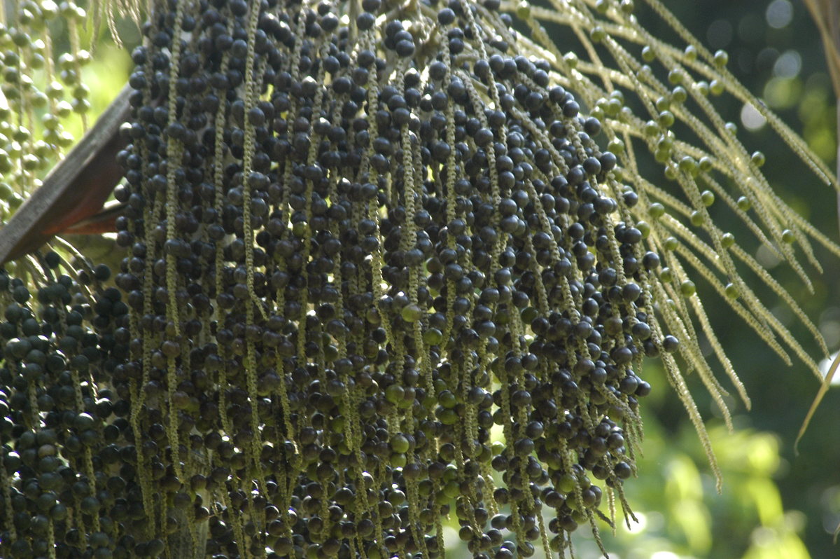
The açaí palm (, , from Nheengatu ''asai''), '' Euterpe oleracea'', is a species of palm tree (Arecaceae) cultivated for its fruit (açaí berries, or simply açaí), hearts of palm (a vegetable), leaves, and trunk wood. Global demand for the fruit has expanded rapidly in the 21st century, and the tree is cultivated for that purpose primarily. The species is native to eastern Amazonia, especially in Brazil, mainly in swamps and floodplains. Açaí palms are tall, slender trees growing to more than tall, with pinnate leaves up to long. The fruit is small, round, and black-purple in color. The fruit became a staple food in floodplain areas around the 18th century, but its consumption in urban areas and promotion as a health food only began in the mid-1990s along with the popularization of other Amazonian fruits outside the region. Name The folk etymology says that chief Itaqui ordered all newborns put to death owing to a period of famine. When his own daughter gave birth ... [...More Info...] [...Related Items...] OR: [Wikipedia] [Google] [Baidu] |
Tropical Rainforest
Tropical rainforests are dense and warm rainforests with high rainfall typically found between 10° north and south of the Equator. They are a subset of the tropical forest biome that occurs roughly within the 28° latitudes (in the torrid zone between the Tropic of Cancer and Tropic of Capricorn). Tropical rainforests are a type of tropical moist broadleaf forest, that includes the more extensive seasonal tropical forests. True rainforests usually occur in tropical rainforest climates where no dry season occurs; all months have an average precipitation of at least . Seasonal tropical forests with tropical monsoon climate, tropical monsoon or tropical savanna climate, savanna climates are sometimes included in the broader definition. Tropical rainforests ecosystems are distinguished by their consistent, high temperatures, exceeding monthly, and substantial annual rainfall. The abundant rainfall results in nutrient-poor, leached soils, which profoundly affect the flora and fau ... [...More Info...] [...Related Items...] OR: [Wikipedia] [Google] [Baidu] |
Marajó
Marajó () is a large coastal island in the state of Pará, Brazil. It is the main and largest of the islands in the Marajó Archipelago. Marajó Island is separated from the mainland by Marajó Bay, Pará River, smaller rivers (especially Macacos and Tajapuru), Companhia River, Jacaré Grande River, Vieira Grande Bay and the Atlantic Ocean. From approximately 400 BC to 1600 AD, Marajó was the site of an advanced pre-Cabraline society called the Marajoara culture, which may have numbered more than 100,000 people at its peak. Today, the island is known for its large water buffalo population, as well as the ''pororoca'' tidal bore periodically exhibited by high tides overcoming the usual complex hydrodynamic interactions in the surrounding rivers. It is the second-largest island in South America, and the 35th largest island in the world. With a land area of Marajó is comparable in size to Switzerland. Its maximum span is long and in perpendicular width. Geography ... [...More Info...] [...Related Items...] OR: [Wikipedia] [Google] [Baidu] |
Vieira Grande Bay
Vieira Grande Bay ( Portuguese: ''Baía do Vieira Grande'') is a bay off the Brazilian coast located in the state of Pará. The bay forms one of the main river channels in the Amazon Delta. The bay is fed in the South by the Jacaré Grande River and by a complex system of numerous river channels that are called ''furos'' in Portuguese. These channels form a link between the Amazon and the Vieira Grande Bay. The influence of the Amazon waters can be shown for example through the occurrence of the phytoplankton '' Thalassionema nitzschioides'' in the bay. Further downstream, the bay is lined on the Western side by a string of islands, of which Serraria is the largest. These islands separate the bay from the main channel of the Amazon. In the East, the bay is bordered by the North-Western coast of the island Marajó, where it touches the municipalities of Chaves and Afuá. The town of Afuá is built on stilts because high waters in the Bay cause the rivers surrounding it to rise ... [...More Info...] [...Related Items...] OR: [Wikipedia] [Google] [Baidu] |
Marajó Archipelago
The Marajó Archipelago (' is the largest fluvial-maritime archipelago on Earth. Located in the Brazilian states of Amapá and Pará, the island group has approx. 2,500 islands. The main island of the archipelago also has the name of Marajó, having about 42,000 km² of area, considered, due to its size, as the largest coastal island in Brazil, extending from the mouth of the Amazon River, between the Line of the Equator and the parallel 1.55º south latitude and, in the E/W direction between the meridians 47º and 53º west longitude, until the Atlantic Ocean. The aquatic and forming limits of the archipelago are: the Atlantic Ocean (north); Marajó Bay (east); the Pará River estuary complex (south), and; the Amazon Delta (west). Most important islands The largest and most important islands include: *Marajó Island: the largest and most populated island in the archipelago; * Grande de Gurupá Island; * Island of Franco; * Island of Brique; * Island of Flautino; * ... [...More Info...] [...Related Items...] OR: [Wikipedia] [Google] [Baidu] |
Amazon Delta
The Amazon Delta (Portuguese language, Portuguese: delta do Amazonas) is a vast river delta formed by the Amazon River and the Tocantins River (through the Pará River distributary channel) in northern South America. It is located in the Federative units of Brazil, Brazilian states of Amapá and Pará and encompasses the Marajó Archipelago, with Marajó, Marajó Island as its largest island. The main cities located in the vicinity are Belém and Macapá, each with its respective metropolitan area. The Amazon Delta has a tropical climate with high humidity and high temperatures. It has a wet season with frequent flooding and a dry season where the delta dries out. These seasons shape the environment of the Amazon Delta and the life that lives there, such as the water buffalo for which Marajó Island is well known, three-toed sloths, three-toed sloth, capybara, giant anteater, giant otter, jaguar and Amazon river dolphin, pink river dolphins. References River deltas Geogr ... [...More Info...] [...Related Items...] OR: [Wikipedia] [Google] [Baidu] |


