|
Sendaidō
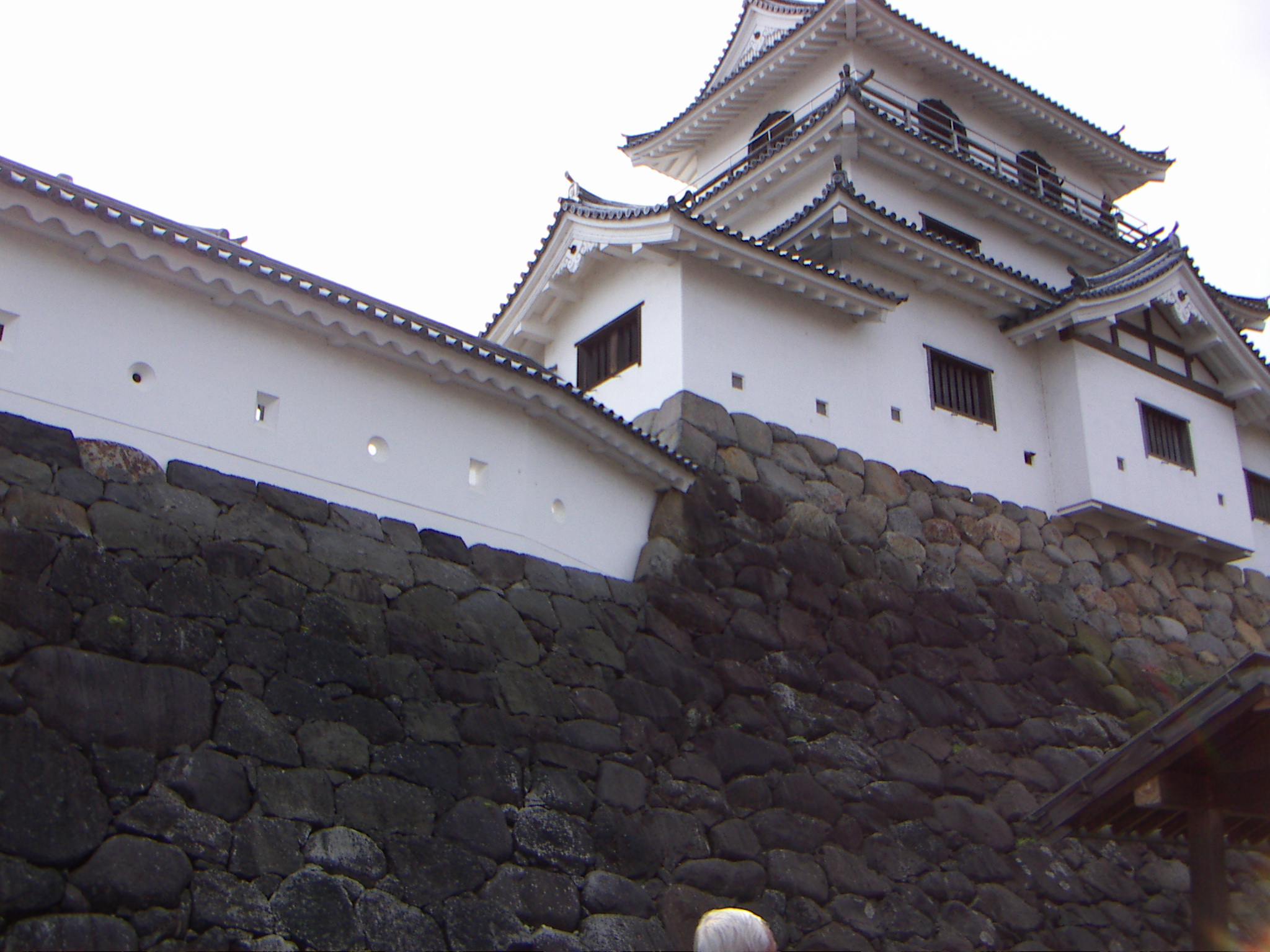
The was a subroute of the Ōshū Kaidō, one of the Edo Five Routes of Japan. It connected the Ōshū Kaidō's terminus in Shirakawa, Fukushima, Shirakawa and Mutsu Province with Sendai. It was established by Tokugawa Ieyasu for government officials traveling through the area. Stations of the Sendaidō The 41 shukuba, post stations along the Sendaidō are listed below in order and are divided by their modern-day prefecture. The present day municipality is listed afterwards in parentheses. The Matsumaedō connects the end of the Sendaidō with the northern tip of modern-day Aomori Prefecture. Fukushima Prefecture :Starting Location: Komine Castle, Shirakawa Castle (白河城) (Shirakawa, Fukushima, Shirakawa) :1. Neda-juku (根田宿) (Shirakawa) :2. Kotagawa-juku (小田川宿) (Shirakawa) :3. Ōtagawa-juku (太田川宿) (Izumizaki, Fukushima, Izumizaki, Nishishirakawa District, Fukushima, Nishishirakawa District) :4. Fumase-juku (踏瀬宿) (Izumizaki, Nishishirakawa District) : ... [...More Info...] [...Related Items...] OR: [Wikipedia] [Google] [Baidu] |
Ushū Kaidō
The was a subroute of the Ōshū Kaidō and the Sendaidō in Japan. It breaks off from the Sendaidō at Kōri-juku in the modern-day Koori in Fukushima Prefecture. It connects to Aburakawa-juku along Matsumaedō, the other subroute of the Ōshū Kaidō. It is traced by National Routes 13 and 7. It was established after Tokugawa Ieyasu called for the construction of routes connecting the capital of Edo (now Tokyo) with other parts of Japan.Ushū Kaidō NTT Akita Branch. Accessed January 4, 2007. Stations of the Ushū Kaidō The 57 post stations along the Ushū Kaidō are listed below in order and are divided by their modern-day prefecture. The present day municipality is listed afterwards in parentheses. (Actual post stations are indicat ...[...More Info...] [...Related Items...] OR: [Wikipedia] [Google] [Baidu] |
Ōshū Kaidō
The was one of the five routes of the Edo period. It was built to connect Edo (modern-day Tokyo) with Mutsu Province and the present-day city of Shirakawa, Fukushima Prefecture, Japan. It was established by Tokugawa Ieyasu for government officials traveling through the area. Subroutes In addition to the established use of traveling from Edo to Mutsu Province, there were also many roads that connected from the Ōshū Kaidō. One such sub-route was the Sendaidō (仙台道), which connected Mutsu Province with Sendai. The terminus for the Sendaidō is in Aoba-ku in modern Sendai. From there, the Matsumaedō (松前道) connected Sendai with Hakodate, Hokkaidō. Though the Ōshū Kaidō has only 27 post stations,Ōshū Kaidō Map Yumekaidō. Accessed September 4, 2007. there were over 100 designated post stations when the subrout ... [...More Info...] [...Related Items...] OR: [Wikipedia] [Google] [Baidu] |
Matsumaedō
The was the continuation of the Ōshū Kaidō, one of the Edo Five Routes of Japan. It connected the Sendaidō's terminus at Sendai Castle with the northern tip of modern-day Aomori Prefecture. It was established by Tokugawa Ieyasu for government officials traveling through the area. The route is named after the Matsumae Domain, the only Edo period feudal domain to have been located in Ezo (now called Hokkaidō); Matsumae was accessible by boat from the northern terminus of the Matsumaedō. Travel In the early Edo period, travel along the road mostly consisted of ''daimyō'' and their retainers heading to-and-from Edo under their '' sankin kōtai'' obligations. After Hakodate's development, the late Edo period saw travel further increase as a result of increasing trade with Imperial Russia. Today, the path of the Ōshū Kaidō is followed by National Route 4, which runs parallel to the Tōhoku Expressway and the Hachinohe Expressway. Stations of the Matsumaedō The 44 post stati ... [...More Info...] [...Related Items...] OR: [Wikipedia] [Google] [Baidu] |
Edo Five Routes
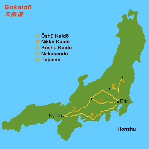
The , sometimes translated as "Five Highways", were the five centrally administered routes, or ''kaidō'', that connected the ''de facto'' capital of Japan at Edo (now Tokyo) with the outer provinces during the Edo period (1603–1868). The most important of the routes was the Tōkaidō, which linked Edo and Kyoto. Tokugawa Ieyasu started the construction of these five routes to increase his control over the country in 1601, but it was Tokugawa Ietsuna, the 4th ''shōgun'' of the Tokugawa shogunate and Ieyasu's great-grandson, who declared them as major routes. Post stations were set up along the route for travelers to rest and buy supplies. The routes thrived due to the policy of ''sankin-kōtai'', that required the ''daimyō'' (regional rulers) to travel in alternate years along the routes to Edo. History The various roads that make up the Five Routes existed in some form before becoming an official set of routes. Tokugawa Ieyasu began work on the routes shortly after bec ... [...More Info...] [...Related Items...] OR: [Wikipedia] [Google] [Baidu] |
Zaō, Miyagi
is a town located in Miyagi Prefecture, Japan. , the town had an estimated population of 11,790, and a population density of 77 persons per km² in 4,493 households. The total area of the town is . Geography Zaō is located in the Tōhoku region of northern Japan in southwestern Miyagi Prefecture in the Ōu Mountains, bordered by Yamagata Prefecture to the west. Parts of the town are within the borders of Zaō Quasi-National Park and Zaō Kōgen Prefectural Natural Park. Neighboring municipalities Miyagi Prefecture * Shiroishi * Shichikashuku * Ōgawara * Murata * Kawasaki Yamagata Prefecture *Kaminoyama Climate Zaō has a humid climate (Köppen climate classification ''Cfa'') characterized by mild summers and cold winters. The average annual temperature in Zaō is . The average annual rainfall is with September as the wettest month. The temperatures are highest on average in August, at around , and lowest in January, at around . Demographics Per Japanese census data, th ... [...More Info...] [...Related Items...] OR: [Wikipedia] [Google] [Baidu] |
Shiroishi Castle
is a flatland-style Japanese castle in what is now the city of Shiroishi, Miyagi. During the Edo period, it was the castle of the Katakura clan, who were hereditary retainers of the Date clan of Sendai Domain. During the Boshin War, it was also temporarily the headquarters of the Ōuetsu Reppan Dōmei. The castle was also known by the name of Early history Shiroishi Castle was founded in the Kamakura period, by the Karita clan. Sengoku Era In 1591, during the late Azuchi–Momoyama period, the castle was completely rebuilt by the Gamō clan with stone walls and a donjon, and ruled by the senior retainer Gamō Satonari. Edo Era Beginning in 1600, the castle and its environs were recovered by the Date clan as part of Sendai Domain under the Tokugawa shogunate. From 1600 onward, Shiroishi Castle was ruled by the Katakura clan, who were retainers of the Date. It was also one of the few exceptions to the Tokugawa shogunate's rule of one castle per domain. The castle burned down in ... [...More Info...] [...Related Items...] OR: [Wikipedia] [Google] [Baidu] |
Shiroishi, Miyagi
is a city in Miyagi Prefecture, Japan. , the city had an estimated population of 33,330 and a population density of 120 persons per km2 in 14,242 households. The total area of the city is . Geography Shiroishi is in southern Miyagi Prefecture, in the Tōhoku region of northern Japan, bordered by Fukushima Prefecture to the south. The southern peak of Mount Zaō is within the city borders. Neighboring municipalities Miyagi Prefecture * Kakuda * Shichikashuku * Zaō * Ōgawara *Marumori Fukushima Prefecture *Fukushima *Date * Kunimi *Koori Climate Shiroishi has a humid climate (Köppen climate classification ''Cfa'') characterized by mild summers and cold winters. The average annual temperature in Shiroishi is . The average annual rainfall is with September as the wettest month. The temperatures are highest on average in August, at around , and lowest in January, at around . Demographics Per Japanese census data, the population of Shiroishi peaked around the year 1990 and ha ... [...More Info...] [...Related Items...] OR: [Wikipedia] [Google] [Baidu] |
Kunimi, Fukushima
is a town located in Fukushima Prefecture, Japan. , the town had an estimated population of 8843 and a population density of 250 persons per km². The total area of the town was . Geography Kunimi is located in Date District in the very northern portion Fukushima prefecture, bordering on Miyagi prefecture. Mt. Handa and Mt. Ugasu are near the western end of the town, and a continuous mountain range runs along the northern end of the town, which is also the prefectural border with Miyagi Prefecture. The Abukuma River flows south of the town. The town center, where government offices and various types of transportation are concentrated, is relatively close to the border with the neighboring Koori town. *Mountains: Atsukashiyama (289.4m) *Rivers: Abukuma River Neighboring municipalities * Fukushima Prefecture ** Date ** Koori *Miyagi Prefecture ** Shiroishi Climate Kunimi has a humid climate (Köppen climate classification ''Cfa''). The average annual temperature in Kunim ... [...More Info...] [...Related Items...] OR: [Wikipedia] [Google] [Baidu] |
Date District, Fukushima
is a district located in Fukushima Prefecture, Japan. As of 2008, the district has an estimated population of 39,633 and a density of 190 persons per km2. The total area is 208.53 km2. Towns and villages * Kawamata *Koori * Kunimi Mergers *On January 1, 2006 the towns of Date, Hobara, Ryōzen, Tsukidate and Yanagawa merged to create the city of Date. *On July 1, 2008 the town of Iino was annexed by the city of Fukushima (excluding Kawamata). See also *Date clan The is a Japanese samurai kin group. Papinot, Jacques Edmond Joseph. (1906). ''Dictionnaire d’histoire et de géographie du Japon''; Papinot, (2003)"Date", ''Nobiliare du Japon'', p. 5 retrieved 2013-5-5. History The Date family was founded ... Districts in Fukushima Prefecture District Date {{Fukushima-geo-stub ... [...More Info...] [...Related Items...] OR: [Wikipedia] [Google] [Baidu] |
Koori, Fukushima
270px, Koori Post Office on the former Ōshū Kaidō 270px, former Date District Office is a town located in Fukushima Prefecture, Japan. , the town had an estimated population of 11,679 in 4599 households, and a population density of 270 persons per km². The total area the town was . Geography Kōri is located in the northern Fukushima Basin on the northern border of Fukushima prefecture with Miyagi Prefecture. The northwestern half of the town is mountainous and hilly, and the eastern and southern portions of the town are in the Fukushima Basin along the Abukuma River, which runs through the southeast of the town. There is Mount Handa (865 meters) is to the northwest of the town. *Rivers: Abukuma River Neighboring municipalities * Fukushima Prefecture ** Date ** Fukushima ** Kunimi *Miyagi Prefecture ** Shiroishi Demographics Per Japanese census data, the population of Koori peaked around the year 1950 and has been in decline since. It is now less than it was a cen ... [...More Info...] [...Related Items...] OR: [Wikipedia] [Google] [Baidu] |
Ai No Shuku
{{nihongo, Ai no Shuku, 間の宿, mid-station were unofficial post stations along historical routes in Japan. These post stations formed organically along routes (such as the Tōkaidō and the Nakasendō) when the distance between two places was too far or when there were difficult passes nearby. Because they were not officially designated rest areas, travelers along the roads were not allowed to stay in these post stations. Sometimes the Japanese is shortened to 間宿. Notable ''ai no shuku'' Tōkaidō :*Ninomiya-shuku (二宮宿) (between Ōiso-juku and Odawara-juku) ( Ninomiya, Kanagawa Prefecture) :*Hatake-shuku (畑宿) (between Odawara-juku and Hakone-juku) (Hakone, Kanagawa Prefecture) :*Iwabuchi-shuku (岩淵宿) (between Yoshiwara-juku and Kanbara-juku) ( Fujikawa, Shizuoka Prefecture) :*Kikugawa-shuku (菊川宿) (between Kanaya-juku and Nissaka-shuku) ( Shimada, Shizuoka Prefecture) :*Moto-juku (本宿) (between Akasaka-juku and Fujikawa-shuku) ( Okazaki, Aichi Pre ... [...More Info...] [...Related Items...] OR: [Wikipedia] [Google] [Baidu] |
Fukushima, Fukushima
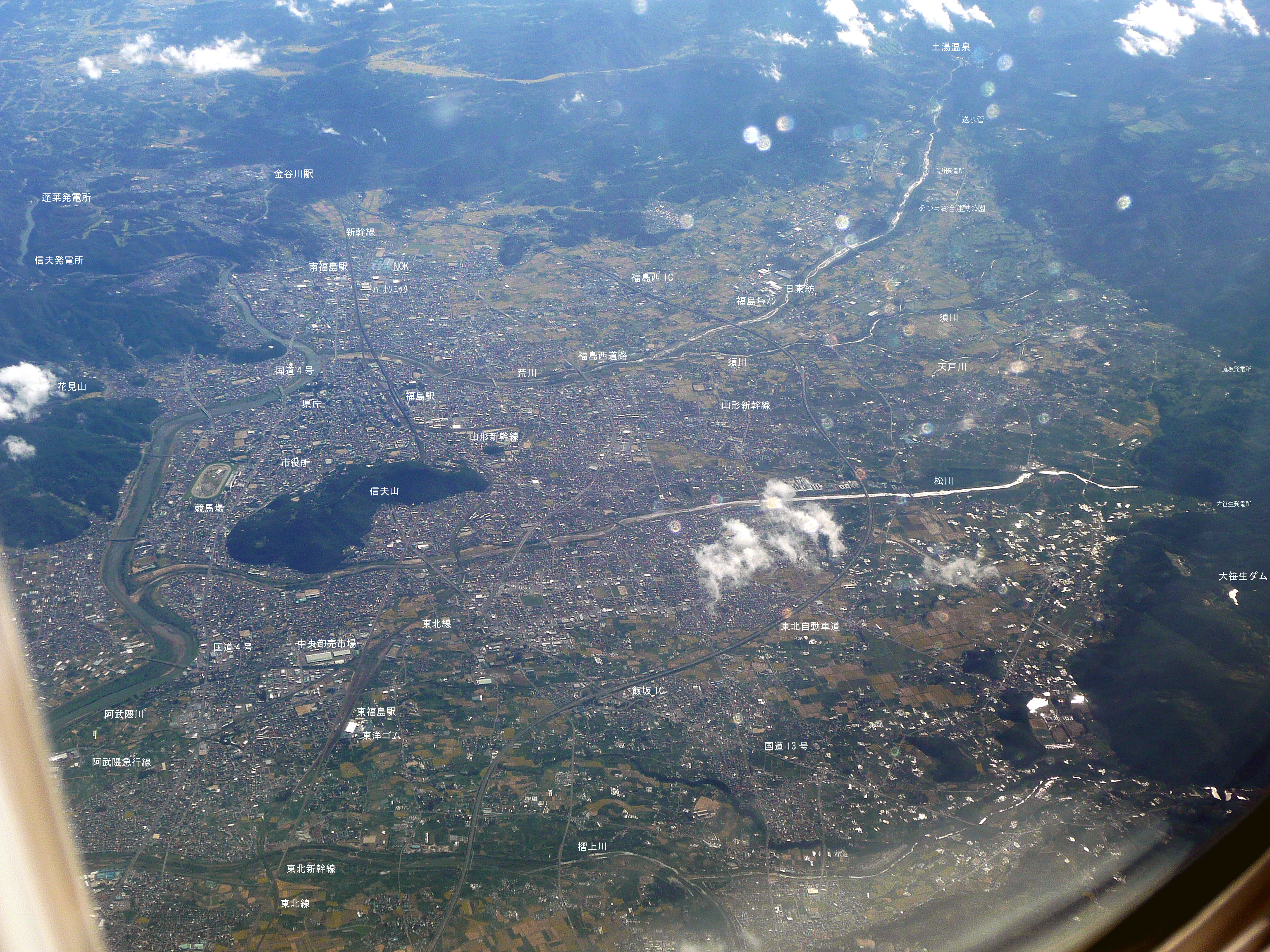
is the capital city of Fukushima Prefecture, Japan. It is located in the northern part of the Nakadōri, central region of the prefecture. , the city has an estimated population of 283,742 in 122,130 households and a population density of . The total area of the city is . The present-day city of Fukushima partially consists of most of the former Shinobu and Date Districts and a portion of the former Adachi District. The city is located in the Fukushima Basin's southwest area and nearby mountains. There are many onsen on the outskirts of the city, including the resort areas of Iizaka Onsen, Takayu Onsen, and Tsuchiyu Onsen. Fukushima is also the location of the Fukushima Race Course, the only Japan Racing Association horse racing track in the Tōhoku region of Japan. Geography Fukushima is located in the central northeast section of Fukushima Prefecture, approximately east of Lake Inawashiro, north of Tokyo, and about south of Sendai. It lies between the Ōu Mountains ... [...More Info...] [...Related Items...] OR: [Wikipedia] [Google] [Baidu] |


