|
Seattle Public Library
The Seattle Public Library (SPL) is the public library system serving the city of Seattle, Washington. Efforts to start a Seattle library had commenced as early as 1868, with the system eventually being established by the city in 1890. The system currently comprises 27 branches, most of which are named after the neighborhoods in which they are located. The Seattle Public Library also includes Mobile Services and the Central Library, which was designed by Rem Koolhaas and opened in 2004. The Seattle Public Library also founded the Washington Talking Book & Braille Library (WTBBL), which it administered until July 2008. All but one of Seattle's early purpose-built libraries were Carnegie libraries. Although the central Carnegie library has since been replaced twice, all the purpose-built branches from the early 20th century survive; however, some have undergone significant alterations. Ballard's former Carnegie library has since housed a number of restaurants and antique store ... [...More Info...] [...Related Items...] OR: [Wikipedia] [Google] [Baidu] |
Seattle Central Library
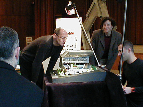
The Seattle Central Library is the flagship library of the Seattle Public Library system. The 11-story (185 feet or 56.9 meters high) glass and steel building in downtown Seattle, Washington was opened to the public on May 23, 2004. Rem Koolhaas and Joshua Prince-Ramus of OMA/LMN were the principal architects, and Magnusson Klemencic Associates was the structural engineer with Arup. Arup also provided mechanical, electrical, and plumbing engineering, as well as fire/life safety, security, IT and communications, and audio visual consulting. Hoffman Construction Company of Portland, Oregon, was the general contractor. The public library has the capacity to hold about one and a half million books and other materials. It offers underground public parking for 143 vehicles and over 400 computers accessible to the public. Over two million people visited the library during its first year. It is the third Seattle Central Library building to be located on the same site at 1000 Fourth Avenu ... [...More Info...] [...Related Items...] OR: [Wikipedia] [Google] [Baidu] |
Delridge, Seattle
Delridge is a district in West Seattle, Washington, United States that stretches along Delridge Way, an arterial that follows the eastern slope of the valley of Longfellow Creek, from near its source just within the southern city limits north to the West Seattle Bridge over the Duwamish River. The Delridge district is a mostly residential and open space district that lies generally between the eastern ridge on which South Seattle College sits and the western ridge that peaks in the High Point district. The Delridge Neighborhood Plan Area includes most of the area within the valley itself. Some other nearby neighborhoods also have Neighborhood Plan Areas. The City of Seattle also uses the term Delridge more loosely to describe an informal collection of neighborhoods near the Delridge valley. This area is not precisely defined, but often is considered to be bounded by the Duwamish River to the north and east, unincorporated White Center to the south, and West Seattle to the west alo ... [...More Info...] [...Related Items...] OR: [Wikipedia] [Google] [Baidu] |
View Ridge, Seattle
View Ridge is a neighborhood in north Seattle, Washington. As with all Seattle neighborhoods, its boundaries are not fixed, but can be thought of as NE 65th Street in the south, 40th and 45th Avenues NE in the west, the Sand Point Country Club in the north, and Sand Point Way NE in the east. Many homes offer views of Lake Washington, Mount Rainier, and the Cascade Range. View Ridge Elementary School is located within the neighborhood, and the neighborhood also offers a large park and playfield ( View Ridge Park) across the street from the elementary school. The View Ridge Swim and Tennis Club is located on the eastern edge of View Ridge, and the Sand Point Country Club is located on the northern edge. Demographics View Ridge is home to a considerable Jewish community, with a Hasidic synagogue, Congregation Shaarei Tefillah Lubavitch, located at the corner of NE 65th St. and 43rd Ave. NE. There are several churches, too: Lutheran, Methodist, Presbyterian, and Catholic. In addit ... [...More Info...] [...Related Items...] OR: [Wikipedia] [Google] [Baidu] |
Montlake, Seattle
Montlake is a wealthy residential neighborhood in central Seattle, Washington. It is located along the Montlake Cut of the Lake Washington Ship Canal, bounded to the north by Portage Bay, to the east by the Washington Park Arboretum, and to the south and west by Interlaken Park. Capitol Hill is on its south and west sides, and the University of Washington campus lies across the Montlake Cut to the north. State Route 520 runs through the northern tip of Montlake, isolating four blocks from the rest of the neighborhood. Though sports at the University of Washington are referred to metonymically as "Montlake," UW sports facilities are not located within the traditional bounds of the neighborhood; instead, they are located on Montlake Boulevard, across the Montlake Cut from the neighborhood. History Montlake was primarily developed by John E. Boyer and Herbert Turner (also known as H.S. Turner) from 1903 through the early 1930s. In 1916, the northern boundary of Montlake w ... [...More Info...] [...Related Items...] OR: [Wikipedia] [Google] [Baidu] |
Magnolia, Seattle
Magnolia is the second largest neighborhood of Seattle, Washington by area. It occupies a hilly peninsula northwest of downtown. Magnolia has been a part of the city since 1891. A good portion of the peninsula is taken up by Discovery Park, formerly the U.S. Army's Fort Lawton. Magnolia is isolated from the rest of Seattle, connected by road to the rest of the city by only three bridges over the tracks of the BNSF Railway: W. Emerson Street in the north, W. Dravus Street in the center, and W. Garfield Street (the Magnolia Bridge) in the south — the Salmon Bay Bridge to Ballard is rail-only, no motorized traffic is permitted to cross the Hiram M. Chittenden Locks, and the W. Fort Street bridge over the railroad tracks only affords access to the W. Commodore Way industrial area (traffic to the rest of the city from that area still needs to take the W. Emerson Street bridge). Boundaries Magnolia is bounded on the north by Salmon Bay and Shilshole Bay of the Lake Washington ... [...More Info...] [...Related Items...] OR: [Wikipedia] [Google] [Baidu] |
Madrona, Seattle
Madrona is a mostly residential neighborhood in east Seattle, Washington. It is bounded on the east by Lake Washington; on the south by E. Cherry Street, beyond which is Leschi; on the west by Martin Luther King Jr. Way, beyond which is the Central District; and on the north by E. Howell Street, beyond which is Denny-Blaine. The neighborhood's main thoroughfares are E. Union and E. Cherry Streets (east- and westbound), Madrona Drive (northwest- and southeast-bound), and 34th Avenue and Lake Washington Boulevard (north- and southbound). It is home to Madrona Park and the 34th Avenue and E. Union commercial area. History The neighborhood was named by John Ayer, who contributed the land for Madrona Park, after a species of tree ( Arbutus) common to the area. Madrona's motto, "The Peaceable Kingdom," reflects its racially mixed heritage. In the early 20th century, the coal mining industry brought Chinese immigrants to Madrona. Later, the shipbuilding boom brought an influx ... [...More Info...] [...Related Items...] OR: [Wikipedia] [Google] [Baidu] |
Lake City, Seattle
Lake City is the northeast region of Seattle, centered along Lake City Way NE ( SR-522), 7–8 miles (11–13 km) northeast of Downtown Seattle. A broader definition of the Lake City area includes all the land between 15th Avenue NE and Lake Washington, and between NE 95th and 98th streets to the Seattle city limits at NE 145th Street.(1) (2) See heading, "Note about limitations of these data", and "Sources for this atlas and the neighborhood names used in it include". (3) Shenk, Pollack, Dornfeld, Frantilla, & Neman. Sources for this atlas and the neighborhood names used in it include a 1980 neighborhood map produced by the Department of Community Development, Seattle Public Library indexes, a 1984-1986 Neighborhood Profiles feature series in the ''Seattle Post-Intelligencer'', numerous parks, land use and transportation planning studies, and records in the Seattle Municipal Archives. ic.html" ;"title="aps "NN-1120S", "NN-1130S", "NN-1140S".Jpg [sic">aps "NN-1120S", "NN ... [...More Info...] [...Related Items...] OR: [Wikipedia] [Google] [Baidu] |
High Point, Seattle
West Seattle is a conglomeration of neighborhoods in Seattle, Washington, United States. It comprises two of the thirteen districts, Delridge and Southwest, and encompasses all of Seattle west of the Duwamish River. It was incorporated as an independent town in 1902 before being annexed by Seattle five years later. Among the area's attractions are its saltwater beach parks along Elliott Bay and Puget Sound, including Alki Beach Park and Lincoln Park. The area is also known for its views of the Olympic Mountains to the west and the Cascade Range to the east. One-third of Seattle's green space and urban forest is located in West Seattle, much of it in the West Duwamish Greenbelt. Neighborhoods High Point High Point is a neighborhood in the Delridge district. It is so named because it contains the highest point in the city of Seattle: the intersection of 35th Avenue SW and SW Myrtle Street, which is above sea level. The neighborhood is located on the east side of 35th Ave SW ... [...More Info...] [...Related Items...] OR: [Wikipedia] [Google] [Baidu] |
Greenwood, Seattle
Greenwood is a neighborhood in north central Seattle, Washington, United States. The intersection of Greenwood Avenue North and North 85th Street is the commercial center. Greenwood is known for its numerous bars, restaurants, coffee houses, theatres and specialty stores. Greenwood's main thoroughfares are Greenwood Avenue North and North 80th and 85th streets. Since 1993 the neighborhood has hosted the "Greenwood Car Show" on the last Saturday in June. Another annual event is the "Greenwood Seafair Parade", held on the fourth Wednesday in July. Both events draw tens of thousands of visitors to the neighborhood. Boundaries The generally accepted boundaries are Aurora Avenue N (State Route 99) to the east, beyond which lies Licton Springs; N 105th Street/Holman Road to the north, beyond which lie Broadview and Bitter Lake; 8th Avenue NW to the west, beyond which lies Crown Hill, and N 75th Street to the south, beyond which lies Phinney Ridge. The division between Greenwood ... [...More Info...] [...Related Items...] OR: [Wikipedia] [Google] [Baidu] |
Green Lake, Seattle
Green Lake is a neighborhood in north central Seattle, Washington. Its centerpiece is the lake and park after which it is named. Its generally accepted boundaries are Interstate 5 to the east, beyond which lie Roosevelt and Maple Leaf; N 85th Street to the north, beyond which lies the neighborhood North College Park/Licton Springs; Aurora Avenue N (State Route 99) to the west, beyond which lies Phinney Ridge and Greenwood, and N 60th Street and Woodland Park to the south, beyond which lies Wallingford. Its main thoroughfares are the circumferential road around the lake, known at different points as East Green Lake Way N, East Green Lake Drive N, West Green Lake Drive N, Aurora Avenue N, and West Green Lake Way N; N 65th, N 71st, and N 80th Streets (east- and westbound); Wallingford Avenue N and 1st, 5th, Latona, and Woodlawn Avenues NE (generally north- and southbound but following the contours of the shoreline at some points); Green Lake Drive N and NE Ravenna Boulevard ... [...More Info...] [...Related Items...] OR: [Wikipedia] [Google] [Baidu] |
Fremont, Seattle
Fremont is a list of neighborhoods in Seattle, neighborhood in Seattle, Washington (state), Washington, United States. Originally a separate city, it was annexed to Seattle in 1891. It is named after Fremont, Nebraska, the hometown of two of its founders: Luther H. Griffith and Edward Blewett. Geography Fremont is situated along the Fremont Cut of the Lake Washington Ship Canal to the north of Queen Anne, Seattle, Queen Anne, the east of Ballard, Seattle, Ballard, the south of Phinney Ridge, Seattle, Phinney Ridge, and the southwest of Wallingford, Seattle, Wallingford. Its boundaries are not formally fixed, but they can be thought of as consisting of the Ship Canal to the south, Stone Way N. to the east, N. 50th Street to the north, and 8th Avenue N.W. to the west. The neighborhood's main thoroughfares are Fremont and Aurora Avenues N. (north- and southbound) and N. 46th, 45th, 36th, and 34th Streets (east- and westbound). The Aurora Bridge (George Washington Memorial Bridge) c ... [...More Info...] [...Related Items...] OR: [Wikipedia] [Google] [Baidu] |


