|
Scraggy Neck
Scraggy Neck is a peninsula in Buzzards Bay south of the Cape Cod Canal, in Cataumet, Massachusetts, USA. It is south of Wings Neck and southeast of Bassetts Island. As with all land in the area, the ancestral people on and around Scraggy Neck were Wampanoag. In 1637, through means that are not entirely clear, Thomas Dexter acquired the land that is now Scraggy Neck from the Wampanoag. Around 1667, he transferred the land to the Town of Sandwich and it became "parsonage property" of the First Church, Sandwich Massachusetts First Church UCC (or "First Church," or "First Church Sandwich," or "First Church of Christ") is a Congregational church, Congregational church in Sandwich, Massachusetts, Sandwich, Massachusetts founded in 1638 under Plymouth Colony Charter and th .... On 9 February 1847 the "First Parish in Sandwich County of Barnstable" transferred title to Martin Ellis for $1,350. In 1866, Ellis offered the property for sale, advertising in the Yarmouth Register "Scraggy ... [...More Info...] [...Related Items...] OR: [Wikipedia] [Google] [Baidu] |
Buzzards Bay
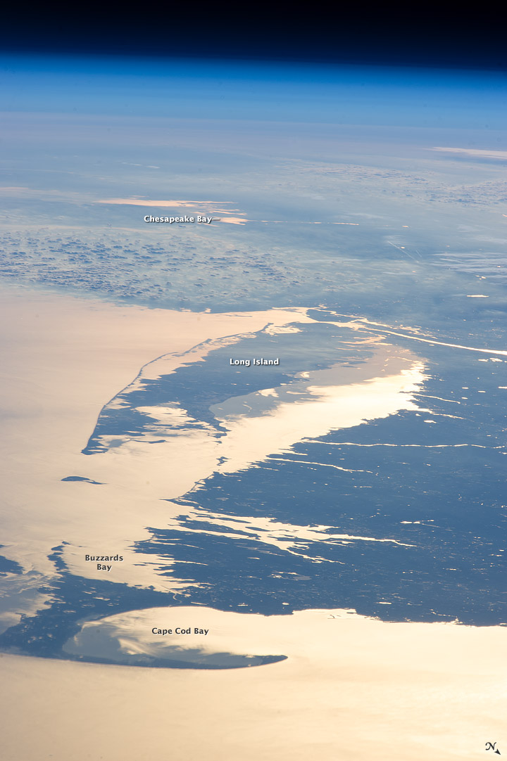
Buzzards Bay is a bay of the Atlantic Ocean adjacent to the U.S. state of Massachusetts. It is approximately 28 miles (45 kilometers) long by 8 miles (12 kilometers) wide. It is a popular destination for fishing, boating, and tourism. Since 1914, Buzzards Bay has been connected to Cape Cod Bay by the Cape Cod Canal. In 1988, under the Clean Water Act, the Environmental Protection Agency and the Commonwealth of Massachusetts designated Buzzards Bay to the National Estuary Program, as "an estuary of national significance" that is threatened by pollution, land development, or overuse. Geography It is surrounded by the Elizabeth Islands on the south, by Cape Cod on the east, and the southern coasts of Bristol and Plymouth counties in Massachusetts to the northwest. To the southwest, the bay is connected to Rhode Island Sound. The city of New Bedford, Massachusetts is a historically significant port on Buzzards Bay; it was the world's most successful whaling port during the ... [...More Info...] [...Related Items...] OR: [Wikipedia] [Google] [Baidu] |
Cape Cod Canal
The Cape Cod Canal is an artificial waterway in the U.S. state of Massachusetts connecting Cape Cod Bay in the north to Buzzards Bay in the south, and is part of the Atlantic Intracoastal Waterway. The approximately canal traverses the neck of land joining Cape Cod to the state's mainland. It mostly follows tidal rivers widened to and deepened to at mean low water, shaving off the journey around the Cape for its approximately 14,000 annual users. Most of the canal is located in the town of Bourne, but its northeastern terminus is in Sandwich. Scusset Beach State Reservation lies near the canal's north entrance, and the Massachusetts Maritime Academy is near its south. A swift-running current changes direction every six hours and can reach during the receding ebb tide. The waterway is maintained by the United States Army Corps of Engineers and has no toll fees. It is spanned by the Cape Cod Canal Railroad Bridge, the Bourne Bridge, and the Sagamore Bridge. Traffic lights ... [...More Info...] [...Related Items...] OR: [Wikipedia] [Google] [Baidu] |
Cataumet, Massachusetts
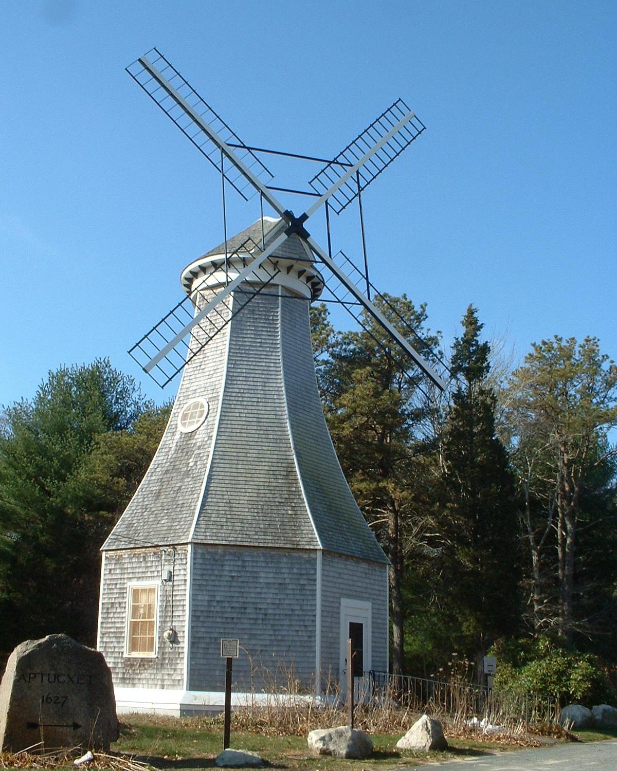
Bourne ( ) is a town in Barnstable County, Massachusetts, United States. The population was 20,452 at the 2020 census. For geographic and demographic information on specific parts of the town of Bourne, please see the articles on Bourne (CDP), Buzzards Bay, Monument Beach, Pocasset, Sagamore, and Sagamore Beach. History Bourne was first settled in 1640 by Ezra Perry as a part of the town of Sandwich. Prior to its separation from Sandwich, the area was referred to as West Sandwich. It was officially incorporated in 1884, the last town to be incorporated in Barnstable County. It was named for Jonathan Bourne Sr. (1811–1889), whose ancestor Richard Bourne represented Sandwich in the first Massachusetts General Court and was the first preacher to the Mashpee Wampanoag on Cape Cod. The town lies at the northeast corner of Buzzards Bay and is the site of Aptucxet Trading Post, the nation's oldest store. It was founded by the Pilgrims in 1627 at a site halfway between the two rive ... [...More Info...] [...Related Items...] OR: [Wikipedia] [Google] [Baidu] |
Massachusetts
Massachusetts (Massachusett language, Massachusett: ''Muhsachuweesut [Massachusett writing systems, məhswatʃəwiːsət],'' English: , ), officially the Commonwealth of Massachusetts, is the most populous U.S. state, state in the New England region of the Northeastern United States. It borders on the Atlantic Ocean and Gulf of Maine to the east, Connecticut and Rhode Island to the south, New Hampshire and Vermont to the north, and New York (state), New York to the west. The state's capital and List of municipalities in Massachusetts, most populous city, as well as its cultural and financial center, is Boston. Massachusetts is also home to the urban area, urban core of Greater Boston, the largest metropolitan area in New England and a region profoundly influential upon American History of the United States, history, academia, and the Economy of the United States, research economy. Originally dependent on agriculture, fishing, and trade. Massachusetts was transformed into a manuf ... [...More Info...] [...Related Items...] OR: [Wikipedia] [Google] [Baidu] |
United States
The United States of America (U.S.A. or USA), commonly known as the United States (U.S. or US) or America, is a country primarily located in North America. It consists of 50 states, a federal district, five major unincorporated territories, nine Minor Outlying Islands, and 326 Indian reservations. The United States is also in free association with three Pacific Island sovereign states: the Federated States of Micronesia, the Marshall Islands, and the Republic of Palau. It is the world's third-largest country by both land and total area. It shares land borders with Canada to its north and with Mexico to its south and has maritime borders with the Bahamas, Cuba, Russia, and other nations. With a population of over 333 million, it is the most populous country in the Americas and the third most populous in the world. The national capital of the United States is Washington, D.C. and its most populous city and principal financial center is New York City. Paleo-Americ ... [...More Info...] [...Related Items...] OR: [Wikipedia] [Google] [Baidu] |
Wings Neck
Wings Neck is a peninsula that juts out into Buzzards Bay on the south side of the Cape Cod Canal, in Bourne, Massachusetts, USA. The southwestern tip of the neck is the site of the Wing's Neck Light The Wing's Neck Light is a historic lighthouse in the Pocasset village of Bourne, Massachusetts. It is located on Wing's Neck Road at the end of Wing's Neck, a peninsula between Pocasset Harbor and the Hog Island Channel, which provides access t ...house, which operated from 1889 to 1945, and is now a private residence. References External links *Map: * Bourne, Massachusetts Peninsulas of Massachusetts Landforms of Barnstable County, Massachusetts {{BarnstableCountyMA-geo-stub ... [...More Info...] [...Related Items...] OR: [Wikipedia] [Google] [Baidu] |
Bassetts Island
Bassetts Island is a "Y"-shaped island within Pocasset Harbor and Red Brook Harbor, in Bourne, Massachusetts, USA. 41-40’48” North x 070-38’13” West Is located between two Peninsulas, Wings Neck to the North and Scraggy Neck to the South, and is geographically separated into four portions, the central, northeast, southeast, and the western. The island is approximately 60 acres of woodland, marshland and beach. The island is inhabited year round with one house on the western portion and five houses on the northeastly portion. There are no roads on the island, but with the exception of the southernly portion, there is a minor path that runs throughout the island. The island can only be accessed via boat and has no utility services to the island. There are two channels, one on the North Side and one on the South side. The North channel provides access to Pocassett Harbor and the Barlow's Landing Boat Ramp. The South channel provides access to Red Brook Harbor, Kingman Yacht ... [...More Info...] [...Related Items...] OR: [Wikipedia] [Google] [Baidu] |
Wampanoag
The Wampanoag , also rendered Wôpanâak, are an Indigenous people of the Northeastern Woodlands based in southeastern Massachusetts and historically parts of eastern Rhode Island,Salwen, "Indians of Southern New England and Long Island," p. 171. Their territory included the islands of Martha's Vineyard and Nantucket. Today there are two federally recognized Wampanoag tribes: * Mashpee Wampanoag Tribe * Wampanoag Tribe of Gay Head (Aquinnah). The Wampanoag language was a dialect of Masschusett, a Southern New England Algonquian language. At the time of their first contact with the English in the 17th century, they were a large confederation of at least 24 recorded tribes. Their population numbered in the thousands; 3,000 Wampanoag lived on Martha's Vineyard alone. From 1615 to 1619, the Wampanoag suffered an epidemic, long suspected to be smallpox. Modern research, however, has suggested that it may have been leptospirosis, a bacterial infection that can develop into Weil ... [...More Info...] [...Related Items...] OR: [Wikipedia] [Google] [Baidu] |
First Church, Sandwich Massachusetts
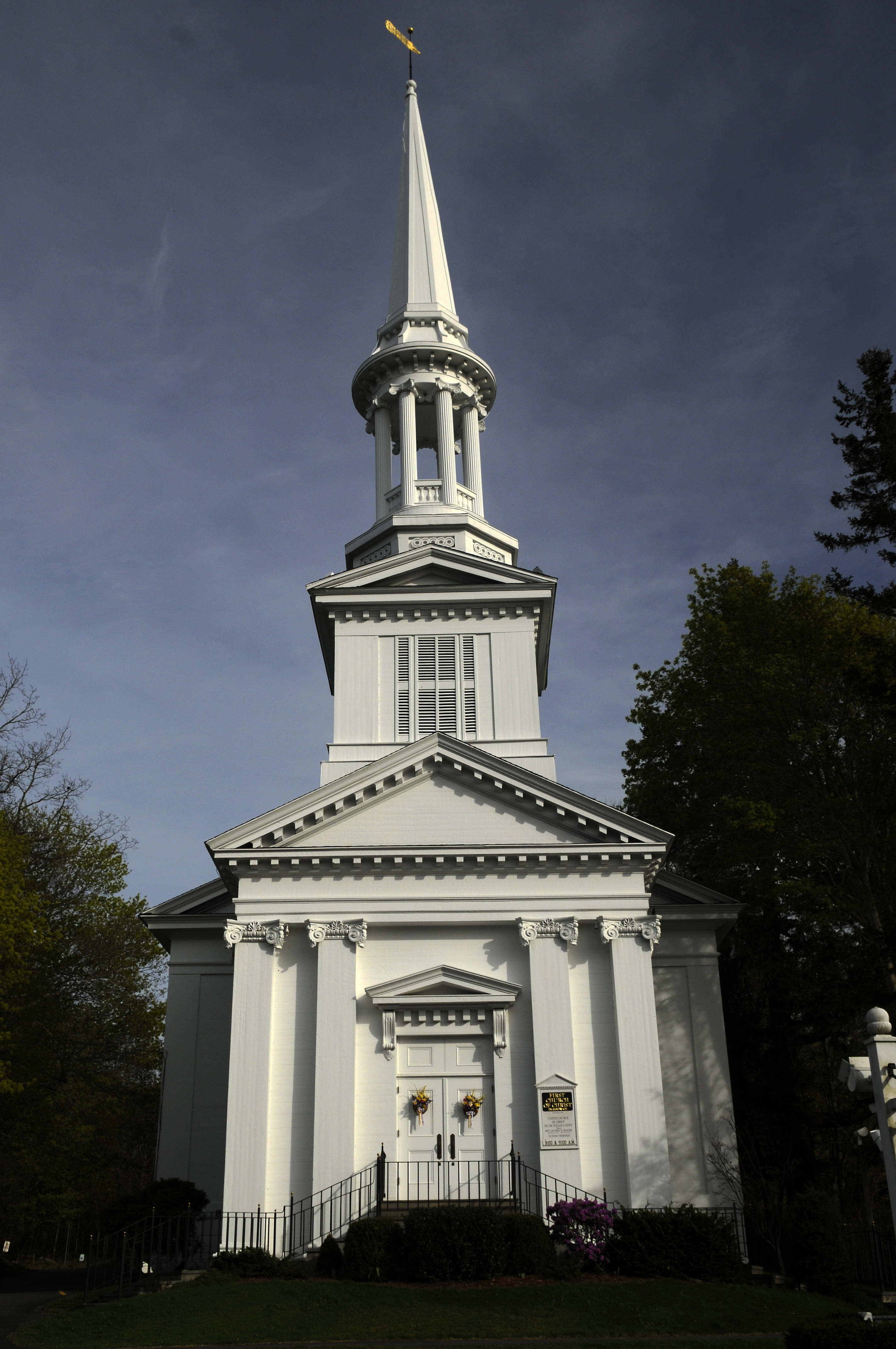
First Church UCC (or "First Church," or "First Church Sandwich," or "First Church of Christ") is a Congregational church in Sandwich, Massachusetts founded in 1638 under Plymouth Colony Charter and the Mayflower Compact. It is either the oldest church on Cape Cod or the second oldest depending on the interpretation. First Church boasts Mayflower Pilgrims and their first-generation descendants as charter members. By Plymouth Colony Charter, a church was required as an official part of the governance of any newly founded township, and First Church was founded as the official church within the town of Sandwich. First Church is now a congregation of the United Church of Christ, a large theologically and socially liberal denomination. The church is open and affirming – an appellation signifying both openness to and active affirmation of all persons regardless of status (and including LGBTQI persons). First Church is well known to tourists because of the inclusion of its current s ... [...More Info...] [...Related Items...] OR: [Wikipedia] [Google] [Baidu] |
Edward C
Edward is an English given name. It is derived from the Anglo-Saxon name ''Ēadweard'', composed of the elements '' ēad'' "wealth, fortune; prosperous" and '' weard'' "guardian, protector”. History The name Edward was very popular in Anglo-Saxon England, but the rule of the Norman and Plantagenet dynasties had effectively ended its use amongst the upper classes. The popularity of the name was revived when Henry III named his firstborn son, the future Edward I, as part of his efforts to promote a cult around Edward the Confessor, for whom Henry had a deep admiration. Variant forms The name has been adopted in the Iberian peninsula since the 15th century, due to Edward, King of Portugal, whose mother was English. The Spanish/Portuguese forms of the name are Eduardo and Duarte. Other variant forms include French Édouard, Italian Edoardo and Odoardo, German, Dutch, Czech and Romanian Eduard and Scandinavian Edvard. Short forms include Ed, Eddy, Eddie, Ted, Teddy and Ned. ... [...More Info...] [...Related Items...] OR: [Wikipedia] [Google] [Baidu] |
Bourne, Massachusetts
Bourne ( ) is a town in Barnstable County, Massachusetts, United States. The population was 20,452 at the 2020 census. For geographic and demographic information on specific parts of the town of Bourne, please see the articles on Bourne (CDP), Buzzards Bay, Monument Beach, Pocasset, Sagamore, and Sagamore Beach. History Bourne was first settled in 1640 by Ezra Perry as a part of the town of Sandwich. Prior to its separation from Sandwich, the area was referred to as West Sandwich. It was officially incorporated in 1884, the last town to be incorporated in Barnstable County. It was named for Jonathan Bourne Sr. (1811–1889), whose ancestor Richard Bourne represented Sandwich in the first Massachusetts General Court and was the first preacher to the Mashpee Wampanoag on Cape Cod. The town lies at the northeast corner of Buzzards Bay and is the site of Aptucxet Trading Post, the nation's oldest store. It was founded by the Pilgrims in 1627 at a site halfway between the two riv ... [...More Info...] [...Related Items...] OR: [Wikipedia] [Google] [Baidu] |
Peninsulas Of Massachusetts
A peninsula (; ) is a landform that extends from a mainland and is surrounded by water on most, but not all of its borders. A peninsula is also sometimes defined as a piece of land bordered by water on three of its sides. Peninsulas exist on all continents. The size of a peninsula can range from tiny to very large. The largest peninsula in the world is the Arabian Peninsula. Peninsulas form due to a variety of causes. Etymology Peninsula derives , which is translated as 'peninsula'. itself was derived , or together, 'almost an island'. The word entered English in the 16th century. Definitions A peninsula is usually defined as a piece of land surrounded on most, but not all sides, but is sometimes instead defined as a piece of land bordered by water on three of its sides. A peninsula may be bordered by more than one body of water, and the body of water does not have to be an ocean or a sea. A piece of land on a very tight river bend or one between two rivers is sometimes ... [...More Info...] [...Related Items...] OR: [Wikipedia] [Google] [Baidu] |

%2C_1834_map.jpg)


