|
Schnebly Hill Formation
The Schnebly Hill Formation is a section of red bed deposits found at the Colorado Plateau, near Sedona, Arizona. It is a dark red sandstone, from to thick. It lies between Coconino Sandstone and the older Hermit Formation. It is near the Supai Group. The source of the name "Schnebly" is Sedona Schnebly, after whom the city of Sedona, Arizona was named. Geology The formation traces to the Permian Age. The formation is the most prominent layer of the red rocks of the Sedona area due the presence of hematite – iron-oxide, frankly, rust – giving the sandstone a red color. The Schnebly Hill Sandstone formation comprises three sections: * the Bell Rock member, * the Fort Apache member, and * the Sycamore Pass member. See also Sedona-area rocks * Bell Rock * Cathedral Rock * Courthouse Butte * Red Rock State Park * Slide Rock State Park Local geology * Colorado Plateau * Mogollon Rim * Supai Group Local interest * Cottonwood, Arizona * Honanki * Jerome ... [...More Info...] [...Related Items...] OR: [Wikipedia] [Google] [Baidu] |
Permian Period
The Permian ( ) is a geologic period and stratigraphic system which spans 47 million years from the end of the Carboniferous Period million years ago (Mya), to the beginning of the Triassic Period 251.9 Mya. It is the last period of the Paleozoic Era; the following Triassic Period belongs to the Mesozoic Era. The concept of the Permian was introduced in 1841 by geologist Sir Roderick Murchison, who named it after the region of Perm in Russia. The Permian witnessed the diversification of the two groups of amniotes, the synapsids and the sauropsids (reptiles). The world at the time was dominated by the supercontinent Pangaea, which had formed due to the collision of Euramerica and Gondwana during the Carboniferous. Pangaea was surrounded by the superocean Panthalassa. The Carboniferous rainforest collapse left behind vast regions of desert within the continental interior. Amniotes, which could better cope with these drier conditions, rose to dominance in place of their amphibia ... [...More Info...] [...Related Items...] OR: [Wikipedia] [Google] [Baidu] |
Hematite
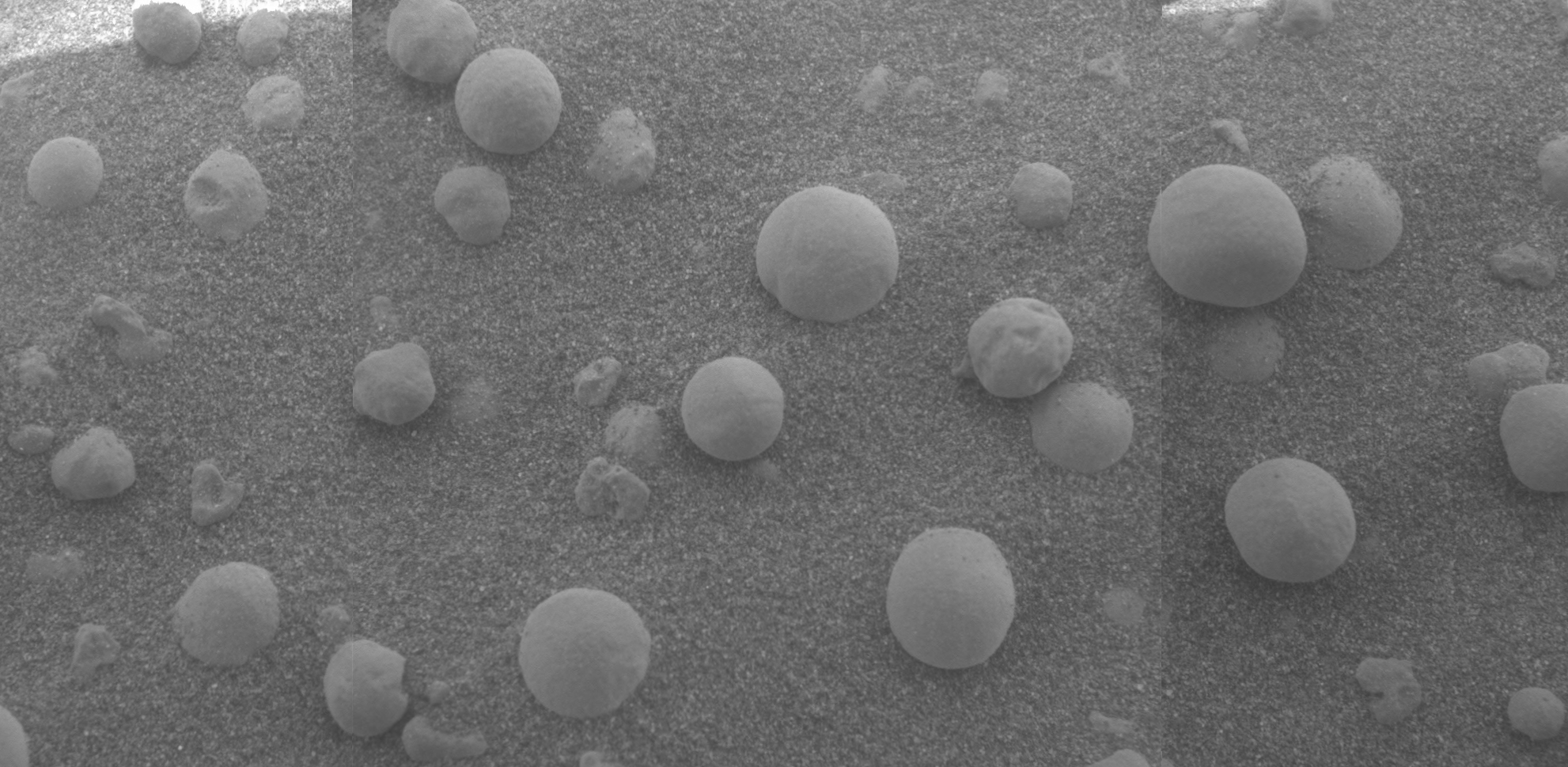
Hematite (), also spelled as haematite, is a common iron oxide compound with the formula, Fe2O3 and is widely found in rocks and soils. Hematite crystals belong to the rhombohedral lattice system which is designated the alpha polymorph of . It has the same crystal structure as corundum () and ilmenite (). With this it forms a complete solid solution at temperatures above . Hematite naturally occurs in black to steel or silver-gray, brown to reddish-brown, or red colors. It is mined as an important ore mineral of iron. It is electrically conductive. Hematite varieties include ''kidney ore'', ''martite'' (pseudomorphs after magnetite), ''iron rose'' and ''specularite'' (specular hematite). While these forms vary, they all have a rust-red streak. Hematite is not only harder than pure iron, but also much more brittle. Maghemite is a polymorph of hematite (γ-) with the same chemical formula, but with a spinel structure like magnetite. Large deposits of hematite are found in ... [...More Info...] [...Related Items...] OR: [Wikipedia] [Google] [Baidu] |
Palatki Heritage Site
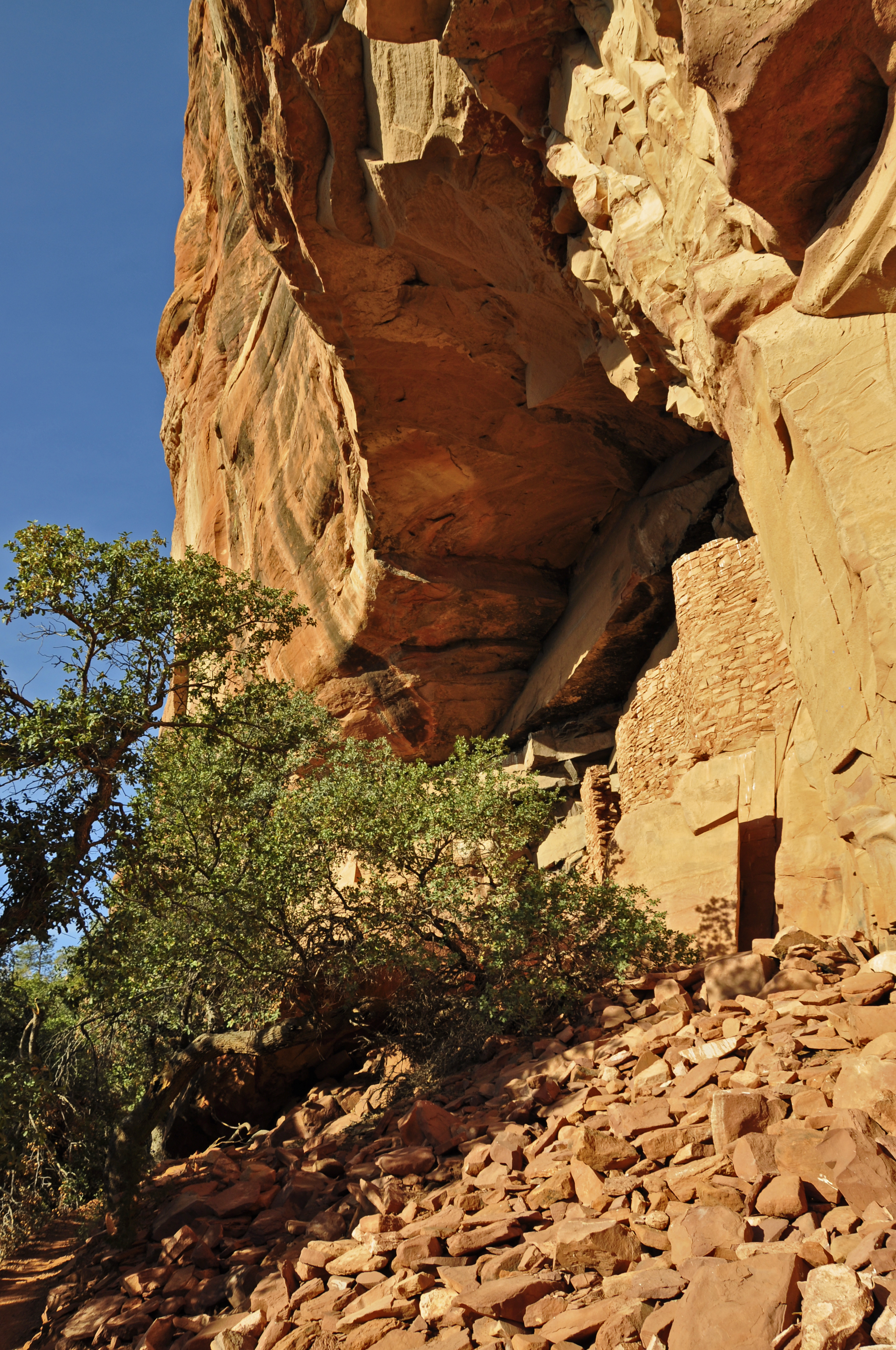
The Palatki Heritage Site is an archaeological site and park located in the Coconino National Forest, near Sedona, in Arizona, United States. In the Hopi language ''Palatki'' means 'red house'. History ;Cliff dwellings The Palatki site has a set of ancient cliff dwellings in the red sandstone cliffs, built from 1100 to 1400 CE by the Sinagua people of the Ancestral Puebloans. The cliff dwellings were built under south-facing overhangs for shelter and winter sun. The Sinagua people planted crops and made pottery in the area. Palatki and Honanki, another nearby archaeological site, had the largest cliff dwellings in the Red Rock formation area from . Palatki consists of two separate pueblos, suggesting two family or kin groups may have lived here, one in each pueblo. The circular shield-like pictographs above the eastern pueblo have been interpreted by some archaeologists as being a kin or clan symbol. [...More Info...] [...Related Items...] OR: [Wikipedia] [Google] [Baidu] |
Oak Creek Canyon
Oak Creek Canyon is a river gorge located in northern Arizona between the cities of Flagstaff and Sedona. The canyon is often described as a smaller cousin of the Grand Canyon because of its scenic beauty. State Route 89A enters the canyon on its north end via a series of hairpin turns before traversing the bottom of the canyon for about until the highway enters the town of Sedona. Geography Oak Creek Canyon is about long, ranging in width from . The depth of the canyon ranges from . However, due to the faulting that played a major role in its formation, the west rim of the canyon is higher than the east rim. The average elevation of the west rim is while the east rim elevation is . Oak Creek Oak Creek, a tributary of the Verde River, flows along the bottom of the canyon, and is one of the few perennial streams in the high desert region of northern Arizona. Oak Creek is largely responsible for carving the modern Oak Creek Canyon, although movement along the Oak Creek ... [...More Info...] [...Related Items...] OR: [Wikipedia] [Google] [Baidu] |
Chapel Of The Holy Cross (Sedona, Arizona)
The Chapel of the Holy Cross is a Roman Catholic chapel built from 1954 to 1956 into the red rock buttes of Sedona, Arizona, within the Coconino National Forest. It was inspired and commissioned by local rancher and sculptor Marguerite Brunswig Staude, and was designed by August K. Strotz of the firm of Anshen & Allen, with Richard Hein of the firm as the project architect. The chapel is under the auspices of the episcopal see of the Roman Catholic Diocese of Phoenix and its ministry is conducted by St. John Vianney Parish, Sedona. The chapel was added to the National Register of Historic Places in 2011. History The chapel was inspired and commissioned by local rancher and sculptor Marguerite Brunswig Staude, who had been inspired in 1932 by the newly constructed Empire State Building to build such a church. After an attempt to do so in Budapest, Hungary – with the help of Lloyd Wright, son of architect Frank Lloyd Wright – was abandoned due to the outbreak of W ... [...More Info...] [...Related Items...] OR: [Wikipedia] [Google] [Baidu] |
Jerome State Historic Park
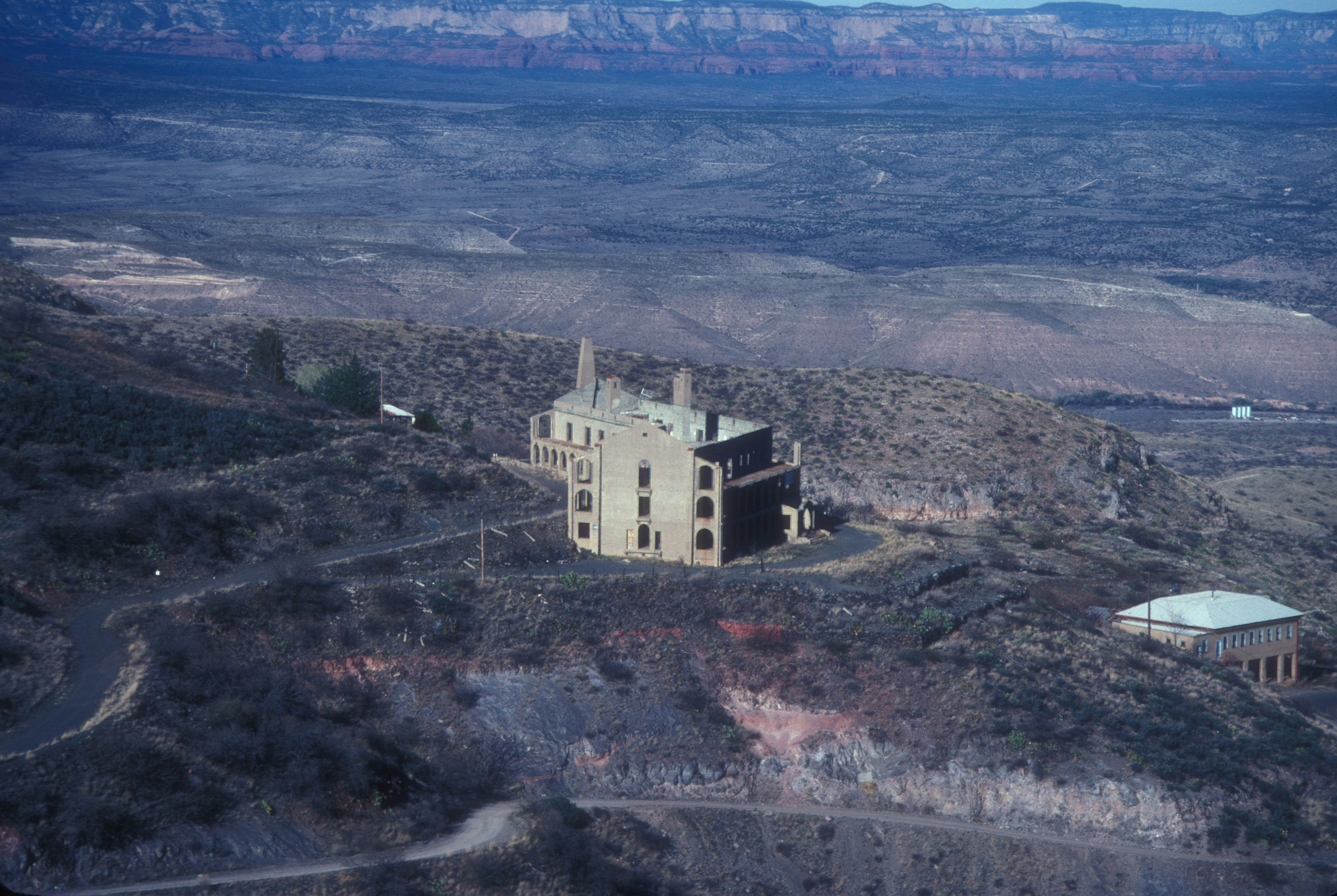
Jerome State Historic Park is a state park of Arizona, US, featuring the Douglas Mansion, built in 1916 by a family of influential mining entrepreneurs in Jerome, Arizona, a mining region in the northeast of the Black Hills, east Yavapai County. A museum is located in the old Douglas Mansion. Jerome State Historic Park reopened on October 14, 2010, after being closed since February 27, 2009, because of budget cuts and the need to repair the historic mansion. Renovation and stabilization were funded by a state heritage grant and donations from the Douglas family. The park is open on a seven-day schedule thanks to additional funding raised by Yavapai County, the city of Jerome, and the Jerome Historical Society. Douglas Mansion The Douglas Mansion has been a landmark in Jerome since 1916, when Jimmy Douglas built it on the hill just above his Little Daisy Mine. Douglas designed the house as a hotel for mining officials and investors as well as for his own family. It featured a w ... [...More Info...] [...Related Items...] OR: [Wikipedia] [Google] [Baidu] |
Jerome, Arizona
Jerome is a town in the Black Hills of Yavapai County in the U.S. state of Arizona. Founded in the late 19th century on Cleopatra Hill overlooking the Verde Valley, Jerome is located more than above sea level. It is about north of Phoenix along State Route 89A between Sedona and Prescott. Supported in its heyday by rich copper mines, it was home to more than 10,000 people in the 1920s. As of the 2010 census, its population was 444. It is now known for its tourist attractions, such as its "ghost town" status and local wineries. The town owes its existence mainly to two ore bodies that formed about 1.75billion years ago along a ring fault in the caldera of an undersea volcano. Tectonic plate movements, plate collisions, uplift, deposition, erosion, and other geologic processes eventually exposed the tip of one of the ore bodies and pushed the other close to the surface, both near Jerome. In the late 19th century, the United Verde Mine, developed by William A. Clark, extracted ... [...More Info...] [...Related Items...] OR: [Wikipedia] [Google] [Baidu] |
Honanki
The Honanki Heritage Site is a cliff dwelling and rock art site located in the Coconino National Forest, about west of Sedona, Arizona. The Sinagua people of the Ancestral Puebloans, and ancestors of the Hopi people, lived here from about . The Palatki Heritage Site is nearby, also in the Coconino National Forest. History ;Ancient peoples The Honanki and Palatki archaeological sites were first studied by Jesse Walter Fewkes of the Smithsonian Institution. He conducted test excavations at both sites in 1895 and in 1911, during his study of Hopi migration traditions. Fewkes named the site "Honanki," which means "Bear House" in the Hopi language. Honanki was one of the largest prehistoric pueblos in the Verde Valley. This period in Southern Sinagua prehistory is called the "Honanki Phase." Many of the cliff dwellings in the area west of Sedona were occupied during the Honanki Phase. The Sinagua occupation of Honanki was probably between 1130 and 1280 CE, based on a tree-ring d ... [...More Info...] [...Related Items...] OR: [Wikipedia] [Google] [Baidu] |
Cottonwood, Arizona
Cottonwood is a city in Yavapai County, Arizona, United States. According to the 2010 census, the population of the city is 11,265. Geography Cottonwood is located at (34.7321, -112.0186). According to the United States Census Bureau, the city has a total area of , all land. Climate Cottonwood has a semi-arid steppe climate. In January the normal high temperature is with a low of . In July the normal high temperature is with a low of . Annual precipitation is approximately . Demographics At the 2000 census there were 9,179 people, 3,983 households and 2,369 families in the city. The population density was . There were 4,427 housing units at an average density of . The racial makeup of the city was 85.2% White, 0.5% Black or African American, 1.6% Native American, 0.4% Asian, <0.1% Pacific Islander, 9.7% from other races, and 2.6% from two or more races. 20.5% of the population were Hispanic or Latino of any race. Of the 3,983 households 25.3% ha ... [...More Info...] [...Related Items...] OR: [Wikipedia] [Google] [Baidu] |
Mogollon Rim
The Mogollon Rim ( or or ) is a topographical and geological feature cutting across the northern half of the U.S. state of Arizona. It extends approximately , starting in northern Yavapai County and running eastward, ending near the border with New Mexico.The Mogollon Rim is not to be confused with the Mogollon Mountains in New Mexico located somewhat east of the eastern end of the Rim. The official estimate of the eastern end is near Show Low, AZ, Show Low, although some sources extend it farther east. See It forms the southern edge of the Colorado Plateau in Arizona. Description The Rim is an escarpment defining the southwestern edge of the Colorado Plateau. Its central and most spectacular portions are characterized by high cliffs of limestone and sandstone, namely the Kaibab Limestone and Coconino Sandstone cliffs. The escarpment was created by erosion and geologic fault, faulting, cutting dramatic canyons into it, including Fossil Creek Canyon and Pine Canyon. The na ... [...More Info...] [...Related Items...] OR: [Wikipedia] [Google] [Baidu] |
Slide Rock State Park
Slide Rock State Park is an Arizona State Park located in Oak Creek Canyon north of Sedona, Arizona, United States. It takes its name from a natural water slide formed by the slippery bed of Oak Creek. Slide Rock State Park is located on Coconino National Forest land and is co-managed by the Arizona State Parks agency and the United States Forest Service. Tall red rock formations that are typical of the region also surround the park, which contains a working apple farm. History The land was first developed by Frank L. Pendley, who arrived in the canyon in 1907 and acquired title to the land under the Homestead Act in 1910. Pendley developed an irrigation system (which is still in use today) and planted an apple orchard in 1912. The state completed a road through the canyon in 1914, and Pendley built rustic tourist cabins in 1933 that in part survive today. Several films were shot in the area: ''Angel and the Badman'' (1946), '' Broken Arrow'' (1950), ''Drum Beat'' (1954), an ... [...More Info...] [...Related Items...] OR: [Wikipedia] [Google] [Baidu] |
Red Rock State Park
Red Rock State Park is a state park of Arizona, United States, featuring a red sandstone canyon outside the city of Sedona, Arizona, Sedona. The main mission of this day-use park is the preservation of the riparian habitat along Oak Creek. Red Rock State Park serves as an environmental education facility for the public and for school or private groups, and provides limited passive recreational opportunities. Natural history Red Rock State Park includes a stretch of Oak Creek, which upstream flows through the famous Oak Creek Canyon in Coconino National Forest. The rich riparian zone along the creek supports a diverse array of species. Trees in this habitat include Populus fremontii, Fremont cottonwood, Platanus wrightii, Arizona sycamore, Fraxinus velutina, velvet ash, and Alnus oblongifolia, Arizona alder. Oak Creek supports rare native fish, several frog species, and the threatened species, threatened Sonora mud turtle. Away from the creek the dominant trees are Prosopis ... [...More Info...] [...Related Items...] OR: [Wikipedia] [Google] [Baidu] |


.jpg)


