|
Schellweiler
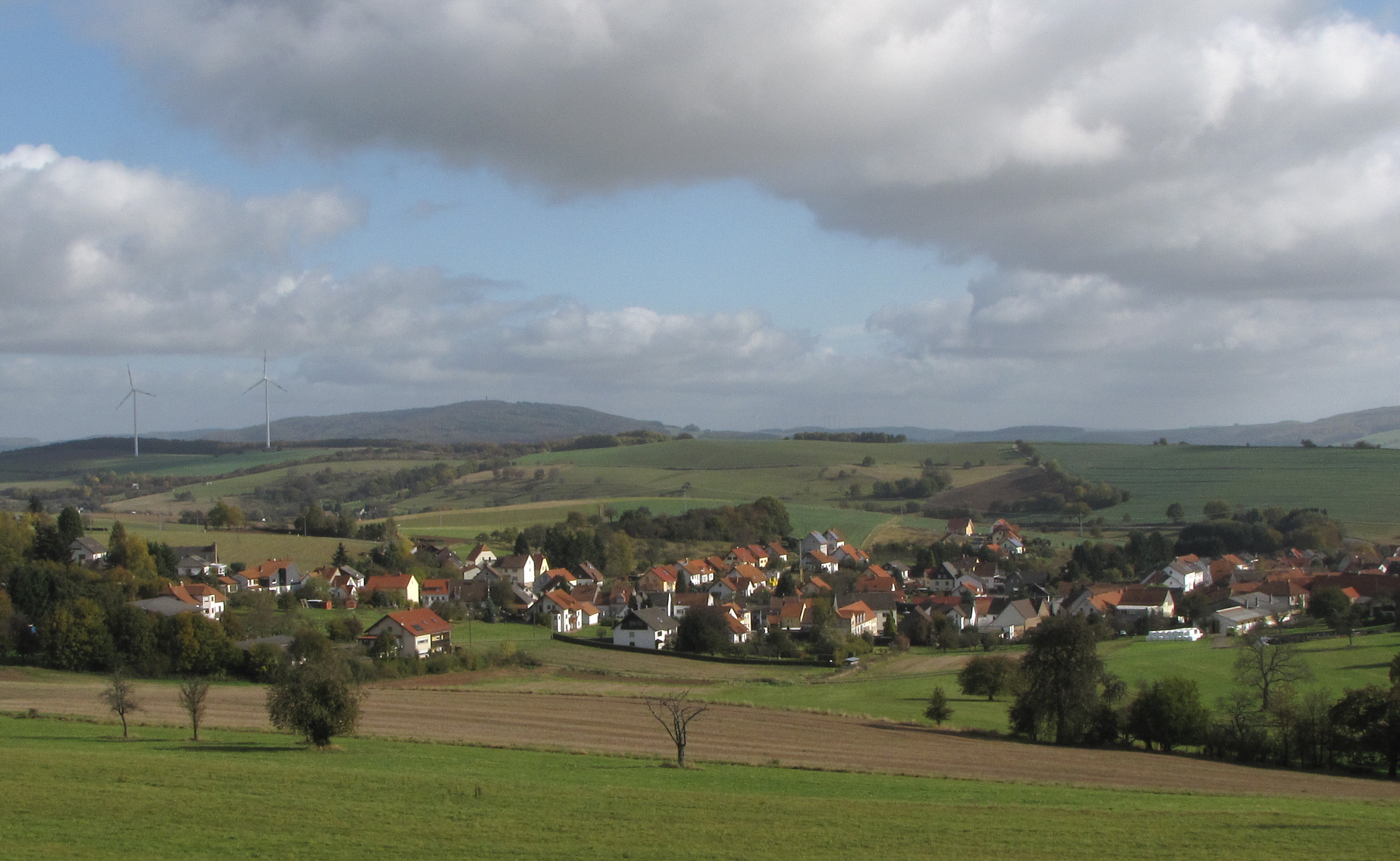
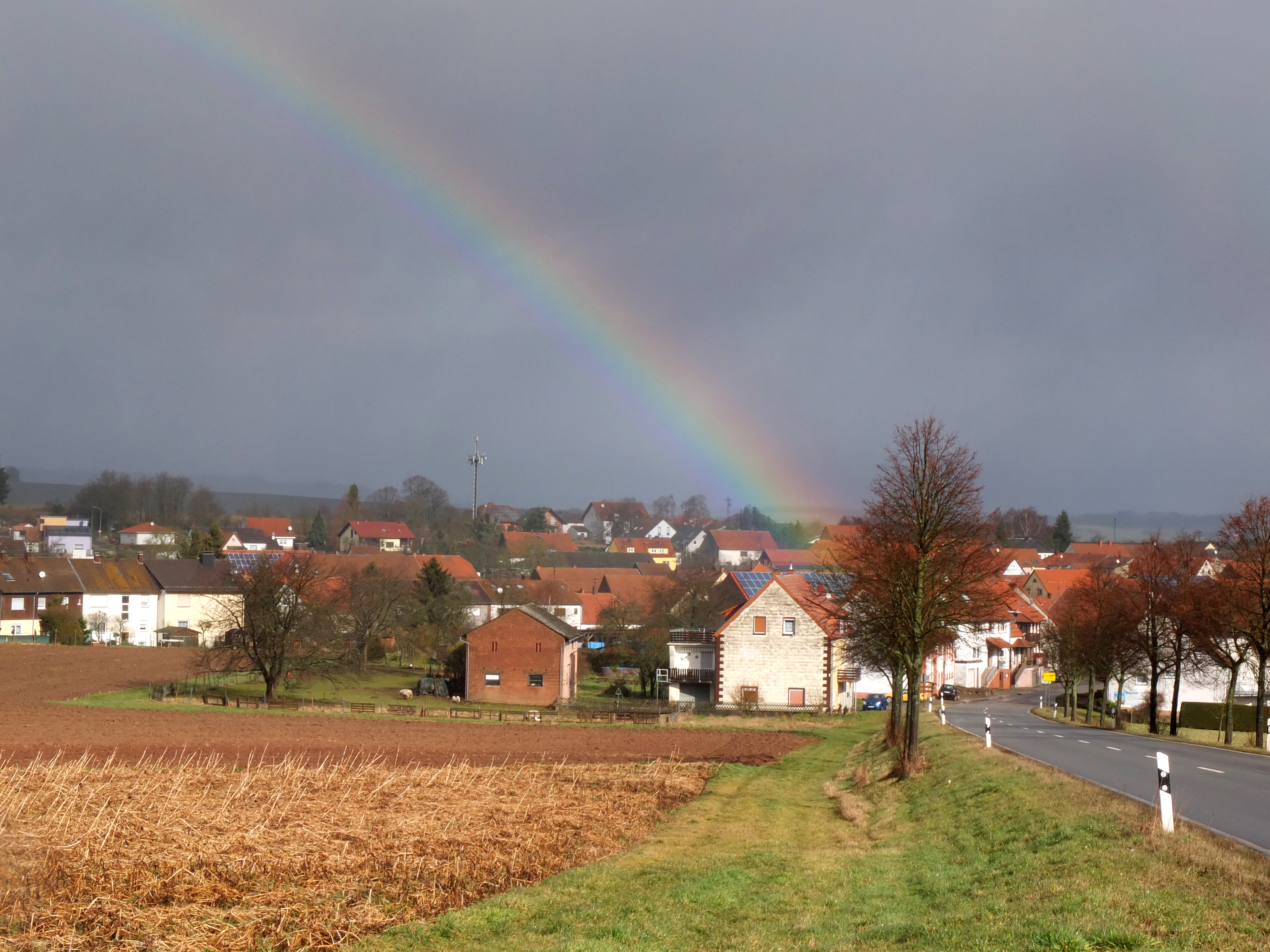
Schellweiler is an ''Ortsgemeinde'' – a municipality belonging to a ''Verbandsgemeinde'', a kind of collective municipality – in the Kusel district in Rhineland-Palatinate, Germany. It belongs to the ''Verbandsgemeinde'' of Kusel-Altenglan, whose seat is in Kusel. Geography Location The municipality lies in the Bledesbach valley, which stretches from Schellweiler to Wahnwegen along the highway between Kusel and Glan-Münchweiler. The valley is also known locally as the ''Saubeeretal''. Forty-seven hectares of the municipal area's 431 ha is wooded. Schellweiler is a clump village. The bottom of the valley lies roughly 280 m above sea level, and the land rises upwards on three sides. Only to the north does it remain even. The most heavily built-up area is on the eastern slope on the brook's right bank, more than 300 m above sea level, at about the same elevation as the Autobahn A 62 (Kaiserslautern–Trier), which passes by. The built-up area reaches an ele ... [...More Info...] [...Related Items...] OR: [Wikipedia] [Google] [Baidu] |
Etschberg
Etschberg is an ''Ortsgemeinde'' – a Municipalities of Germany, municipality belonging to a ''Verbandsgemeinde'', a kind of collective municipality – in the Kusel (district), Kusel Districts of Germany, district in Rhineland-Palatinate, Germany. It belongs to the Kusel-Altenglan, ''Verbandsgemeinde'' of Kusel-Altenglan, whose seat is in Kusel. Geography Location The municipality lies in the Kusel ''Musikantenland'' (“Minstrels’ Land") in the Western Palatinate (region), Palatinate, in the northerly shelter of a ridge stretching southeastwards from the 402 m-high Odersberg (or Ödesberg). The Rödelsbach (brook) touches the village along the northern edge, then flowing east to the river Glan (Nahe), Glan. Surrounded by gardens and meadows with many fruit trees, Etschberg lies in a relatively small municipal area with an elevation ranging from 220 to 320 m above sea level. The broader area is rich in woodlands. Within the municipal area, the highest elevation is 38 ... [...More Info...] [...Related Items...] OR: [Wikipedia] [Google] [Baidu] |
Hüffler
Hüffler is an ''Ortsgemeinde'' – a municipality belonging to a ''Verbandsgemeinde'', a kind of collective municipality – in the Kusel district in Rhineland-Palatinate, Germany. It belongs to the ''Verbandsgemeinde'' of Oberes Glantal. Geography Location Hüffler is a linear village – by some definitions, a “thorpe” – that lies in the Bledesbach valley (Standard High German name: ''Bledesbachtal''; locally customary name: ''Saubeeredaal'' or ''Saubeeretal'') along ''Landesstraße'' (State Road) 360 and one other, parallel road. One road links Kusel with Glan-Münchweiler. Running almost parallel to the village is the Autobahn A 62 ( Kaiserslautern–Trier). The elevation on the valley floor is 310 m above sea level. This rises to either side of the village. The highest hill is the ''Dillmeßrech'' or ''Dilmersrech'' at 390 m above sea level. At its highest point, the Autobahn A 62 ( Kaiserslautern–Trier) cuts through the hill. To the village’s ... [...More Info...] [...Related Items...] OR: [Wikipedia] [Google] [Baidu] |
Wahnwegen
Wahnwegen is an ''Ortsgemeinde'' – a municipality belonging to a ''Verbandsgemeinde'', a kind of collective municipality – in the Kusel district in Rhineland-Palatinate, Germany. It belongs to the ''Verbandsgemeinde'' of Oberes Glantal. Geography Location The municipality lies at the foot of the 437 m-high Hühnerkopf in the Saubeertal (valley) in the Western Palatinate. Wahnwegen's elevation is roughly 310 m above sea level and the village lies in the Bledesbach's headwaters, northeast of the Hühnerkopf (“Chickenhead” – a mountain) with its stone quarries, although these lie within Herschweiler-Pettersheim's limits. A relatively narrow strip of land roughly 3 km long and barely 1 km wide forms Wahnwegen's municipal area, broadening out somewhat towards the north. The local area is rich in forests, especially to the south, where the Hodenbach rises, flowing southwestwards to the Henschbach. The dale through which the Hodenbach flows is well known as ... [...More Info...] [...Related Items...] OR: [Wikipedia] [Google] [Baidu] |
Kusel (district)
Kusel () is a district (''Kreis'') in the south of Rhineland-Palatinate, Germany. Neighboring districts are (from north-west clockwise) Birkenfeld, Bad Kreuznach, Donnersbergkreis, Kaiserslautern, Saarpfalz and Sankt Wendel (the last two belonging to the state of Saarland). History The district of Kusel was created at the beginning of the 19th century. In 1939 it was renamed as ''Landkreis Kusel''. The boundary was altered slightly as part of the communal reform of 1969/72 with some parts of the district of Birkenfeld being added to Kusel. Geography The district of Kusel lies in the North Palatine Uplands (''Nordpfälzer Bergland''), to the north of the industrial areas of the Saarland. The largest rivers are the Lauter (also called the Waldlauter, to distinguish it from other rivers in German-speaking Europe named Lauter) and the Glan. Coat of arms The German blazon reads: ''Gespalten: Vorne in Schwarz ein linksgewendeter, rot bewehrter goldener Löwe, hinten in Silber ein ... [...More Info...] [...Related Items...] OR: [Wikipedia] [Google] [Baidu] |
Kusel-Altenglan
Kusel-Altenglan is a ''Verbandsgemeinde'' ("collective municipality") in the district of Bad Dürkheim, in Rhineland-Palatinate, Germany. The seat of the ''Verbandsgemeinde'' is in Kusel. It was formed on 1 January 2018 by the merger of the former ''Verbandsgemeinden'' Kusel and Altenglan. The ''Verbandsgemeinde'' Kusel-Altenglan consists of the following ''Ortsgemeinden'' ("local municipalities"): # Albessen # Altenglan # Bedesbach # Blaubach # Bosenbach # Dennweiler-Frohnbach # Ehweiler # Elzweiler # Erdesbach # Etschberg # Föckelberg # Haschbach am Remigiusberg # Herchweiler # Horschbach # Körborn # Konken # Kusel # Neunkirchen am Potzberg # Niederalben # Niederstaufenbach # Oberalben # Oberstaufenbach # Pfeffelbach # Rammelsbach # Rathsweiler # Reichweiler # Ruthweiler # Rutsweiler am Glan # Schellweiler # Selchenbach # Thallichtenberg # Theisbergstegen Theisbergstegen is an '' Ortsgemeinde'' – a municipality belonging to a ''Verbandsgemeinde'', a kind of collective ... [...More Info...] [...Related Items...] OR: [Wikipedia] [Google] [Baidu] |
Kusel
Kusel (; written ''Cusel'' until 1865) is a town in the Kusel (district), Kusel Districts of Germany, district in Rhineland-Palatinate, Germany. It is the seat of the Kusel-Altenglan ''Verbandsgemeinde'' and is also the district seat. The well-known operatic tenor Fritz Wunderlich was born in Kusel. Geography Location Kusel lies on the Kuselbach in Rhineland-Palatinate's southwest, in the North Palatine Uplands roughly 30 km northwest of Kaiserslautern. The Kuselbach rises in the outlying centre of Diedelkopf where the Bledesbach and the Pfeffelbach (or Aalbach) meet. The dale is hemmed in by a row of mountains, on the left bank the Ödesberg (375 m), and on the right the Gaisberg (355 m), the Roßberg (314 m) and the Herrchenberg (385 m). The floor of the dale lies roughly 220 m above sea level. Prominent landmarks just beyond the town's limits are Lichtenberg Castle (Palatinate), Lichtenberg Castle to the west and the Remigiusberg (368 m) and t ... [...More Info...] [...Related Items...] OR: [Wikipedia] [Google] [Baidu] |
Haschbach Am Remigiusberg
Haschbach am Remigiusberg is an ''Ortsgemeinde'' – a municipality belonging to a ''Verbandsgemeinde'', a kind of collective municipality – in the Kusel district in Rhineland-Palatinate, Germany. It belongs to the ''Verbandsgemeinde'' of Kusel-Altenglan, whose seat is in Kusel. Geography Location The municipality lies in a hollow on the upper reaches of the Haschbach at the western foot of the Remigiusberg hill in the Western Palatinate, roughly 4 km southeast of Kusel. To the east lies the river Glan, into which the Haschbach flows. The municipality's elevation is roughly 260 m above sea level. The heights around the municipal area reach 375 m above sea level at the Langenberg to the west and 368 m above sea level at the Remigiusberg, which with its church and Michelsburg castle ruin is said to be a landmark of the Westrich, an historic region that encompasses areas in both Germany and France. Found mainly in the Remigiusberg area are great melaphyre quar ... [...More Info...] [...Related Items...] OR: [Wikipedia] [Google] [Baidu] |
Ehweiler
Ehweiler is an ''Ortsgemeinde'' – a municipality belonging to a ''Verbandsgemeinde'', a kind of collective municipality – in the Kusel district in Rhineland-Palatinate, Germany. It belongs to the ''Verbandsgemeinde'' of Kusel-Altenglan, whose seat is in Kusel. Geography Location The municipality lies 5 km southwest of Kusel some 330 m above sea level in a hollow of the Korbach, which rises in the municipality's west from several springs, and empties in the municipality's southeast into the Albessbach. In the municipal area's north, another stream flows parallel to the Korbach in the Ehweiler Grund, which also forms the municipal limit. The heights around the village climb up to almost 400 m above sea level (Ehweiler Höhe 390 m), and beyond the municipal limit reach higher than 400 m (Anieshügel 429 m). In the southwest and south, Autobahn A 62 (Kaiserslautern–Trier) touches the municipal limit. The municipal area measures 360 ha, o ... [...More Info...] [...Related Items...] OR: [Wikipedia] [Google] [Baidu] |
Konken
Konken is an ''Ortsgemeinde'' – a municipality belonging to a ''Verbandsgemeinde'', a kind of collective municipality – in the Kusel district in Rhineland-Palatinate, Germany. It belongs to the ''Verbandsgemeinde'' of Kusel-Altenglan, whose seat is in Kusel. Geography Location The municipality lies in the highlands in the Western Palatinate. With 833 inhabitants, Konken is, after Kusel and Pfeffelbach, the third biggest municipality in the ''Verbandsgemeinde''. The long village of Konken lies roughly 330 m above sea level in a broad, flat-bottomed, seashell-shaped dale that opens towards the east and through which flows the Konker Bach in that same direction. The district seat of Kusel lies to the northeast. In the south and east the dale abuts a vista of four separate hills, known as the Hettersberg, the Rundwieshübel (404 m), the Harzberg or Harzhöhe (412 m) and the Konker Wart or Konker Warte (414 m). To the north, the other side of the dale is formed ... [...More Info...] [...Related Items...] OR: [Wikipedia] [Google] [Baidu] |
Celts
The Celts (, see pronunciation for different usages) or Celtic peoples () are. "CELTS location: Greater Europe time period: Second millennium B.C.E. to present ancestry: Celtic a collection of Indo-European peoples. "The Celts, an ancient Indo-European people, reached the apogee of their influence and territorial expansion during the 4th century bc, extending across the length of Europe from Britain to Asia Minor."; . " e Celts, were Indo-Europeans, a fact that explains a certain compatibility between Celtic, Roman, and Germanic mythology."; . "The Celts and Germans were two Indo-European groups whose civilizations had some common characteristics."; . "Celts and Germans were of course derived from the same Indo-European stock."; . "Celt, also spelled Kelt, Latin Celta, plural Celtae, a member of an early Indo-European people who from the 2nd millennium bce to the 1st century bce spread over much of Europe."; in Europe and Anatolia, identified by their use of Celtic langua ... [...More Info...] [...Related Items...] OR: [Wikipedia] [Google] [Baidu] |
Herschweiler-Pettersheim
Herschweiler-Pettersheim is an ''Ortsgemeinde'' – a municipality belonging to a ''Verbandsgemeinde'', a kind of collective municipality – in the Kusel district in Rhineland-Palatinate, Germany. It belongs to the ''Verbandsgemeinde'' of Oberes Glantal. Geography Location Herschweiler-Pettersheim lies in the Western Palatinate in the upper Ohmbach valley, which forks to the northwest into the Langenbach valley and to the northeast into the Klingelbach hollow. At the fork, the Harzhöhe climbs from 275 m above sea level to a 372 m-high sloping terrace and onwards to an elevation of 412 m above sea level at the top. Because it is so windswept, four wind turbines were installed on the mountaintop in late 2001. The village's own elevation is 274 m above sea level. As part of the North Palatine Uplands, the local natural environment is characterized by an extraordinarily intricately compartmentalized relief. It is marked by the constant alternation between jagged ... [...More Info...] [...Related Items...] OR: [Wikipedia] [Google] [Baidu] |
Roman Roads
Roman roads ( la, viae Romanae ; singular: ; meaning "Roman way") were physical infrastructure vital to the maintenance and development of the Roman state, and were built from about 300 BC through the expansion and consolidation of the Roman Republic and the Roman Empire. They provided efficient means for the overland movement of armies, officials, civilians, inland carriage of official communications, and trade goods. Roman roads were of several kinds, ranging from small local roads to broad, long-distance highways built to connect cities, major towns and military bases. These major roads were often stone-paved and metaled, cambered for drainage, and were flanked by footpaths, bridleways and drainage ditches. They were laid along accurately surveyed courses, and some were cut through hills, or conducted over rivers and ravines on bridgework. Sections could be supported over marshy ground on rafted or piled foundations.Corbishley, Mike: "The Roman World", page 50. Warwick Press, ... [...More Info...] [...Related Items...] OR: [Wikipedia] [Google] [Baidu] |


