|
Saxony-Anhalt (1945–1952)
The State of Saxony-Anhalt (German: ''Land Sachsen-Anhalt'') was a subdivision of the Soviet occupation zone (until 1949) and state of East Germany (from 1949) which corresponds widely to the present-day German state Saxony-Anhalt. After the retreat of the US troops from the Western parts - following the agreements of the Yalta Conference - it was formed as administrative division called Province of Saxony (German: ''Provinz Sachsen'') by the Soviet Military Administration in Germany (SMAD) in July 1945. The province was a re-establishment of the Province of Saxony which existed in Prussia from 1816 to 1944. On 1 July 1944, the Province of Saxony was divided along the lines of its three government districts of Halle-Merseburg (became province), Magdeburg (became province) and Erfurt (became part of Thuringia). The two provinces became part of the new state including small parts of Thuringia (Allstedt) and Soviet-occupied parts of Anhalt (Dessau) and Brunswick (surrounding areas o ... [...More Info...] [...Related Items...] OR: [Wikipedia] [Google] [Baidu] |
Soviet Occupation Zone
The Soviet Occupation Zone ( or german: Ostzone, label=none, "East Zone"; , ''Sovetskaya okkupatsionnaya zona Germanii'', "Soviet Occupation Zone of Germany") was an area of Germany in Central Europe that was occupied by the Soviet Union as a communist area, established as a result of the Potsdam Agreement on 1 August 1945. On 7 October 1949 the German Democratic Republic (GDR), commonly referred to in English as East Germany, was established in the Soviet Occupation Zone. The SBZ was one of the four Allied occupation zones of Germany created at the end of World War II with the Allied victory. According to the Potsdam Agreement, the Soviet Military Administration in Germany (German initials: SMAD) was assigned responsibility for the middle portion of Germany. Eastern Germany beyond the Oder-Neisse line, equal in territory to the SBZ, was to be annexed by Poland and its population expelled, pending a final peace conference with Germany. By the time forces of the United St ... [...More Info...] [...Related Items...] OR: [Wikipedia] [Google] [Baidu] |
Soviet Military Administration In Germany
The Soviet Military Administration in Germany (russian: Советская военная администрация в Германии, СВАГ; ''Sovyetskaya Voyennaya Administratsiya v Germanii'', SVAG; german: Sowjetische Militäradministration in Deutschland, SMAD) was the Soviet military government, headquartered in Berlin-Karlshorst, that directly ruled the Soviet occupation zone of Germany from the German surrender in May 1945 until after the establishment of the German Democratic Republic (GDR) in October 1949. According to the Potsdam Agreement in 1945, the SMAD was assigned the eastern portion of present-day Germany, consisting mostly of central Prussia. Prussia was dissolved by the Allies in 1947 and this area was divided between several German states ''(Länder)''. German lands east of the Oder-Neisse line were annexed by Soviet Union or granted to Poland, and Germans living in these areas were forcibly expelled, having had their property expropriated and been rob ... [...More Info...] [...Related Items...] OR: [Wikipedia] [Google] [Baidu] |
Administrative Divisions Of Nazi Germany
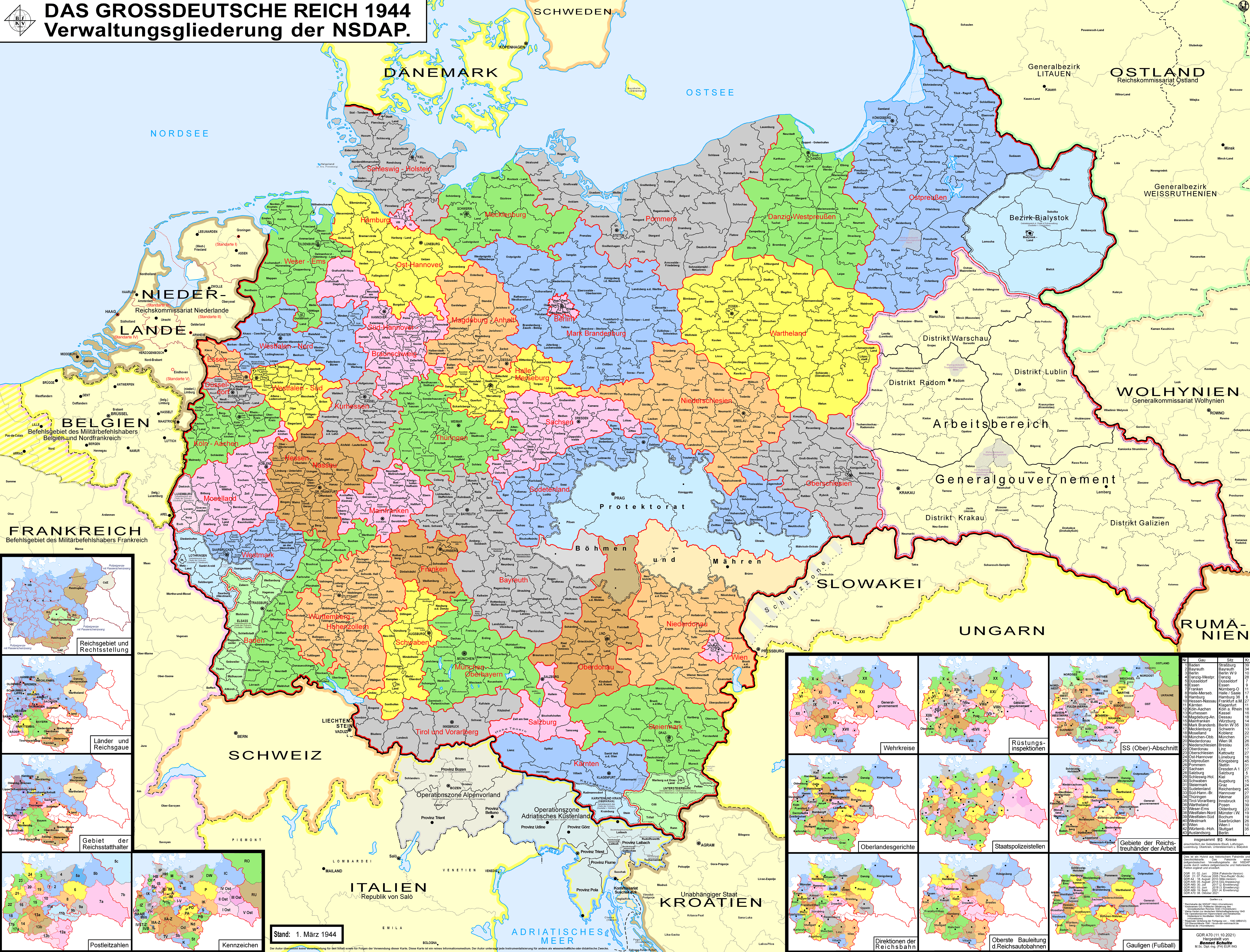
The ''Gaue'' (Singular: ''Gau'') were the main administrative divisions of Nazi Germany from 1934 to 1945. The ''Gaue'' were formed in 1926 as Nazi Party regional districts in Weimar Germany based on the territorial changes after the First World War.Die NS-Gaue , '''', accessed: 25 June 2008 The ''Gau'' system was established in 1934 as part of the '''' process, replacing the '''' syst ... [...More Info...] [...Related Items...] OR: [Wikipedia] [Google] [Baidu] |
Abolition Of Prussia
The formal abolition of Prussia (german: Abschaffung von Preußen) occurred on 25 February 1947, by decree of the Allied Control Council. History Prussia was for many centuries a major power in north-central Europe, based around the cities of Berlin and Königsberg, and rose to particular prominence during the eighteenth and nineteenth centuries. Following its victory in the Austro-Prussian War, Prussia became the driving force in creating a German Empire that excluded Austria (a '' Kleindeutsches Reich'') and in 1871 the King of Prussia became German Emperor. Following the First World War, the new Free State of Prussia bore most of Germany's territorial losses but remained the dominant state of the Weimar Republic. Even before Hitler came to power, the Prussian government had been effectively abolished by the '' Preußenschlag'' of 1932. Following World War II, almost all of Germany's territorial losses were again from areas that had been part of Prussia – Eastern Prussi ... [...More Info...] [...Related Items...] OR: [Wikipedia] [Google] [Baidu] |
Blankenburg (Harz)
Blankenburg (Harz) is a town and health resort in the district of Harz, in Saxony-Anhalt, Germany, at the north foot of the Harz Mountains, southwest of Halberstadt. It has been in large part rebuilt since a fire in 1836, and possesses a castle, with various collections, a museum of antiquities, an old town hall and churches. There are pine-needle baths and a psychiatric hospital. Gardening is a speciality. The nearby ridge of rocks called the ''Teufelsmauer'' (Devils Wall) offers views across the plain and into the deep gorges of the Harz. Geography The town of Blankenburg (Harz) lies on the northern edge of the Harz mountains at a height of about 234 metres. It is located west of Quedlinburg, south of Halberstadt and east of Wernigerode. The stream known as the Goldbach flows through the district of Oesig northwest of the town centre. Divisions The town Blankenburg (Harz) consists of Blankenburg proper and the following ''Ortschaften'' or municipal divisions: [...More Info...] [...Related Items...] OR: [Wikipedia] [Google] [Baidu] |
Calvörde
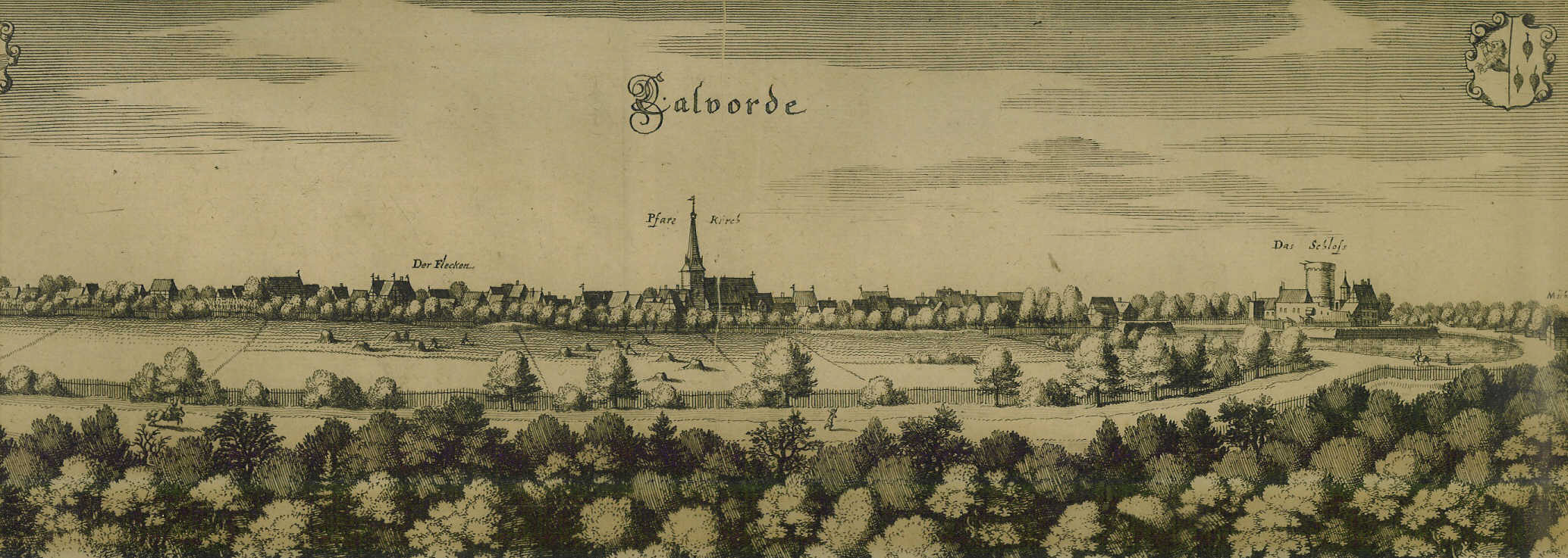
Calvörde () is a municipality in the Börde district of Saxony-Anhalt, Germany. It is part of the Verbandsgemeinde ("collective municipality") Flechtingen. Geography Calvörde is situated approximately northwest of Haldensleben and northwest of the state capital Magdeburg. It is located between the Drömling range in the west and the Flechtingen Hills in the south. In the north, it borders on Gardelegen in the Altmarkkreis Salzwedel district. The main settlement Calvörde proper lies between the Ohre River and the parallel Midland Canal. The municipal area comprises 11 localities (''Ortsteile''):Hauptsatzung der Gemeinde Calvörde July 2014. * |
Free State Of Brunswick
The Free State of Brunswick () was a state of the German Reich in the time of the Weimar Republic. It was formed after the abolition of the Duchy of Brunswick in the course of the German Revolution of 1918–19. Its capital was Braunschweig (Brunswick). History The Duchy of Brunswick had been established after the 1814 Congress of Vienna, as a sovereign successor state of the German Confederation. It roughly comprised the incoherent territory of the former Principality of Brunswick-Wolfenbüttel, stretching from Holzminden on the Weser River in the west to Blankenburg in the Harz mountain range and Calvörde in the east.Wolfgang Meibeyer: ''Die Landesnatur. Territorium - Lage - Grenzen'', in Horst-Rüdiger Jarck / Gerhard Schildt (eds.), ''Die Braunschweigische Landesgeschichte. Jahrtausendrückblick einer Region'', Braunschweig 2000, p. 23 The Brunswick territory was largely surrounded by the Prussian provinces of Hanover (the former Kingdom of Hanover) and Saxony. From 191 ... [...More Info...] [...Related Items...] OR: [Wikipedia] [Google] [Baidu] |
Dessau
Dessau is a town and former municipality in Germany at the confluence of the rivers Mulde and Elbe, in the '' Bundesland'' (Federal State) of Saxony-Anhalt. Since 1 July 2007, it has been part of the newly created municipality of Dessau-Roßlau. Population of Dessau proper: 67,747 (Dec. 2020). Geography Dessau is situated on a floodplain where the Mulde flows into the Elbe. This causes yearly floods. The worst flood took place in the year 2002, when the Waldersee district was nearly completely flooded. The south of Dessau touches a well-wooded area called Mosigkauer Heide. The highest elevation is a 110 m high former rubbish dump called Scherbelberg in the southwest of Dessau. Dessau is surrounded by numerous parks and palaces that make it one of the greenest towns in Germany. History Dessau was first mentioned in 1213. It became an important centre in 1570, when the Principality of Anhalt was founded. Dessau became the capital of this state within the Holy Roman Empire. In ... [...More Info...] [...Related Items...] OR: [Wikipedia] [Google] [Baidu] |
Free State Of Anhalt
The Free State of Anhalt (german: Freistaat Anhalt) was formed after Joachim Ernst, Duke of Anhalt abdicated on 12 November 1918, ending the Duchy of Anhalt. It was a state of Germany during the time of the Weimar Republic. In May 1932 the Nazi Party came to power in Anhalt and, after the Nazis attained power at the federal level in 1933, Anhalt was abolished (d''e facto)'' by the federal Nazi government, becoming part of the Gau of Magdeburg-Anhalt. At the end of World War II, when Germany was divided into zones of occupation, Anhalt was merged with the bulk of the Prussian Province of Saxony to form the Soviet-administered German state of Saxony-Anhalt. This state was then dissolved in 1952 but reformed in 1990 after the reunification of Germany. See also * List of Ministers-President of Anhalt References External links More statistical information States of the Weimar Republic Free State of Anhalt The Free State of Anhalt (german: Freistaat Anhalt) was f ... [...More Info...] [...Related Items...] OR: [Wikipedia] [Google] [Baidu] |
Soviet
The Soviet Union,. officially the Union of Soviet Socialist Republics. (USSR),. was a List of former transcontinental countries#Since 1700, transcontinental country that spanned much of Eurasia from 1922 to 1991. A flagship communist state, it was nominally a Federation, federal union of Republics of the Soviet Union, fifteen national republics; in practice, both Government of the Soviet Union, its government and Economy of the Soviet Union, its economy were highly Soviet-type economic planning, centralized until its final years. It was a one-party state governed by the Communist Party of the Soviet Union, with the city of Moscow serving as its capital as well as that of its largest and most populous republic: the Russian Soviet Federative Socialist Republic, Russian SFSR. Other major cities included Saint Petersburg, Leningrad (Russian SFSR), Kyiv, Kiev (Ukrainian Soviet Socialist Republic, Ukrainian SSR), Minsk (Byelorussian Soviet Socialist Republic, Byelorussian SSR), Tas ... [...More Info...] [...Related Items...] OR: [Wikipedia] [Google] [Baidu] |
Allstedt
Allstedt () is a town in the district of Mansfeld-Südharz, in Saxony-Anhalt, Germany. It is situated approximatively 10 km southeast of Sangerhausen. History Allstedt is mentioned as the tithable place ''Altstedi'' in Friesenfeld in the Hersfeld Tithe Register, created between 881 and 899. Within the German Empire (1871–1918), Allstedt was part of the Grand Duchy of Saxe-Weimar-Eisenach. In 2010 Allstedt absorbed 12 former municipalities, that became subdivisions of the town. Geography The ...[...More Info...] [...Related Items...] OR: [Wikipedia] [Google] [Baidu] |
Province Of Magdeburg
The Province of Magdeburg (german: Provinz Magdeburg) was a province of the Free State of Prussia within Nazi Germany from 1944 to 1945. The provincial capital was Magdeburg. The province was created on 1 July 1944 out of Regierungsbezirk Magdeburg, a government region from the former Province of Saxony. The province was occupied by American troops after the conquest of Magdeburg in April 1945 during World War II. After the territory was transferred from American to Soviet control, it was merged with Halle-Merseburg and Anhalt to recreate the Province of Saxony, later renamed the Province of Saxony-Anhalt and ultimately the Federal State of Saxony-Anhalt. Districts in 1945 Regierungsbezirk Magdeburg ;Urban districts # Aschersleben # Burg bei Magdeburg # Halberstadt # Magdeburg # Quedlinburg # Salzwedel # Stendal ;Rural districts # Calbe a./S. #Gardelegen #Haldensleben # Jerichow I (seat: Burg bei Magdeburg) # Jerichow II (seat: Genthin) #Oschersleben (Bode) # Osterburg #Que ... [...More Info...] [...Related Items...] OR: [Wikipedia] [Google] [Baidu] |


.png)
.jpg)