|
Saunags
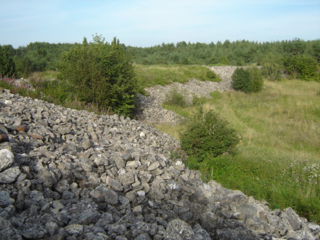
Saunags ( Livonian: ''Sǟnag'') is a populated place in Kolka Parish, Talsi Municipality, Latvia, located from the Cape Kolka, within the borders of Slītere National Park. The name derived from Livonian ''Sǟnag'' – pike perch ( Sander), a local fish. First mentioned in documents in 1310, it is the oldest of the twelve Livonian villages on the Livonian Coast. It consists of two parts - Saunags and Dižsaunags, the later being the oldest and more preserved one. Located along the coast of the Baltic Sea and formerly inhabited by Livonian people. History and local landmarks Saunags is at the same latitude as Gothenburg ( Sweden) and the same longitude as Turku (Finland), both important ancient regional trading and cultural centres. Although far from large towns and sparsely populated, this coastal area had strategic importance in many wars because of its proximity to Irbe Strait, the main sea route to Riga. As a result, the nearby seabed is dotted with medieval to moder ... [...More Info...] [...Related Items...] OR: [Wikipedia] [Google] [Baidu] |
Livonian Coast
Livonian Coast ( liv, Līvõd Rānda, italic=no; lv, Lībiešu krasts, italic=no) is a territory of Latvia historically inhabited by Livonian people. It is located in Northern Courland and encompasses twelve Livonian villages. The protected area is about 60 kilometers long. On February 4, 1991, the Latvian government created a culturally protected territory called ' – the Livonian Coast – which included all twelve of the Livonian villages: Lūžņa (Livonian: Lūž), Miķeļtornis (Pizā), Lielirbe (Īra), Jaunciems (Ūžkilā), Sīkrags (Sīkrõg), Mazirbe (Irē), Košrags (Kuoštrõg), Saunags (Sǟnag), Vaide (Vaid), Kolka (Kūolka) (see also Cape Kolka), Pitrags (Pitrõg), and Melnsils (Mustānum). The Latvian government discourages new settlements here and prohibits alterations to historical village sites. Also, it is restricted for anyone to start a hotel, restaurant, or other public establishment which might adversely influence the Livonian culture o ... [...More Info...] [...Related Items...] OR: [Wikipedia] [Google] [Baidu] |
Irbe Strait
Irbe Strait, also known as Irben Strait ( et, Kura kurk, lv, Irbes jūras šaurums, liv, Sūr mer), forms the main exit out of the Gulf of Riga to the Baltic Sea, between the Sõrve Peninsula forming the southern end of the island Saaremaa in Estonia and Courland Peninsula in Latvia. It is wide at its narrowest point. A shipping channel has been dredged along its southern shore to allow larger ships to pass. See also Saunags. Irbe is also the name of a coastal river on Courland Peninsula. It follows the coastline of the Irbe strait, flowing south-west to north-east, reaching the Baltic sea in the Irbe strait near cape Kolka, in the Slītere national park. on ''google.com/maps''. I ... [...More Info...] [...Related Items...] OR: [Wikipedia] [Google] [Baidu] |
Livonian People
The Livonians, or Livs ( Livonian: ''līvlizt''; Estonian: ''liivlased''; Latvian: ''līvi'', ''lībieši''), are a Balto-Finnic people indigenous to northern and northwestern Latvia. Livonians historically spoke Livonian, a Uralic language closely related to Estonian and related to Finnish. The last person to have learned and spoken Livonian as a mother tongue, Grizelda Kristiņa, died in 2013, making Livonian a dormant language. As of 2010, there were approximately 30 people who had learned it as a second language. Historical, social and economic factors, together with an ethnically dispersed population, have resulted in the decline of the Livonian population, with only a small group surviving in the 21st century. In 2011, there were 250 people who claimed Livonian ethnicity in Latvia. History Prehistory The exact date of migration of Livonians to the region has been disputed. "The Livonians claim to have inhabited their present homeland for over 5,000 years." "The Fi ... [...More Info...] [...Related Items...] OR: [Wikipedia] [Google] [Baidu] |
Kolka Parish
Kolka parish ( lv, Kolkas pagasts, liv, Kūolka pagāst) is an administrative unit of Talsi Municipality in the Courland region of Latvia. Villages of Kolka parish * Kolka - parish administrative center * Košrags * Mazirbe * Pitrags * Saunags * Sīkrags * Uši * Vaide Vaide ( Livonian: ''Vaid'') is a village in Kolka Parish, Talsi Municipality in the Courland region of Latvia. It is one of the remaining twelve Livonian villages on the Livonian Coast. Poulin Klavin (), one of only a handful of native speakers ... References External links Parishes of Latvia Talsi Municipality Courland {{courland-geo-stub ... [...More Info...] [...Related Items...] OR: [Wikipedia] [Google] [Baidu] |
Saaremaa
Saaremaa is the largest island in Estonia, measuring . The main island of Saare County, it is located in the Baltic Sea, south of Hiiumaa island and west of Muhu island, and belongs to the West Estonian Archipelago. The capital of the island is Kuressaare, which in January 2018 had 13,276 inhabitants. The whole island had a recorded population in January 2020 of 31,435. Etymology In old Scandinavian sources, Saaremaa is called ''Eysysla'' and in the Icelandic Sagas ''Eysýsla'' (Old Norse: ), meaning "the district (land) of island". The island is called ''Saaremaa'' in Estonian, and in Finnish ''Saarenmaa''—literally "isle land" or "island land",Toomse, Liine. "10 Estonian Islands You Should Visit." http://www.traveller.ee/blog/tallinn/10-estonian-islands-you-should-visit. Retrieved 8 March 2016. i.e. the same as the Scandinavian name for the island. The old Scandinavian name is also the origin of the island's name in Danish ''Øsel'', German and Swedish ''Ösel'', ... [...More Info...] [...Related Items...] OR: [Wikipedia] [Google] [Baidu] |
Cape Kolka
, lv, Kolkasrags , type =Cape , photo = Kolkas rags.jpg , photo_width = , photo_alt = , photo_caption = Cape Kolka , map = Latvia , map_width = , map_caption = , map_alt = , relief = , label = , label_position = , mark = , marker_size = , location = , grid_ref = , grid_ref_UK = , grid_ref_Ireland = , coordinates = , coordinates_ref = , range = , part_of = , water_bodies = Irbe Strait, Gulf of Riga, Baltic Sea , elevation_m = 2 , elevation_ref = , surface_elevation_ft = , surface_elevation_ref = , highest_point = , highest_elevation = , highest_coords = , length = , width = , area = , depth = , drop = , formed_by = , geology = , age = , orogeny ... [...More Info...] [...Related Items...] OR: [Wikipedia] [Google] [Baidu] |
Slītere National Park
Slītere National Park ( lv, Slīteres nacionālais parks) is a national park in Talsi Municipality, Courland, on the west coast of Latvia. Although formally established in 2000, it is based on former Slītere Nature Reserve, one of the oldest nature reserves in Baltic States. It is the smallest national park in Latvia. Geography The park is set in the Courland Peninsula, at the point of cape Kolka that marks the end of the Irbe Strait, the southern way out of the bay of Riga. It covers an area of (including in the Baltic Sea), making it the smallest national park in Latvia. The "Zilie Kalni" or "Blue Hills" are one of the most recognizable geological features of the park. Thousands of years ago, the Zilie Kalni formed the ancient shore of the Baltic ice lake. Further back in time, 40 M years ago, the climate was sub-tropical; fossilized amber from that period is still found by the sea-shore after heavy storms have stirred the sediments on the sea bed. [...More Info...] [...Related Items...] OR: [Wikipedia] [Google] [Baidu] |
Navy
A navy, naval force, or maritime force is the branch of a nation's armed forces principally designated for naval and amphibious warfare; namely, lake-borne, riverine, littoral, or ocean-borne combat operations and related functions. It includes anything conducted by surface ships, amphibious ships, submarines, and seaborne aviation, as well as ancillary support, communications, training, and other fields. The strategic offensive role of a navy is projection of force into areas beyond a country's shores (for example, to protect sea-lanes, deter or confront piracy, ferry troops, or attack other navies, ports, or shore installations). The strategic defensive purpose of a navy is to frustrate seaborne projection-of-force by enemies. The strategic task of the navy also may incorporate nuclear deterrence by use of submarine-launched ballistic missiles. Naval operations can be broadly divided between riverine and littoral applications (brown-water navy), open-ocean applications (blue- ... [...More Info...] [...Related Items...] OR: [Wikipedia] [Google] [Baidu] |
Russian Empire
The Russian Empire was an empire and the final period of the List of Russian monarchs, Russian monarchy from 1721 to 1917, ruling across large parts of Eurasia. It succeeded the Tsardom of Russia following the Treaty of Nystad, which ended the Great Northern War. The rise of the Russian Empire coincided with the decline of neighbouring rival powers: the Swedish Empire, the Polish–Lithuanian Commonwealth, Qajar Iran, the Ottoman Empire, and Qing dynasty, Qing China. It also held colonies in North America between 1799 and 1867. Covering an area of approximately , it remains the list of largest empires, third-largest empire in history, surpassed only by the British Empire and the Mongol Empire; it ruled over a population of 125.6 million people per the Russian Empire Census, 1897 Russian census, which was the only census carried out during the entire imperial period. Owing to its geographic extent across three continents at its peak, it featured great ethnic, linguistic, re ... [...More Info...] [...Related Items...] OR: [Wikipedia] [Google] [Baidu] |
First World War
World War I (28 July 1914 11 November 1918), often abbreviated as WWI, was one of the deadliest global conflicts in history. Belligerents included much of Europe, the Russian Empire, the United States, and the Ottoman Empire, with fighting occurring throughout Europe, the Middle East, Africa, the Pacific, and parts of Asia. An estimated 9 million soldiers were killed in combat, plus another 23 million wounded, while 5 million civilians died as a result of military action, hunger, and disease. Millions more died in genocides within the Ottoman Empire and in the 1918 influenza pandemic, which was exacerbated by the movement of combatants during the war. Prior to 1914, the European great powers were divided between the Triple Entente (comprising France, Russia, and Britain) and the Triple Alliance (containing Germany, Austria-Hungary, and Italy). Tensions in the Balkans came to a head on 28 June 1914, following the assassination of Arch ... [...More Info...] [...Related Items...] OR: [Wikipedia] [Google] [Baidu] |
Livonian Language
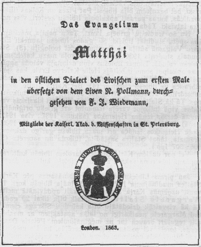
The Livonian language ( liv, līvõ kēļ, link=no or ; et, liivi keel, link=yes) is a Finnic language whose native land is the Livonian Coast of the Gulf of Livonia, located in the north of the Kurzeme peninsula in Latvia. Although its last native speaker died in 2013, there are about 40 reported L2 speakers and 210 having reported some knowledge of the language. Possibly uniquely among the Uralic languages, Livonian has been described as a pitch-accent language (see below). Currently, the only person whose native language is Livonian is Kuldi Medne who was born in 2020. Her parents are Livonian language revival activists Jānis Mednis and Renāte Medne. Some ethnic Livonians are learning or have learned Livonian in an attempt to revive it, but because ethnic Livonians are a small minority, opportunities to use Livonian are limited. The Estonian newspaper '' Eesti Päevaleht'' erroneously announced that Viktors Bertholds, who died on 28 February 2009, was the last native ... [...More Info...] [...Related Items...] OR: [Wikipedia] [Google] [Baidu] |

.jpg)


