|
Saroha Rajgan
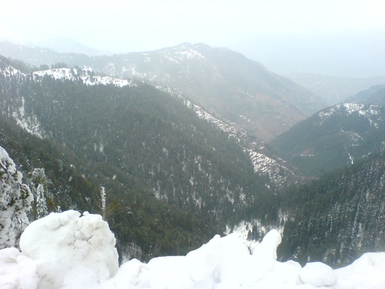
Saroha Rajgan is a village in Kallar Syedan Tehsil, Rawalpindi District, Pakistan. On 1 July 2004 Saroha Rajgan became part of Tehsil Kallar Syedan, which was formerly a Union Council of Kahuta Tehsil Kahuta Tehsil ( pa, ; ur, تحصیل کہوٹہ) is one of the seven tehsils (subdivisions) of Rawalpindi District in the Punjab province of Pakistan. The neighbouring tehsil of Kallar Sayedan used to be part of Kahuta, but was later created as .... References External links *https://lgcd.punjab.gov.pk/system/files/demarcation%20notifications%20combined%20(1).pdf Villages in Kallar Syedan Tehsil {{Rawalpindi-geo-stub ... [...More Info...] [...Related Items...] OR: [Wikipedia] [Google] [Baidu] |
Kallar Syedan Tehsil
Kallar Syedan is a tehsil in the Rawalpindi District, Punjab, Pakistan. Earlier a part of the Kahuta Tehsil, it became a separate tehsil on 1 July 2004. Kallar Syedan is the capital of the tehsil. Demography According to the 2017 census of Pakistan, Kallar Syedan Tehsil has a total population of 217,273. Many clans are living in Kallar Syedan Tehsil such as the Kashmiri Bhatt tribes, the Mughal tribe Baig (Looni sahlyal), the Mengal tribe (Mangal Rajgan), the Saroha Rajgan tribe, Gujjars, the Awan, the Raeen, the Ghakhar Kiani tribe, the Muhajir Siddiqui, the Mirza tribe, the Sheikh tribe, the Malik tribe and others. The Bhakri Sadaat of Kallar Syedan are most prominent clan in this area. Because one study clearly defined them the founder of Kallar Syedan. Administrative divisions The tehsil is divided into 11 Union Councils: * Municipal Committee Kallar Syedan City ** Kallar Sagwal ** Kallar Badhal ** Tota ** Mera Sangal ** Mangloora ** Kambili ** Sadiq ** Looni Sa ... [...More Info...] [...Related Items...] OR: [Wikipedia] [Google] [Baidu] |
Rawalpindi District
Rawalpindi District ( Punjabi and ur, ) is a district located in the northernmost part of the Punjab province of Pakistan. Parts of the district form part of the Islamabad Rawalpindi metropolitan area. Rawalpindi city is the district capital. The district has an area of . Originally, its area was until the 1960s when Islamabad Capital Territory was carved out of the district, giving away an area of . It is situated on the southern slopes of the north-western extremities of the Himalayas, including large mountain tracts with rich valleys traversed by mountain rivers. The chief rivers are the Indus and the Jhelum, and it is noted for its milder climate and abundant rainfall due to its proximity to the foothills.Rawalpindi - Encyclopædia Britannica Eleventh Edition History Ancient history In ancient times the whole or the greater part of the area between the Indus and the Jhelum seems to have belonged to a Naga tribe called Takshakas, who gave their name to the city of ... [...More Info...] [...Related Items...] OR: [Wikipedia] [Google] [Baidu] |
Kahuta Tehsil
Kahuta Tehsil ( pa, ; ur, تحصیل کہوٹہ) is one of the seven tehsils (subdivisions) of Rawalpindi District in the Punjab province of Pakistan. The neighbouring tehsil of Kallar Sayedan used to be part of Kahuta, but was later created as separate tehsil. The name Kahuta was derived from "Koh" a local medicinal tree (Look the leaves as Oliven) and "Boota". Perhaps "Koh Boota" was shortened to Kohuta/Kahuta over the passage of time. History In 997 CE, Sultan Mahmud Ghaznavi, took over the Ghaznavid dynasty empire established by his father, Sultan Sebuktegin, In 1005 he conquered the Shahis in Kabul in 1005, and followed it by the conquests of Punjab region. The Delhi Sultanate and later Mughal Empire ruled the region. The Punjab region became predominantly Muslim due to missionary Sufi saints whose dargahs dot the landscape of Punjab region. After the decline of the Mughal Empire, the Sikh Empire invaded and occupied Rawalpindi District. The local Muslims faced restrict ... [...More Info...] [...Related Items...] OR: [Wikipedia] [Google] [Baidu] |
