|
Santa Teresa Station
Santa Teresa station is a light rail station operated by Santa Clara Valley Transportation Authority (VTA). This station is the southern terminus of the Blue Line of the VTA Light Rail system. It was built in the late 1980s as part of the original ''Guadalupe Line'', the first segment of light rail that stretched to Tasman in northern San Jose. Santa Teresa station is located just south of State Route 85, near Santa Teresa Boulevard in the Santa Teresa neighborhood in southern San Jose, California San Jose, officially San José (; ; ), is a major city in the U.S. state of California that is the cultural, financial, and political center of Silicon Valley and largest city in Northern California by both population and area. With a 2020 popul .... It is a major local transit center, and as such is the terminus of several bus routes. It is served by a shuttle to IBM's campus in South San Jose. Service Station layout Connecting transit * VTA Bus: , , Express , ... [...More Info...] [...Related Items...] OR: [Wikipedia] [Google] [Baidu] |
San Jose, California
San Jose, officially San José (; ; ), is a major city in the U.S. state of California that is the cultural, financial, and political center of Silicon Valley and largest city in Northern California by both population and area. With a 2020 population of 1,013,240, it is the most populous city in both the Bay Area and the San Jose–San Francisco–Oakland, CA Combined Statistical Area, San Jose-San Francisco-Oakland Combined Statistical Area, which contain 7.7 million and 9.7 million people respectively, the List of largest California cities by population, third-most populous city in California (after Los Angeles and San Diego and ahead of San Francisco), and the List of United States cities by population, tenth-most populous in the United States. Located in the center of the Santa Clara Valley on the southern shore of San Francisco Bay, San Jose covers an area of . San Jose is the county seat of Santa Clara County, California, Santa Clara County and the main component of the San ... [...More Info...] [...Related Items...] OR: [Wikipedia] [Google] [Baidu] |
Santa Clara Valley Transportation Authority
The Santa Clara Valley Transportation Authority, more commonly known simply as the Valley Transportation Authority (VTA), is a special district responsible for public transit services, congestion management, specific highway improvement projects, and countywide transportation planning for Santa Clara County, California. It serves San Jose, California, and the surrounding Silicon Valley. It is one of the governing parties for the Caltrain commuter rail line that serves the county. In , the VTA's public transportation services had a combined ridership of , or about per weekday as of . History Santa Clara County Transit District In 1969, Santa Clara County had three private bus companies, all of which were in serious financial trouble: Peninsula Transit, San Jose City Lines, and Peerless Stages. The California Legislature enacted the Santa Clara County Transit District Act in 1969, which allowed the Santa Clara County Board of Supervisors to place a ballot measure asking coun ... [...More Info...] [...Related Items...] OR: [Wikipedia] [Google] [Baidu] |
Island Platform
An island platform (also center platform, centre platform) is a station layout arrangement where a single platform is positioned between two tracks within a railway station, tram stop or transitway interchange. Island platforms are popular on twin-track routes due to pragmatic and cost reasons. They are also useful within larger stations where local and express services for the same direction of travel can be provided from opposite sides of the same platform thereby simplifying transfers between the two tracks. An alternative arrangement is to position side platforms on either side of the tracks. The historical use of island platforms depends greatly upon the location. In the United Kingdom the use of island platforms is relatively common when the railway line is in a cutting or raised on an embankment, as this makes it easier to provide access to the platform without walking across the tracks. Advantages and tradeoffs Island platforms are necessary for any station with many th ... [...More Info...] [...Related Items...] OR: [Wikipedia] [Google] [Baidu] |
Blue Line (VTA)
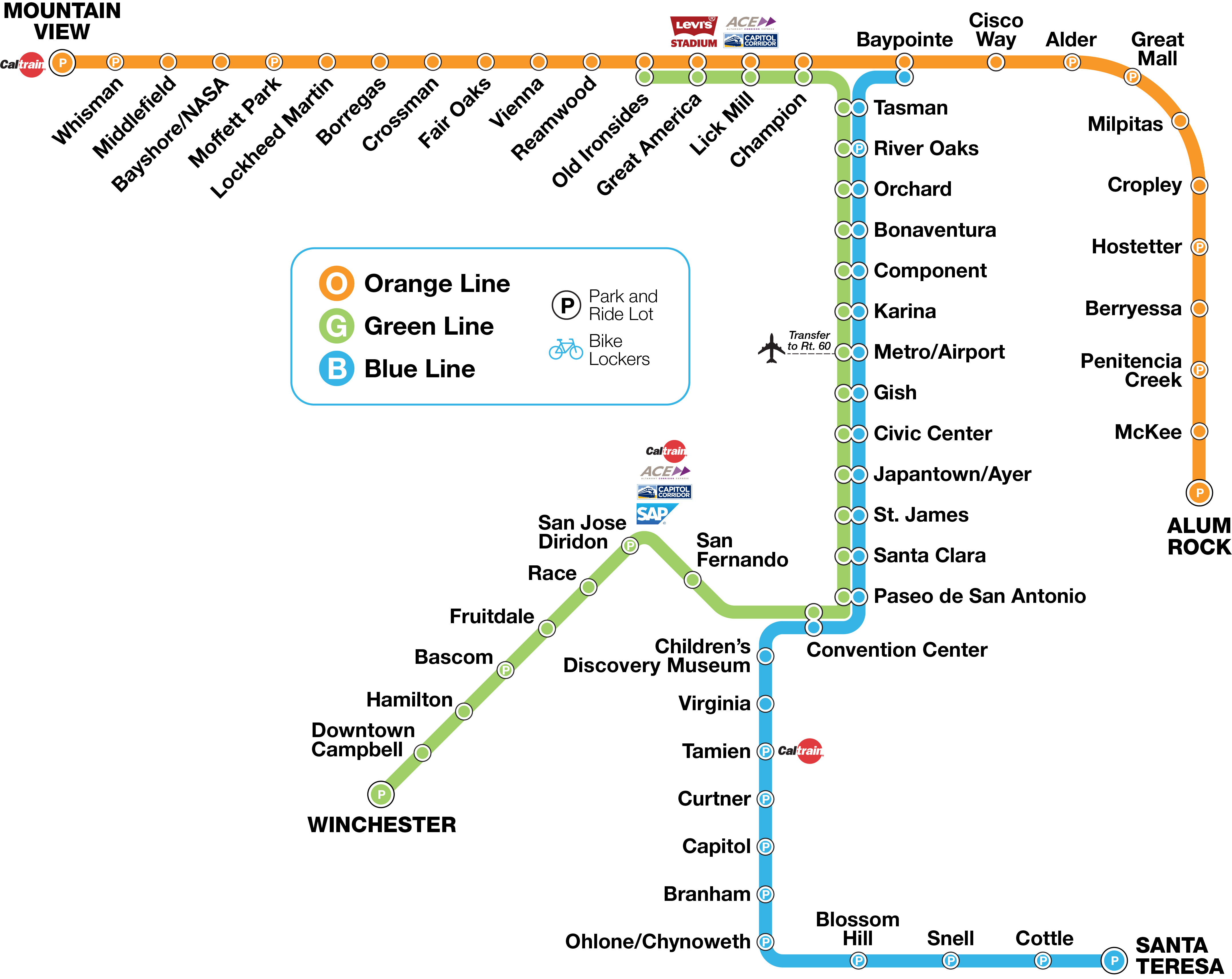
The Blue Line is a light rail line in Santa Clara County, California, and part of the Santa Clara Valley Transportation Authority (VTA) light rail system. It serves 26 stations entirely in the city of San Jose traveling between Baypointe and Santa Teresa stations, stopping at San Jose International Airport (via a bus connection), Downtown San Jose, San Jose State University, and the Children's Discovery Museum of San Jose along the way. The line connects to Caltrain at Tamien. The Blue Line is one of three lines in the VTA Light Rail system; the other two being the Green Line and the Orange Line. Route description From north to south, the Blue Line starts at Baypointe station in North San Jose, travels south on First Street, through downtown San Jose, until reaching the San Jose Convention Center where the line enters the median of State Route 87 (the Guadalupe Freeway), until it approaches the interchange with State Route 85, where it briefly exits the median to serve O ... [...More Info...] [...Related Items...] OR: [Wikipedia] [Google] [Baidu] |
Santa Clara Valley Transportation Authority Light Rail
VTA Light Rail is a light rail system in San Jose and nearby cities in Santa Clara County, California. It is operated by the Santa Clara Valley Transportation Authority, or VTA, and consists of of network comprising three main lines on standard gauge tracks. Originally opened on December 11, 1987, the light rail system has gradually expanded since then, and currently has 60 stations in operation. The light rail system has been criticized for being one of the least used in the United States (24.3 passenger trips per revenue hour) and the most heavily subsidized ($9.30 per passenger trip). VTA leaders have admitted that building light rail was a poor match with adjoining land uses. The system's average weekday daily ridership as of is passengers and a total annual ridership of passengers. Service Lines VTA operates of light rail route on 3 lines. All the lines and the corridors they run through are designed to move passengers from the suburban areas of Santa Clara Va ... [...More Info...] [...Related Items...] OR: [Wikipedia] [Google] [Baidu] |
Tasman (VTA)
Tasman station is an at-grade light rail station located in the center median of First Street at its intersection with Tasman Drive, after which the station is named, in San Jose, California. The station is owned by Santa Clara Valley Transportation Authority (VTA) and is served by the Blue Line and the Green Line of the VTA light rail VTA Light Rail is a light rail system in San Jose and nearby cities in Santa Clara County, California. It is operated by the Santa Clara Valley Transportation Authority, or VTA, and consists of of network comprising three main lines on stand ... system. This is the northernmost station served by both the Blue and Green lines and serves as one of the primary transfer points between the two lines. Services Platform layout References External links * Santa Clara Valley Transportation Authority light rail stations Santa Clara Valley Transportation Authority bus stations Railway stations in San Jose, California Railway stations in ... [...More Info...] [...Related Items...] OR: [Wikipedia] [Google] [Baidu] |
California State Route 85
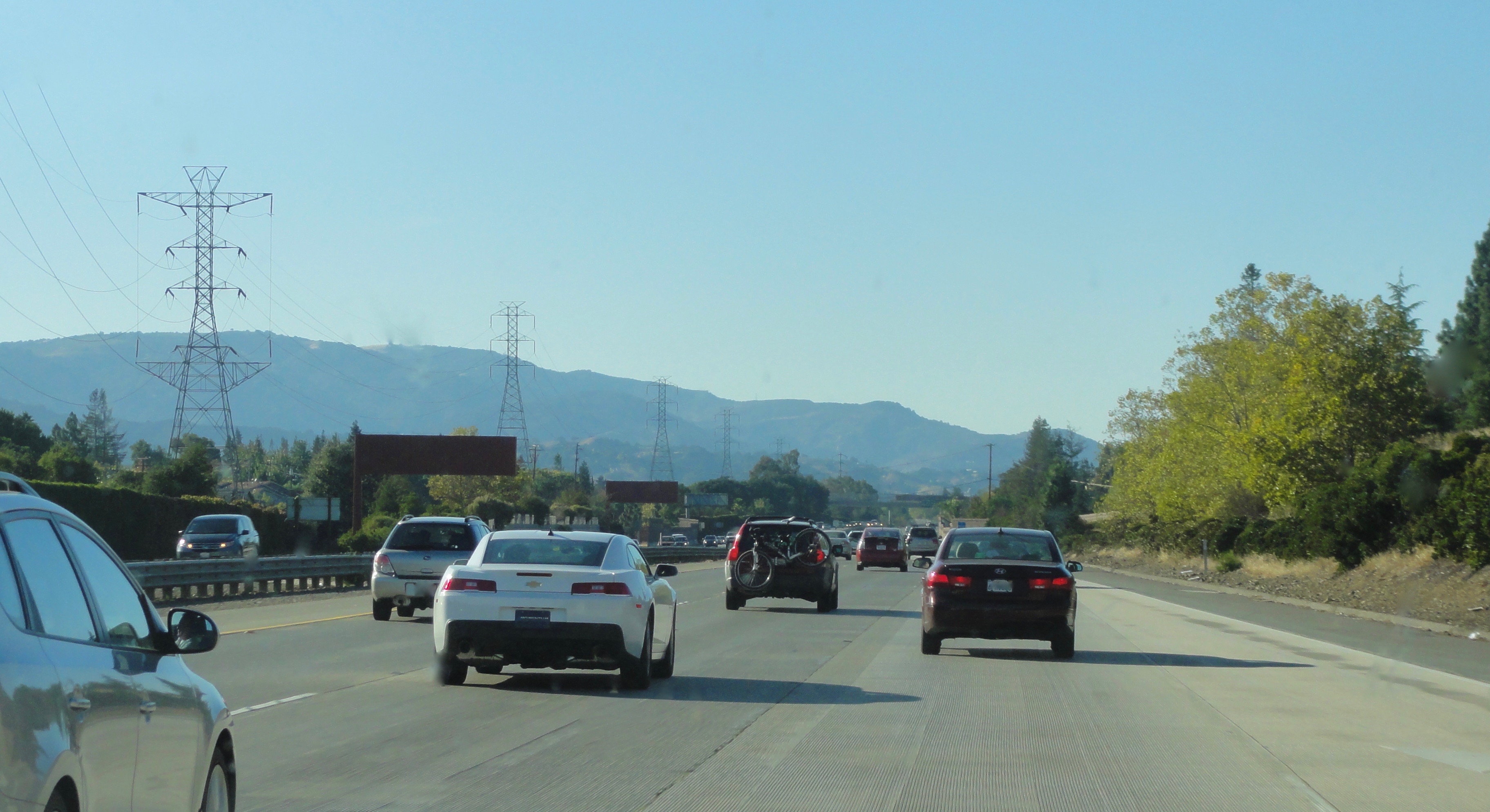
State Route 85 (SR 85), known as the West Valley Freeway along its entire length, is a state highway which connects the cities of southern San Jose and Mountain View in the U.S. State of California. The highway intersects with major highways such as I-280, SR 17, and SR 87. The route provides an alternate to U.S. Route 101 (US 101), bypassing downtown San Jose and instead passing through the foothill cities of Los Gatos, Saratoga, Cupertino, and other cities in the southern San Francisco Peninsula, roughly paralleling the Santa Cruz Mountains up to its interchange with I-280. SR 85 was built in two phases: the first, comprising the northern half, runs 5.7 miles from Stevens Creek Boulevard near Interstate 280 to its northern terminus at US 101 in Mountain View, was built in the 1960s. The second half, running 18.5 miles from US 101 in southern San Jose to Stevens Creek Boulevard in Cupertino, remained unbuilt until the 1980s and was opened in segments between 1991 and 1994. ... [...More Info...] [...Related Items...] OR: [Wikipedia] [Google] [Baidu] |
Santa Teresa, San Jose, California
Santa Teresa is a district of San Jose, California, United States, located in South San Jose. Founded in 1834, Santa Teresa was originally established as Rancho Santa Teresa by the Bernal family, a prominent Californio clan. Today, Santa Teresa is largely a residential area, but also home to numerous Silicon Valley tech campuses. Santa Teresa is the southernmost urban district of San Jose, bordering the largely protected Coyote Valley to its south. It is bound by the Santa Teresa Hills to its west and the Bayshore Freeway (101) to its east. History Santa Teresa was founded in 1834 as Rancho Santa Teresa, a rancho grant given by Governor José Figueroa to Don José Joaquín Bernal, a retired soldier who came to Alta California as part of the De Anza Expedition in 1776. Prior to receiving the rancho grant, José Joaquín Bernal had already settled in the area since 1826. Bernal named the area Santa Teresa after attributing the healing waters of the Santa Teresa Spring to Sai ... [...More Info...] [...Related Items...] OR: [Wikipedia] [Google] [Baidu] |
Baypointe Station
Baypointe is an at-grade light rail station located in the center median of Tasman Drive at its intersection with Baypointe Parkway, after which the station is named, in San Jose, California. The station is owned by Santa Clara Valley Transportation Authority (VTA) and is served by the Blue Line and the Orange Line of the VTA light rail system. Baypointe station is the current northern terminus for the Blue Line. Baypointe station is differentiated from other VTA light rail stations as it features three tracks and two island platforms. Blue Line trains stop and reverse direction on the center track, while Orange Line trains use the two outer tracks. Passengers can make a cross platform transfer with either line in any direction. History Baypointe was built as part of the Tasman West extension which included the Baypointe station along with 11 other stations and of trackway west of the Old Ironsides station (which was part of the original system opened in 1987). Baypointe ... [...More Info...] [...Related Items...] OR: [Wikipedia] [Google] [Baidu] |
Cottle Station
Cottle station is a light rail station operated by Santa Clara Valley Transportation Authority (VTA). The station is served by the Blue Line of the VTA Light Rail system. It was part of the original ''Guadalupe Line'', the first segment of light rail from Santa Teresa to Tasman. Location Cottle station is located in the median of State Route 85, near Cottle Road in the southern part of San Jose, California. It is located very close (one mile) to Caltrain's Blossom Hill station, and is even closer to the local hospital and to the Hitachi Global Storage Technologies campus in South San Jose. Since the Caltrain only serves this area in rush hours on weekdays, the light rail service may be used in other hours, although it is slower. Notes *The station is also served by shuttles to thlocal Kaiser hospitaland to the Hitachi campus. *The station is about one mile (1.6 km) from Caltrain Caltrain (reporting mark JPBX) is a California commuter rail line serving the San ... [...More Info...] [...Related Items...] OR: [Wikipedia] [Google] [Baidu] |
Island Platform
An island platform (also center platform, centre platform) is a station layout arrangement where a single platform is positioned between two tracks within a railway station, tram stop or transitway interchange. Island platforms are popular on twin-track routes due to pragmatic and cost reasons. They are also useful within larger stations where local and express services for the same direction of travel can be provided from opposite sides of the same platform thereby simplifying transfers between the two tracks. An alternative arrangement is to position side platforms on either side of the tracks. The historical use of island platforms depends greatly upon the location. In the United Kingdom the use of island platforms is relatively common when the railway line is in a cutting or raised on an embankment, as this makes it easier to provide access to the platform without walking across the tracks. Advantages and tradeoffs Island platforms are necessary for any station with many th ... [...More Info...] [...Related Items...] OR: [Wikipedia] [Google] [Baidu] |


.jpg)

_05.jpg)