|
San Joaquín, Bolivia
San Joaquín is a small agricultural town in the Beni Department in the Bolivian lowlands. It is served by San Joaquín Airport. History The Jesuit mission of San Joaquín was founded in 1709.. Baure Indians resided at the mission. Languages Camba Spanish is the primary vernacular lingua franca spoken in the town. The Joaquiniano dialect of Baure is also spoken in San Joaquín. Location San Joaquín is the administrative capital of Mamoré Province and is at an elevation of 142 m above sea level. It is just west of the Machupo River, a tributary of the Iténez River. San Joaquín is north of Trinidad, the department's capital. Geography San Joaquín is located in the Moxos Plains (''Llanos de Moxos''), at 100,000 km² one of the greatest wetlands of the Earth. Main vegetation in the area of San Joaquín is the tropical savanna. Climate The yearly precipitation of the region is 1,800 mm, with a distinct dry season from May to September. Monthly averag ... [...More Info...] [...Related Items...] OR: [Wikipedia] [Google] [Baidu] |
Flag Of Bolivia
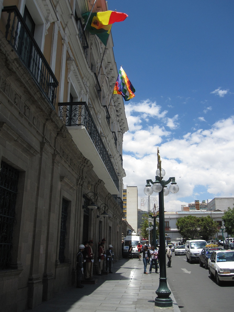
The flag of Bolivia is the national flag of the Plurinational State of Bolivia. It was originally adopted in 1851. The state and war flag is a horizontal tricolor of red, yellow and green with the Bolivian coat of arms in the center. According to one source, the red stands for Bolivia's brave soldiers, while the green symbolizes fertility and yellow the nation's mineral deposits. Since 2009 the Wiphala also holds the status of ''dual flag'' in the country. According to the revised Constitution of Bolivia of 2009, the Wiphala is considered a national symbol of Bolivia (along with the flag, national anthem, coat of arms, the cockade; kantuta flower and patujú flower). Despite its landlocked status, Bolivia has a naval ensign used by navy vessels on rivers and lakes. It consists of a blue field with the state flag in the canton bordered by nine small yellow five-pointed stars, with a larger yellow five-pointed star in the fly. The nine small stars represent the nine de ... [...More Info...] [...Related Items...] OR: [Wikipedia] [Google] [Baidu] |
Machupo River
The Machupo River is a river in Beni Department, Bolivia, a tributary of the Amazon. It rises in the foothills of the Andes and flows east and northeast into the Guaporé River Guaporé River ( pt, Rio Guaporé, es, Río Iténez) is a river in western Brazil and northeastern Bolivia. It is long; of the river forms the border between Brazil and Bolivia. The Guaporé River is part of the Madeira River basin, which even ... (Rio Itenez) just to the east of Forte Principe da Beira. References External links * * Rivers of Beni Department {{Bolivia-river-stub ... [...More Info...] [...Related Items...] OR: [Wikipedia] [Google] [Baidu] |
Jeanine Áñez
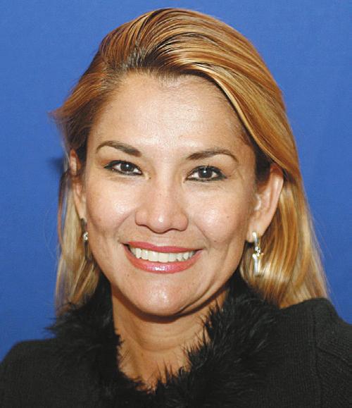
Jeanine Áñez Chávez (; born 13 June 1967) is a Bolivian lawyer, politician, and television presenter who served as the 66th president of Bolivia from 2019 to 2020. A former member of the Social Democratic Movement, she previously served two terms as senator for Beni from 2015 to 2019 on behalf of the Democratic Unity coalition and from 2010 to 2014 on behalf of the National Convergence alliance. During this time, she served as second vice president of the Senate from 2015 to 2016 and in 2019 and, briefly, was president of the Senate, also in 2019. Before that, she served as a uninominal member of the Constituent Assembly from Beni, representing circumscription 61 from 2006 to 2007 on behalf of the Social Democratic Power alliance. Born in San Joaquín, Beni, Áñez graduated as a lawyer from the José Ballivián Autonomous University, then worked in television journalism. An early advocate of departmental autonomy, in 2006, she was invited by the Social Democratic Power ... [...More Info...] [...Related Items...] OR: [Wikipedia] [Google] [Baidu] |
Machupo Virus
Bolivian hemorrhagic fever (BHF), also known as black typhus or Ordog Fever, is a hemorrhagic fever and zoonotic infectious disease originating in Bolivia after infection by ''Machupo mammarenavirus''.Public Health Agency of Canada: ''Machupo Virus Pathogen Safety Data Sheet'', http://www.phac-aspc.gc.ca/lab-bio/res/psds-ftss/machupo-eng.php, Date Modified: 2011-02-18. BHF was first identified in 1963 as an ambisense RNA virus of the '' Arenaviridae'' family, by a research group led by Karl Johnson. The mortality rate is estimated at 5 to 30 percent. Due to its pathogenicity, Machupo virus requires Biosafety Level Four conditions, the highest level.Center for Food Security & Public Health and Institute for International Cooperation in Animal Biologics, Iowa State University: ''Viral Hemorrhagic Fevers Caused by Arenaviruses'', http://www.cfsph.iastate.edu/Factsheets/pdfs/viral_hemorrhagic_fever_arenavirus.pdf, last updated: February 23, 2010. During the period between February ... [...More Info...] [...Related Items...] OR: [Wikipedia] [Google] [Baidu] |
Census
A census is the procedure of systematically acquiring, recording and calculating information about the members of a given population. This term is used mostly in connection with national population and housing censuses; other common censuses include censuses of agriculture, traditional culture, business, supplies, and traffic censuses. The United Nations (UN) defines the essential features of population and housing censuses as "individual enumeration, universality within a defined territory, simultaneity and defined periodicity", and recommends that population censuses be taken at least every ten years. UN recommendations also cover census topics to be collected, official definitions, classifications and other useful information to co-ordinate international practices. The UN's Food and Agriculture Organization (FAO), in turn, defines the census of agriculture as "a statistical operation for collecting, processing and disseminating data on the structure of agriculture, coverin ... [...More Info...] [...Related Items...] OR: [Wikipedia] [Google] [Baidu] |
Dry Season
The dry season is a yearly period of low rainfall, especially in the tropics. The weather in the tropics is dominated by the tropical rain belt, which moves from the northern to the southern tropics and back over the course of the year. The temperate counterpart to the tropical dry season is summer or winter. Rain belt The tropical rain belt lies in the southern hemisphere roughly from October to March; during that time the northern tropics have a dry season with sparser precipitation, and days are typically sunny throughout. From April to September, the rain belt lies in the northern hemisphere, and the southern tropics have their dry season. Under the Köppen climate classification, for tropical climates, a dry season month is defined as a month when average precipitation is below . The rain belt reaches roughly as far north as the Tropic of Cancer and as far south as the Tropic of Capricorn. Near these latitudes, there is one wet season and one dry season annually. At ... [...More Info...] [...Related Items...] OR: [Wikipedia] [Google] [Baidu] |
Savanna
A savanna or savannah is a mixed woodland-grassland (i.e. grassy woodland) ecosystem characterised by the trees being sufficiently widely spaced so that the canopy does not close. The open canopy allows sufficient light to reach the ground to support an unbroken herbaceous layer consisting primarily of grasses. According to '' Britannica'', there exists four savanna forms; ''savanna woodland'' where trees and shrubs form a light canopy, ''tree savanna'' with scattered trees and shrubs, ''shrub savanna'' with distributed shrubs, and ''grass savanna'' where trees and shrubs are mostly nonexistent.Smith, Jeremy M.B.. "savanna". Encyclopedia Britannica, 5 Sep. 2016, https://www.britannica.com/science/savanna/Environment. Accessed 17 September 2022. Savannas maintain an open canopy despite a high tree density. It is often believed that savannas feature widely spaced, scattered trees. However, in many savannas, tree densities are higher and trees are more regularly spaced than in for ... [...More Info...] [...Related Items...] OR: [Wikipedia] [Google] [Baidu] |
Tropics
The tropics are the regions of Earth surrounding the Equator. They are defined in latitude by the Tropic of Cancer in the Northern Hemisphere at N and the Tropic of Capricorn in the Southern Hemisphere at S. The tropics are also referred to as the tropical zone and the torrid zone (see geographical zone). In terms of climate, the tropics receive sunlight that is more direct than the rest of Earth and are generally hotter and wetter as they aren't affected as much by the solar seasons. The word "tropical" sometimes refers to this sort of climate in the zone rather than to the geographical zone itself. The tropical zone includes deserts and snow-capped mountains, which are not tropical in the climatic sense. The tropics are distinguished from the other climatic and biomatic regions of Earth, which are the middle latitudes and the polar regions on either side of the equatorial zone. The tropics constitute 40% of Earth's surface area and contain 36% of Earth's landmass. ... [...More Info...] [...Related Items...] OR: [Wikipedia] [Google] [Baidu] |
Moxos Plains
The Beni savanna, also known as the Llanos de Moxos or Moxos plains, is a tropical savanna ecoregion of the Beni Department of northern Bolivia. Setting The Beni savanna covers an area of in the lowlands of northern Bolivia, with small portions in neighboring Brazil and Peru. Most of the Llanos de Moxos lies within the departments of El Beni, Cochabamba, La Paz, Pando, and Santa Cruz. The Llanos de Moxos occupies the southwestern corner of the Amazon basin, and the region is crossed by numerous rivers that drain the eastern slope of the Andes Mountains. The low relief of the savannas, coupled with wet season rains and snowmelt from the Andes, cause up to half the land to flood seasonally. The Beni savanna is surrounded by tropical moist forests; the Southwestern Amazonian moist forests to the north, west, and south, and the Madeira-Tapajós moist forests to the east. Climate The climate of the Beni savanna is tropical, with pronounced wet and dry seasons. The wet season gen ... [...More Info...] [...Related Items...] OR: [Wikipedia] [Google] [Baidu] |
Trinidad, Bolivia
Trinidad, Kimsantin officially La Santísima Trinidad (Spanish, 'The Most Holy Trinity'), is a city in Bolivia, capital of the department of Beni. The population is 130,000 (2010 official estimate). While historically a peripheral city in Bolivia, Trinidad is today an important center for the Bolivian Bovine industry and has enjoyed a modest economic boom in recent years and enjoys an HDI index of above 0.700. While technically on the periphery of the Amazon rainforest, Trinidad is a wet monsoonal location that is connected by the Mamoré river to the greater Amazon Basin. While wet enough to be a rainforest in total annual precipitation, dry monsoonal weather separates the year into dry and wet seasons as is common throughout much of the greater Amazon basin, particularly to the southeast. Trinidad is a growing city of medium size, and while not an important national center, has grown in importance for the local economy of the Bolivian orient north of Santa Cruz de la Sierra. ... [...More Info...] [...Related Items...] OR: [Wikipedia] [Google] [Baidu] |
Baure Language
Bauré is an endangered Arawakan language spoken by only 40 of the thousand Baure people of the Beni Department of northwest of Magdalena, Bolivia. Some Bible portions have been translated into Bauré. Most speakers have been shifting to Spanish. Orthography Vowels * a - * e - �/e* i - /ɪ* o - /ɔ/u Consonants * ch/č/z - _[d͡ʒ.html" ;"title="͡ʃ[, [d͡ʒ">͡ʃ[, [d͡ʒafter n * h/j - [h* k/c/qu/g - [k], [g] after n * m - [m] * n - [n] * p/b - [p], [b] after m * r/l - [r/l] * s - [s] * sh/š/x - [ʃ] * t/d - [t], [d] after n * v/b - [β/b] * w/hu/u - [w] * y - [j] * '/h - [ʔ] Grammar Baure has an active–stative syntax.Aikhenvald, "Arawak", in Dixon & Aikhenvald, eds., ''The Amazonian Languages'', 1999. See also *Llanos de Moxos (archaeology) The Llanos (Spanish ''Los Llanos'', "The Plains"; ) is a vast tropical grassland plain situated to the east of the Andes in Colombia and Venezuela, in northwestern South America. It is an ecoregion of the tropical and ... [...More Info...] [...Related Items...] OR: [Wikipedia] [Google] [Baidu] |


