|
San Gregorio De Polanco
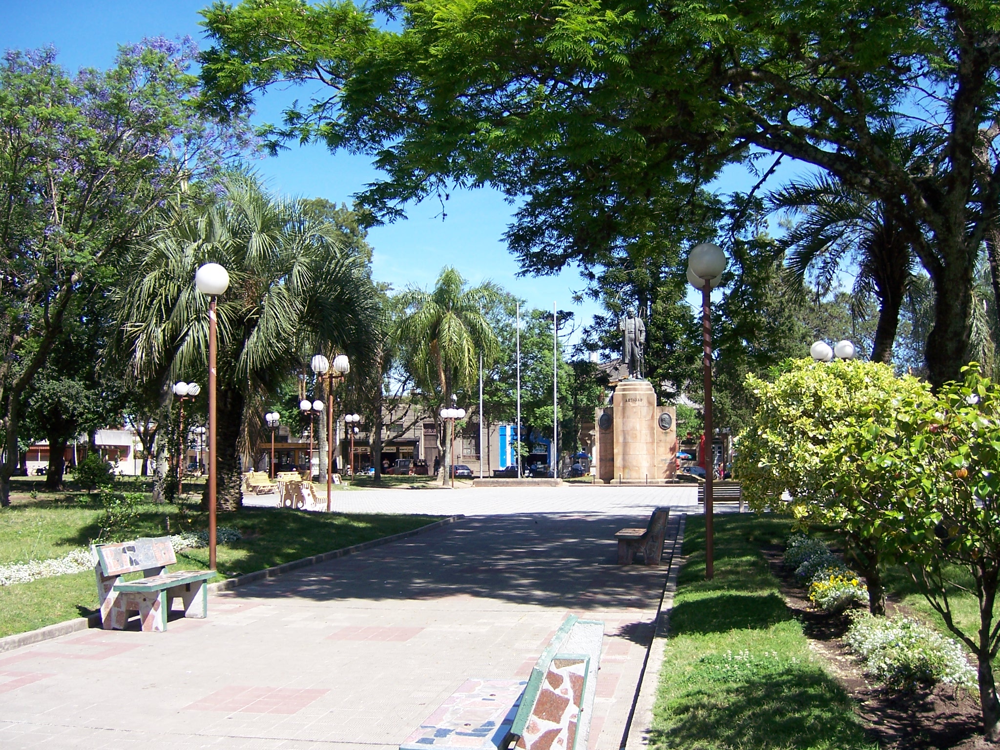
San Gregorio de Polanco is a small city in the Tacuarembó Department of northern-central Uruguay. Geography The city is located on a peninsula on the north shore of the artificial Rincón del Bonete Lake and along Route 43, about south of the department capital city of Tacuarembó. Route 43 passes across the lake to Durazno Department by ferryboat. History It was founded on 27 November 1853. On 13 October 1963, its status was elevated to "Villa" (town) by the Act of Ley Nº 13.167, and then on 13 December 1994 to "Ciudad" (city) by the Act of Ley Nº 16.666. In 1945, the artificial lake of Rincon del Bonete hugely changed the landscape of this town, adding a water surface and, later, beaches. Population In 2011, San Gregorio de Polanco had a population of 3,415. Source: ''Instituto Nacional de Estadística de Uruguay'' Places of worship * Nuestra Señora del Carmen, San Gregorio de Polanco, Parish Church of Our Lady of Mt. Carmel References External linksINE map of San ... [...More Info...] [...Related Items...] OR: [Wikipedia] [Google] [Baidu] |
Departments Of Uruguay
Uruguay consists of 19 departments (''departamentos''). Each department has a legislature called a Departmental Board. The ''Intendente'' is the department's chief executive. History The first division of the Republic into six departments occurred on 27 January 1816. In February of the same year, two more departments were formed, and in 1828 one more was added. When the First Constitution was signed in 1830, there were nine departments. These were the departments of Montevideo, Maldonado, Canelones, San José, Colonia, Soriano, Paysandú, Durazno and Cerro Largo. At that time, the department of Paysandú occupied all the territory north of the Río Negro, which included the current departments of Artigas, Rivera, Tacuarembó, Salto, Paysandú and Río Negro. On 17 June 1837 a new division of Uruguay was made and this northern territory was divided in three parts by the creation of the departments of Salto and Tacuarembó. At the same time the department of Minas (which was even ... [...More Info...] [...Related Items...] OR: [Wikipedia] [Google] [Baidu] |
Tacuarembó Department
Tacuarembó () is the largest department of Uruguay and it is part of its northern region. Its capital is Tacuarembó. It borders Rivera Department to its north and east, the departments of Salto, Paysandú and Río Negro to its west and has the river Río Negro flowing along its south border, separating it from the departments of Durazno and Cerro Largo. History The first division of the Republic in six departments happened in 1816. Two more departments were formed later in that year. At that time, Paysandú Department included all the territory north of the Río Negro, which included the current departments of Artigas, Rivera, Tacuarembó, Salto, Paysandú and Río Negro. On 17 June 1837 a new division of Uruguay was made and this territory was divided in three parts. In the new division, the Tacuarembó Department included also the actual department of Rivera, until it was split from it in 1884. Geography The south borders of the department are delimited by Río Negro, w ... [...More Info...] [...Related Items...] OR: [Wikipedia] [Google] [Baidu] |
Telephone Numbers In Uruguay
Uruguay's calling code is +598. Since 2010, national long distance calling was eliminated, thus there are no area codes in each city. Landline telephony ANTEL (Spanish abbreviation for National Administration of Telecommunications) is Uruguay's state-owned company for telecommunications. Previously in Uruguay, phone numbers used to have between 4 and 7 digits. To make a local phone call, you only had to dial those digits. To make a call between two cities from different departments, you had to dial zero, plus area code, plus phone number. As from August 29, 2010, all phone numbers have 8 digits, according to the new National Numbering Plan. Zero prior to area code was eliminated. Therefore, to make a call to any city in the country you have to dial 8 digits. This plan was implemented by URSEC (Spanish abbreviation for Regulator Unit of Services of Communications). National Numbering Plan Montevideo and metropolitan area In the Metropolitan area of Montevideo, all nation ... [...More Info...] [...Related Items...] OR: [Wikipedia] [Google] [Baidu] |
Uruguay
Uruguay (; ), officially the Oriental Republic of Uruguay ( es, República Oriental del Uruguay), is a country in South America. It shares borders with Argentina to its west and southwest and Brazil to its north and northeast; while bordering the Río de la Plata to the south and the Atlantic Ocean to the southeast. It is part of the Southern Cone region of South America. Uruguay covers an area of approximately and has a population of an estimated 3.4 million, of whom around 2 million live in the metropolitan area of its capital and largest city, Montevideo. The area that became Uruguay was first inhabited by groups of hunter–gatherers 13,000 years ago. The predominant tribe at the moment of the arrival of Europeans was the Charrúa people, when the Portuguese first established Colónia do Sacramento in 1680; Uruguay was colonized by Europeans late relative to neighboring countries. The Spanish founded Montevideo as a military stronghold in the early 18th century bec ... [...More Info...] [...Related Items...] OR: [Wikipedia] [Google] [Baidu] |
Rincón Del Bonete Lake
The Rincón del Bonete Lake is the largest body of fresh water in Uruguay. It is located in the middle of the country in the south part of Tacuarembó Department with a small part of it reaching into the north part of Durazno Department Durazno () is a department of Uruguay. Its capital is Durazno. Its name means ''"peach"'' in Spanish, referring to the department's peaches and its status as an agricultural breadbasket. It is located in the centre of the country, and is bounded .... Rincón del Bonete is an artificial lake formed by a dam on the course of Río Negro. It was built in 1945 and has a surface of about . The dam was overtopping during the 1959 floods, and the hydroelectric facilities damaged. The riverine tug ''Don Pancho'' was assigned to the transport of building materials and supplies from Salto during the construction of the dam, between 1937 and 1946. She was later used to evacuate local residents in the course of the 1959 floods. The vessel was eventually ... [...More Info...] [...Related Items...] OR: [Wikipedia] [Google] [Baidu] |
Tacuarembó
Tacuarembó ( Guarani: ''Takuarembo'', literally: "Bamboo shoot") is the capital city of the Tacuarembó Department in north-central Uruguay. Location and geography The city is located on Km. 390 of Route 5, south-southwest of Rivera, the capital city of the Rivera Department. Routes 26 and 31 also meet Route 5 within the city limits. The stream Arroyo Tacuarembó Chico, a tributary of Río Tacuarembó, flows through the north part of the city. As of the census of 2011, it is the eighth most populated city of the country. History On 24 October 1831, a presidential decree by Fructuoso Rivera ordered the creation of a city in the region. The task was entrusted to the President's brother, Colonel Bernabé Rivera. Colonel Rivera left Montevideo on a three-month journey with a caravan of wagons and families, towards the shore of the Tacuaremboty River, which in the Guaraní language means "river of the reeds". The area was surveyed and divided into blocks for settlement. On ... [...More Info...] [...Related Items...] OR: [Wikipedia] [Google] [Baidu] |
Durazno Department
Durazno () is a department of Uruguay. Its capital is Durazno. Its name means ''"peach"'' in Spanish, referring to the department's peaches and its status as an agricultural breadbasket. It is located in the centre of the country, and is bounded to the north by the Río Negro and the Río Yi to the South. To its north are the departments of Río Negro and Tacuarembó, to it southeast the departments of Treinta y Tres, to its south the departments of Flores and Florida, while on its east is the department of Cerro Largo. History In 1827, while the territory was under Portuguese dominion, the Portuguese asked their ally, General Fructuoso Rivera to establish a military body of cavalry and artillery in the area of Paso del Durazno on the banks of Río Yi. For this, the town of San Pedro del Durazno was founded, named after the regent of Brazil. In 1828 the department named "Entre Ríos Yí y Negro" was formed, which was soon after renamed to Durazno. When the First Constitution ... [...More Info...] [...Related Items...] OR: [Wikipedia] [Google] [Baidu] |
Brecha (newspaper)
Brecha is a Uruguayan weekly newspaper. History Founded in 1985 by Hugo Alfaro and other journalists that had started their careers at Marcha under the influence of Carlos Quijano. As Quijano had died in 1984 in exile, they decided to take a new name, and try to continue with the original idea: an independent leftist weekly newspaper. Together with '' Búsqueda'', it is considered one of the two most influential political weekly newspapers in Uruguay Uruguay (; ), officially the Oriental Republic of Uruguay ( es, República Oriental del Uruguay), is a country in South America. It shares borders with Argentina to its west and southwest and Brazil to its north and northeast; while bordering .... References Newspapers established in 1985 1985 establishments in Uruguay Newspapers published in Uruguay Spanish-language newspapers Mass media in Montevideo {{uruguay-newspaper-stub ... [...More Info...] [...Related Items...] OR: [Wikipedia] [Google] [Baidu] |
Nuestra Señora Del Carmen, San Gregorio De Polanco
''Nuestra'' is the debut studio album of the Venezuelan rock band La Vida Bohème, released in August 2010. Recorded and produced by Rudy Pagliuca, it is a free download on the website of the record label All of the Above. The album was nominated for "Best Latin Pop, Rock or Urban Album" in the 54th Grammy Awards. The two singles from this album are "Radio Capital" and "Danz!". Background and Recording The album was recorded in Caracas in 2009, on fairly independent terms. Guitarist Daniel De Sousa happened to be studying engineering at the time, and took on designing a distortion pedal that was used on the album. The synths were designed/programmed by fellow Venezuelan artist Arca, then known as Nuuro. In popular culture The song "El Buen Salvaje" is included in the video game ''FIFA 12'', winning the MTV Game Awards 2012 for "Best song in a video game". "Radio Capital" is present in the Rockstar's video game ''Grand Theft Auto V ''Grand Theft Auto V'' is a 2013 ac ... [...More Info...] [...Related Items...] OR: [Wikipedia] [Google] [Baidu] |


