|
Samaritans Way South West
Samaritans Way South West is a Long-distance footpath in South West England. It was officially opened on 21 April 2004 by the Ramblers Vice Chairman, the Samaritans (charity) Chief Executive and a farmer from Gloucestershire who headed the Farmers Helpline. In the same year it appeared on the Ordnance Survey maps supported and encouraged by Local Authorities, National Parks and Area of Outstanding Natural Beauty by giving their consent; however Somerset County Council later asked the Ordnance Survey to remove the route from their maps. A way marked walk linking the Cotswolds, the Mendips, the Polden Hills, the Quantocks, the Brendons, Exmoor National Park and the North Devon Coast. It starts at Clifton Suspension Bridge on the Avon Gorge in Bristol, and continues across the Chew Valley with its lakes, over the Mendip Hills to Cheddar Gorge and Cheddar, along the Somerset Levels to Glastonbury and Street and on through Bridgwater and Goathurst to the Quantock Hil ... [...More Info...] [...Related Items...] OR: [Wikipedia] [Google] [Baidu] |
Quantock Hills
The Quantock Hills west of Bridgwater in Somerset, England, consist of heathland, oak woodlands, ancient parklands and agricultural land. They were England's first Area of Outstanding Natural Beauty, designated in 1956. Natural England have designated the Quantock Hills as a national character area. They are entirely surrounded by another: the Vale of Taunton and Quantock Fringes. The hills run from the Vale of Taunton Deane in the south, for about to the north-west, ending at Kilve and West Quantoxhead on the coast of the Bristol Channel. They form the western border of Sedgemoor and the Somerset Levels. From the top of the hills on a clear day, it is possible to see Glastonbury Tor and the Mendips to the east, Wales as far as the Gower Peninsula to the north, the Brendon Hills and Exmoor to the west, and the Blackdown Hills to the south. The highest point on the Quantocks is Wills Neck, at . Soil types and weather combine to support the hills' plants and animals. In 1 ... [...More Info...] [...Related Items...] OR: [Wikipedia] [Google] [Baidu] |
Cheddar Gorge
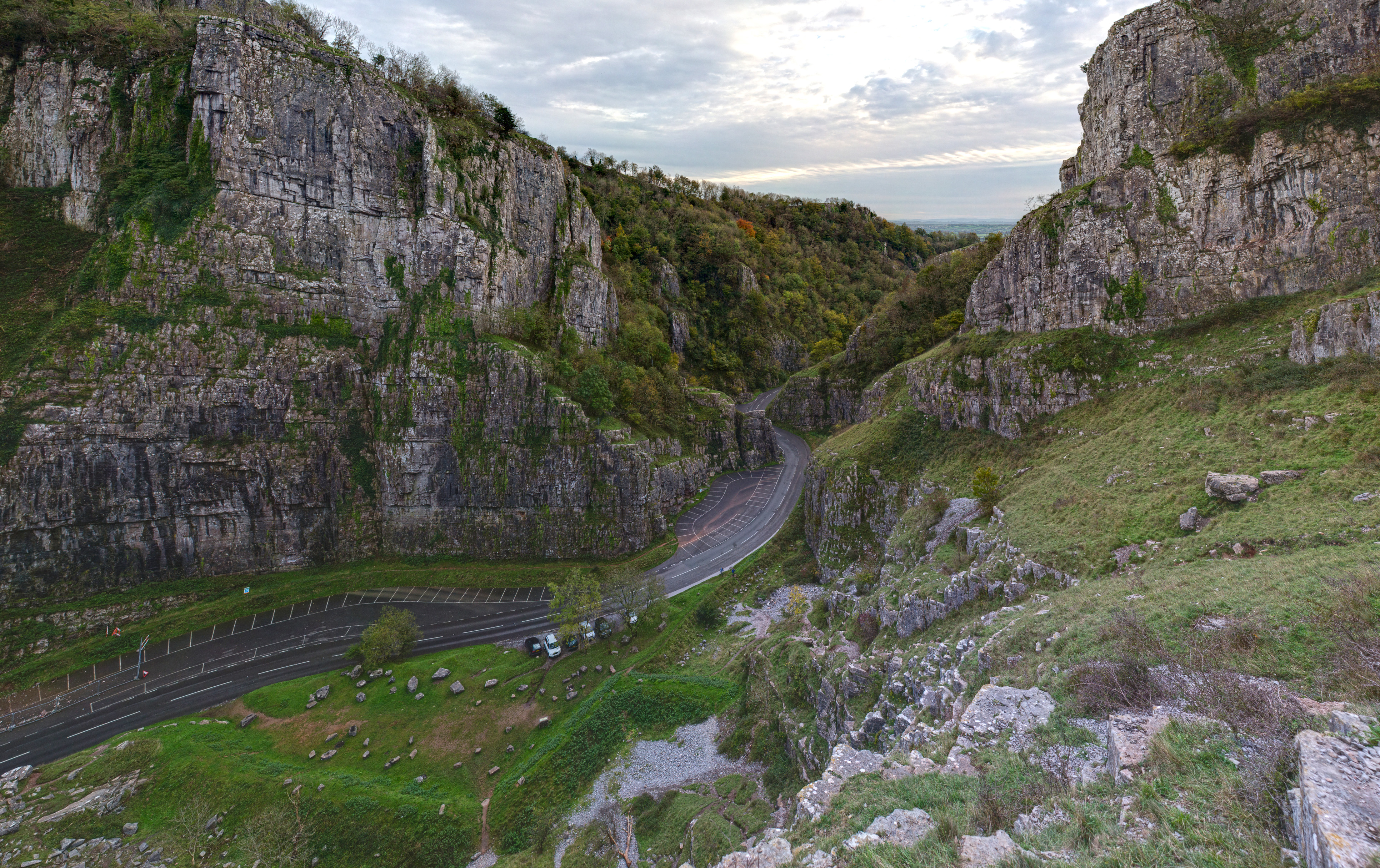
Cheddar Gorge is a limestone gorge in the Mendip Hills, near the village of Cheddar, Somerset, England. The gorge is the site of the Cheddar show caves, where Britain's oldest complete human skeleton, Cheddar Man, estimated to be 9,000 years old, was found in 1903. Older remains from the Upper Late Palaeolithic era (12,000–13,000 years ago) have been found. The caves, produced by the activity of an underground river, contain stalactites and stalagmites. The gorge is part of a Site of Special Scientific Interest called Cheddar Complex. Cheddar Gorge, including the caves and other attractions, has become a tourist destination. In a 2005 poll of ''Radio Times'' readers, following its appearance on the television programme '' Seven Natural Wonders'' (2005), Cheddar Gorge was named as the second greatest natural wonder in Britain, surpassed only by Dan yr Ogof caves. The gorge attracts about 500,000 visitors per year. Geology Cheddar is a gorge lying on the southern e ... [...More Info...] [...Related Items...] OR: [Wikipedia] [Google] [Baidu] |
Winsford, Somerset
Winsford is a village and civil parish in Somerset, England, located about north-west of Dulverton. It is within the borders of the Exmoor National Park and around south-west of the coastal town of Minehead. The village has one hotel, The Royal Oak dating to before the start of the 16th century, and one shop and post office. There is also a tea garden and a service station, which does not serve fuel for motor vehicles. The village is on the route of the Samaritans Way South West and is located within the Exmoor National Park, to the east of the village is the hamlet of West Howetown. History Winsford Hill is the location of the Wambarrows, a number of Bronze Age burial sites, and Road Castle an Iron Age bank and ditch approximately west from the village. The ditch is almost square in plan with rounded corners and covers an area of approximately . The area is home to the Caratacus Stone, a standing stone believed to have been erected by pagan inhabitants of the village, ... [...More Info...] [...Related Items...] OR: [Wikipedia] [Google] [Baidu] |
Luxborough
Luxborough is a small village and civil parish located some south of Dunster, lying amongst the Brendon Hills and the Exmoor National Park in Somerset, England. It is divided into the hamlets of Churchtown, Kingsbridge and Pooltown, which lie within a mile of each other. Luxborough, 'Lolochesberie' in the Domesday Book, means 'stronghold or hill of a man called Lulluc'. Administratively, the civil parish falls within the Somerset West and Taunton local government district and the Somerset shire county, with administrative tasks shared between county, district and parish councils. In 2011, the population of the parish was 237. History Luxborough was part of the hundred of Carhampton. About 100 years ago, people used to mine iron ore around Luxborough. It was taken by train down the West Somerset Mineral Railway's incline to Watchet, beside the Bristol Channel and shipped to Newport. There are the remains of several buildings, including stations, such as Luxborough Road railwa ... [...More Info...] [...Related Items...] OR: [Wikipedia] [Google] [Baidu] |
Monksilver
Monksilver is a village west of the town of Williton in Somerset, England, on the eastern flank of the Brendon Hills and the border of the Exmoor National Park. The Coleridge Way trail, footpath passes through the village. History The name of the village means ''monk's wood''. In the Domesday Book it was simply ''Selvre'', from the Latin ''silva'' for a wood, although it has also been suggested that ''Sulfhere'', in AD 897, referred to the silvery stream below the village. In 1113 the manor was given by Robert de Chandos to endow Goldcliff Priory, which he had just established near Newport, Wales, Newport in Monmouthshire . In 1441 it passed, with the priory, to Tewkesbury Abbey and then in 1474 to the canons of Windsor Castle, Windsor. In the 14th century the name changed to "Monksilver". The parish of Monksilver was part of the Williton and Freemanners (hundred), Williton and Freemanners Hundred (county subdivision), Hundred. In the 16th and 17th centuries it was a centre for ... [...More Info...] [...Related Items...] OR: [Wikipedia] [Google] [Baidu] |
Exmoor
Exmoor is loosely defined as an area of hilly open moorland in west Somerset and north Devon in South West England. It is named after the River Exe, the source of which is situated in the centre of the area, two miles north-west of Simonsbath. Exmoor is more precisely defined as the area of the former ancient royal hunting forest, also called Exmoor, which was officially surveyed 1815–1818 as in extent. The moor has given its name to a National Park, which includes the Brendon Hills, the East Lyn Valley, the Vale of Porlock and of the Bristol Channel coast. The total area of the Exmoor National Park is , of which 71% is in Somerset and 29% in Devon. The upland area is underlain by sedimentary rocks dating from the Devonian and early Carboniferous periods with Triassic and Jurassic age rocks on lower slopes. Where these reach the coast, cliffs are formed which are cut with ravines and waterfalls. It was recognised as a heritage coast in 1991. The highest point on Exmoo ... [...More Info...] [...Related Items...] OR: [Wikipedia] [Google] [Baidu] |
Brendon Hills
The Brendon Hills are a range of hills in west Somerset, England. The hills merge level into the eastern side of Exmoor and are included within the Exmoor National Park. The highest point of the range is Lype Hill at above sea level with a secondary summit several kilometres to the southeast at . Both points are marked by Ordnance Survey trig points and are located within enclosed farmland. Early versions of the name include ''Brunedun'' and ''Brundon'' reflecting an original name of ''Bruna'' or ''Brune'', meaning 'brown one'. ''Dun'' is a common Old English word for a fairly flat and extensive hill. This name is not connected with the village of Brendon in Devon, the name of which has a different origin. The terrain is broken by a series of deeply incised streams and rivers running roughly southwards to meet the River Haddeo, a tributary of the River Exe. The hills are quite heavily cultivated unlike their neighbouring upland areas of Exmoor and the Quantock Hills. The Bre ... [...More Info...] [...Related Items...] OR: [Wikipedia] [Google] [Baidu] |
Stogumber
Stogumber () is a village and civil parish in Somerset, England, on the eastern flank of the Brendon Hills. Besides Stogumber village itself, the parish includes the Hamlet (place), hamlets of Ashbeer, Capton, Escott, Higher Vexford, Kingswood, Lower Vellow, Lower Vexford, Preston, and Vellow. The village is on the route of the Samaritans Way South West. History The name comes from the Old English ''Stoke'', meaning 'place' or 'dairy farm', with the addition in 1225 of the personal name ''Gunner''. Approximately north-west of the village is Curdon Camp a univallate Iron Age hill fort. The camp was nearly completely destroyed by quarrying and bulldozing. The parish of Stogumber was part of the Williton and Freemanners (hundred), Williton and Freemanners Hundred (county subdivision), Hundred. The manor of Stogumber was held from 1286 by the Andleys family, and later by the Sydenhams (1396–1626) and Notleys (from 1896). Five fulling mills were established in the village betwee ... [...More Info...] [...Related Items...] OR: [Wikipedia] [Google] [Baidu] |
Crowcombe
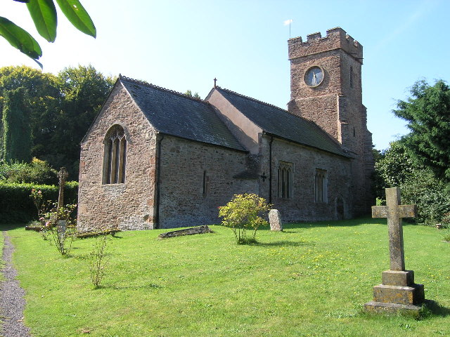
Crowcombe is a village and civil parish under the Quantock Hills in Somerset, England, southeast of Watchet, and from Taunton. The village has a population of 489. The parish covers the hamlets of Crowcombe Heathfield, Flaxpool, Halsway, Lawford and Triscombe. The village is on the route of the Samaritans Way South West. History The name Triscombe is believed to derive from the Old English words and . The first documentary evidence of the village is by Æthelwulf of Wessex in 854, where it was spelt 'Cerawicombe'. At that time the manor belonged to Glastonbury Abbey. Later Gytha Thorkelsdóttir, wife of Earl Godwin, gave it to the monks of Winchester to make amends for her husband's "treacherous abuses of divers monastic institutions". The Domesday Book of 1086 lists the village as 'Crawcombe', which is believed to come from the Old English words ''craw'' and ''cumb''. The parish of Crowcombe was part of the Williton and Freemanners Hundred. The medieval cross of r ... [...More Info...] [...Related Items...] OR: [Wikipedia] [Google] [Baidu] |
Goathurst
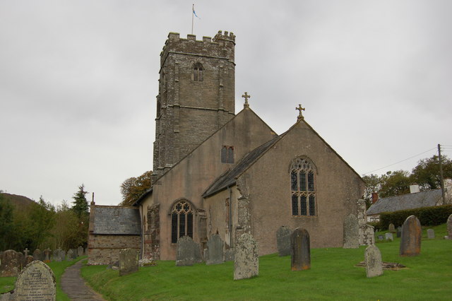
Goathurst is a small village and civil parish in the English county of Somerset, around 3 miles from the town of Bridgwater. The parish includes the hamlets of Andersfield and Huntstile. The village is on the route of the Samaritans Way South West. History Goathurst was part of the hundred of Andersfield. Originally part of the Royal Forest of North Petherton, its first squire owned Goathurst's St Edward's church, a Grade I listed building which includes a 19th-century monument to three-year-old Isabella Kemeys, showing the child lying on a pillow holding a broken flower. Goathurst was the location of a 300-person prisoner of war camp during World War II, initially housing Italian prisoners from the Western Desert Campaign, and later German prisoners following the Battle of Normandy. Governance The parish council has responsibility for local issues, including setting an annual precept (local rate) to cover the council's operating costs and producing annual accounts for pu ... [...More Info...] [...Related Items...] OR: [Wikipedia] [Google] [Baidu] |
Bridgwater
Bridgwater is a large historic market town and civil parish in Somerset, England. Its population currently stands at around 41,276 as of 2022. Bridgwater is at the edge of the Somerset Levels, in level and well-wooded country. The town lies along both sides of the River Parrett; it has been a major inland port and trading centre since the industrial revolution. Most of its industrial bases still stand today. Its larger neighbour, Taunton, is linked to Bridgwater via a canal, the M5 motorway and the Great Western Railway, GWR railway line. Historically, the town had a politically radical tendency. The Battle of Sedgemoor, where the Monmouth Rebellion was finally crushed in 1685, was fought nearby. Notable buildings include the Church of St Mary, Bridgwater, Church of St Mary and Blake Museum, which is a largely restored house in Blake Street and was the birthplace of Robert Blake (admiral), Admiral Blake in 1598. The town has an arts centre and plays host to the annual West Countr ... [...More Info...] [...Related Items...] OR: [Wikipedia] [Google] [Baidu] |
Street, Somerset
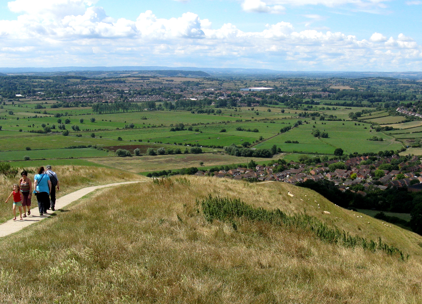
Street is a large village and civil parish in Somerset, England, with a population of 11,805 in 2011. On a dry spot in the Somerset Levels, at the end of the Polden Hills, it is south-west of Glastonbury. There is evidence of Roman occupation. Much of the history of the village is dominated by Glastonbury Abbey, and a 12th-century causeway from Glastonbury built to transport local Blue Lias stone to it. The Society of Friends was established there by the mid-17th century. One Quaker family, the Clarks, started a business in sheepskin rugs, woollen slippers and, later, boots and shoes. This became C&J Clark which still has its headquarters in Street. In 1993, redundant factory buildings were converted to form Clarks Village, the first purpose-built factory outlet in the United Kingdom. The Shoe Museum provides information about the history of Clarks and footwear manufacture in general. The Clark family's former mansion and its estate at the edge of the village are now owned b ... [...More Info...] [...Related Items...] OR: [Wikipedia] [Google] [Baidu] |


