|
Saikhan, Selenge
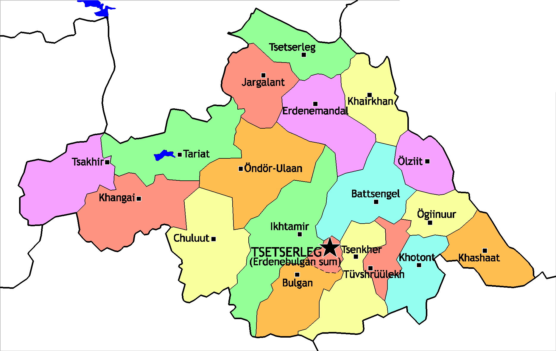
Saikhan ( mn, Сайхан, ''beautiful'') is a sum (district) of the Selenge Province in northern Mongolia. The center of the sum is the Khötöl city. The Nomgon urban-type settlement is 14 km NE from Khötöl. History Saikhan District was established in 1977 and total square meters is around 137.5. The city was established to support the Khutul lime mine and cement plant. It is bordered by Darkhan-Uul province, Bayangol district, Orkhon Province and Hushaat District. Saikhan district has approximately 8795 population and 2068 householders living there. Eventually the official name of the 'Khotol' town was established in 1984. Geography The Khotol town is 260 km away from the Capital city Ulanbator, 165 km from Sukhbaatar province, Darkhan-Uul Province it 58 km and 148 км from Orkhon Province. Transportation The town is a stop on a branch line of the Trans-Mongolian Railway connecting the copper mine in Erdenet Erdenet ( mn, Эрдэнэт, lit ... [...More Info...] [...Related Items...] OR: [Wikipedia] [Google] [Baidu] |
Districts Of Mongolia
A district ( mn, сум, , , ; "arrow"), is a second level administrative subdivision of Mongolia. The 21 Provinces of Mongolia are divided into 331 districts.Montsame News Agency. ''Mongolia''. 2006, Foreign Service office of Montsame News Agency, , p. 46 On average, each district administers a territory of with about 5,000 inhabitants, primarily nomadic herders. Its total revenue is 120 million Tögrög, 90% of which comes from national subsidies. Each district is again subdivided into ''bags'' (brigades; sometimes spelled ''baghs''). Most bags are of an entirely virtual nature. Their purpose is to sort the families of nomads in the district into groups, without a permanent human settlement. Officially, and occasionally on maps, many district seats (sum centers) bear a name different from that of the district. However, in practice the district seat (sum center) is most often referred to under the name of the district, to the point of the official name of the district se ... [...More Info...] [...Related Items...] OR: [Wikipedia] [Google] [Baidu] |
Countries Of The World
The following is a list providing an overview of sovereign states around the world with information on their status and recognition of their sovereignty. The 206 listed states can be divided into three categories based on membership within the United Nations System: 193 member states of the United Nations, UN member states, 2 United Nations General Assembly observers#Present non-member observers, UN General Assembly non-member observer states, and 11 other states. The ''sovereignty dispute'' column indicates states having undisputed sovereignty (188 states, of which there are 187 UN member states and 1 UN General Assembly non-member observer state), states having disputed sovereignty (16 states, of which there are 6 UN member states, 1 UN General Assembly non-member observer state, and 9 de facto states), and states having a political status of the Cook Islands and Niue, special political status (2 states, both in associated state, free association with New Zealand). Compi ... [...More Info...] [...Related Items...] OR: [Wikipedia] [Google] [Baidu] |
Mongolia
Mongolia; Mongolian script: , , ; lit. "Mongol Nation" or "State of Mongolia" () is a landlocked country in East Asia, bordered by Russia to the north and China to the south. It covers an area of , with a population of just 3.3 million, making it the world's most sparsely populated sovereign nation. Mongolia is the world's largest landlocked country that does not border a closed sea, and much of its area is covered by grassy steppe, with mountains to the north and west and the Gobi Desert to the south. Ulaanbaatar, the capital and largest city, is home to roughly half of the country's population. The territory of modern-day Mongolia has been ruled by various nomadic empires, including the Xiongnu, the Xianbei, the Rouran, the First Turkic Khaganate, and others. In 1206, Genghis Khan founded the Mongol Empire, which became the largest contiguous land empire in history. His grandson Kublai Khan conquered China proper and established the Yuan dynasty. After the co ... [...More Info...] [...Related Items...] OR: [Wikipedia] [Google] [Baidu] |
Provinces Of Mongolia
A province is almost always an administrative division within a country or state. The term derives from the ancient Roman ''provincia'', which was the major territorial and administrative unit of the Roman Empire's territorial possessions outside Italy. The term ''province'' has since been adopted by many countries. In some countries with no actual provinces, "the provinces" is a metaphorical term meaning "outside the capital city". While some provinces were produced artificially by colonial powers, others were formed around local groups with their own ethnic identities. Many have their own powers independent of central or federal authority, especially in Canada and Pakistan. In other countries, like China or France, provinces are the creation of central government, with very little autonomy. Etymology The English word ''province'' is attested since about 1330 and derives from the 13th-century Old French , which itself comes from the Latin word , which referred to the sphere ... [...More Info...] [...Related Items...] OR: [Wikipedia] [Google] [Baidu] |
Selenge Province
Selenge ( mn, Сэлэнгэ) is one of the 21 aimags (provinces) of Mongolia, located in the north of the country. The name is derived from the Selenge river. The capital is Sükhbaatar. The province of Darkhan-Uul Darkhan-Uul ( mn, Дархан-Уул, literally ''Blacksmith Mountain'') is one of the 21 aimags (provinces) of Mongolia. It is located in the north of the country. History The city Darkhan was founded on October 17, 1961, as a second indus ..., and its capital Darkhan, is located as an enclave inside Selenge. Administrative subdivisions * The aimag capital Sükhbaatar. References Provinces of Mongolia States and territories established in 1934 1934 establishments in Mongolia {{Mongolia-geo-stub ... [...More Info...] [...Related Items...] OR: [Wikipedia] [Google] [Baidu] |
Sums Of Mongolia
A district ( mn, сум, , , ; "arrow"), is a second level administrative subdivision of Mongolia. The 21 Provinces of Mongolia are divided into 331 districts.Montsame News Agency. ''Mongolia''. 2006, Foreign Service office of Montsame News Agency, , p. 46 On average, each district administers a territory of with about 5,000 inhabitants, primarily nomadic herders. Its total revenue is 120 million Mongolian tögrög, Tögrög, 90% of which comes from national subsidies. Each district is again subdivided into ''bags'' (brigades; sometimes spelled ''baghs''). Most bags are of an entirely virtual nature. Their purpose is to sort the families of nomads in the district into groups, without a permanent human settlement. Officially, and occasionally on maps, many district seats (sum centers) bear a name different from that of the district. However, in practice the district seat (sum center) is most often referred to under the name of the district, to the point of the official name ... [...More Info...] [...Related Items...] OR: [Wikipedia] [Google] [Baidu] |
Khötöl, Selenge
Khötöl ( mn, Хөтөл) is a town, the center of the Saikhan sum (district) of Selenge Province in northern Mongolia. The cement A cement is a binder, a chemical substance used for construction that sets, hardens, and adheres to other materials to bind them together. Cement is seldom used on its own, but rather to bind sand and gravel ( aggregate) together. Cement mix ... production plant is in the town. Populated places in Mongolia {{Mongolia-geo-stub ... [...More Info...] [...Related Items...] OR: [Wikipedia] [Google] [Baidu] |
Nomgon, Selenge
Nomgon ( mn, Номгон) is an urban-type settlement in the Saikhan sum (district) of Selenge Province in northern Mongolia Mongolia; Mongolian script: , , ; lit. "Mongol Nation" or "State of Mongolia" () is a landlocked country in East Asia, bordered by Russia to the north and China to the south. It covers an area of , with a population of just 3.3 million, .... The settlement population is 2,200 (200 Populated places in Mongolia {{Mongolia-geo-stub ... [...More Info...] [...Related Items...] OR: [Wikipedia] [Google] [Baidu] |
Trans-Mongolian Railway
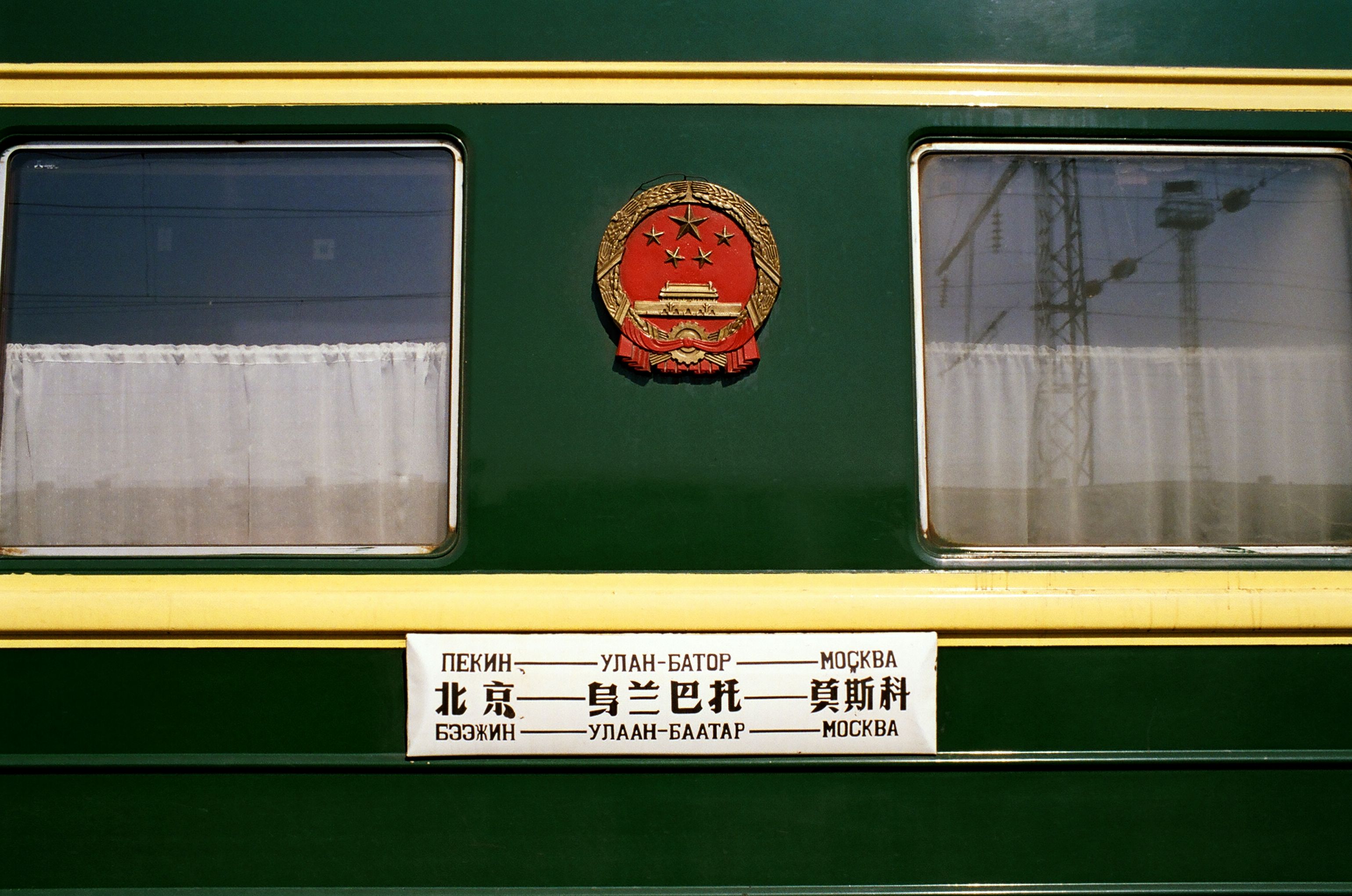
, map_name = , map_state = collapsed , embedded = The Trans-Mongolian Railway follows an ancient tea-caravan route from China to Russia and connects Ulan-Ude, on the Trans–Baikal ( Trans–Siberian) railway in Russia, with the Chinese city of Jining, by way of Ulaanbaatar in Mongolia. Other important stops are Sükhbaatar, Darkhan, Choir, and Zamyn-Üüd/Erenhot (border crossing and gauge-changing station). The line was built between 1949 and 1961. In most of Mongolia, it is single track, and in China double track. The gauge is in Russia and Mongolia and in China. There are important branches leading to Erdenet and Baganuur. History Railway development came late to Mongolia. Construction of the Trans-Mongolian line began in 1947, reaching Ulan Bator from the north in 1950 and the Chinese border in 1955. Before that the only railways in Mongolia had been a line (opened in 1938) connecting the coal mines at Nalaikh to the capital and a So ... [...More Info...] [...Related Items...] OR: [Wikipedia] [Google] [Baidu] |
Erdenet
Erdenet ( mn, Эрдэнэт, literally "with treasure") is the third-largest city in Mongolia, with a 2018 population of 98,045, and the capital of the aimag (province) of Orkhon. Located in the northern part of the country, it lies in a valley between the Selenge and Orkhon rivers about (as the crow flies) northwest of Ulaanbaatar, Darkhan, the capital. The road length between Ulaanbaatar and Erdenet is about . History Erdenet, one of the youngest settlements in Mongolia, was founded in 1974Michael Kohn: ''Mongolia'', p. 142, London (2008) in an area where large deposits of copper had been discovered in the 1950s. A single-track railway line with a length of linking Erdenet to the Trans-Mongolian Railway was inaugurated in 1977. In the middle of the 1980s, more than 50% of the inhabitants were Russians working as engineers or miners. After the fall of Soviet Communism in 1990, however, most Russians left Erdenet. Today, about 10% of the population is Russian. Erdenet Mini ... [...More Info...] [...Related Items...] OR: [Wikipedia] [Google] [Baidu] |
Populated Places In Mongolia
Population typically refers to the number of people in a single area, whether it be a city or town, region, country, continent, or the world. Governments typically quantify the size of the resident population within their jurisdiction using a census, a process of collecting, analysing, compiling, and publishing data regarding a population. Perspectives of various disciplines Social sciences In sociology and population geography, population refers to a group of human beings with some predefined criterion in common, such as location, race, ethnicity, nationality, or religion. Demography is a social science which entails the statistical study of populations. Ecology In ecology, a population is a group of organisms of the same species who inhabit the same particular geographical area and are capable of interbreeding. The area of a sexual population is the area where inter-breeding is possible between any pair within the area and more probable than cross-breeding with ind ... [...More Info...] [...Related Items...] OR: [Wikipedia] [Google] [Baidu] |


