|
Sahtu
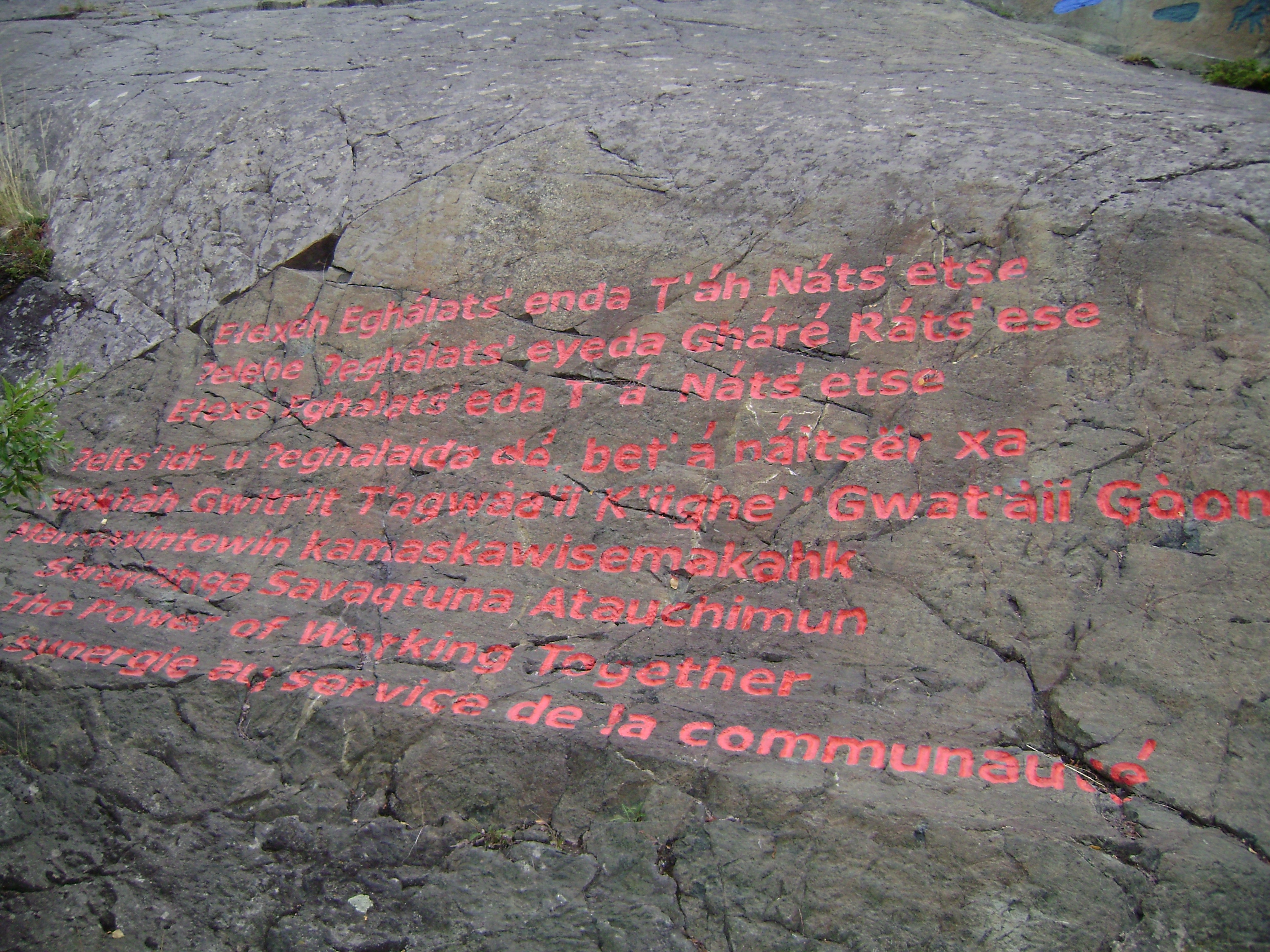
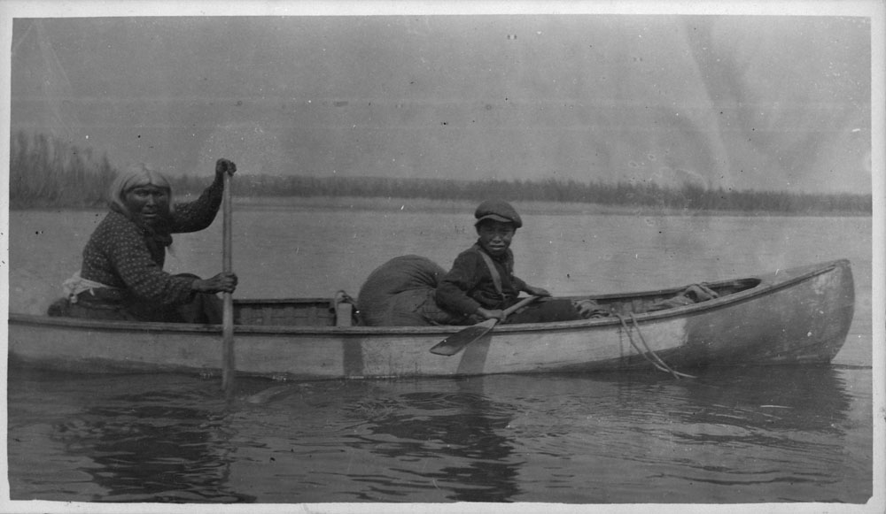
The Sahtú or North Slavey (historically called ''Hare'' or ''Hareskin Indians'') are a Dene First Nations people of the Athabaskan-speaking ethnolinguistic group living in the vicinity of Great Bear Lake (''Sahtú'', the source of their name), Northwest Territories, Canada. The Sahtú peoples live in Colville Lake, Deline, Fort Good Hope, Norman Wells and Tulita which form the Sahtu Region of the NWT. The Dene of the region are represented by the Sahtu Dene Council who, in 1993, signed the Sahtu Dene and Metis Comprehensive Land Claim Agreement. Sahtú groups include the ''Hare Dene'' (K'ahsho Got'ine District, today: Colville Lake and Fort Good Hope), ''Bear Lake Dene'' (Déline District), and ''Mountain Dene'' (Tulit'a District). They call themselves also ''Ɂehdzo Got’ı̨ne'' (Trap People). Ethnography An early description of Sahtú cultures is given in Alexander Mackenzie's journal of his voyage down the Mackenzie River to the Arctic Ocean in 1789. Although ther ... [...More Info...] [...Related Items...] OR: [Wikipedia] [Google] [Baidu] |
Sahtu Region
The Sahtu Region is an administrative region in Canada's Northwest Territories. Coterminous with the settlement region described in the 1993 Sahtu Dene and Metis Comprehensive Land Claim Agreement, of the Sahtu is collectively owned by its Indigenous Sahtu (Dene) and Métis inhabitants. Although the region's population is predominantly First Nations, a significant non-Indigenous presence exists in Norman Wells, the regional office, established in 1920 to serve the only producing oilfield in the Canadian Territories. Considered to be of vital strategic importance during World War II in the event of a Japanese invasion of Alaska, the region's petroleum resources were exploited by the United States Army with the Canol pipeline, but the project never became necessary and ultimately operated for less than one year. Since the abandonment of the Canol project, development within the region has been more limited than in the rest of the territory. Although plans have long existed for p ... [...More Info...] [...Related Items...] OR: [Wikipedia] [Google] [Baidu] |
Norman Wells
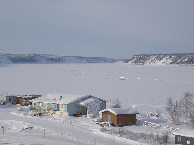
Norman Wells ( Slavey language: ''Tłegǫ́hłı̨'' "where there is oil") is a town located in the Sahtu Region, Northwest Territories, Canada, settled about 140 km (87 mi) south of the Arctic Circle. The town, which hosts the Sahtu Regional office, is situated on the north side of the Mackenzie River and provides a view down the valley of the Franklin and Richardson mountains. Demographics In the 2021 Census of Population conducted by Statistics Canada, Norman Wells had a population of living in of its total private dwellings, a change of from its 2016 population of . With a land area of , it had a population density of in 2021. A total of 315 people identified as Indigenous, and of these, 195 were First Nations, 80 were Métis, 15 were Inuit and 20 gave multiple Indigenous responses. The main languages in the town are North Slavey and English. Of the population, 78.1% is 15 and older, with the median age being 32.8, slightly less than the NWT averages of 79.3% and 3 ... [...More Info...] [...Related Items...] OR: [Wikipedia] [Google] [Baidu] |
Tulita
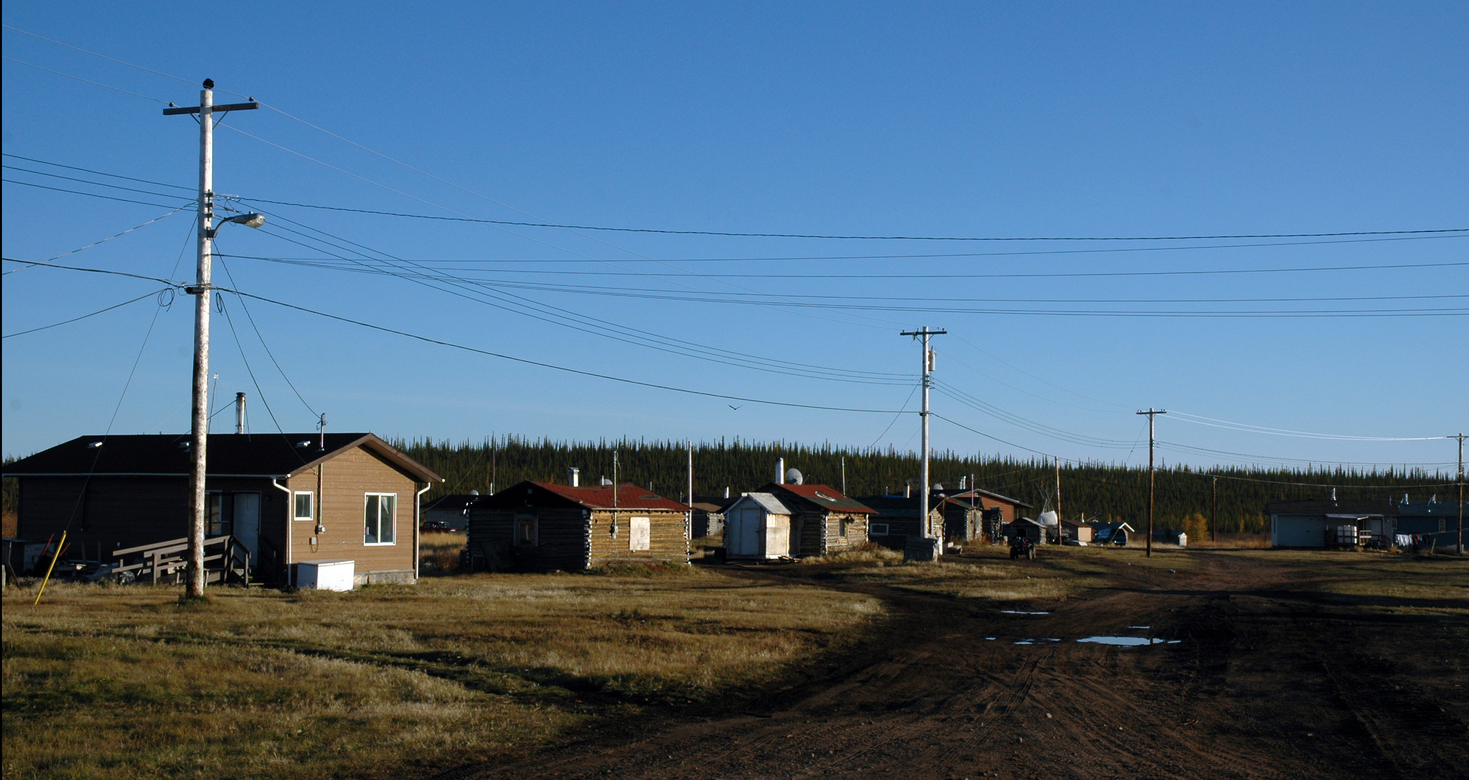
Tulita, which in Slavey means "where the rivers or waters meet," is a hamlet in the Sahtu Region of the Northwest Territories, Canada. It was formerly known as ''Fort Norman'', until 1 January 1996. It is located at the junction of the Great Bear River and the Mackenzie River; the Bear originates at Great Bear Lake adjacent to Deline. Tulita is in an area that is forested and well south of the tree line. Permafrost underlays the area, more or less continuous in distribution. Tulita is surrounded by mountains, the latter renowned for Dall sheep, and faces the Mackenzie Mountains to the west, which has mountain goats. History Fort Norman originated as a Hudson's Bay Company trading post in the 19th century and has occupied a number of geographical locations prior to the settling of the modern community. A post by the name of Fort Norman occupied several locations, on the Mackenzie River, on the islands within it, on Bear River, and on the shore of Great Bear Lake near the pres ... [...More Info...] [...Related Items...] OR: [Wikipedia] [Google] [Baidu] |
Sahtu Dene Council
The Sahtu Dene Council is a council that represents the Sahtu people of the Northwest Territories, Canada. The council signed a comprehensive land claim agreement in 1993 with the Government of Canada, the Sahtu Dene and Metis Comprehensive Land Claim Agreement, for the seven Dene and Métis communities in the Sahtu Region. It is the first such agreement to include three Métis members (Tulita, Fort Good Hope and Norman Wells) in the Northwest Territories. The Sahtu Secretariat Incorporated and various designated organizations implement the agreement and pursue ongoing negotiations. The Sahtu Dene Council represents the four Indian Band councils. Members *Begade Shotagotine (Tulita Land & Financial Corporation) - Tulita *Behdzi Ahda First Nation (Ayoni Keh Land Corporation) - Colville Lake *Deline First Nation (Deline Got'ine Government) - Deline *K’sasho Go’tine Community Council (Yamogo Land Corporation) - Fort Good Hope Fort Good Hope (formerly ''Fort Hope'', ''Fort Cha ... [...More Info...] [...Related Items...] OR: [Wikipedia] [Google] [Baidu] |
Colville Lake, Northwest Territories
Colville Lake (''K'áhbamį́túé'' meaning "ptarmigan net place") is a settlement corporation located in the Sahtu Region of the Northwest Territories, Canada. The community is located north of the Arctic Circle, on a lake of the same name, and is northeast of Norman Wells. This settlement is the administrative office of the Behdzi Ahda band government. The community is likely named for Hudson's Bay Company Governor Andrew Colvile. Demographics In the 2021 Census of Population conducted by Statistics Canada, Colville Lake had a population of living in of its total private dwellings, a change of from its 2016 population of . With a land area of , it had a population density of in 2021. The GNWT has reported that the majority, 148 people, were Indigenous, Sahtu Dene. They are represented by the Behdzi Ahda' First Nation and belong to the Sahtu Dene Council Geography and climate Colville Lake is located by air, northwest of Yellowknife. The terrain is characterized b ... [...More Info...] [...Related Items...] OR: [Wikipedia] [Google] [Baidu] |
Sahtu Dene And Metis Comprehensive Land Claim Agreement
The Sahtu Dene and Metis Comprehensive Land Claim Agreement, is a comprehensive lands claim agreement between The Crown in the right of Canada and the Dene and Métis of the Sahtu area in the Northwest Territories. The agreement was signed by the Chiefs of the Sahtu Dene bands, the presidents of the Metis Locals, the Minister of Indian Affairs, and the Premier of the Northwest Territories on September 6, 1993, in Tulita (then called Fort Norman) and came into effect on June 23, 1994. The agreement is a Modern Treaty which is protected by Section 35 of the Constitution of Canada. The agreement includes recognizing Sahtu Dene and Metis ownership of 41,437 km² of land in the Mackenzie River Valley. This includes subsurface or mineral rights to 1,813 km² of land. The Government of Canada agreed to negotiate self-government agreements on a community by community basis with the five Sahtu communities of Colville Lake, Fort Good Hope, Tulita, Deline, and Norman Wells ... [...More Info...] [...Related Items...] OR: [Wikipedia] [Google] [Baidu] |
Fort Good Hope
Fort Good Hope (formerly ''Fort Hope'', ''Fort Charles'', also now known as the ''Charter Community of K'asho Got'ine''), is a charter community in the Sahtu Region of the Northwest Territories, Canada. It is located on a peninsula between Jackfish Creek and the east bank of the Mackenzie River, about northwest of Norman Wells. The two principal languages are North Slavey and English. Hunting and trapping are two major sources of income. The Church of Our Lady of Good Hope, a National Historic Site, is located in the community. The church, completed in 1885, was once home to Father Émile Petitot. History The settlement was established as a North West Company fur trading outpost in 1804 (or 1805). It was known mainly as Fort Good Hope, but also as Fort Hope and Fort Charles (not the same as the HBC fort from 1686) The outpost was relocated several times from the current site; between 1804 to before 1823 somewhere between Arctic Red River and Peel River (by NWC and HBC) ... [...More Info...] [...Related Items...] OR: [Wikipedia] [Google] [Baidu] |
Slavey Language
Slavey (; also Slave, Slavé) is a group of Athabaskan languages and a dialect continuum spoken amongst the Dene peoples of Canada in the Northwest Territories – or central Denendeh – where it also has official status.Northwest Territories Official Languages Act, 1988 (as amended 1988, 1991-1992, 2003) The languages are primarily written using a modified , with some using Canadian Aboriginal syllabics. In their own languages, these languages are referred to as: Sahtúgot’įné Yatı̨́ (spoken by the [...More Info...] [...Related Items...] OR: [Wikipedia] [Google] [Baidu] |
Slavey People
The Slavey (also Slave and South Slavey) are a First Nations indigenous peoples of the Dene group, indigenous to the Great Slave Lake region, in Canada's Northwest Territories, and extending into northeastern British Columbia and northwestern Alberta. Name Cree exonym "slave" ''Slavey'' or just ''Slave'' is a translation of the name given to ''Dene'' by the Cree "who sometimes raided and enslaved their less aggressive northern neighbors". The names of the Slave River, Lesser Slave River, Great Slave Lake, and Lesser Slave Lake all derive from this Cree name. ''Esclaves'' remains incorporated in the French names of these geographical features, since the French traded with the Cree before the English did. The people now called ''Slavey'' in English were not necessarily taken as slaves in that period. Dehcho autonym The name Slavey is seldom used by the people themselves, who call themselves ''Dene.'' Indigenous ethnonyms for South Slavey people and language are Dehcho, Deh Cho D ... [...More Info...] [...Related Items...] OR: [Wikipedia] [Google] [Baidu] |
Slavey
The Slavey (also Slave and South Slavey) are a First Nations indigenous peoples of the Dene group, indigenous to the Great Slave Lake region, in Canada's Northwest Territories, and extending into northeastern British Columbia and northwestern Alberta. Name Cree exonym "slave" ''Slavey'' or just ''Slave'' is a translation of the name given to ''Dene'' by the Cree "who sometimes raided and enslaved their less aggressive northern neighbors". The names of the Slave River, Lesser Slave River, Great Slave Lake, and Lesser Slave Lake all derive from this Cree name. ''Esclaves'' remains incorporated in the French names of these geographical features, since the French traded with the Cree before the English did. The people now called ''Slavey'' in English were not necessarily taken as slaves in that period. Dehcho autonym The name Slavey is seldom used by the people themselves, who call themselves ''Dene.'' Indigenous ethnonyms for South Slavey people and language are Dehcho, Deh Cho D ... [...More Info...] [...Related Items...] OR: [Wikipedia] [Google] [Baidu] |
Dene
The Dene people () are an Aboriginal peoples in Canada, indigenous group of First Nations in Canada, First Nations who inhabit the northern Boreal forest of Canada, boreal and Arctic regions of Canada. The Dene speak Northern Athabaskan languages. ''Dene'' is the common Athabaskan word for "people". The term "Dene" has two usages. More commonly, it is used narrowly to refer to the Athabaskan speakers of the Northwest Territories and Nunavut in Canada, especially including the Chipewyan (Denesuline), Tlicho (''Dogrib''), Yellowknives (T'atsaot'ine), Slavey people, Slavey (Deh Gah Got'ine or Deh Cho), and Sahtu (the Eastern group in Jeff Leer's classification; part of the Northwestern Canada group in Keren Rice's classification). However, it is sometimes also used to refer to all Northern Athabaskan speakers, who are spread in a wide range all across Alaska and northern Canada. The Southern Athabaskan speakers, however, also refer to themselves by similar words: Navajo people, D ... [...More Info...] [...Related Items...] OR: [Wikipedia] [Google] [Baidu] |
Northwest Territories
The Northwest Territories (abbreviated ''NT'' or ''NWT''; french: Territoires du Nord-Ouest, formerly ''North-Western Territory'' and ''North-West Territories'' and namely shortened as ''Northwest Territory'') is a federal territory of Canada. At a land area of approximately and a 2016 census population of 41,790, it is the second-largest and the most populous of the three territories in Northern Canada. Its estimated population as of 2022 is 45,605. Yellowknife is the capital, most populous community, and only city in the territory; its population was 19,569 as of the 2016 census. It became the territorial capital in 1967, following recommendations by the Carrothers Commission. The Northwest Territories, a portion of the old North-Western Territory, entered the Canadian Confederation on July 15, 1870. Since then, the territory has been divided four times to create new provinces and territories or enlarge existing ones. Its current borders date from April 1, 1999, when the ... [...More Info...] [...Related Items...] OR: [Wikipedia] [Google] [Baidu] |


