|
SR-111 (UT)
State Route 111 (SR-111) is a state highway in the U.S state of Utah that runs north–south across the west side of the Salt Lake Valley in Salt Lake County. It connects SR-201 in Magna to SR-209 in West Jordan in a span of . It is known as 8400 West and Bacchus Highway throughout the route's course, in respect of north to south. Prior to 1969, SR-111 extended past SR-209 (then SR-48) and passed through Herriman before terminating at SR-71. Route description The route begins at a junction with SR-209 on the rural western end of West Jordan, near Copperton. It continues north as a two-lane road and curves northwest past its junction with 7800 South. The highway widens to four lanes by the time 5400 West terminates on the road. Past 5400 West, SR-111 turns north and passes the ghost town of Bacchus, where there is currently an industrial presence. SR-111 continues into Magna and cuts a path through the center of the town before terminating at SR-201, an expressway/freeway th ... [...More Info...] [...Related Items...] OR: [Wikipedia] [Google] [Baidu] |
Utah Department Of Transportation
The Utah Department of Transportation (UDOT) is an agency of the state government of Utah, United States; it is usually referred to by its initials UDOT (pronounced "you-dot"). UDOT is charged with maintaining the more than of roadway that constitute the network of state highways in Utah. The agency is headquartered in the Cal Rampton, Calvin L. Rampton state office complex in Taylorsville, Utah, Taylorsville, Utah. The executive director is Carlos Braceras with Lisa Wilson and Teri Newell as Deputy Directors. Project priorities are set forth by the independent Utah Transportation Commission, which coordinates directly with the UDOT. Structure UDOT maintains over of highways. The department is divided into four geographically defined regions and 10 functional groups: project development; operations; program development; technology and innovation; employee development; communications; policy and legislative services; audit; and finance. While the agency has maintenance stati ... [...More Info...] [...Related Items...] OR: [Wikipedia] [Google] [Baidu] |
National Highway System (United States)
The National Highway System (NHS) is a network of strategic highways within the United States, including the Interstate Highway System and other roads serving major airports, ports, military bases, rail or truck terminals, railway stations, pipeline terminals and other strategic transport facilities. Altogether, it constitutes the largest highway system in the world. Individual states are encouraged to focus federal funds on improving the efficiency and safety of this network. The roads within the system were identified by the United States Department of Transportation (USDOT) in cooperation with the states, local officials, and metropolitan planning organizations (MPOs) and approved by the United States Congress in 1995. Legislation The Intermodal Surface Transportation Efficiency Act (ISTEA) in 1991 established certain key routes such as the Interstate Highway System, be included. The act provided a framework to develop a National Intermodal Transportation System which "cons ... [...More Info...] [...Related Items...] OR: [Wikipedia] [Google] [Baidu] |
SR-209 (UT)
State Route 209 (SR-209) is a state highway in the U.S. state of Utah, following 9000 South and other east–west streets south of Salt Lake City. It connects the Bingham Canyon Mine with I-15 in Sandy and the ski areas of Little Cottonwood Canyon. Route description The road begins at the gate to the Bingham Canyon Mine and heads northeast as a two-lane undivided highway on the Bingham Highway. The road enters the town of Copperton and turns east. After exiting the town, the Bingham Highway splits into the Old and New Bingham Highway, with SR-209 turning northeast on the latter. The highway enters West Jordan and widens to four lanes as it curves east into 9000 South, just before crossing the Mountain View Corridor. After crossing 5600 West, the route heads downhill within the Salt Lake Valley. It crosses the Savage Bingham and Garfield Railroad line to the Bingham Canyon Mine (ex- D&RGW) at Welby, as well as Bangerter Highway and Utah State Route 68, SR-68 before it reache ... [...More Info...] [...Related Items...] OR: [Wikipedia] [Google] [Baidu] |
Copperton, UT
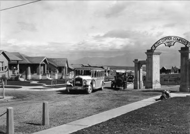
Copperton is a metro township in Salt Lake County, Utah, United States, located at the mouth of Bingham Canyon, approximately southwest of Salt Lake City. The metro township boundaries include a smaller area than that of both the former CDP (designated by the U.S. Census) and the former township. Much of the town is included in the Copperton Historic District, which is listed on the National Register of Historic Places. Demographics History Copperton was established in 1926, by the Utah Copper Company as a residential area and "model city" for its employees. It emerged as a "showplace for company-subsidized family life." Housing construction ended in the 1930s, and company-furnished housing ended in 1955. After that, a private real estate developer managed the homes for employees. A rather large park was also built in the small town. As of the 2010 Census, Copperton has a population of 826. Copperton is the only mining town remaining for the Bingham Canyon Mine afte ... [...More Info...] [...Related Items...] OR: [Wikipedia] [Google] [Baidu] |
SR-201 (UT)
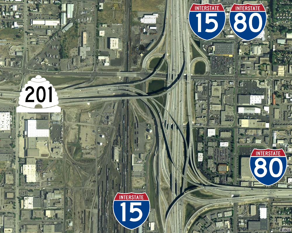
State Route 201 (SR-201) is an east–west expressway and freeway located in Salt Lake County in the U.S. state of Utah. Colloquially known by some as the ''21st South Freeway'', the route serves as an alternative to Interstate 80 (I-80) through Salt Lake City. From the western terminus of the route west of Magna, the highway heads east through Kennecott Copper property as an expressway before running through the western suburbs of Salt Lake City as a freeway. Shortly after the route returns on a surface route, SR-201 terminates on its eastern end at State Street State Street may refer to: Streets and locations *State Street (Chicago), Illinois * State Street (Portland, Maine) *State Street (Boston), Massachusetts *State Street (Ann Arbor), Michigan * State Street (Albany), New York *State Street (Manhatta ... (U.S. Route 89 in Utah, U.S. Route 89). The history of the route predates the invention of the automobile; the Donner Party, California Trail and Pony Express all foll ... [...More Info...] [...Related Items...] OR: [Wikipedia] [Google] [Baidu] |
Sandy, UT
Sandy is a city in the Salt Lake City metropolitan area, located in Salt Lake County, Utah, United States. The population of Sandy was 87,461 at the 2010 census, making it the sixth-largest city in Utah. The population is currently estimated to be about 96,380 according to the July 1, 2019 United States Census estimates. Sandy is home to the Shops at South Town shopping mall; the Jordan Commons entertainment, office and dining complex; and the Mountain America Exposition Center. It is also the location of the soccer-specific America First Field (formerly known as Rio Tinto Stadium), which hosts Real Salt Lake and Utah Royals FC home games, and opened on October 8, 2008. The city is currently developing a walkable and transit-oriented city center called The Cairns. A formal master plan was adopted in January 2017 to accommodate regional growth and outlines developments and related guidelines through the next 25 years, while dividing the city center into distinct villages. T ... [...More Info...] [...Related Items...] OR: [Wikipedia] [Google] [Baidu] |
Magna, UT
Magna ( ) is a metro township in Salt Lake County, Utah, United States. The current population of the township stands at 29,251 according to the 2020 census, a 10.4% increase over 26,505 in 2010. History Settlement Settlement of the area began in 1851 shortly after pioneers reached the Salt Lake Valley. Early farmers settled in 1868 at the base of the northern Oquirrh Mountains and called their community Pleasant Green. By 1900, there were about 20 families in the area. One of the first Pleasant Green farmers was Abraham Coon, who established a livestock ranch and settlement called Coonville in a canyon mouth at about 5400 South now known as Coon Canyon. Coon Creek flows out of Coon Canyon and is one of the major Oquirrh Mountain drainages. Coon Creek flows north and west through Magna to the Great Salt Lake. The Pleasant Green Cemetery located in the Oquirrh foothills, at about 3500 South, was established in 1883. In 1890, in response to a law requiring all children to rece ... [...More Info...] [...Related Items...] OR: [Wikipedia] [Google] [Baidu] |
SR-171 (UT)
State Route 171 (SR-171) is a state highway in the Salt Lake City metropolitan area in northern Utah that runs from SR-111 in Magna in the west side of the city to Interstate 215 in the city of Millcreek in the eastern part valley. In its sixteen-mile span, the route is named 3500 South and 3300 South. Route description From SR-111 in Magna, the highway (known as 3500 South) runs due east with between one and four general-purpose lanes in each direction until its junction with Redwood Road ( SR-68), where it veers to the northeast before again straightening out to the east. Other than the west end, this portion is entirely within West Valley City. The route passes through the former towns (now neighborhoods) of Hunter and Granger as well as West Valley City's modern downtown area near I-215 (which overlaps with historic Granger). The intersection with Bangerter Highway ( SR-154) was the first continuous flow intersection built in Utah. At the intersection with 2700 West just ... [...More Info...] [...Related Items...] OR: [Wikipedia] [Google] [Baidu] |
Oquirrh Mountains
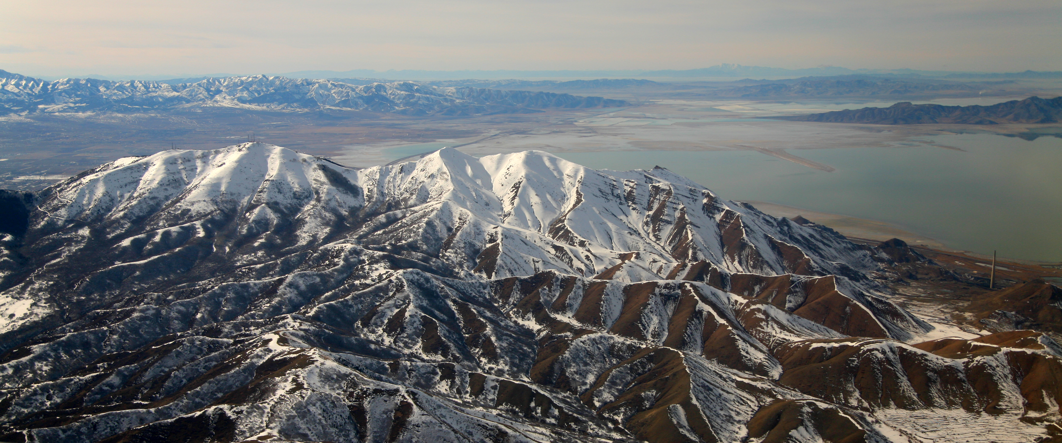
The Oquirrh Mountains is a mountain range that runs north-south for approximately 30 miles (50 km) to form the west side of Utah's Salt Lake Valley, separating it from Tooele Valley. The range runs from northwestern Utah County–central & eastern Tooele County, to the south shore of the Great Salt Lake. The highest elevation is Flat Top Mountain at 10,620 ft (3,237 m). The name Oquirrh was taken from the Goshute word meaning "wood sitting."William Bright, ed. ''Native American Placenames of the United States'' (2004, University of Oklahoma Press) The Oquirrh Mountains have been mined for gold, silver, lead, and most famously for copper, as home of the porphyry copper deposit at Bingham Canyon Mine The Bingham Canyon Mine, more commonly known as Kennecott Copper Mine among locals, is an open-pit mining operation extracting a large porphyry copper deposit southwest of Salt Lake City, Utah, in the Oquirrh Mountains. The mine is the largest m ..., one of the worl ... [...More Info...] [...Related Items...] OR: [Wikipedia] [Google] [Baidu] |
Lark, Utah
Lark is a ghost town located west of Herriman in the Oquirrh Mountains of southwest Salt Lake County, Utah, United States. Lark was the location of several copper mines. History The discovery of gold in Bingham Canyon in 1863 brought a rush of prospectors, two of whom were named ''Dalton'' and ''Lark''. Settlements with these names grew up around the two mining claims, but Dalton was later merged into Lark. The town of Lark was officially established January 3, 1866. The town had enough Latter-day Saint residents by 1918 to be made a ward, but by 1923, the ward was reduced to a branch. It had 234 members in 1930.Jenson, Andrew. ''Encyclopedic History of the Church of Jesus Christ of Latter-day Saints'', (Salt Lake City: Deseret Book, 1941) p.414. By 1929, Lark was a company town of the United States Smelting and Refining Company, which expanded the town through the 1940s and 1950s. At its peak, the population exceeded 800. Then the nearby non-copper mines began to close, and t ... [...More Info...] [...Related Items...] OR: [Wikipedia] [Google] [Baidu] |
Herriman, UT
Herriman ( ) is a city in southwestern Salt Lake County, Utah. The population was 55,144 as of the 2020 census. Although Herriman was a town in 2000, it has since been classified as a fourth-class city by state law. The city has experienced rapid growth since incorporation in 1999, as its population was just 1,523 at the 2000 census. It grew from being the 111th-largest incorporated place in Utah in 2000 to the 14th-largest in 2020. History Founding Herriman was established in 1851 by Henry Harriman, Thomas Jefferson Butterfield, John Jay Stocking, and Robert Cowan Petty. A fort was established where the community garden is today. The only remnants of Fort Herriman are the two black locust trees that stand where the entrance to the fort once was. The Fort was abandoned in 1857 as the Johnston Army came West. Incorporation Herriman remained a small community until 1999, when proactive citizens, including Brett Wood and J. Lynn Crane, went door to door asking people to sig ... [...More Info...] [...Related Items...] OR: [Wikipedia] [Google] [Baidu] |
Riverton, UT
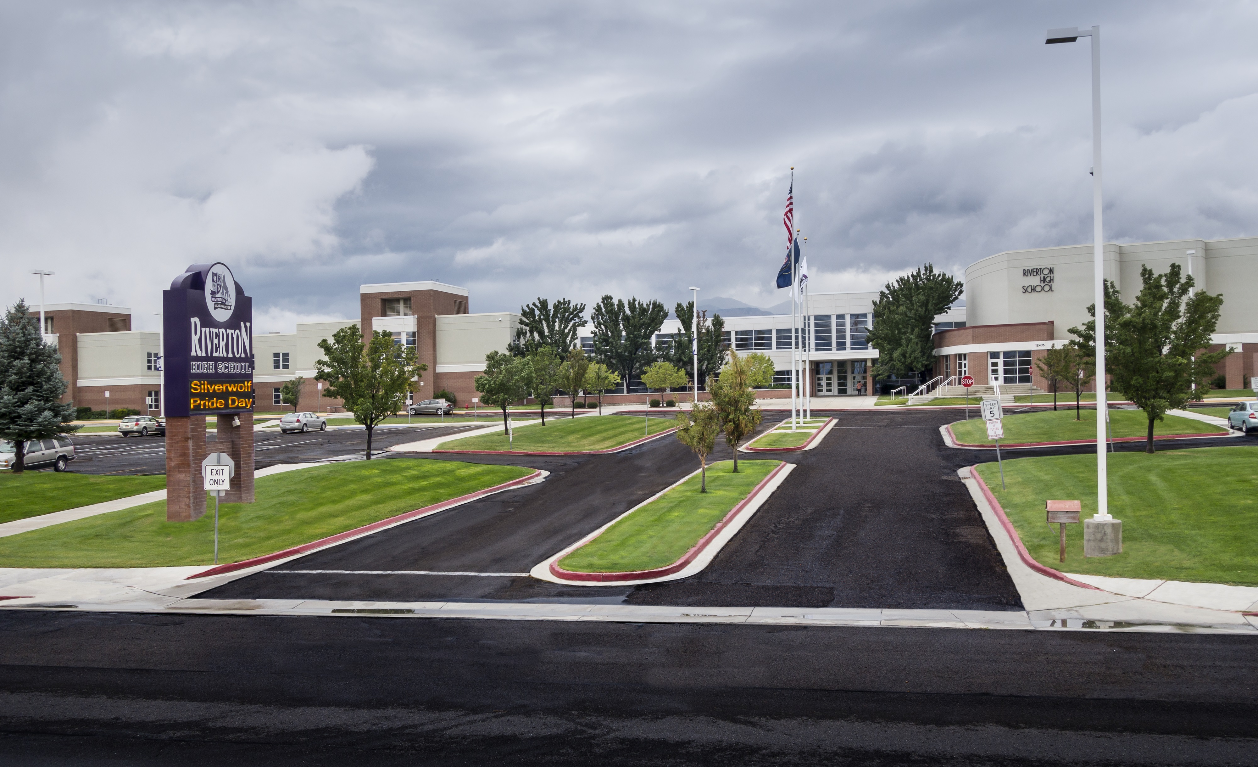
Riverton is a city in Salt Lake County, Utah, United States. It is part of the Salt Lake City, Utah Metropolitan Statistical Area. The population was 45,285 as of the 2020 census. Riverton is located in the rapidly growing southwestern corner of the Salt Lake Valley. Education Public education in Riverton is provided by the Jordan School District, one of the largest school districts in Utah. Elementary Schools: Foothills Elementary, Midas Creek Elementary, Riverton Elementary, Rosamond Elementary, Rose Creek Elementary, Southland Elementary Middle Schools: Oquirrh Hills Middle School, South Hills Middle School High School: Riverton High School Kauri Sue Hamilton School for students with special needs, Jordan Academy for Technology and Careers (JATC) south campus, and Saint Andrew Catholic School are also located in the community. Many students from Riverton attend schools in Bluffdale, Herriman and South Jordan, as school boundaries do not coincide with city boundaries. ... [...More Info...] [...Related Items...] OR: [Wikipedia] [Google] [Baidu] |


