|
SEPTA Route 38
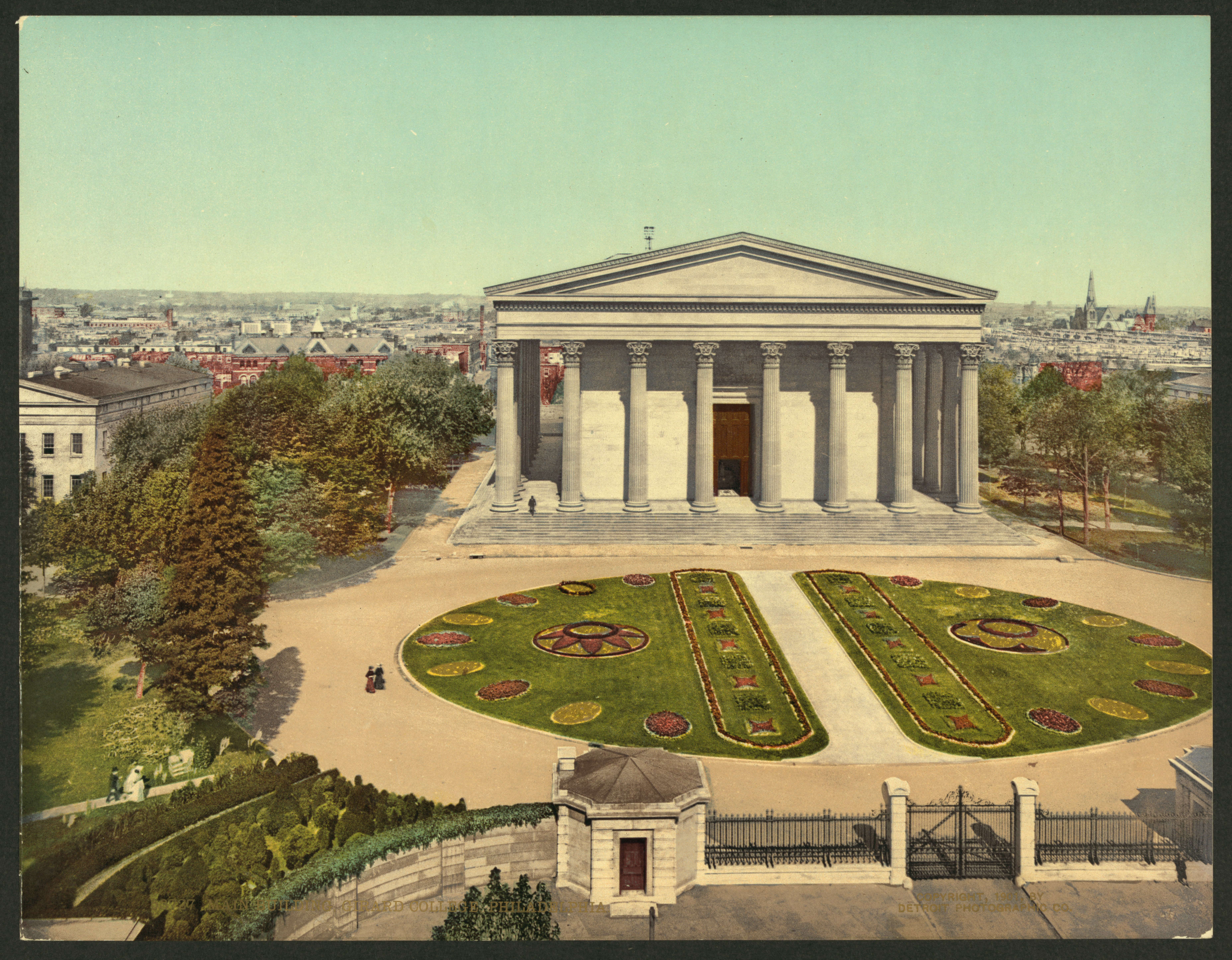
Route 38 is a bus and former streetcar route operated by the Southeastern Pennsylvania Transportation Authority (SEPTA) in Philadelphia, Pennsylvania, United States. Route description Starting at the Wissahickon Transfer Center, Route 38 crosses the Schuylkill River along City Avenue, winds its way through the River Park neighborhood to Belmont Avenue and the Please Touch Museum in Fairmount Park. Turning southeast, the route continues along Parkside Avenue, 40th Street, Mantua Avenue and Spring Garden Street. After recrossing the Schuylkill River and circling the Philadelphia Museum of Art, the route enters Downtown via Benjamin Franklin Parkway and 20th Street. Buses reach 5th and Market Streets by way of Market and Chestnut Streets, and return on Market Street and JFK Boulevard. History Streetcar service The original streetcar line ran from Parkside Loop on Parkside Avenue (where it connected with the Fairmount Park trolley) to Market Street and Delaware Avenue (now Colu ... [...More Info...] [...Related Items...] OR: [Wikipedia] [Google] [Baidu] |
SEPTA
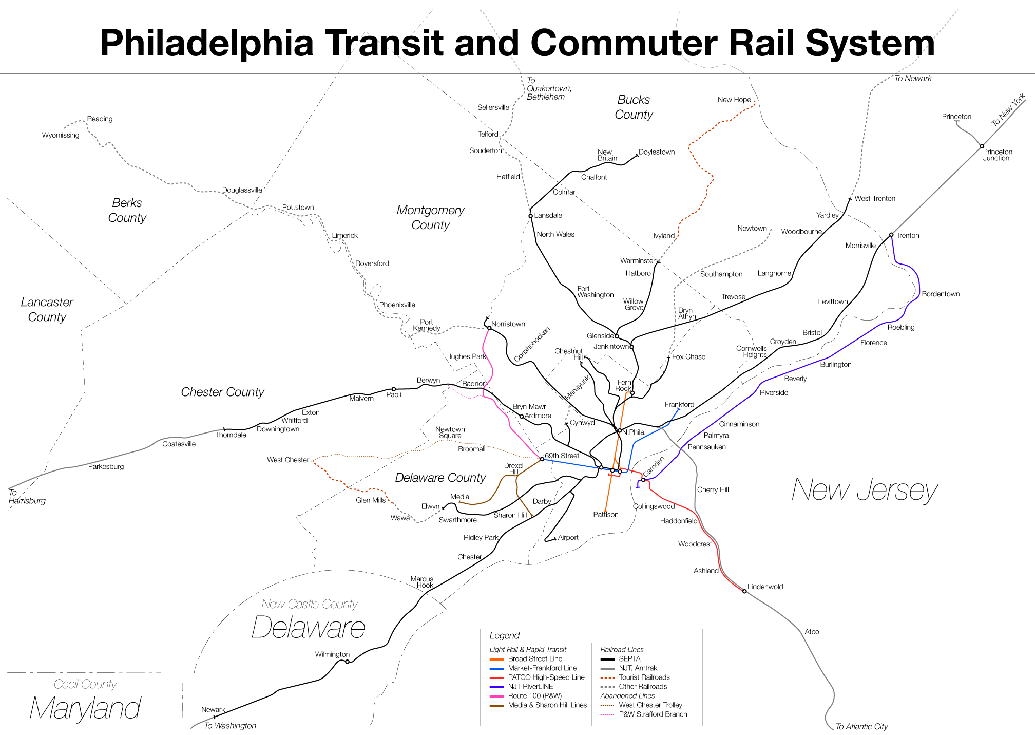
The Southeastern Pennsylvania Transportation Authority (SEPTA) is a regional public transportation authority that operates bus, rapid transit, commuter rail, light rail, and electric trolleybus services for nearly 4 million people in five counties in and around Philadelphia, Pennsylvania. It also manages projects that maintain, replace and expand its infrastructure, facilities and vehicles. SEPTA is the major transit provider for Philadelphia and the counties of Delaware, Montgomery, Bucks, and Chester. It is a state-created authority, with the majority of its board appointed by the five Pennsylvania counties it serves. While several SEPTA commuter rail lines terminate in the nearby states of Delaware and New Jersey, additional service to Philadelphia from those states is provided by other agencies: the PATCO Speedline from Camden County, New Jersey is run by the Delaware River Port Authority, a bi-state agency; NJ Transit operates many bus lines and a commuter rail line to ... [...More Info...] [...Related Items...] OR: [Wikipedia] [Google] [Baidu] |
Fairmount Park
Fairmount Park is the largest municipal park in Philadelphia and the historic name for a group of parks located throughout the city. Fairmount Park consists of two park sections named East Park and West Park, divided by the Schuylkill River, with the two sections together totalling . Management of Fairmount Park and the entire citywide park system is overseen by Philadelphia Parks & Recreation, a city department created in 2010 from the merger of the Fairmount Park Commission and the Department of Recreation. Many of the city’s other parks had historically also been included in the Fairmount Park system prior to 2010, including Wissahickon Valley Park in Northwest Philadelphia, Pennypack Park in Northeast Philadelphia, Cobbs Creek Park in West Philadelphia, Franklin Delano Roosevelt Park in South Philadelphia, and 58 additional parks, parkways, plazas, squares, and public golf courses spread throughout the city. Since the 2010 merger, however, the term "Fairmount Park system" i ... [...More Info...] [...Related Items...] OR: [Wikipedia] [Google] [Baidu] |
Bala Cynwyd, Pennsylvania
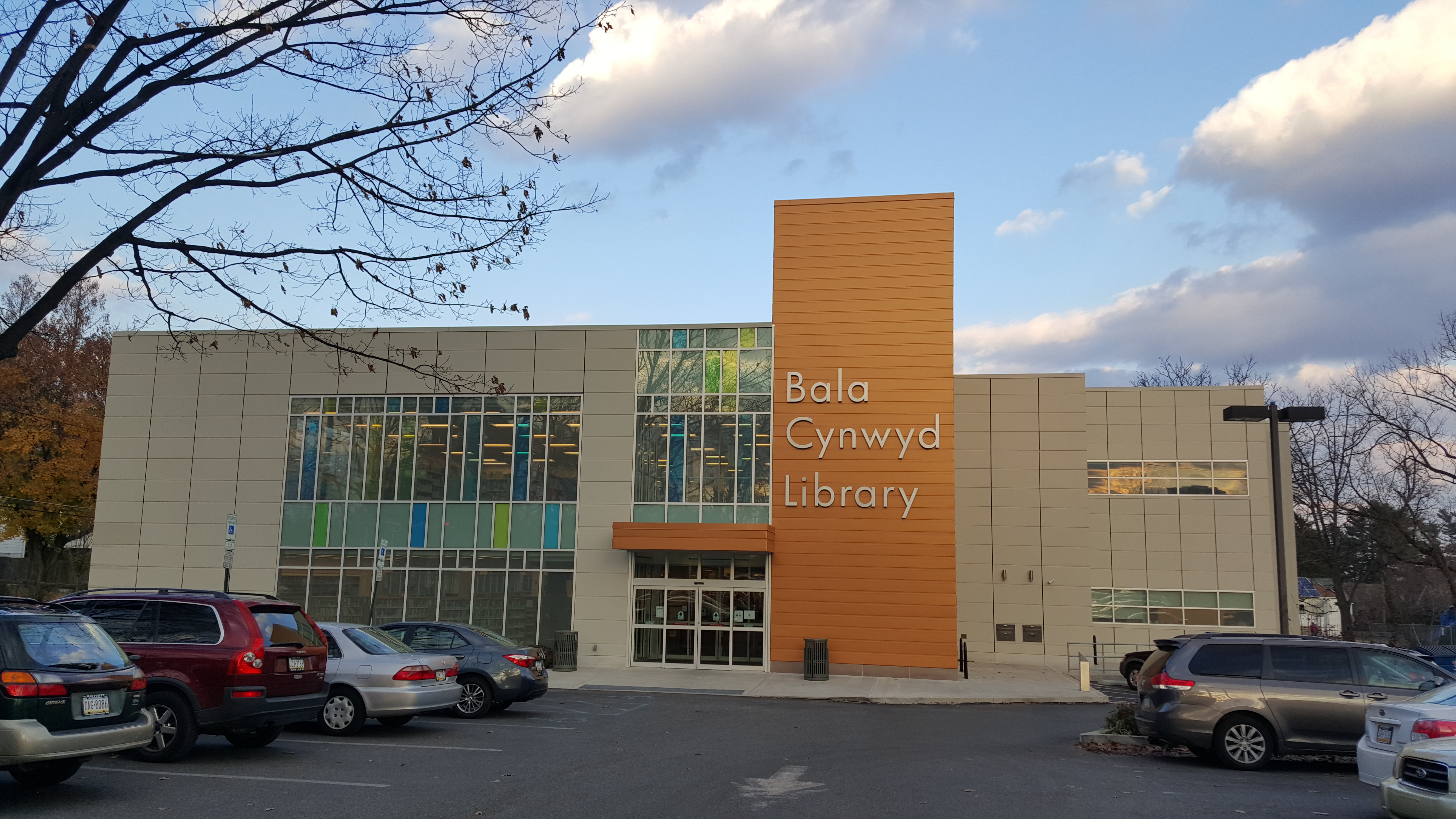
Bala Cynwyd ( ) is a community in Lower Merion Township, Pennsylvania. It is located on the Philadelphia Main Line in Southeastern Pennsylvania, bordering the western edge of Philadelphia at U.S. Route 1 (City Avenue). It was originally two separate towns, Bala and Cynwyd, but is commonly treated as a single community. This came about when a single U.S. Post Office served both towns (the Bala Cynwyd branch) using ZIP Code 19004. The community was long known as hyphenated Bala-Cynwyd. Bala and Cynwyd are currently served by separate stations on SEPTA's Cynwyd Line of Regional Rail. Description Bala Cynwyd lies in the Welsh Tract of Pennsylvania and was settled in the 1680s by Welsh Quakers, who named it after the town of Bala and the village of Cynwyd in Wales. A mixed residential community made up predominantly of single-family detached homes, it extends west of the Philadelphia city limits represented by City Avenue from Old Lancaster Road at 54th Street west to Meeting House ... [...More Info...] [...Related Items...] OR: [Wikipedia] [Google] [Baidu] |
SEPTA Route 30
The City Transit Division of the Southeastern Pennsylvania Transportation Authority (SEPTA) operate almost all of Philadelphia's public transit, including all six trolley, three trackless trolley, and 70 bus lines within city limits. Some of the bordering municipalities are served by the City Transit division, despite not being part of the city. For example, Cheltenham Township has 13 city division routes and no Suburban Division ones. The City Transit division also operates the 400 Series routes which are designed to serve students attending schools in the city of Philadelphia. The City Transit Division is broken down into seven districts (Allegheny, Callowhill, Comly, Elmwood, Frankford, Midvale, and Southern) and Contract Operations. __TOC__ History Transit in Philadelphia began with multiple independent horse car, cable, and traction companies, including the privately established entities: Philadelphia Passenger Railway Company, the Thirteenth & Fifteenth Street Passenge ... [...More Info...] [...Related Items...] OR: [Wikipedia] [Google] [Baidu] |
Powelton Village
Powelton Village is a neighborhood of mostly Victorian, mostly twin homes in the West Philadelphia section of the United States city of Philadelphia, Pennsylvania. It is a national historic district that is part of University City. It extends north from Market Street to Spring Garden Street, east to 32nd Street, west to 40th and Spring Garden Streets, and to 44th and Market Streets. History Powelton Village takes its name from the Powel Family, seventeenth- and eighteenth-century Welsh colonialists who held extensive estates in the area. Samuel Powel served as mayor of Philadelphia from 1775 to 1776 and again from 1789 to 1790. As in other parts of West Philadelphia, in the late 1800s trolley lines opened the area up to urbanization. Powelton soon became a choice residential spot for Philadelphia industrial tycoons. Powelton's luster began to wane by the 1920s, and by the 1940s the neighborhood was populated by low-income families and infested with "bottom" gangs, whose member ... [...More Info...] [...Related Items...] OR: [Wikipedia] [Google] [Baidu] |
Penn Square, Philadelphia
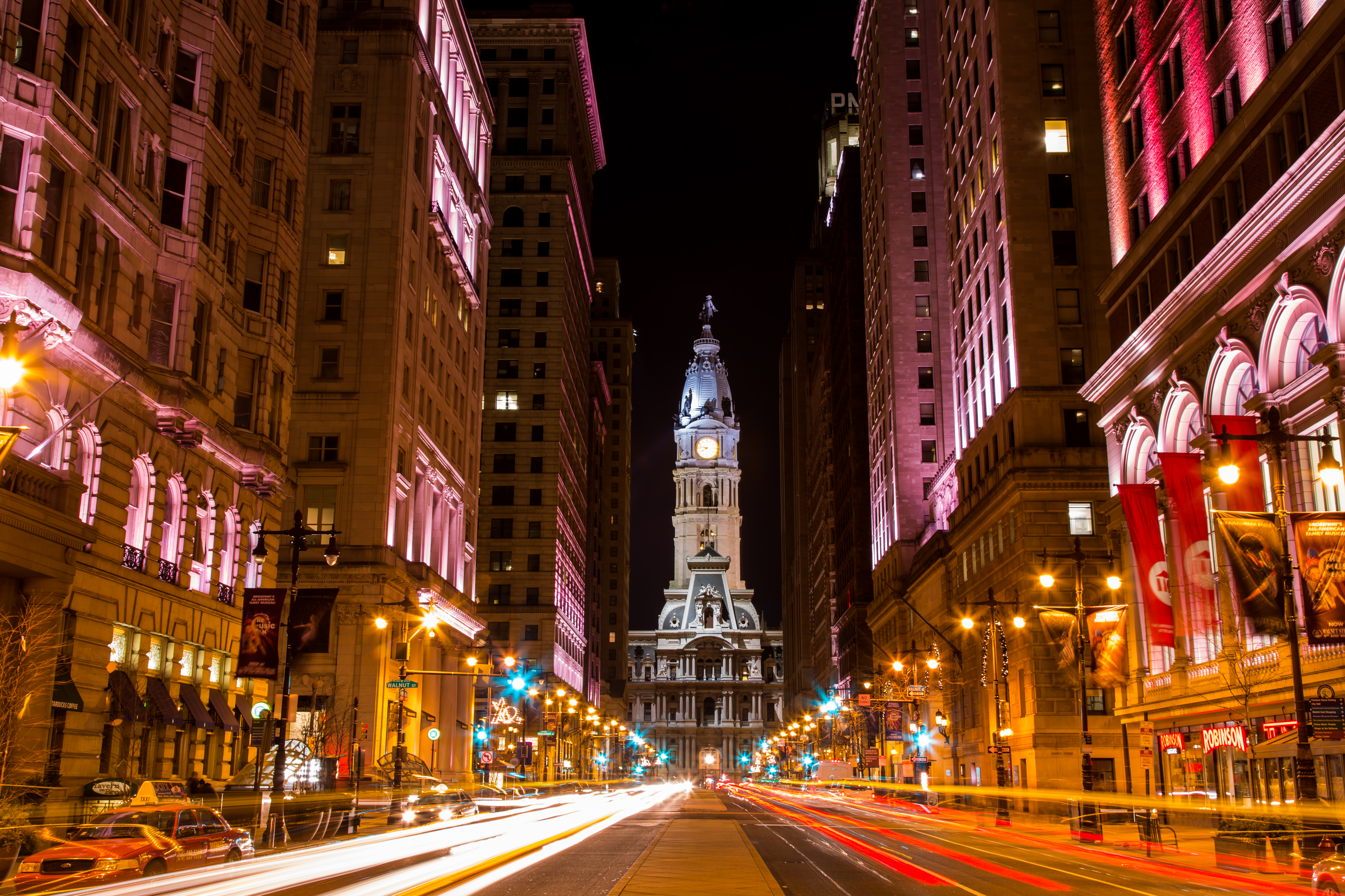
Philadelphia City Hall is the seat of the municipal government of the City of Philadelphia. Built in the ornate Second Empire style, City Hall houses the chambers of the Philadelphia City Council and the offices of the Mayor of Philadelphia. It is also a courthouse, serving as the seat of the First Judicial District of Pennsylvania, and houses the Civil Trial and Orphans' Court Divisions of the Court of Common Pleas of Philadelphia County. Built of brick, white marble, and limestone, Philadelphia City Hall is the world's largest free-standing masonry building and was the world's tallest habitable building upon its completion in 1894. In 1976, it was designated a National Historic Landmark, and in 2006, was also named a National Historic Civil Engineering Landmark by the American Society of Civil Engineers. History and description The building was designed by Scottish-born architect John McArthur Jr. and Thomas Ustick Walter [...More Info...] [...Related Items...] OR: [Wikipedia] [Google] [Baidu] |
Girard Avenue
Girard Avenue is a major commercial and residential street in Philadelphia, Pennsylvania. For most of its length it runs east–west, but at Frankford Avenue it makes a 135-degree turn north. Parts of the road are signed as U.S. Route 13 and U.S. Route 30. Route description Girard Avenue begins in West Philadelphia at 67th Street, runs east through the Carroll Park neighborhood and the Centennial District, crosses the Schuylkill River via the Girard Avenue Bridge, and continues through East Fairmount Park and across North Philadelphia to Frankford Avenue in the Fishtown neighborhood. At Frankford Avenue it makes a 135-degree turn to the north and becomes East Girard Avenue, running parallel to the Delaware River until it ends at Richmond Street. *East–west section: 6.8 miles (10.94 km). *Northeast–southwest section: 1 mile (1.61 km). History Girard Avenue was named for banker Stephen Girard (1750–1831) – at his death, the richest man in the United States &nd ... [...More Info...] [...Related Items...] OR: [Wikipedia] [Google] [Baidu] |
Schuylkill Expressway
The Schuylkill Expressway , locally known as "the Schuylkill", is a Controlled-access highway, freeway through southern Montgomery County, Pennsylvania, Montgomery County and the city of Philadelphia in Philadelphia County, Pennsylvania, Philadelphia County, and the easternmost segment of Interstate 76 (east), Interstate 76 (I-76) in the U.S. state of Pennsylvania. It extends from the Valley Forge, Pennsylvania, Valley Forge exit of the Pennsylvania Turnpike in King of Prussia, Pennsylvania, King of Prussia, paralleling its namesake Schuylkill River for most of the route, southeast to the Walt Whitman Bridge over the Delaware River in South Philadelphia. It serves as the primary corridor into Philadelphia from points west. Maintenance and planning are administered through Pennsylvania Department of Transportation (PennDOT) District 6, with the Delaware River Port Authority (DRPA) maintaining the approach to the Walt Whitman Bridge. Constructed over a period of ten years from 1949 ... [...More Info...] [...Related Items...] OR: [Wikipedia] [Google] [Baidu] |
Parkside, Philadelphia
Parkside is a neighborhood in the West Philadelphia section of Philadelphia, Pennsylvania, USA. Much of the Parkside neighborhood was built during the 1876 Centennial Exhibition. It is a National Register of Historic Places Historic District with many examples of Victorian architecture, some well-preserved, others in poor condition. The neighborhood was populated by German Americans, followed by Eastern European Jews, before becoming heavily African American after World War II. (Directly after World War II it was home to many displaced persons from Eastern Europe, which included Latvians.) In 2008, a shopping mall called the Park West Town Village Shopping Center was completed. Its anchor stores are Shop Rite, Lowe's, McDonald's, and CW Price. It is located on North 52nd Street. Parkside is the home of the Evans Recreation Center. In 2014, the Philly Pumptrack opened at Evans. Parkside was the early home of gangsta rapper Schoolly D Jesse Bonds Weaver Jr. (born June 22, 1 ... [...More Info...] [...Related Items...] OR: [Wikipedia] [Google] [Baidu] |
Center City, Philadelphia
Center City includes the central business district and central neighborhoods of Philadelphia. It comprises the area that made up the City of Philadelphia prior to the Act of Consolidation, 1854, which extended the city borders to be coterminous with Philadelphia County. Greater Center City (defined from Girard Avenue to Tasker Street) has grown into the second-most densely populated downtown area in the United States, after Midtown Manhattan in New York City, with an estimated 202,100 residents in 2020 and a population density of 26,284 per square mile. Geography Boundaries Center City is bounded by South Street to the south, the Delaware River to the east, the Schuylkill River to the west, and Vine Street to the north. The district occupies the old boundaries of the City of Philadelphia before the city was made coterminous with Philadelphia County in 1854. The Center City District, which has special powers of taxation, has a complicated, irregularly shaped boundary that inc ... [...More Info...] [...Related Items...] OR: [Wikipedia] [Google] [Baidu] |
SEPTA Route XB
The City Transit Division of the Southeastern Pennsylvania Transportation Authority (SEPTA) operate almost all of Philadelphia's public transit, including all six trolley, three trackless trolley, and 70 bus lines within city limits. Some of the bordering municipalities are served by the City Transit division, despite not being part of the city. For example, Cheltenham Township has 13 city division routes and no Suburban Division ones. The City Transit division also operates the 400 Series routes which are designed to serve students attending schools in the city of Philadelphia. The City Transit Division is broken down into seven districts (Allegheny, Callowhill, Comly, Elmwood, Frankford, Midvale, and Southern) and Contract Operations. __TOC__ History Transit in Philadelphia began with multiple independent horse car, cable, and traction companies, including the privately established entities: Philadelphia Passenger Railway Company, the Thirteenth & Fifteenth Street Passenge ... [...More Info...] [...Related Items...] OR: [Wikipedia] [Google] [Baidu] |
Philadelphia City Hall
Philadelphia City Hall is the seat of the municipal government of the City of Philadelphia. Built in the ornate Second Empire style, City Hall houses the chambers of the Philadelphia City Council and the offices of the Mayor of Philadelphia. It is also a courthouse, serving as the seat of the First Judicial District of Pennsylvania, and houses the Civil Trial and Orphans' Court Divisions of the Court of Common Pleas of Philadelphia County. Built of brick, white marble, and limestone, Philadelphia City Hall is the world's largest free-standing masonry building and was the world's tallest habitable building upon its completion in 1894. In 1976, it was designated a National Historic Landmark, and in 2006, was also named a National Historic Civil Engineering Landmark by the American Society of Civil Engineers. History and description The building was designed by Scottish-born architect John McArthur Jr. and Thomas Ustick Walter [...More Info...] [...Related Items...] OR: [Wikipedia] [Google] [Baidu] |


_p11_STATUE_OF_WILLIAM_PENN.jpg)


