|
Roxeth
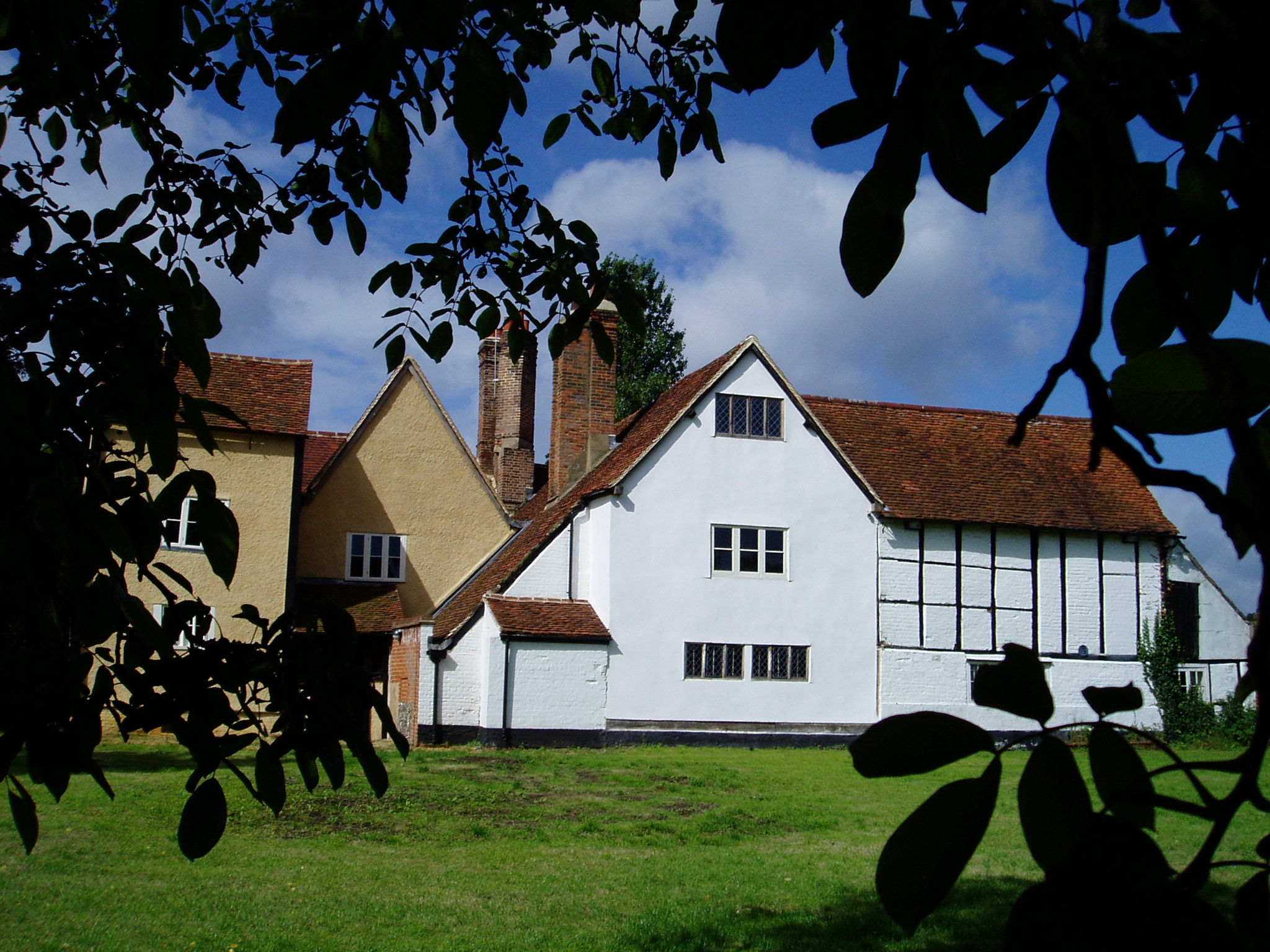
Roxeth was a hamlet in the ancient Harrow on the Hill parish, which now forms part of the London Borough of Harrow in Greater London, England. The ancient parish of Harrow on the Hill, or simply Harrow, was one of the largest parishes in Middlesex. Apart from Harrow Town, it encompassed a number of smaller settlements, including Roxeth itself, Greenhill, Harrow Weald, Kenton, Preston, Uxendon, Tokyngton, Sudbury, Wembley and Alperton. Roxeth village was adjacent to Harrow on the Hill, along the main road to the south. The name ''Roxeth'' is thought to derive from a contraction of 'Rooks Heath' and much of the land between Roxeth and Sudbury was indeed heathland as far as the early 19th century. A mediaeval moated manor existed until the mid-20th century. On its site stands a council housing estate. Development around the crossroads at the bottom of Harrow on the Hill, an area known as Roxeth Corner, was under way in the early 19th century, using brick from the nearby br ... [...More Info...] [...Related Items...] OR: [Wikipedia] [Google] [Baidu] |
Harrow, Middlesex
Harrow () is a large town in Greater London, England, and serves as the principal settlement of the London Borough of Harrow. Lying about north-west of Charing Cross and south of Watford, the entire town including its localities had a population of 149,246 at the 2011 census, whereas the wider borough (which also contains Pinner and Stanmore) had a population of 250,149. The historic centre of Harrow was atop the Harrow Hill. The modern town of Harrow grew out at the foot of the settlement, in what was historically called Greenhill. With the arrival of the Metropolitan Railway in the 19th century, the centre of Harrow moved to Greenhill and it grew as the unofficial "capital" of the Metroland suburbia in the early 20th century; Harrow-on-the-Hill station is on one of the railway corridors between London and the Chilterns. Meanwhile, Harrow & Wealdstone station is on the West Coast Main Line and is the eighth oldest railway station, having opened in 1837 one and a half mi ... [...More Info...] [...Related Items...] OR: [Wikipedia] [Google] [Baidu] |
Harrow On The Hill
Harrow on the Hill is a locality and historic village in the borough of London Borough of Harrow, Harrow in Greater London, England. The name refers to Harrow Hill, ,Mills, A., ''Dictionary of London Place Names'', (2001) and is located some half a mile south of the modern Harrow, London, town of Harrow. The village dates back to early Middle Ages, medieval times, built around the 11th-century St Mary's Church, Harrow on the Hill, St Mary's Church, and is the location of Harrow School, Harrow, St Dominic's Sixth Form College, St Dominic's and The John Lyon School, John Lyon schools. Etymology Etymology before 1398 derives from Harrow, London, Harrow, & The Saxon Chronicles/The Peterborough Chronicle, which first recorded Harrow Hill in 767 as ''Gumeninga Hergae''. A suggested meaning is "heathen temple" of a tribe called the 'Gumeningas', sons of Gumen. One of the earliest recorded uses of the name is found in 1398 as ''Harrowe atte Hille''. The hill has historically been used a ... [...More Info...] [...Related Items...] OR: [Wikipedia] [Google] [Baidu] |
Rooks Heath School
Rooks Heath School (formerly known as Rooks Heath High School,Rooks Heath College and before that Roxeth Senior School) is a state secondary school and Sixth Form, in South Harrow in the London Borough of Harrow. It is a mixed comprehensive school serving culturally and socially diverse community in South Harrow. Built on the grounds of a former hospital, the school has approximately 1000 pupils. The sixth form is part of the Harrow Sixth Form Collegiate. History Roxeth Manor Secondary Modern School opened on the site in Eastcote Lane in the 1930s, next to the primary school. Additional buildings were added in the 1960s. The secondary school was renamed Rooks Heath in September 1974 when the London Borough of Harrow adopted the comprehensive system of education. The school gained specialist status as a Business and Enterprise College Business and Enterprise Colleges (BECs) were introduced in 2002 as part of the Specialist Schools Programme in England. The system enabled sec ... [...More Info...] [...Related Items...] OR: [Wikipedia] [Google] [Baidu] |
Northolt Park Railway Station
Northolt Park railway station is a National Rail station in Northolt, Greater London. It is in Cadogan Close and spans the boundary between the London Borough of Harrow and the London Borough of Ealing, with a footbridge connecting the north side (leading to Roxeth and South Harrow) to the south side (leading to Northolt and Greenford). South Harrow Tube Station on the Piccadilly line is by foot from Northolt Park Station. Northolt Underground station on the Central line is less than away and is accessible by the 140 and X140 buses from Northolt Road. The service to the station has much improved (until the late 1990s only peak hour trains stopped there) History The Great Central Railway line to High Wycombe from Marylebone opened in 1906 but this station (originally known as South Harrow and Roxeth) was not opened until 1926, being given its current name in 1929. Services The off-peak service on all days in trains per hour (tph) is: * 1 tph to London Marylebone * 1 tph to ... [...More Info...] [...Related Items...] OR: [Wikipedia] [Google] [Baidu] |
London Borough Of Harrow
The London Borough of Harrow () is a London borough in northwest London, England; it forms part of Outer London. It borders four other London boroughs Barnet to the east of ancient Watling Street (now the A5 road), Brent to the southeast, Ealing to the south and Hillingdon to the west plus the Hertfordshire districts of Three Rivers and Hertsmere to the north. The local authority is Harrow London Borough Council. The London borough was formed in 1965, based on boundaries that had been established in 1934. The borough is made up of three towns: Harrow, Pinner and Stanmore, but also includes western parts of Edgware. Administrative history The modern borough has its roots in three Ancient Parishes: Harrow on the Hill and the much smaller areas of Great Stanmore and Little Stanmore (also known as Whitchurch). These had consistent boundaries from the High Middle Ages down to the modern era. Pinner became independent of ''Harrow on the Hill'' in 1766 and the remaining ar ... [...More Info...] [...Related Items...] OR: [Wikipedia] [Google] [Baidu] |
Earlsmead Stadium
Earlsmead Stadium is a football stadium in Harrow, north-west London, England. It is the home ground of Harrow Borough F.C. The stadium has a capacity of 3,070 people, which includes 350 seats and standing under cover for 1,000 people. The record attendance is 3000 for an FA Cup match against local rivals Wealdstone FC in 1946. History Harrow Borough F.C. took residency in 1934, a year after forming. They played their first season at a ground on nearby Northolt Road. A local pavilion was dismantled and rebuilt on the Earlmead site in 1938. Having been presented to the club by a local land owner Mr G Champniss, later club president, it was to call the Champniss Stand. This stand had room for 250 seated and a further 100 standing. During the Second World War the Pavilion was successfully blacked out and the club could continue playing. Hurricane lamps under biscuit tins with words such as 'way in' and 'turn left' punched out provided signage. In 1947-48 extra covering was bu ... [...More Info...] [...Related Items...] OR: [Wikipedia] [Google] [Baidu] |
South Harrow Tube Station
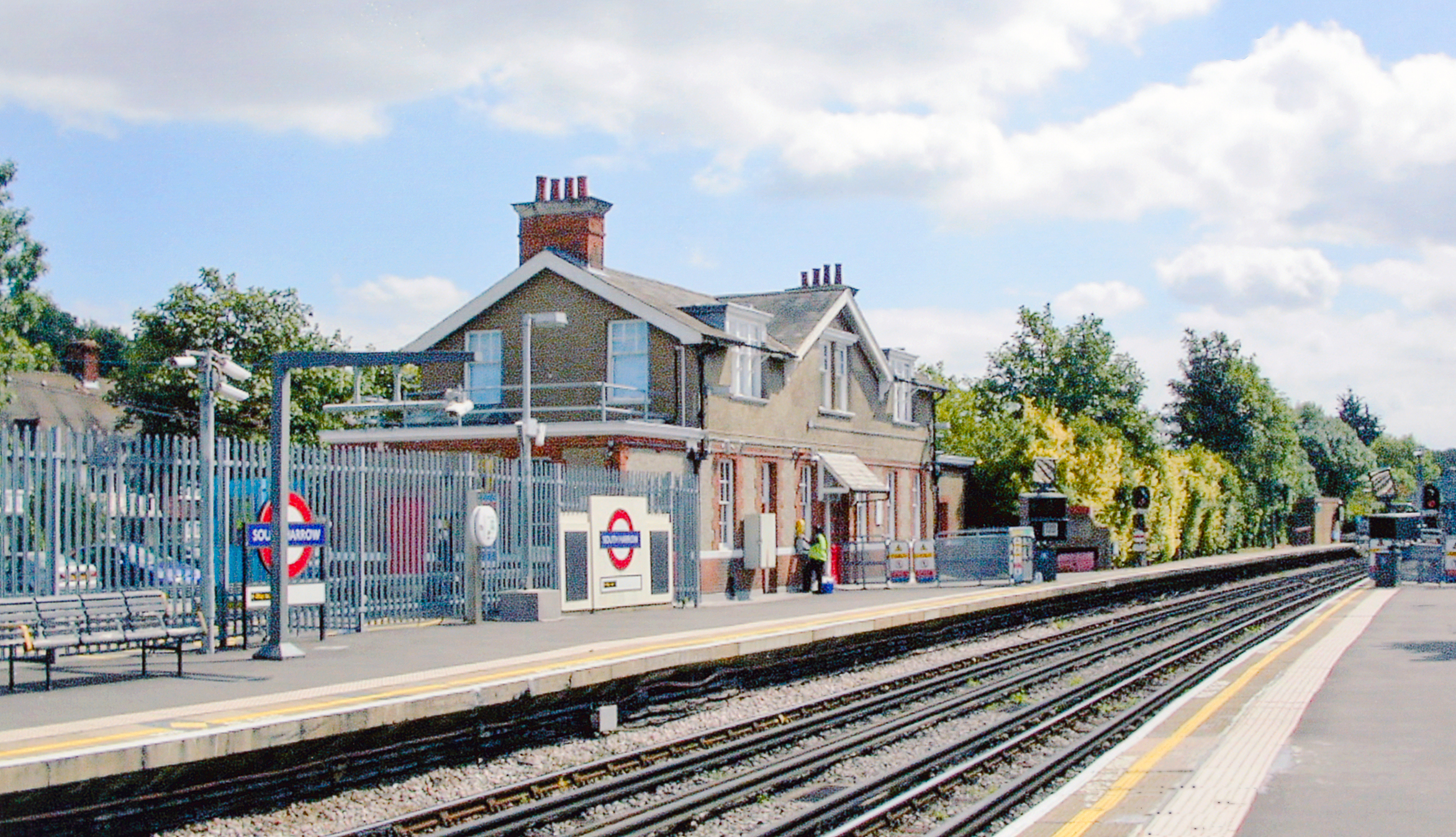
South Harrow is a London Underground station on the Uxbridge branch of the Piccadilly line. It is between Rayners Lane and Sudbury Hill stations. It is located on Northolt Road ( A312). The station is in Travelcard Zone 5. There are several bus stands outside the station as well as overnight train stabling sidings. History South Harrow station was opened on 28 June 1903 by the District Railway (DR, now the District line) as the terminus of its new extension from Park Royal & Twyford Abbey. This new extension was, together with the existing tracks back to Acton Town, the first section of the Underground's surface lines to be electrified and operate electric instead of steam trains. The Deep level tube lines open at that time (City & South London Railway, Waterloo & City Railway and Central London Railway) had been electrically powered from the start. On 1 March 1910, the DR was extended north to meet the Metropolitan Railway (MR, now the Metropolitan line) tracks at R ... [...More Info...] [...Related Items...] OR: [Wikipedia] [Google] [Baidu] |
Alperton
Alperton () is an area of north west London, England, within the London Borough of Brent. It forms the southern part of the town of Wembley and is west north-west of Charing Cross. It includes a handful of high-rise and many mid-rise buildings as well as streets of low-rise houses with gardens. It adjoins the Grand Union Canal's Paddington Arm, which is fed by the Brent Reservoir. Toponymy The name ''Alperton'' means "farmstead or estate associated with a man named Ealhbeorht", deriving from an Anglo-Saxon personal name and ''tūn'', meaning farmstead or village in Old English. Demography Alperton has one of the capital's highest populations from black or minority ethnic groups ( BME). In the 1991 census, 43.2% of Alperton ward's population was Asian, only one point less than White. British Indians formed 31.5% in 1991 and 32.4% in 2001, with white having decreased to 27.8%. According to the 2011 census, the largest ethnic group was Indian, 42% of the population, well abo ... [...More Info...] [...Related Items...] OR: [Wikipedia] [Google] [Baidu] |
Districts Of The London Borough Of Harrow
A district is a type of administrative division that, in some countries, is managed by the local government. Across the world, areas known as "districts" vary greatly in size, spanning regions or counties, several municipalities, subdivisions of municipalities, school district, or political district. By country/region Afghanistan In Afghanistan, a district (Persian ps, ولسوالۍ ) is a subdivision of a province. There are almost 400 districts in the country. Australia Electoral districts are used in state elections. Districts were also used in several states as cadastral units for land titles. Some were used as squatting districts. New South Wales had several different types of districts used in the 21st century. Austria In Austria, the word is used with different meanings in three different contexts: * Some of the tasks of the administrative branch of the national and regional governments are fulfilled by the 95 district administrative offices (). The area a dist ... [...More Info...] [...Related Items...] OR: [Wikipedia] [Google] [Baidu] |
Harrow Borough F
Harrow may refer to: Places * Harrow, Victoria, Australia * Harrow, Ontario, Canada * The Harrow, County Wexford, a village in Ireland * London Borough of Harrow, England ** Harrow, London, a town in London ** Harrow (UK Parliament constituency) ** Harrow on the Hill * Harrow, Caithness, a hamlet in Scotland Schools * Harrow School, independent school in Harrow, London, founded 1572 * Harrow College, college in Harrow, London, founded 1999 * Harrow High School, secondary school in Harrow, London * Harrow International School Bangkok * Harrow International School Beijing * Harrow International School Hong Kong Other uses * Harrow (surname) * Harrow (tool), an agricultural implement * ''Harrow'' (TV series), an Australian television series * '' The Harrow'', a fantasy and horror magazine * Harrow football, a football style played at Harrow School * Harrow History Prize, a prize for children at British preparatory schools * Harrow RFC, a rugby club * Harrow Road, a road in Lon ... [...More Info...] [...Related Items...] OR: [Wikipedia] [Google] [Baidu] |
Church Lads' And Church Girls' Brigade
The Church Lads' and Church Girls' Brigade is an Anglican youth organisation with branches in the United Kingdom, Ireland, Bermuda, Kenya, South Africa, Barbados, Newfoundland and St Helena. Its origins lie in the formation in 1891 of the Church Lads' Brigade with its sister organisation, the Church Red Cross Brigade, later the Church Girls' Brigade, founded in 1901. The two respective founders were Walter M. Gee and the Reverend Thomas Milner. The two brigades amalgamated in 1978 to form the Church Lads' and Church Girls' Brigade. The Church Lads' Brigade was one of the founding members of The National Council for Voluntary Youth Services (NCVYS), and the Church Lads' and Church Girls' Brigade remains a member by virtue of its work towards the personal and social development of young people.Full list of NCVYS members [...More Info...] [...Related Items...] OR: [Wikipedia] [Google] [Baidu] |
Wesleyanism
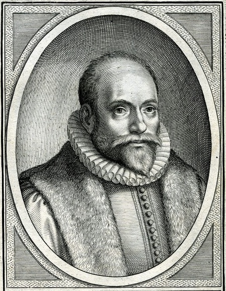
Wesleyan theology, otherwise known as Wesleyan–Arminianism, Arminian theology, or Methodist theology, is a Christian theology, theological tradition in Protestant Christianity based upon the Christian ministry, ministry of the 18th-century evangelical reformer brothers John Wesley and Charles Wesley. More broadly it refers to the theological system inferred from the various sermons (e.g. the Forty-four Sermons), theological treatises, letters, journals, diaries, hymns, and other spiritual writings of the Wesleys and their contemporary coadjutors such as John William Fletcher. In 1736, the Wesley brothers travelled to the Georgia colony in America as Christian missionaries; they left rather disheartened at what they saw. Both of them subsequently had "religious experiences", especially John in 1738, being greatly influenced by the Moravian Church, Moravian Christians. They began to organize a renewal movement within the Church of England to focus on personal faith and holiness. ... [...More Info...] [...Related Items...] OR: [Wikipedia] [Google] [Baidu] |


