|
Rock Carvings At Møllerstufossen
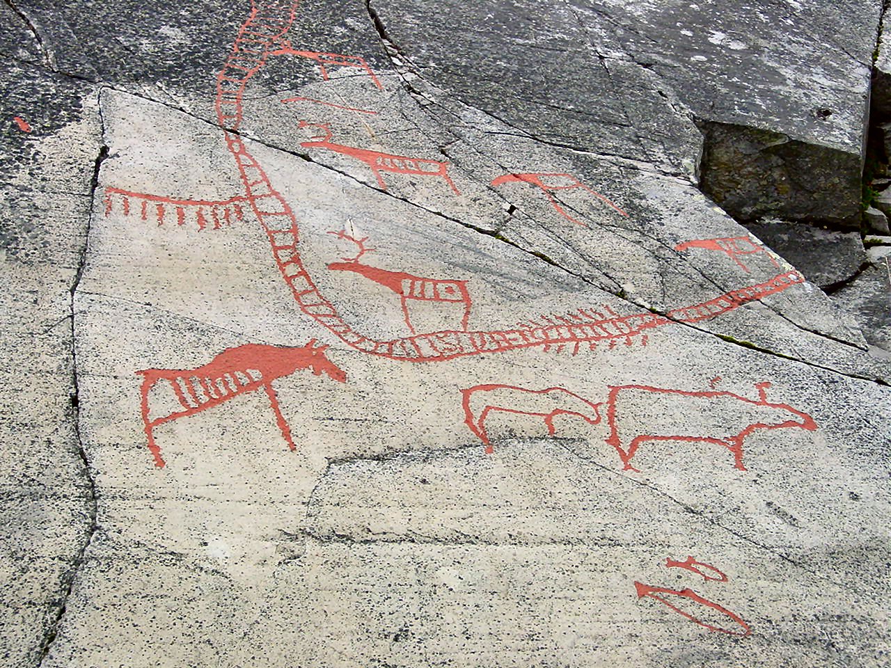
The Rock carvings at Møllerstufossen in Nord-Sinni in Nordre Land municipality in Oppland county of Norway comprise several carvings of moose and one other animal. The site covers about 20 m². The largest figure measures about 90 cm across. The figures are carved with deep and wide strokes and are easy to spot. How to get there The carvings have been repainted and the site is signposted near the road between Dokka in Nordre Land and Aurdal in Nord-Aurdal. The river Etna runs approximately 10 meters away, and in spring nearly floods the site. There is also a small wooden bridge near the site to provide access and to limit wear on the carvings. Gallery File:Hellerisninger Etna, Nordre Land, 2005-08-13, 01.jpg File:Hellerisninger Etna, Nordre Land, 2005-08-13, 02.jpg File:Hellerisninger Etna, Nordre Land, 2005-08-13, 03.jpg File:Hellerisninger Etna, Nordre Land, 2005-08-13, 04.jpg See also *Pre-historic art *Petroglyph *History of Norway *List of World Heritage Sites in ... [...More Info...] [...Related Items...] OR: [Wikipedia] [Google] [Baidu] |
Nordre Land
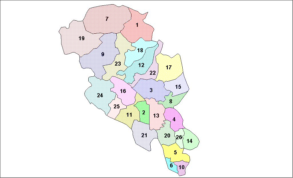
Nordre Land is a municipality in Innlandet county, Norway. It is located in the traditional district of Land. The administrative centre of the municipality is the village of Dokka. Other villages in the municipality include Vest-Torpa, Nord-Torpa, Aust-Torpa, Fagerlund, and Nordsinni. The municipality is the 122nd largest by area out of the 356 municipalities in Norway. Nordre Land is the 150th most populous municipality in Norway with a population of 6,577. The municipality's population density is and its population has decreased by 2.8% over the previous 10-year period. General information The old Land Municipality was established on 1 January 1838 after the formannskapsdistrikt law went into effect. This municipality was quite large and in less than a decade, the municipality was divided. In 1847, the old Land Municipality was divided into Nordre Land (population: 4,595) in the north and Søndre Land (population: 4,604) in the south. On 1 January 1868, a part of Søndr ... [...More Info...] [...Related Items...] OR: [Wikipedia] [Google] [Baidu] |
Oppland
Oppland is a former county in Norway which existed from 1781 until its dissolution on 1 January 2020. The old Oppland county bordered the counties of Trøndelag, Møre og Romsdal, Sogn og Fjordane, Buskerud, Akershus, Oslo and Hedmark. The county administration was located in the town of Lillehammer. Merger On 1 January 2020, the neighboring counties of Oppland and Hedmark were merged to form the new Innlandet county. Both Oppland and Hedmark were the only landlocked counties of Norway, and the new Innlandet county is the only landlocked county in Norway. The two counties had historically been one county that was divided in 1781. Historically, the region was commonly known as "Opplandene". In 1781, the government split the area into two: Hedemarkens amt and Kristians amt (later renamed Hedmark and Oppland. In 2017, the government approved the merger of the two counties. There were several names debated, but the government settled on ''Innlandet''. Geography Oppland extend ... [...More Info...] [...Related Items...] OR: [Wikipedia] [Google] [Baidu] |
Norway
Norway, officially the Kingdom of Norway, is a Nordic country in Northern Europe, the mainland territory of which comprises the western and northernmost portion of the Scandinavian Peninsula. The remote Arctic island of Jan Mayen and the archipelago of Svalbard also form part of Norway. Bouvet Island, located in the Subantarctic, is a dependency of Norway; it also lays claims to the Antarctic territories of Peter I Island and Queen Maud Land. The capital and largest city in Norway is Oslo. Norway has a total area of and had a population of 5,425,270 in January 2022. The country shares a long eastern border with Sweden at a length of . It is bordered by Finland and Russia to the northeast and the Skagerrak strait to the south, on the other side of which are Denmark and the United Kingdom. Norway has an extensive coastline, facing the North Atlantic Ocean and the Barents Sea. The maritime influence dominates Norway's climate, with mild lowland temperatures on the se ... [...More Info...] [...Related Items...] OR: [Wikipedia] [Google] [Baidu] |
Moose
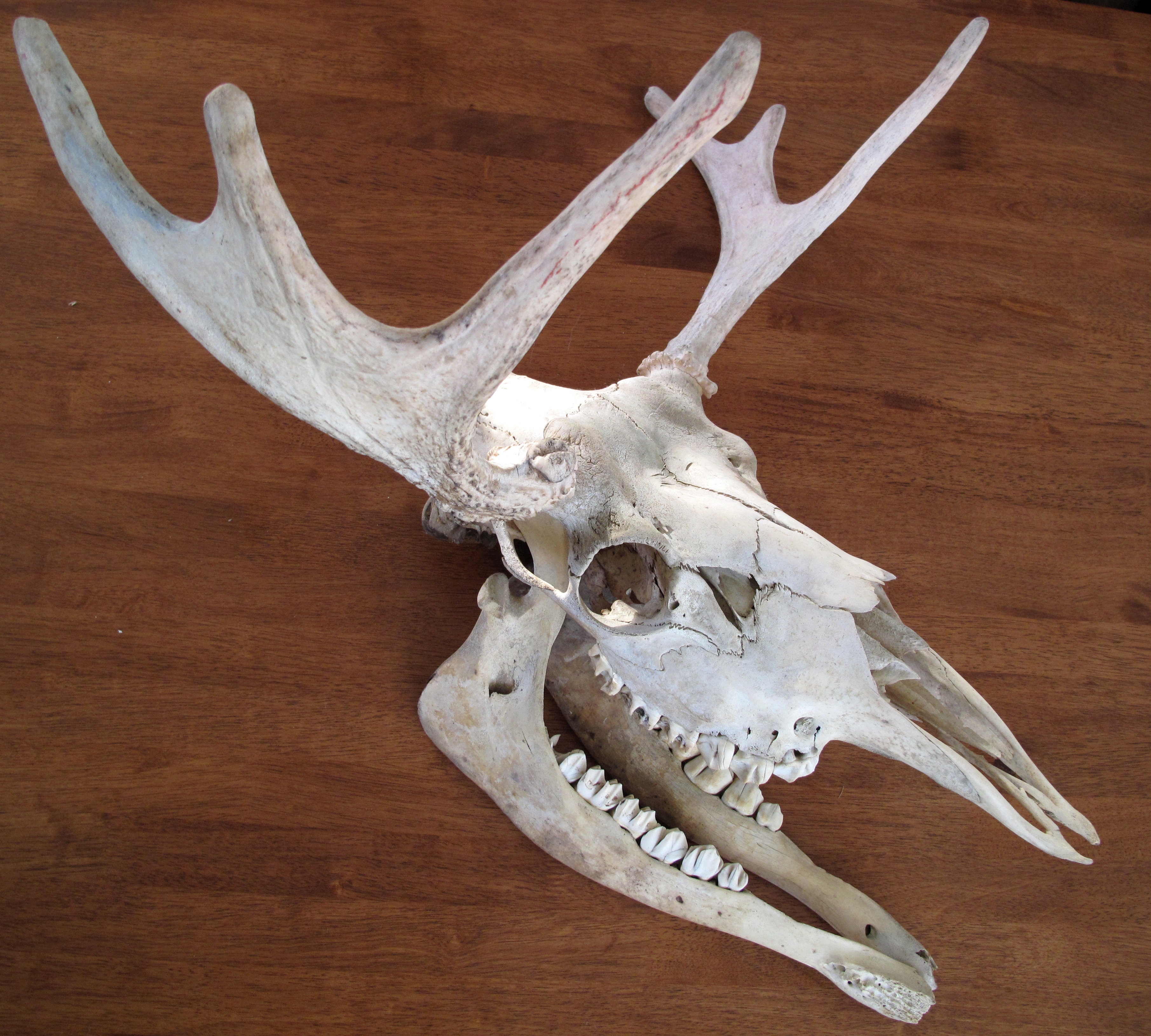
The moose (in North America) or elk (in Eurasia) (''Alces alces'') is a member of the New World deer subfamily and is the only species in the genus ''Alces''. It is the largest and heaviest extant species in the deer family. Most adult male moose have distinctive broad, palmate ("open-hand shaped") antlers; most other members of the deer family have antlers with a dendritic ("twig-like") configuration. Moose typically inhabit boreal forests and temperate broadleaf and mixed forests of the Northern Hemisphere The Northern Hemisphere is the half of Earth that is north of the Equator. For other planets in the Solar System, north is defined as being in the same celestial hemisphere relative to the invariable plane of the solar system as Earth's Nort ... in temperate to subarctic climates. Hunting and other human activities have caused a reduction in the size of the moose's range over time. It has been reintroduced to some of its former habitats. Currently, most moose occ ... [...More Info...] [...Related Items...] OR: [Wikipedia] [Google] [Baidu] |
Dokka
Dokka is the administrative centre of Nordre Land Municipality in Innlandet county, Norway. The village is located at the confluence of the rivers Dokka and Etna, about north of the lake Randsfjorden, the fourth largest lake in Norway. The village has a population (2021) of 2,924 and a population density of . The Østsinni Church is located on the north edge of the village. The Norwegian County Road 33 runs from Odnes in the southeast through Dokka, past Nordsinni and westwards to Etnedal and Bjørgo. Norwegian County Road 245 runs to the south from Dokka, along the west side of the Randsfjorden to Bjoneroa. Norwegian County Road 250 heads north from Dokka towards Aust-Torpa. In 2002, Dokka celebrated its 100th anniversary. Name The village is named after the local river Dokka, a tributary of the river Etna. The name of the river Dokka is derived from the Old Norse word which means "hollow" or "depression". Fun fact: The word dokka (どっか)is a slang term meani ... [...More Info...] [...Related Items...] OR: [Wikipedia] [Google] [Baidu] |
Aurdal
Aurdal is a village in Nord-Aurdal Municipality in Innlandet county, Norway. The village is located along the European route E16 highway about to the northwest of the village of Bagn (in Sør-Aurdal) and about to the southeast of the town of Fagernes and the village of Leira. The river Begna flows past Aurdal, just south of the village. Aurdal Church is located in the village. The village has a population (2021) of 658 and a population density Population density (in agriculture: standing stock or plant density) is a measurement of population per unit land area. It is mostly applied to humans, but sometimes to other living organisms too. It is a key geographical term.Matt RosenberPopul ... of . References Nord-Aurdal Villages in Innlandet {{Innlandet-geo-stub ... [...More Info...] [...Related Items...] OR: [Wikipedia] [Google] [Baidu] |
Nord-Aurdal
Nord-Aurdal is a municipality in Innlandet county, Norway. It is located in the traditional district of Valdres. The administrative centre of the municipality is the town Fagernes. Other urban centres in Nord-Aurdal include the villages of Aurdal, Leira, and Skrautvål. The municipality is served by Fagernes Airport, Leirin. In Nord-Aurdal, there is an alpine skiing center called ''Valdres Alpinsenter''. The municipality is the 128th largest by area out of the 356 municipalities in Norway. Nord-Aurdal is the 152nd most populous municipality in Norway with a population of 6,354. The municipality's population density is and its population has decreased by 1.2% over the previous 10-year period. General information The parish of ''Nordre Aurdal'' was established as a municipality on 1 January 1838 (see formannskapsdistrikt law). On 1 January 1894, the new Etnedal Municipality was established by merging the eastern valley area of ''Nordre Etnedal'' (population: 362) from Nordre ... [...More Info...] [...Related Items...] OR: [Wikipedia] [Google] [Baidu] |
Etna (river)
Etna or Etne is a river in the Valdres region of Innlandet county, Norway. The long river flows through the municipalities of Øystre Slidre, Nord-Aurdal, Etnedal, and Nordre Land before joining the river Dokka at the village of Dokka in Nordre Land Municipality. Soon after the confluence of those two rivers, they join the Randsfjorden (a long, narrow inland lake). The river begins near the mountains Skaget and Langsua inside the Langsua National Park. It then flows in a southerly direction. Much of the river runs through the Etnedalen valley (the namesake of the municipality of Etnedal). The river runs through the village of Bruflat and then shortly after this, it begins heading in a more easterly direction. The river was formally protected from hydropower development by the government in 1993. See also *List of rivers in Norway The following are the 19 longest rivers of Norway, ranked by length: # Glomma, # Pasvikelva and Ivalo, (109 km in Norway) # Numedalslågen, ... [...More Info...] [...Related Items...] OR: [Wikipedia] [Google] [Baidu] |
Pre-historic Art
In the history of art, prehistoric art is all art produced in preliterate, prehistorical cultures beginning somewhere in very late geological history, and generally continuing until that culture either develops writing or other methods of record-keeping, or makes significant contact with another culture that has, and that makes some record of major historical events. At this point ancient art begins, for the older literate cultures. The end-date for what is covered by the term thus varies greatly between different parts of the world. The earliest human artifacts showing evidence of workmanship with an artistic purpose are the subject of some debate. It is clear that such workmanship existed by 40,000 years ago in the Upper Paleolithic era, although it is quite possible that it began earlier. In September 2018, scientists reported the discovery of the earliest known drawing by '' Homo sapiens'', which is estimated to be 73,000 years old, much earlier than the 43,000 years old ... [...More Info...] [...Related Items...] OR: [Wikipedia] [Google] [Baidu] |
Petroglyph
A petroglyph is an image created by removing part of a rock surface by incising, picking, carving, or abrading, as a form of rock art. Outside North America, scholars often use terms such as "carving", "engraving", or other descriptions of the technique to refer to such images. Petroglyphs are found worldwide, and are often associated with prehistoric peoples. The word comes from the Greek prefix , from meaning "stone", and meaning "carve", and was originally coined in French as . Another form of petroglyph, normally found in literate cultures, a rock relief or rock-cut relief is a relief sculpture carved on "living rock" such as a cliff, rather than a detached piece of stone. While these relief carvings are a category of rock art, sometimes found in conjunction with rock-cut architecture, they tend to be omitted in most works on rock art, which concentrate on engravings and paintings by prehistoric or nonliterate cultures. Some of these reliefs exploit the rock's nat ... [...More Info...] [...Related Items...] OR: [Wikipedia] [Google] [Baidu] |
History Of Norway
The history of Norway has been influenced to an extraordinary degree by the terrain and the climate of the region. About 10,000 BC, following the retreat inland of the great ice sheets, the earliest inhabitants migrated north into the territory which is now Norway. They traveled steadily northwards along the coastal areas, warmed by the Gulf Stream. They were hunter-gatherers whose diet included seafood and game, particularly reindeer as staple foods. Between 5,000 BC and 4,000 BC the earliest agricultural settlements appeared around the Oslofjord. Gradually, between 1500 BC and 500 BC, agricultural settlements spread to the entire south Norway, while the inhabitants of the regions north of Trøndelag continued to hunt and fish. The Neolithic period started in 4000 BC. The Migration Period caused the first chieftains to take control and hilltop forts to be constructed. From the 8th century Norwegians started expanding across the seas to the British Isles and later Iceland and G ... [...More Info...] [...Related Items...] OR: [Wikipedia] [Google] [Baidu] |


