|
Rock Art In Europe
Rock art has been produced in Europe since the Upper Palaeolithic period through to recent centuries. It is found in all of the major regions of the continent.#Bra01, Bradley, Chippindale and Helskog 2001. p. 482. One of the most famous examples of parietal art is the Grotte Chauvet in France. The cultural purpose of these remnants of the Paleolithic and other periods of prehistoric art is not known. However, some theories suggest that, because these paintings were created in parts of the caves that were not easily accessed, it is unlikely that they were intended simply as decoration. In the post-Palaeolithic period, during later prehistory, regional variants grew up across the continent, being produced by settled, agricultural communities. Scholarly interest in European rock art began in the 17th century. Background The defining characteristic of rock art is the fact that it is placed on natural rock surfaces; in this way it is distinct from artworks placed on constructed walls o ... [...More Info...] [...Related Items...] OR: [Wikipedia] [Google] [Baidu] |
Lascaux Painting
Lascaux ( , ; french: Grotte de Lascaux , "Lascaux Cave") is a network of caves near the village of Montignac, in the department of Dordogne in southwestern France. Over 600 parietal wall paintings cover the interior walls and ceilings of the cave. The paintings represent primarily large animals, typical local contemporary fauna that correspond with the fossil record of the Upper Paleolithic in the area. They are the combined effort of many generations and, with continued debate, the age of the paintings is now usually estimated at around 17,000 years (early Magdalenian). Because of the outstanding prehistoric art in the cave, Lascaux was inducted into the UNESCO World Heritage List in 1979, as an element of the '' Prehistoric Sites and Decorated Caves of the Vézère Valley''. The original caves have been closed to the public since 1963, as their condition was deteriorating, but there are now a number of replicas. History since rediscovery On 12 September 1940, the entra ... [...More Info...] [...Related Items...] OR: [Wikipedia] [Google] [Baidu] |
Arcy-sur-Cure
Arcy-sur-Cure (, literally ''Arcy on Cure'') is a commune in the Yonne department in Bourgogne-Franche-Comté in north-central France. The caves of Arcy-sur-Cure, just south of the commune, hold the second-oldest cave paintings known, after those of Chauvet Cave.Grottes d'Arcy-sur-CurOfficial website Archeological remains at the Grotte du Renne were taken to provide evidence that Neanderthals had modern human behavior, but this is now doubted.Higham T, Jacobi R, Julien M, David F, Basell L, Wood R, Davies W, Ramsey CB.C (2010). Chronology of the Grotte du Renne (France) and implications for the context of ornaments and human remains within the Chatelperronian. Proc Natl Acad Sci U S A. Mellars P. (2010). Neanderthal symbolism and ornament manufacture: The bursting of a bubble? Proc Natl Acad Sci U S A. See also *Communes of the Yonne department The following is a list of the 423 Communes of France, communes of the Yonne Departments of France, department of France. The com ... [...More Info...] [...Related Items...] OR: [Wikipedia] [Google] [Baidu] |
British Isles
The British Isles are a group of islands in the North Atlantic Ocean off the north-western coast of continental Europe, consisting of the islands of Great Britain, Ireland, the Isle of Man, the Inner and Outer Hebrides, the Northern Isles (Orkney and Shetland), and over six thousand smaller islands. They have a total area of and a combined population of almost 72 million, and include two sovereign states, the Republic of Ireland (which covers roughly five-sixths of Ireland), and the United Kingdom of Great Britain and Northern Ireland. The Channel Islands, off the north coast of France, are normally taken to be part of the British Isles, even though geographically they do not form part of the archipelago. Under the UK Interpretation Act 1978, the Channel Islands are clarified as forming part of the British Islands, not to be confused with the British Isles. The oldest rocks are 2.7 billion years old and are found in Ireland, Wales and the north-west of Scotland. Du ... [...More Info...] [...Related Items...] OR: [Wikipedia] [Google] [Baidu] |
Straight Of Gibraltar
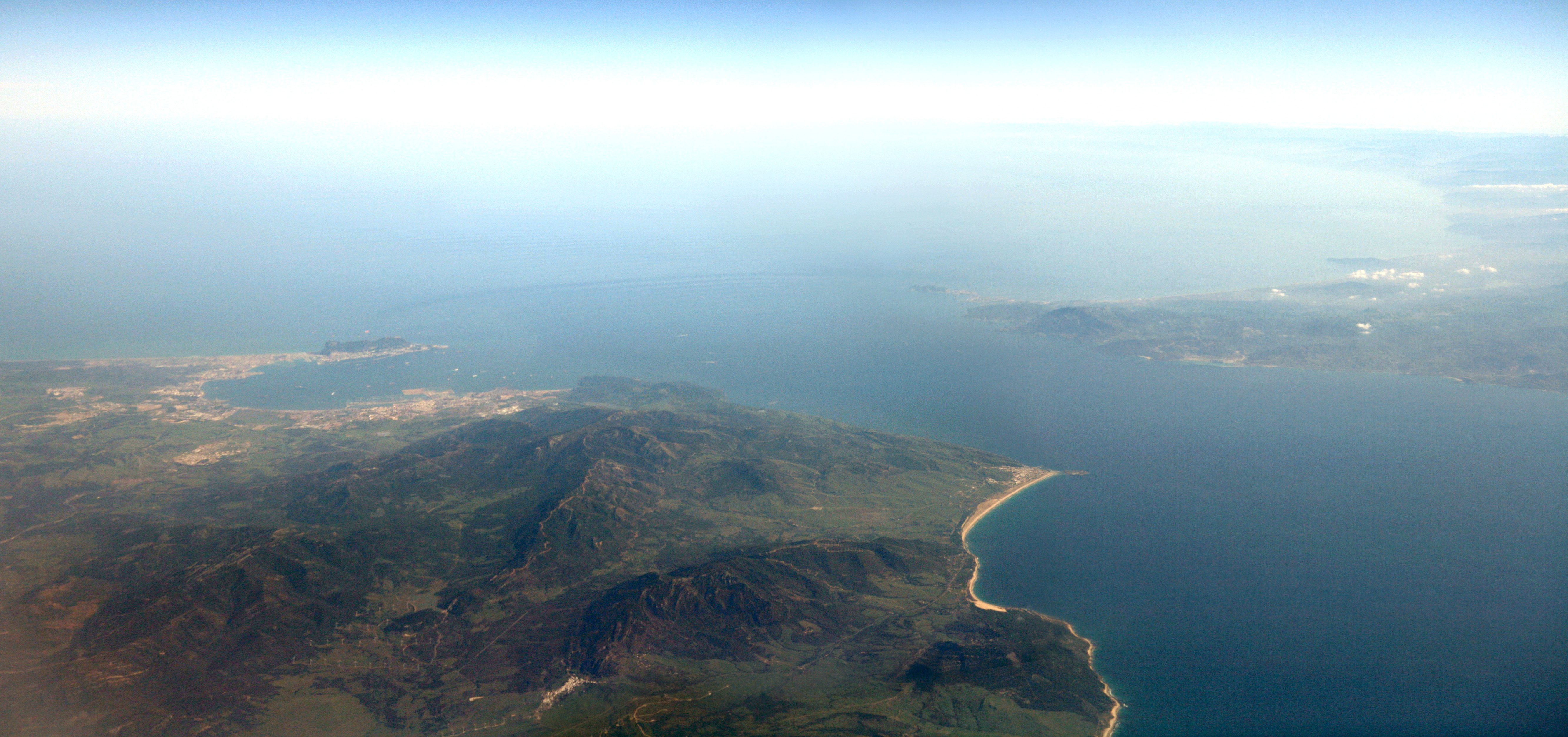
The Strait of Gibraltar ( ar, مضيق جبل طارق, Maḍīq Jabal Ṭāriq; es, Estrecho de Gibraltar, Archaic: Pillars of Hercules), also known as the Straits of Gibraltar, is a narrow strait that connects the Atlantic Ocean to the Mediterranean Sea and separates the Iberian Peninsula in Europe from Morocco in Africa. The two continents are separated by of ocean at the Strait's narrowest point between Point Marroquí in Spain and Point Cires in Morocco. Ferries cross between the two continents every day in as little as 35 minutes. The Strait's depth ranges between which possibly interacted with the lower mean sea level of the last major glaciation 20,000 years ago when the level of the sea is believed to have been lower by . The strait lies in the territorial waters of Morocco, Spain, and the British overseas territory of Gibraltar. Under the United Nations Convention on the Law of the Sea, foreign vessels and aircraft have the freedom of navigation and overflight ... [...More Info...] [...Related Items...] OR: [Wikipedia] [Google] [Baidu] |
Atlantic Europe
Atlantic Europe is a geographical term for the western portion of Europe which borders the Atlantic Ocean. The term may refer to the idea of Atlantic Europe as a cultural unit and/or as a biogeographical region. It comprises the Atlantic Isles (Great Britain and Ireland), Iceland, Belgium, the Netherlands, the central and northern regions of Portugal, northwestern and northern Spain (including Galicia, Asturias, Cantabria, Southern Basque Country and some portions of Castile and León), the southwestern and western portion of France (Northern Basque Country), western Scandinavia and northern Germany. Weather and overall physical conditions are relatively similar along this area (with the exception of parts of Scandinavia and the Baltic), resulting in similar landscapes with common endemic plant and animal species. From a strictly physical point of view most of the Atlantic European shoreline can be considered a single biogeographical region. Physical geographers label this bioge ... [...More Info...] [...Related Items...] OR: [Wikipedia] [Google] [Baidu] |
Rock Art Of The Iberian Mediterranean Basin
The group of over 700 sites of prehistoric Rock art of the Iberian Mediterranean Basin, also known as Levantine art, were collectively declared a World Heritage Site by UNESCO in 1998. The sites are in the eastern part of Spain and contain rock art dating to the Upper Paleolithic or (more likely) Mesolithic periods of the Stone Age. The art consists of small painted figures of humans and animals, which are the most advanced and widespread surviving from this period, certainly in Europe, and arguably in the world, at least in the earlier works. It is notable for the number of places included, the largest concentration of such art in Europe. Its name refers to the Mediterranean Basin; however, while some sites are located near the sea, many of them are inland in Aragon and Castilla–La Mancha; it is also often referred to as Levantine Art (meaning "from Eastern Spain", not the Levant region). Historical period There has been much debate over the dating of Levantine paintings, an ... [...More Info...] [...Related Items...] OR: [Wikipedia] [Google] [Baidu] |
Altamira (cave)
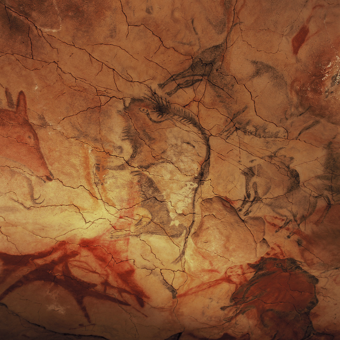
The Cave of Altamira (; es, Cueva de Altamira ) is a cave complex, located near the historic town of Santillana del Mar in Cantabria, Spain. It is renowned for prehistoric cave art featuring charcoal drawings and polychrome paintings of contemporary local fauna and human hands. The earliest paintings were applied during the Upper Paleolithic, around 36,000 years ago. The site was discovered in 1868 by Modesto Cubillas and subsequently studied by Marcelino Sanz de Sautuola. Aside from the striking quality of its polychromatic art, Altamira's fame stems from the fact that its paintings were the first European cave paintings for which a prehistoric origin was suggested and promoted. Sautuola published his research with the support of Juan de Vilanova y Piera in 1880, to initial public acclaim. However, the publication of Sanz de Sautuola's research quickly led to a bitter public controversy among experts, some of whom rejected the prehistoric origin of the paintings on the ground ... [...More Info...] [...Related Items...] OR: [Wikipedia] [Google] [Baidu] |
Cueva De La Pasiega
Cueva de La Pasiega, or Cave of La Pasiega, situated in the Spanish municipality of Puente Viesgo, is one of the most important monuments of Paleolithic art in Cantabria. It is included in the UNESCO World Heritage List since July 2008, as part of the inscription: Cave of Altamira and Paleolithic Cave Art of Northern Spain. It is located in the heart of the uniprovincial community, in the middle of the Pas River valley, around the cave of Hornos de la Pena and Monte Castillo, in the same group of caves as Las Monedas, Las Chimeneas, and the cave of El Castillo. The caves of Monte Castillo form an amazingly complete series, both as regards the material culture of the Old Stone Age and from an artistic point of view. La Pasiega is basically an enormous gallery, its known extent more than 120 meters, that runs more or less parallel to the slope of the mount, opening to the surface at six different places: six small mouths, the majority obstructed, of which two can be accessed for in ... [...More Info...] [...Related Items...] OR: [Wikipedia] [Google] [Baidu] |
Font De Gaume
Font-de-Gaume is a cave near Les Eyzies-de-Tayac-Sireuil in the Dordogne départment of south-west France. The cave contains prehistoric polychrome cave paintings and engravings dating to the Magdalenian period. Discovered in 1901, more than 200 images have been identified in Font-de-Gaume. Along with other nearby prehistoric archeological sites, Font-de-Gaume was inscribed on the UNESCO World Heritage List in 1979 as the Prehistoric Sites and Decorated Caves of the Vézère Valley. History The paintings were discovered by Denis Peyrony, a local schoolmaster, on 12 September 1901. The cave had been known to the general public before this, but the significance of the paintings had not been recognised. Four days earlier Peyrony had visited the cave at Les Combarelles, a short distance away, with the archaeologist Henri Breuil, where he saw its prehistoric engravings. The paintings in the cave at Font-de-Gaume were the first to be discovered in the Périgord province. Prehist ... [...More Info...] [...Related Items...] OR: [Wikipedia] [Google] [Baidu] |
Lascaux
Lascaux ( , ; french: Grotte de Lascaux , "Lascaux Cave") is a network of caves near the village of Montignac, in the department of Dordogne in southwestern France. Over 600 parietal wall paintings cover the interior walls and ceilings of the cave. The paintings represent primarily large animals, typical local contemporary fauna that correspond with the fossil record of the Upper Paleolithic in the area. They are the combined effort of many generations and, with continued debate, the age of the paintings is now usually estimated at around 17,000 years (early Magdalenian). Because of the outstanding prehistoric art in the cave, Lascaux was inducted into the UNESCO World Heritage List in 1979, as an element of the '' Prehistoric Sites and Decorated Caves of the Vézère Valley''. The original caves have been closed to the public since 1963, as their condition was deteriorating, but there are now a number of replicas. History since rediscovery On 12 September 1940, the entr ... [...More Info...] [...Related Items...] OR: [Wikipedia] [Google] [Baidu] |
.jpg)


.png)
