|
Rob Roy Canoe
John MacGregor (24 January 1825 Gravesend – 16 July 1892 Boscombe, Bournemouth), nicknamed ''Rob Roy'' after a renowned relative, was an English explorer, travel writer and philanthropist. He is generally credited with the development of the first sailing canoes and with popularising canoeing as a sport in Europe and the United States. He founded the British Royal Canoe Club (RCC) in 1866 becoming its first Captain and also founded American Canoe Association in 1880. MacGregor worked as a barrister in London, and was an accomplished artist who drew all the illustrations in his travel books. Early life MacGregor was born in Gravesend to Major Duncan MacGregor, a Scottish soldier, and Elizabeth, the daughter of Sir William Dick, Baronet of Prestonfield. When he was five weeks old, he was amongst the survivors of the sinking of the ''Kent''. His schooling followed his father's postings, and he attended The King's School in Canterbury and Trinity College in Dublin. He gradu ... [...More Info...] [...Related Items...] OR: [Wikipedia] [Google] [Baidu] |
Gravesend, Kent
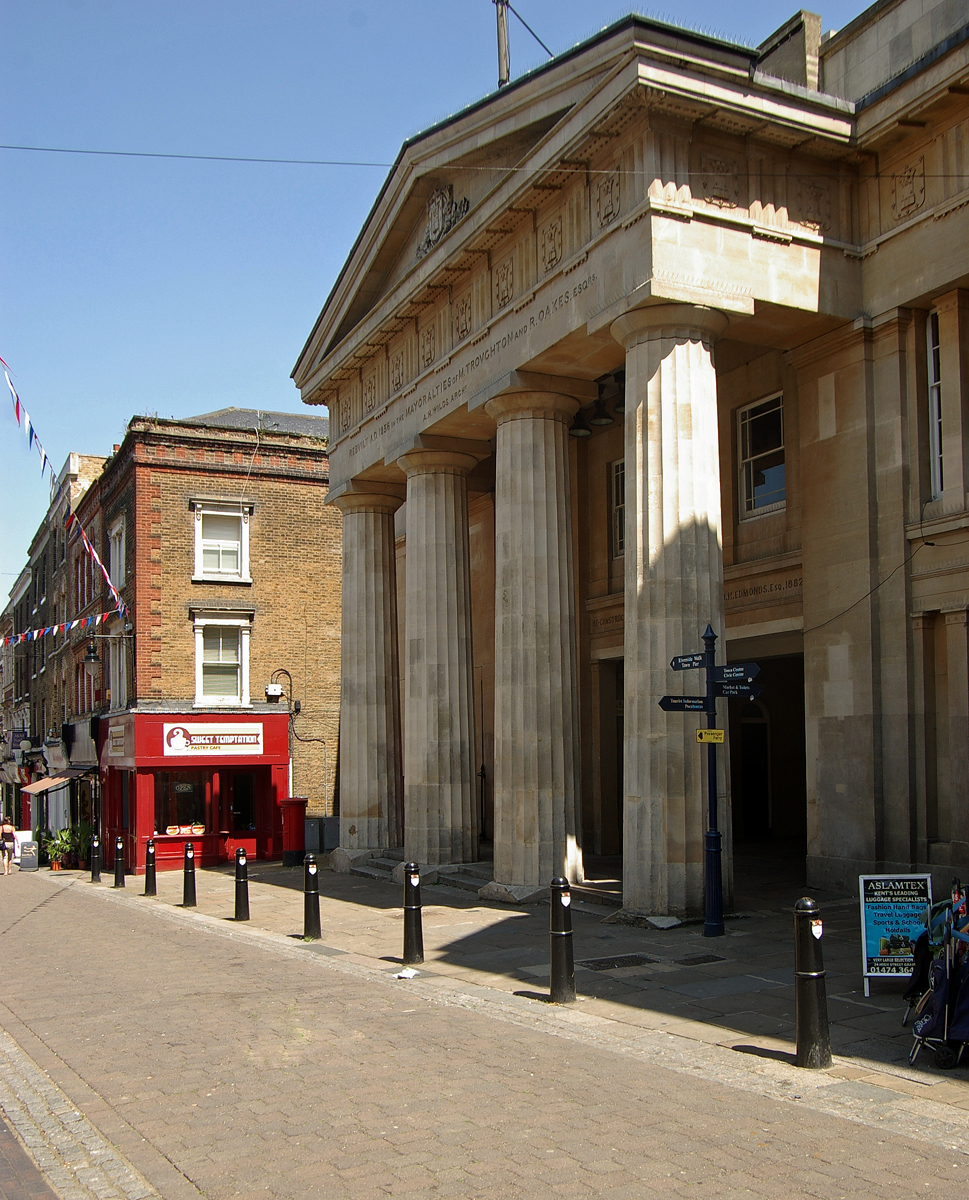
Gravesend is a town in northwest Kent, England, situated 21 miles (35 km) east-southeast of Charing Cross (central London) on the south bank of the River Thames and opposite Tilbury in Essex. Located in the diocese of Rochester, it is the administrative centre of the Borough of Gravesham. Its geographical situation has given Gravesend strategic importance throughout the maritime and communications history of South East England. A Thames Gateway commuter town, it retains strong links with the River Thames, not least through the Port of London Authority Pilot Station and has witnessed rejuvenation since the advent of High Speed 1 rail services via Gravesend railway station. The station was recently refurbished and now has a new bridge. Toponymy Recorded as Gravesham in the Domesday Book of 1086 when it belonged to Odo, Earl of Kent and Bishop of Bayeux, the half-brother of William the Conqueror, its name probably derives from ''graaf-ham'': the home of the reeve or ... [...More Info...] [...Related Items...] OR: [Wikipedia] [Google] [Baidu] |
Open-air Preaching
Open-air preaching, street preaching, or public preaching is the act of evangelizing a religious faith in public places. It is an ancient method of proselytizing a religious or social message and has been used by many cultures and religious traditions, but today it is usually associated with evangelical Protestant Christianity. Supporters of this approach note that both Jesus and many of the Old Testament prophets often preached about God in public places. It is one of the oldest approaches to evangelism.Spurgeon, p. 234 In the Bible One of the earliest open-air preachers of Christianity, according to the gospels, was Jesus Christ, whose first specifically recorded sermon was the Sermon on the Mount,http://www.biblebelievers.com/StreetPreaching2.html "OPEN-AIR PREACHING, A SKETCH OF ITS HISTORY AND REMARKS THEREON", Charles H. Spurgeon. which took place on a mountainside in the open air. In the Gospel of Luke (), it was recorded that Jesus also gave an open-air sermon known as t ... [...More Info...] [...Related Items...] OR: [Wikipedia] [Google] [Baidu] |
Damascus
)), is an adjective which means "spacious". , motto = , image_flag = Flag of Damascus.svg , image_seal = Emblem of Damascus.svg , seal_type = Seal , map_caption = , pushpin_map = Syria#Mediterranean east#Arab world#Asia , pushpin_label_position = right , pushpin_mapsize = , pushpin_map_caption = Location of Damascus within Syria , pushpin_relief = 1 , coordinates = , subdivision_type = Country , subdivision_name = , subdivision_type1 = Governorate , subdivision_name1 = Damascus Governorate, Capital City , government_footnotes = , government_type = , leader_title = Governor , leader_name = Mohammad Tariq Kreishati , parts_type = Municipalities , parts = 16 , established_title = , established_date ... [...More Info...] [...Related Items...] OR: [Wikipedia] [Google] [Baidu] |
Nile Delta
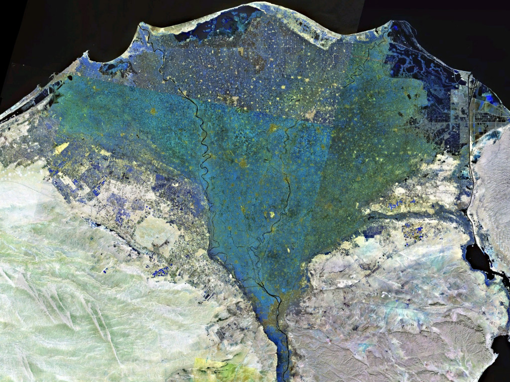
The Nile Delta ( ar, دلتا النيل, or simply , is the delta formed in Lower Egypt where the Nile River spreads out and drains into the Mediterranean Sea. It is one of the world's largest river deltas—from Alexandria in the west to Port Said in the east, it covers of Mediterranean coastline and is a rich agricultural region. From north to south the delta is approximately in length. The Delta begins slightly down-river from Cairo. Geography From north to south, the delta is approximately in length. From west to east, it covers some of coastline. The delta is sometimes divided into sections, with the Nile dividing into two main distributaries, the Damietta and the Rosetta, flowing into the Mediterranean at port cities with the same name. In the past, the delta had several distributaries, but these have been lost due to flood control, silting and changing relief. One such defunct distributary is Wadi Tumilat. The Suez Canal is east of the delta and enters the coa ... [...More Info...] [...Related Items...] OR: [Wikipedia] [Google] [Baidu] |
Dragoman
A dragoman or Interpretation was an interpreter, translator, and official guide between Turkish-, Arabic-, and Persian-speaking countries and polities of the Middle East and European embassies, consulates, vice-consulates and trading posts. A dragoman had to have a knowledge of Arabic, Persian, Turkish, and European languages. In the Ottoman Empire, Dragomans were mainly members of the Ottoman Greek community, which possessed considerable multilingual skills, because substantial Greek trading communities did business in the worlds of the Mediterranean Sea, the Black Sea, the Atlantic Ocean and the Indian Ocean. To a lesser extent, other communities with international commercial links, notably the Armenians, were recruited. Etymology and variants In Arabic the word is ترجمان (''tarjumān''), in Turkish ''tercüman''. Deriving from the Semitic quadriliteral root ''t-r-g-m'', it appears in Akkadian as "targumannu," in Ge'ez (Classical Ethiopic) as ትርጓም (''t-r- ... [...More Info...] [...Related Items...] OR: [Wikipedia] [Google] [Baidu] |
National Maritime Museum Cornwall
The National Maritime Museum, Cornwall is located in a harbourside building at Falmouth in Cornwall, England. The building was designed by architect M. J. Long, following an architectural design competition managed by RIBA Competitions. The museum grew out of the FIMI (Falmouth International Maritime Initiative) partnership which was created in 1992 and was the result of collaboration between the National Maritime Museum, Greenwich and the former Cornwall Maritime Museum in Falmouth. It opened in February 2003. It is an independent charitable trust and, unlike other national museums, receives no direct government support. Its mission is to promote an understanding of boats and their place in people's lives, and of the maritime heritage of Cornwall. It does this by presenting the story of the sea, boats and the maritime history of Cornwall. It maintains the National Small Boats Register (NSBR). Boats The Museum manages the National Small Boat Collection, which came from the N ... [...More Info...] [...Related Items...] OR: [Wikipedia] [Google] [Baidu] |
Baltic Sea
The Baltic Sea is an arm of the Atlantic Ocean that is enclosed by Denmark, Estonia, Finland, Germany, Latvia, Lithuania, Poland, Russia, Sweden and the North and Central European Plain. The sea stretches from 53°N to 66°N latitude and from 10°E to 30°E longitude. A marginal sea of the Atlantic, with limited water exchange between the two water bodies, the Baltic Sea drains through the Danish Straits into the Kattegat by way of the Øresund, Great Belt and Little Belt. It includes the Gulf of Bothnia, the Bay of Bothnia, the Gulf of Finland, the Gulf of Riga and the Bay of Gdańsk. The " Baltic Proper" is bordered on its northern edge, at latitude 60°N, by Åland and the Gulf of Bothnia, on its northeastern edge by the Gulf of Finland, on its eastern edge by the Gulf of Riga, and in the west by the Swedish part of the southern Scandinavian Peninsula. The Baltic Sea is connected by artificial waterways to the White Sea via the White Sea–Baltic Canal and to the German ... [...More Info...] [...Related Items...] OR: [Wikipedia] [Google] [Baidu] |
Lapstrake
Clinker built (also known as lapstrake) is a method of boat building where the edges of hull planks overlap each other. Where necessary in larger craft, shorter planks can be joined end to end, creating a longer strake or hull plank. The technique originated in Scandinavia, and was successfully used by the Anglo-Saxons, Frisians, Scandinavians, typically in the vessels known as cogs employed by the Hanseatic League. Carvel construction, where plank edges are butted smoothly, seam to seam, supplanted clinker construction in large vessels as the demand for capacity surpassed the limits of clinker construction. (See Comparison between clinker and carvel below.). Examples of clinker-built boats that are directly descended from those of the early medieval period are seen in the traditional round-bottomed Thames skiffs, and the larger (originally) cargo-carrying Norfolk wherries of England. Etymology From ''clinch'', or ''clench'', a common Germanic word, meaning “to fasten ... [...More Info...] [...Related Items...] OR: [Wikipedia] [Google] [Baidu] |
Lambeth
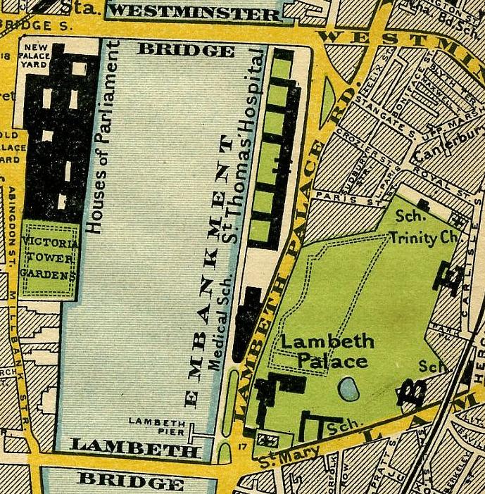
Lambeth () is a district in South London, England, in the London Borough of Lambeth, historically in the County of Surrey. It is situated south of Charing Cross. The population of the London Borough of Lambeth was 303,086 in 2011. The area experienced some slight growth in the medieval period as part of the manor of Lambeth Palace. By the Victorian era the area had seen significant development as London expanded, with dense industrial, commercial and residential buildings located adjacent to one another. The changes brought by World War II altered much of the fabric of Lambeth. Subsequent development in the late 20th and early 21st centuries has seen an increase in the number of high-rise buildings. The area is home to the International Maritime Organization. Lambeth is home to one of the largest Lusophone, Portuguese-speaking communities in the UK, and is the second most commonly spoken language in Lambeth after English language, English. History Medieval The origins of the ... [...More Info...] [...Related Items...] OR: [Wikipedia] [Google] [Baidu] |
Kayaks
A kayak is a small, narrow watercraft which is typically propelled by means of a double-bladed paddle. The word kayak originates from the Greenlandic word '' qajaq'' (). The traditional kayak has a covered deck and one or more cockpits, each seating one paddler. The cockpit is sometimes covered by a spray deck that prevents the entry of water from waves or spray, differentiating the craft from a canoe. The spray deck makes it possible for suitably skilled kayakers to roll the kayak: that is, to capsize and right it without it filling with water or ejecting the paddler. ] Some modern boats vary considerably from a traditional design but still claim the title "kayak", for instance in eliminating the cockpit by seating the paddler on top of the boat ("sit-on-top" kayaks); having inflated air chambers surrounding the boat; replacing the single hull with twin hulls; and replacing paddles with other human-powered propulsion methods, such as foot-powered rotational propellers and ... [...More Info...] [...Related Items...] OR: [Wikipedia] [Google] [Baidu] |
Northern America
Northern America is the northernmost subregion of North America. The boundaries may be drawn slightly differently. In one definition, it lies directly north of Middle America (including the Caribbean and Central America).Gonzalez, Joseph. 2004"Northern America: Land of Opportunity"(ch. 6). ''The Complete Idiot's Guide to Geography.'' () New York: Alpha Books; pp. 57–8 Northern America's land frontier with the rest of North America then coincides with the Mexico–United States border. Geopolitically, according to the United Nations' scheme of geographical regions and subregions, Northern America consists of Bermuda, Canada, Greenland, Saint Pierre and Miquelon and the United States (the contiguous United States and Alaska only, excluding Hawaii, Navassa Island, Puerto Rico, the United States Virgin Islands, and other minor U.S. Pacific territories). From a geographical perspective, Mexico would also be part of Northern America as it is on the same land as the United State ... [...More Info...] [...Related Items...] OR: [Wikipedia] [Google] [Baidu] |
Marksman
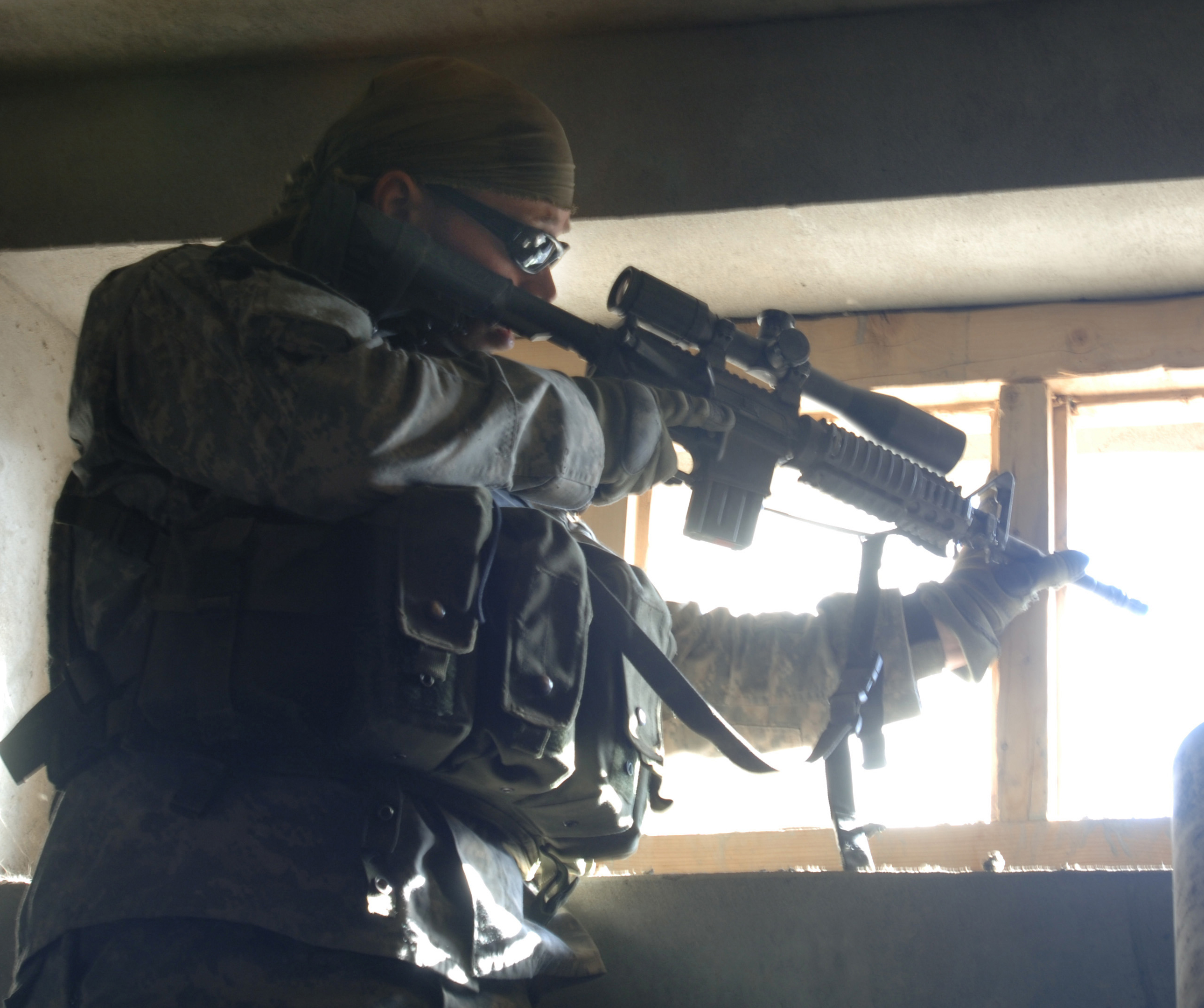
A marksman is a person who is skilled in precision shooting using projectile weapons (in modern days most commonly an accurized scoped long gun such as designated marksman rifle or a sniper rifle) to shoot at high-value targets at longer-than-usual ranges. The proficiency in precision shooting is known as a shooter's marksmanship, which can be used to describe both gunnery and archery. Description In common usage, "sharpshooter" and "marksman" are synonyms. Within the specialized fields of shooting sports and military usage, however, sharpshooter and marksman each refer to different levels of skill. Specifically, in the US Army, "marksman" is a rating below "sharpshooter" and "expert". Four levels of skill are generally recognized today in American military and civilian shooting circles: unqualified, marksman, sharpshooter, and expert. Marksmanship badges for the three qualified levels are commonly awarded to both civilian and military shooters who attain proficiency in shoo ... [...More Info...] [...Related Items...] OR: [Wikipedia] [Google] [Baidu] |


