|
Riverview, New South Wales
Riverview is a suburb on the Lower North Shore of Sydney of Sydney, in the state of New South Wales, Australia. Riverview is located 9 kilometres north-west of the Sydney central business district, in the local government area of the Municipality of Lane Cove. It is situated on the northern side of the Lane Cove River, at the head of Tambourine Bay; the foreshore is occupied bTambourine Bay Park Riverview is primarily a residential area. History Riverview takes its name from its location, which provides a 'view' of the Lane Cove 'River'. St Ignatius' College was built in 1880. A detailed history of Riverview will be found in Ball, John and Pam, ''A history of Riverview: the suburb'', 2013, Oughtershaw Press, , 499 pages, 41 pages of illustrations. Tambourine Bay was named for the woman Tambourine Nell or Tambourine Sal, who lived in a cave on the foreshore whilst hiding from police. Population In the 2016 Census, there were 3,354 people in Riverview. 75.2% of people were b ... [...More Info...] [...Related Items...] OR: [Wikipedia] [Google] [Baidu] |
Municipality Of Lane Cove
The Lane Cove Council is a Local government in Australia, local government area located on the North Shore (Sydney), Lower North Shore of Sydney, New South Wales, Australia. The administrative seat of Lane Cove, New South Wales, Lane Cove is located north-west of the Sydney central business district. The Mayor of Lane Cove Council since 10 January 2022 is Councillor, Cr. Andrew Zbik, the first mayor of Lane Cove representing the Australian Labor Party. Location On the western and southern borders is the Lane Cove River with the City of Ryde, Ryde and Municipality of Hunter's Hill, Hunter's Hill, across the river on the western and southern banks respectively. To the north is the City of Willoughby, Willoughby and to the east is North Sydney Council, North Sydney. Suburbs and localities in the local government area Suburbs in the Municipality of Lane Cove are: Localities in the municipality are: * Blaxlands Corner, New South Wales, Blaxlands Corner * Gore Hill, New South W ... [...More Info...] [...Related Items...] OR: [Wikipedia] [Google] [Baidu] |
Lane Cove River
The Lane Cove River, a northern tributary of the Parramatta River, is a tide-dominated, drowned valley estuary west of Sydney Harbour, located in Sydney, New South Wales, Australia. The river is a tributary of the Parramatta River, winding through a bushland valley. It joins Parramatta River at Greenwich and Woolwich, where together they form an arm of Sydney Harbour, and serves as a border along with Middle Harbour separating Sydney's North Shore. Ecology The Lane Cove River rises near Thornleigh and flows generally south for about . Its catchment area is approximately . The upper reaches are in a narrow, forested valley eroded into the North Shore Plateau. Fiddens Wharf was the site of early 19th century logging. The middle reaches are impounded by a weir just upstream of Fullers Bridge. Sections of the valley are forested and are protected within the Lane Cove National Park, an area of , formerly a State Recreation Area. The lower reaches of the Lane Cove River, downstream ... [...More Info...] [...Related Items...] OR: [Wikipedia] [Google] [Baidu] |
Suburbs Of Sydney
This is a complete listing of the suburbs and localities in the greater Sydney area in alphabetical order. Sydney has about 30 local government areas, each consisting of several suburbs. Suburbs in Australia are purely geographical, not political, divisions. See table below, : Suburbs of Sydney and : Local government areas in Sydney. Suburbs are listed here if they are inside the Sydney metro area, and are listed in the New South Wales Geographical Names Register as being suburbs. For this list, the boundaries of the Sydney metro area are defined as the Hawkesbury/Nepean River in the north/north west, and then the outer boundaries of the City of Penrith, Camden Council, the City of Campbelltown and Sutherland Shire. Some but not all Sydney localities are also listed, and localities are shown in italics to differentiate them from suburbs. Further localities may be added if they are on the Geographical Names Register, are inside the Sydney metro area, and are also listed in ... [...More Info...] [...Related Items...] OR: [Wikipedia] [Google] [Baidu] |
North Sydney, New South Wales
North Sydney is a suburb and major commercial district on the Lower North Shore of Sydney, Australia. North Sydney is located 3 kilometres north of the Sydney central business district and is the administrative centre for the local government area of North Sydney Council. History The Indigenous people on the southern side of Port Jackson (Sydney Harbour) called the north side ''warung'' which meant ''the other side'', while those on the northern side used the same name to describe the southern side. The first name used by European settlers was ''Hunterhill'', named after a property owned by Thomas Muir of Huntershill (1765–1799), a Scottish political reformer. He purchased land in 1794 near the location where the north pylon of the Sydney Harbour Bridge is now located, and built a house which he named after his childhood home. This area north to Gore Hill became known as St Leonards. The township of St Leonards was laid out in 1836 in what is now North Sydney, bounded ... [...More Info...] [...Related Items...] OR: [Wikipedia] [Google] [Baidu] |
Gladesville
Gladesville is a suburb in the Lower North Shore of Sydney, in the state of New South Wales, Australia. Gladesville is located 10 kilometres north-west of the Sydney central business district, in the local government area of the City of Ryde and the Municipality of Hunter's Hill. Gladesville is part of the federal electorates of North Sydney and Bennelong. Gladesville possesses riverside views and bush settings along the Parramatta River. The nearby Gladesville Bridge (a Sydney landmark that links the North Shore to the Inner West) takes its name from the suburb. History Aboriginal Before European settlement, the area of Gladesville was included within the territory of the Wallumettagal people of the Eora nation. Evidence of their presence can still be found in the area; for instance, there are rock carvings and grinding grooves that can be seen in Glades Bay Park, which overlooks Glades Bay. European The area was first called Doody's Bay during the beginnings of European se ... [...More Info...] [...Related Items...] OR: [Wikipedia] [Google] [Baidu] |
Lane Cove West
Lane Cove West is a suburb on the Lower North Shore of Sydney, in the state of New South Wales, Australia. Lane Cove West is located 9 kilometres north-west of the Sydney central business district, in the local government area of the Municipality of Lane Cove. Lane Cove and Lane Cove North are separate suburbs. History The land in the area was originally used for agriculture and owned by John Blackman. From the mid-1950s Lane Cove West was home to the national head office, pressing plant, warehouse and recording studios of the Warner Bros. Records label Festival Mushroom RecordsLane Cove West Public Schoolwas also built at this time. Lane Cove West split off from Lane Cove to become a separate suburb on 6 September 2002. Population In the 2016 Census, there were 2,637 people in Lane Cove West. 62.7% of people were born in Australia. The most common countries of birth were England 5.4% and China 3.8%. 74.0% of people only spoke English at home. The most common responses for r ... [...More Info...] [...Related Items...] OR: [Wikipedia] [Google] [Baidu] |
Lane Cove
Lane Cove is a suburb on the Lower North Shore of Sydney, in the state of New South Wales, Australia. Lane Cove is nine kilometres north-west of the Sydney central business district and is the administrative centre for the local government area of the Lane Cove Council. Lane Cove West and Lane Cove North are separate suburbs. Lane Cove occupies a peninsula on the northern side of Port Jackson (Sydney Harbour), at the opening of the Lane Cove River. The regional administrative and shopping hub of Chatswood is located 3 kilometres away, along with Macquarie Park 4 kilometres away. History There are a number of possibilities of the origin of the name 'Lane Cove'. The first written use of the name was by Lieutenant William Bradley after he had just sailed along the river in 1788. Some have argued that it was named after Lieutenant Michael Lane, a respected cartographer, who had once worked with Captain Cook. Others say that it was in honour of John Lane, who was the son ... [...More Info...] [...Related Items...] OR: [Wikipedia] [Google] [Baidu] |
McMahons Point Ferry Wharf
McMahons Point ferry wharf is located on the northern side of Sydney Harbour serving the Sydney suburb of McMahons Point. It is served by Sydney Ferries Parramatta River and Pyrmont Bay services operated by First Fleet and RiverCat class ferries. History There has been a wharf at McMahons Point since at least 1839, when Blues Point Road was gazetted as a thoroughfare from there to the township of St Leonards. At the beginning of the 20th century, a large number of passenger ferries plied the route between here and the city, with services operating every 10 to 15 minutes. Six million passengers a year were served by the wharf. A tramway opened in 1909 to bring more commuters to the wharf. When the Sydney Harbour Bridge opened in 1932 the ferry services became redundant, and in 1935 small ferries operated by Hegarty Ferries took over the runs formerly operated by the larger craft of Sydney Ferries Limited to McMahons Point. The wharf has since again become part of the Sydney ... [...More Info...] [...Related Items...] OR: [Wikipedia] [Google] [Baidu] |
Busways
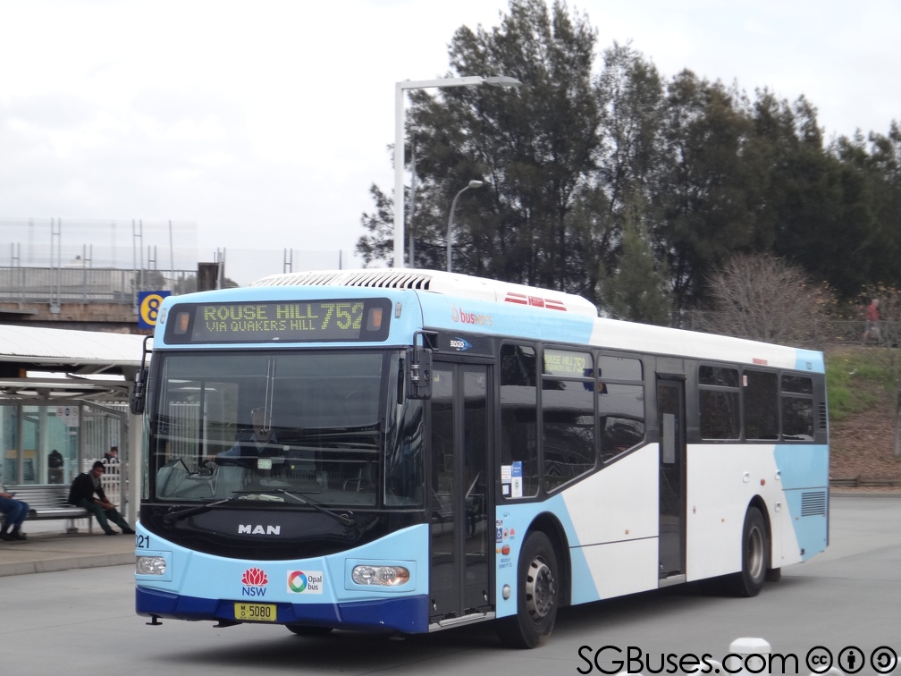
Busways is an Australian bus company operating services in Sydney Sydney ( ) is the capital city of the state of New South Wales, and the most populous city in both Australia and Oceania. Located on Australia's east coast, the metropolis surrounds Sydney Harbour and extends about towards the Blue Mountain ..., and in the Central Coast (New South Wales), Central Coast, Great Lakes Council, Great Lakes, Mid North Coast regions of New South Wales and Adelaide. It is the largest privately owned bus operator in Australia. History The origins of Busways can be traced to 1942 when Dick Rowe commenced a hire car service from Rooty Hill, New South Wales, Rooty Hill to Plumpton, New South Wales, Plumpton. In 1946 Rowe purchased his first bus and further expansion saw a depot established in Plumpton in 1958. [...More Info...] [...Related Items...] OR: [Wikipedia] [Google] [Baidu] |
Register Of The National Estate
The Register of the National Estate was a heritage register that listed natural and cultural heritage places in Australia that was closed in 2007. Phasing out began in 2003, when the Australian National Heritage List and the Commonwealth Heritage List were created and by 2007 the Register had been replaced by these and various state and territory heritage registers. Places listed on the Register remain in a non-statutory archive and are still able to be viewed via the National Heritage Database. History The register was initially compiled between 1976 and 2003 by the Australian Heritage Commission, after which the register was maintained by the Australian Heritage Council. 13,000 places were listed. The expression "national estate" was first used by the British architect Clough Williams-Ellis, and reached Australia in the 1970s.Heritage of Australia, pp. 9–13 It was incorporated into the ''Australian Heritage Commission Act 1975'' and was used to describe a collection o ... [...More Info...] [...Related Items...] OR: [Wikipedia] [Google] [Baidu] |
Victorian Architecture
Victorian architecture is a series of architectural revival styles in the mid-to-late 19th century. ''Victorian'' refers to the reign of Queen Victoria (1837–1901), called the Victorian era, during which period the styles known as Victorian were used in construction. However, many elements of what is typically termed "Victorian" architecture did not become popular until later in Victoria's reign, roughly from 1850 and later. The styles often included interpretations and eclectic revivals of historic styles ''(see Historicism)''. The name represents the British and French custom of naming architectural styles for a reigning monarch. Within this naming and classification scheme, it followed Georgian architecture and later Regency architecture, and was succeeded by Edwardian architecture. Although Victoria did not reign over the United States, the term is often used for American styles and buildings from the same period, as well as those from the British Empire. Victorian arc ... [...More Info...] [...Related Items...] OR: [Wikipedia] [Google] [Baidu] |
Jesuit
, image = Ihs-logo.svg , image_size = 175px , caption = ChristogramOfficial seal of the Jesuits , abbreviation = SJ , nickname = Jesuits , formation = , founders = , founding_location = , type = Order of clerics regular of pontifical right (for men) , headquarters = Generalate:Borgo S. Spirito 4, 00195 Roma-Prati, Italy , coords = , region_served = Worldwide , num_members = 14,839 members (includes 10,721 priests) as of 2020 , leader_title = Motto , leader_name = la, Ad Majorem Dei GloriamEnglish: ''For the Greater Glory of God'' , leader_title2 = Superior General , leader_name2 = Fr. Arturo Sosa, SJ , leader_title3 = Patron saints , leader_name3 = , leader_title4 = Ministry , leader_name4 = Missionary, educational, literary works , main_organ = La Civiltà Cattolica ... [...More Info...] [...Related Items...] OR: [Wikipedia] [Google] [Baidu] |


