|
River Seaton
The River Seaton is a river in east Cornwall, England, UK which flows southwards for into the English Channel. The river rises near Caradon Hill and flows generally south past Darite, Menheniot and Hessenford and a few miles farther south into the sea at Seaton Beach, west of Downderry. The river has been dug into channels in its lower reaches which has sped the flow of the water up and straightened the curves out. Additionally, because of the mining history around Bodmin Moor, the water is polluted with traces of aluminium and copper; both these effects have led to smaller populations of wildlife inhabiting the river. There is an early record of the river as "Seythyn" in 1302; the name means "little arrow river".Weatherhill, Craig (2009). ''A Concise Dictionary of Cornish Place-Names''. Westport, Co. Mayo: Evertype. ; p. 3 See also * Seaton Valley Countryside Park Seaton Valley Countryside Park is the newest of Cornwall's four Country Parks. It is situated in the ... [...More Info...] [...Related Items...] OR: [Wikipedia] [Google] [Baidu] |
Cornwall
Cornwall (; kw, Kernow ) is a historic county and ceremonial county in South West England. It is recognised as one of the Celtic nations, and is the homeland of the Cornish people. Cornwall is bordered to the north and west by the Atlantic Ocean, to the south by the English Channel, and to the east by the county of Devon, with the River Tamar forming the border between them. Cornwall forms the westernmost part of the South West Peninsula of the island of Great Britain. The southwesternmost point is Land's End and the southernmost Lizard Point. Cornwall has a population of and an area of . The county has been administered since 2009 by the unitary authority, Cornwall Council. The ceremonial county of Cornwall also includes the Isles of Scilly, which are administered separately. The administrative centre of Cornwall is Truro, its only city. Cornwall was formerly a Brythonic kingdom and subsequently a royal duchy. It is the cultural and ethnic origin of the Cornish dias ... [...More Info...] [...Related Items...] OR: [Wikipedia] [Google] [Baidu] |
English Channel
The English Channel, "The Sleeve"; nrf, la Maunche, "The Sleeve" (Cotentinais) or ( Jèrriais), (Guernésiais), "The Channel"; br, Mor Breizh, "Sea of Brittany"; cy, Môr Udd, "Lord's Sea"; kw, Mor Bretannek, "British Sea"; nl, Het Kanaal, "The Channel"; german: Ärmelkanal, "Sleeve Channel" ( French: ''la Manche;'' also called the British Channel or simply the Channel) is an arm of the Atlantic Ocean that separates Southern England from northern France. It links to the southern part of the North Sea by the Strait of Dover at its northeastern end. It is the busiest shipping area in the world. It is about long and varies in width from at its widest to at its narrowest in the Strait of Dover."English Channel". ''The Columbia Encyclopedia'', 2004. It is the smallest of the shallow seas around the continental shelf of Europe, covering an area of some . The Channel was a key factor in Britain becoming a naval superpower and has been utilised by Britain as a natural def ... [...More Info...] [...Related Items...] OR: [Wikipedia] [Google] [Baidu] |
Seaton Beach After Heavy Rainfall
Seaton can refer to: Places Antarctica * Seaton Glacier Australia * Seaton, South Australia * Seaton, Victoria Canada * Seaton, Ontario * Seaton House, one of the largest men's homeless shelters located in Toronto, Ontario England * Seaton, Cornwall * Seaton, Cumbria * Seaton, Devon * Seaton, County Durham * Seaton Carew, County Durham * Seaton Burn, Tyne and Wear * Seaton Delaval, Northumberland * Seaton Sluice, Northumberland * Seaton Valley, Northumberland * Seaton, Rutland * Seaton, East Riding of Yorkshire * Seaton Ross, East Riding of Yorkshire Scotland * Seaton Park, Aberdeen United States * Seaton, Illinois People * Alexander Seaton (1626–1649), Scottish soldier * Andy Seaton (born 1977), Scottish footballer * Brad Seaton (born 1993), American football player * Fred Andrew Seaton (1909–1974), United States Secretary of the Interior, 1956–1961 * George Seaton (1911–1979), American playwright and film director * Gordon Seaton (born 194 ... [...More Info...] [...Related Items...] OR: [Wikipedia] [Google] [Baidu] |
Caradon Hill
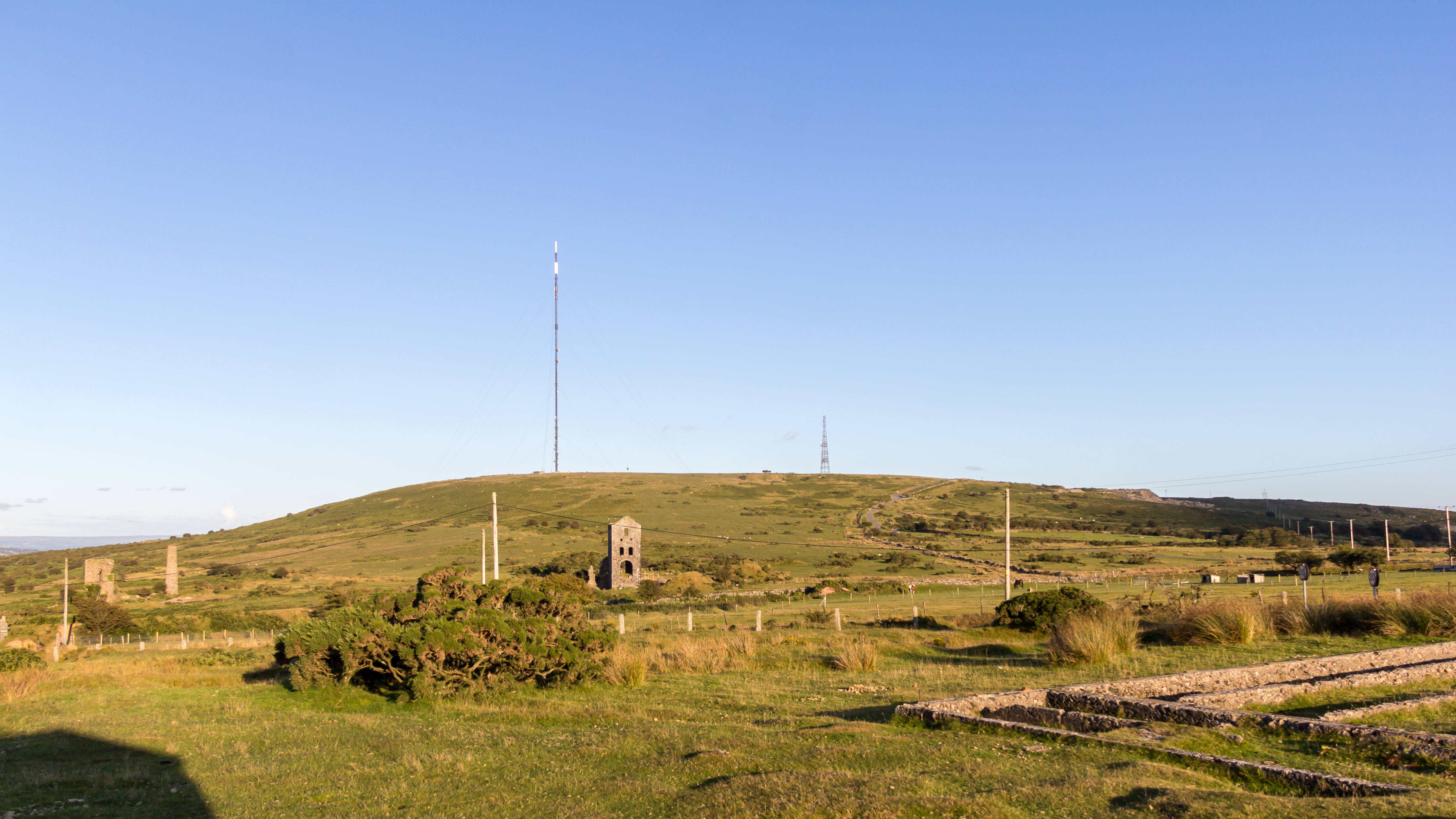
Caradon Hill ( kw, Bre Garn) is on Bodmin Moor in the former Caradon district of Cornwall, England, United Kingdom. The summit is above mean sea level. Caradon Hill is on the southeastern edge of the moor; it is between the villages of Minions (northwest), Upton Cross (northeast), Pensilva (southeast) and Darite (southwest). The hill was once famous for its copper mines but these are now closed. The South Caradon Copper Mine, 1 km to the SW of the transmitter, was the biggest copper mine in the UK in its heyday in the second half of the 19th century. Other disused copper and tin mines are scattered around the base of the hill, including the Wheal Phoenix, well known among mineral collectors. The ruins of the Prince of Wales engine house are prominent at Wheal Phoenix. at < ... [...More Info...] [...Related Items...] OR: [Wikipedia] [Google] [Baidu] |
Darite
Darite is a village in the civil parish of St Cleer (where the 2011 census population was included), Cornwall Cornwall (; kw, Kernow ) is a historic county and ceremonial county in South West England. It is recognised as one of the Celtic nations, and is the homeland of the Cornish people. Cornwall is bordered to the north and west by the Atlantic ..., England, United Kingdom. It is three miles (5 km) north of Liskeard.Ordnance Survey: Landranger map sheet 201 ''Plymouth & Launceston'' References External links Villages in Cornwall {{Caradon-geo-stub ... [...More Info...] [...Related Items...] OR: [Wikipedia] [Google] [Baidu] |
Menheniot
Menheniot (pronounced Men-en-yut; kw, Mahynyet) is a civil parish and village in Cornwall, England, United Kingdom. The village is southeast of Liskeard. The meaning of the name is "sanctuary of Neot" (from ''minihi'' and ''Neot''). Menheniot had a population of 1,605 in the 2001 census. This increased slightly to 1,655 at the 2011 census, whereas the ward population at the same census was 3,658. The village has a primary school, a pub, a shop and a post office. Geography To the south of the civil parish is Clicker Tor Quarry, a Site of Special Scientific Interest noted for its geological interest, containing one of the best examples of ultramafic rocks in South West England. At Coldrenick was a black and white mansion dated 1870 by the architect C. F. Hayward. At Merrymeet is an Anglican mission church dedicated to St Mary the Virgin. Hendra Cross Parish church The parish church, located in the village, is dedicated to St Lalluwy. It has a buttressed tower and a spire. [...More Info...] [...Related Items...] OR: [Wikipedia] [Google] [Baidu] |
Hessenford
Hessenford ( kw, Rys an Gwraghes) is a small village in south-east Cornwall, United Kingdom, four miles west of St Germans on the A387 Polbathic to Polperro road.Ordnance Survey: Landranger map sheet 201 ''Plymouth & Launceston'' The village had a population of 170 at the 2001 census. It is in the civil parish of Deviock. The river Seaton runs through the village and a mill was recorded here in 1286; the last mill closing in the mid-20th century. Hessenford is part of the united parishes of St Germans, Hessenford, Downderry and Tideford. St Anne's Church was built in 1832 as a chapel of ease in the parish of St Germans to serve the growing population of the village. It was built by local subscription, local labour and materials, and was dedicated on 26 September 1833, the perpetual curate being appointed by the vicar of Saint Germans. Hessenford became a parish in its own right by "Order in Council" in 1852 and in 1855 and 1871 the church was rebuilt in early English styl ... [...More Info...] [...Related Items...] OR: [Wikipedia] [Google] [Baidu] |
Downderry
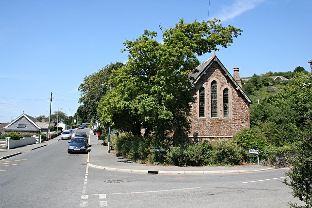
Downderry ( kw, Downderri) is a coastal village in southeast Cornwall, England, United Kingdom. It is situated west of Plymouth and one mile east of Seaton. Downderry has a long beach of light shingle. There is road access down to the beach via a slipway although this is blocked by a locked gate, pedestrian access is still possible. Dogs are allowed on the beach. The east beach has a reputation as a nudist beach. The village and beach offer views of Looe Island to the west and Rame Head to the east and on clear days sight of the Eddystone Lighthouse to the south. The village has a Church of England church, a Methodist chapel, a shop with a post office, a pub, a restaurant, a coffee shop and a primary school. The Church of St Nicolas Downderry began as a mission church to service the growing population of the village. The building dates from the late 19th century. Points of interest Bass rock Approximately east of the village center is a rocky outcrop known locally as " ... [...More Info...] [...Related Items...] OR: [Wikipedia] [Google] [Baidu] |
Weatherhill, Craig
Craig Weatherhill (1950 or 1951 – 18 or 19 July 2020) was a Cornish antiquarian, novelist and writer on the history, archaeology, place names and mythology of Cornwall. Weatherhill attended school in Falmouth, where his parents ran a sports shop. He played football for a number of local clubs, including Mawnan, and played as goalkeeper for the county football team. Between 1972 and 1974, Weatherhill served with the RAF, training as a cartographer. He was discharged after a serious back injury. He worked as a planning officer, architectural designer and historic conservation expert in local government and private practice. Under the tutelage of historian P.A.S. Pool he conducted archaeological surveys of West Cornwall. Weatherhill was also a Conservation Officer at Penwith District Council. He contributed to the BBC's Radyo Kernow, in particular to the series ''The Tinners' Way'' and ''Beachcombers''. In 1981 Weatherhill was made a Bard of Gorsedh Kernow for services to Corn ... [...More Info...] [...Related Items...] OR: [Wikipedia] [Google] [Baidu] |
Seaton Valley Countryside Park
Seaton Valley Countryside Park is the newest of Cornwall's four Country Parks. It is situated in the Seaton valley between the villages of Seaton and Hessenford. It includes two Local Nature Reserves, Seaton Valley North and Seaton Valley South.There is no map of Seaton Valley South. The park was formerly owned and managed by Caradon District Council since 1995 and it was formally opened in 1998. Today, the park is owned and managed by Cornwall Council. It covers over 50 hectares, including a sensory garden, ponds, cycleways and footpaths, with disabled access on the main footpath and to the garden. In 2005, the park became the first one in Cornwall to win a Green Flag Award The Green Flag Award is an international accreditation given to publicly accessible parks and open spaces, managed under licence from the Department for Levelling Up, Housing and Communities, a UK Government department, by Keep Britain Tidy, .... The park provides a flat path of over a mile in ... [...More Info...] [...Related Items...] OR: [Wikipedia] [Google] [Baidu] |


