|
River Hawen
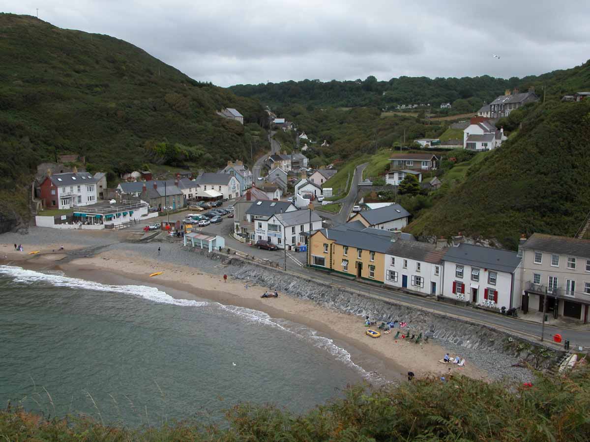
The River Hawen ( cy, Nant Hawen) is the main stream that flows through Llangrannog, Ceredigion, Wales into Cardigan Bay.Ordnance Survey of Great Britain It falls as a waterfall near the centre of the village, then flows to the beach through a v-shaped valley A valley is an elongated low area often running between hills or mountains, which will typically contain a river or stream running from one end to the other. Most valleys are formed by erosion of the land surface by rivers or streams over .... Shortly after passing the waterfall, it is joined by the smaller ''Nant Ddu'' from the south. References Hawen {{Wales-river-stub ... [...More Info...] [...Related Items...] OR: [Wikipedia] [Google] [Baidu] |
Llangrannog
Llangrannog (sometimes spelt as Llangranog) is both a village and a community in Ceredigion, Wales, southwest of New Quay. It lies in the narrow valley of the River Hawen, which falls as a waterfall near the middle of the village. Llangrannog is on the Wales Coast Path. Demographics Population According to the 2011 census, Llangrannog's population was 775. This was a 2.6% decrease since the 796 people noted in 2001. It is estimated that Llangrannog's population decreased further to 759 in 2019. Welsh language The 2011 census showed 46.5% of the town's population could speak Welsh, a fall from 51.8% in 2001. Geography The large rock between Llangrannog and Cilborth Beaches is Carreg Bica, a stack of Ordovician rock weathered by the sea, one of many along the coastline. A large piece of Carreg Bica fell away some years ago. Llangrannog's beach has received Blue Flag beach status. An RNLI lifeguard service is provided. Two streams flow down the beach to the sea - th ... [...More Info...] [...Related Items...] OR: [Wikipedia] [Google] [Baidu] |
Ceredigion
Ceredigion ( , , ) is a county in the west of Wales, corresponding to the historic county of Cardiganshire. During the second half of the first millennium Ceredigion was a minor kingdom. It has been administered as a county since 1282. Ceredigion is considered a centre of Welsh culture and just under half of the population can speak Welsh according to the 2011 Census. The county is mainly rural, with over of coastline and a mountainous hinterland. The numerous sandy beaches and the long-distance Ceredigion Coast Path provide views of Cardigan Bay. In the 18th and early 19th centuries, Cardiganshire had more industry than it does today; Cardigan was the commercial centre of the county; lead, silver and zinc were mined and Cardigan was the principal port of South Wales prior to the silting of its harbour. The economy became highly dependent on dairy farming and the rearing of livestock for the English market. During the 20th century, livestock farming became less prof ... [...More Info...] [...Related Items...] OR: [Wikipedia] [Google] [Baidu] |
Wales
Wales ( cy, Cymru ) is a Countries of the United Kingdom, country that is part of the United Kingdom. It is bordered by England to the Wales–England border, east, the Irish Sea to the north and west, the Celtic Sea to the south west and the Bristol Channel to the south. It had a population in 2021 of 3,107,500 and has a total area of . Wales has over of coastline and is largely mountainous with its higher peaks in the north and central areas, including Snowdon (), its highest summit. The country lies within the Temperateness, north temperate zone and has a changeable, maritime climate. The capital and largest city is Cardiff. Welsh national identity emerged among the Celtic Britons after the Roman withdrawal from Britain in the 5th century, and Wales was formed as a Kingdom of Wales, kingdom under Gruffydd ap Llywelyn in 1055. Wales is regarded as one of the Celtic nations. The Conquest of Wales by Edward I, conquest of Wales by Edward I of England was completed by 1283, th ... [...More Info...] [...Related Items...] OR: [Wikipedia] [Google] [Baidu] |


