|
Rheine
Rheine () is a city in the district of Steinfurt in Westphalia, Germany. It is the largest city in the district and the location of Rheine Air Base. Geography Rheine is on the river Ems, approx. north of Münster, approx. west of Osnabrück and east of Hengelo (Netherlands). Division of the city There is no standard division of the city, different divisions are used for different purposes. The districts do not form administrative units. A detailed breakdown includes 21 districts. * Altenrheine * Baarentelgen * Bentlage * Catenhorn * Dorenkamp * Dutum * Elte * Eschendorf * Gellendorf * Hauenhorst * Hörstkamp * Innenstadt (city centre) * Kanalhafen * Mesum * Rodde * Schleupe * Schotthock * Stadtberg * Südesch * Wadelheim * Wietesch The city of Rheine has eleven district advisory councils. For statistical purposes there is a division into 18 statistical districts. Politically, the city is divided into 22 electoral districts. Eschendorf, Dorenkamp and Schotthock are the ... [...More Info...] [...Related Items...] OR: [Wikipedia] [Google] [Baidu] |
Rheine Railway Station
Rheine is a railway station located in Rheine, Germany. The station is located on the Löhne–Rheine, Emsland Railway (Rheine-Norddeich Mole) and the Münster–Rheine lines. The train services are operated by Deutsche Bahn and WestfalenBahn WestfalenBahn is a railway company operating regional train service in Lower Saxony and North Rhine-Westphalia, Northern Germany. It was founded in 2005 by Essener Versorgungs & Verkehrsgesellschaft, Minden Museum Railway, moBiel and Verkehrsbe .... Train services The following services currently call at Rheine: *Intercity services (IC 35) ''Norddeich - Emden - Münster - Düsseldorf - Cologne - Bonn - Koblenz - Mainz - Ma ... [...More Info...] [...Related Items...] OR: [Wikipedia] [Google] [Baidu] |
Rheine Air Base
Rheine-Bentlage Air Base (german: Heeresflugplatz Rheine-Bentlage) was an air base of the German Armed Forces and located near the village of Bentlage, 2 km northwest of the city of Rheine, North Rhine-Westphalia, Germany. History In 1939 work to build an air base for the Luftwaffe began. These preparations were completed in 1940. During World War II extensive use was made of the air base, particularly by night and day fighter squadrons. After the war the air base was abandoned. In 1960, following the founding of the Bundeswehr in 1955 and the establishing of a new branch within the German Army, the Aviation Corps, completely new military installations, hangars and a small runway made of asphalt, were constructed on the grounds of the former German Air Force base. Since 1960 various units of the German Army Aviation Corps have been stationed at Rheine Air Base. Initially, these units flew Sikorsky H-34 helicopters, which were used extensively during relief operations fol ... [...More Info...] [...Related Items...] OR: [Wikipedia] [Google] [Baidu] |
Rheine-Mesum Railway Station
Rheine-Mesum is a railway station located in Mesum, Germany. History The station is located on the Münster–Rheine line. The train services are operated by Deutsche Bahn and the WestfalenBahn WestfalenBahn is a railway company operating regional train service in Lower Saxony and North Rhine-Westphalia, Northern Germany. It was founded in 2005 by Essener Versorgungs & Verkehrsgesellschaft, Minden Museum Railway, moBiel and Verkehrsbe .... Train services The following services currently call at Rheine-Mesum: Railway stations in North Rhine-Westphalia Rheine {{NorthRhineWestphalia-railstation-stub ... [...More Info...] [...Related Items...] OR: [Wikipedia] [Google] [Baidu] |
Elte, North Rhine-Westphalia
Prior to 1975, Elte was, with approximately 1,300 residents, a self-standing, political community under the authorities of Rheine. On 1 January 1975, Elte became integrated with other communities within the town of Rheine, 9 km from the centre of Rheine town. Elte still has character of a rural location situated between Emsaue and the countryside. It is now officially named Rheine-Elte. The name "Elte" is first mentioned in a document from the year 1154. In the "Codex traditionum", which is kept in the State Archives in Münster, is in Volume VI page 181 read: "Bishop Werner of Münster" founded in 1140 an Augustinian monastery in Asbeck. The noble Eppo of Burgsteinfurt gave this monastery two mansions (farms), located in parochia Rene in villa quae "Elethe'dicitur". The linguists interpret all place and field names ending in èthè and èdè as heathlands. The vernacular then gave the village the name "Elte" over time. People * Josef Pieper (1904-1997), christian philoso ... [...More Info...] [...Related Items...] OR: [Wikipedia] [Google] [Baidu] |
Mesum
Mesum is a village south of Rheine, located in the district Steinfurt, part of North Rhine-Westphalia. The current population in 2004 is about 8500. Mesum was first mentioned in 1373 in a document listing the church. That old church still exists as the oldest building of the village. The village grew in the 19th century with the textile industry. At that time, it was part of the Prussia Prussia, , Old Prussian: ''Prūsa'' or ''Prūsija'' was a German state on the southeast coast of the Baltic Sea. It formed the German Empire under Prussian rule when it united the German states in 1871. It was ''de facto'' dissolved by an ...n Kingdom. Railway station The village has a railway station Rheine-Mesum, however Rheine has more services.Link to city-homepage(German) {{Authority control Towns in North Rhine-Westphalia ... [...More Info...] [...Related Items...] OR: [Wikipedia] [Google] [Baidu] |
Emsdetten
Emsdetten (; Westphalian language, Westphalian: ''Detten'') is a town in the Steinfurt (district), district of Steinfurt, in North Rhine-Westphalia, Germany. Geography Emsdetten is situated on the river Ems (river), Ems, approx. south-east of Rheine and north-west of Münster. Neighbouring places * Rheine * Hörstel * Saerbeck * Greven * Nordwalde * Steinfurt * Neuenkirchen, Westphalia, Neuenkirchen Division of the town Emsdetten consists of 8 districts: * Emsdetten * Ahlintel * Austum * Hembergen * Hollingen * Isendorf * Sinningen * Westum 2006 school shooting On 20 November 2006, 18-year-old former student Bastian Bosse entered the Geschwister Scholl School, fired several shots and set off smoke grenades. He injured 22 people before killing himself by a shot into the mouth. Even though there were no other fatalities, the shooting was considered the deadliest school shooting in the history of Germany since the Erfurt massacre; this position is now held by the Winnenden sc ... [...More Info...] [...Related Items...] OR: [Wikipedia] [Google] [Baidu] |
Neuenkirchen, Westphalia
Neuenkirchen is a municipality in the district of Steinfurt, in North Rhine-Westphalia, Germany. Neuenkirchen is the biggest village in the district of Steinfurt. It is situated approximately 7 km south-west of Rheine and 35 km north-west of Münster. Geography Neighbouring places * Wettringen * Steinfurt * Emsdetten * Rheine * Salzbergen Division of the municipality * * Offlum * Sutrum-Harum * Landersum Politics Town assembly After the local elections on September 26, 2004 the town assembly has the following structure: * CDU 15 seats * SPD 5 seats * Green Party 2 seats * FDP 1 seats * UWG 3 seats Sons and daughters of the community * Johannes Georg Bednorz (born 1950), physicist and Nobel laureate, a residential street bears his name (Georg-Bednorz-Strasse). * Josef F. Bille (born 1944), physicist and inventor, bearer of the European Inventive Price * Isaac Leeser Isaac Leeser (December 12, 1806 – February 1, 1868) was an American Orthodox ... [...More Info...] [...Related Items...] OR: [Wikipedia] [Google] [Baidu] |
Ems (river)
The Ems (german: Ems; nl, Eems) is a river in northwestern Germany. It runs through the states of North Rhine-Westphalia and Lower Saxony, and discharges into the Dollart Bay which is part of the Wadden Sea. Its total length is . The state border between the Lower Saxon area of East Friesland (Germany) and the province of Groningen (Netherlands), whose exact course was the subject of a border dispute between Germany and the Netherlands (settled in 2014), runs through the Ems estuary. Course The source of the river is in the southern Teutoburg Forest in North Rhine-Westphalia. In Lower Saxony, the brook becomes a comparatively large river. Here the swampy region of Emsland is named after the river. In Meppen the Ems is joined by its largest tributary, the Hase River. It then flows northwards, close to the Dutch border, into East Frisia. Near Emden, it flows into the Dollart bay (a national park) and then continues as a tidal river towards the Dutch city of Delfzijl. Betwee ... [...More Info...] [...Related Items...] OR: [Wikipedia] [Google] [Baidu] |
Hengelo
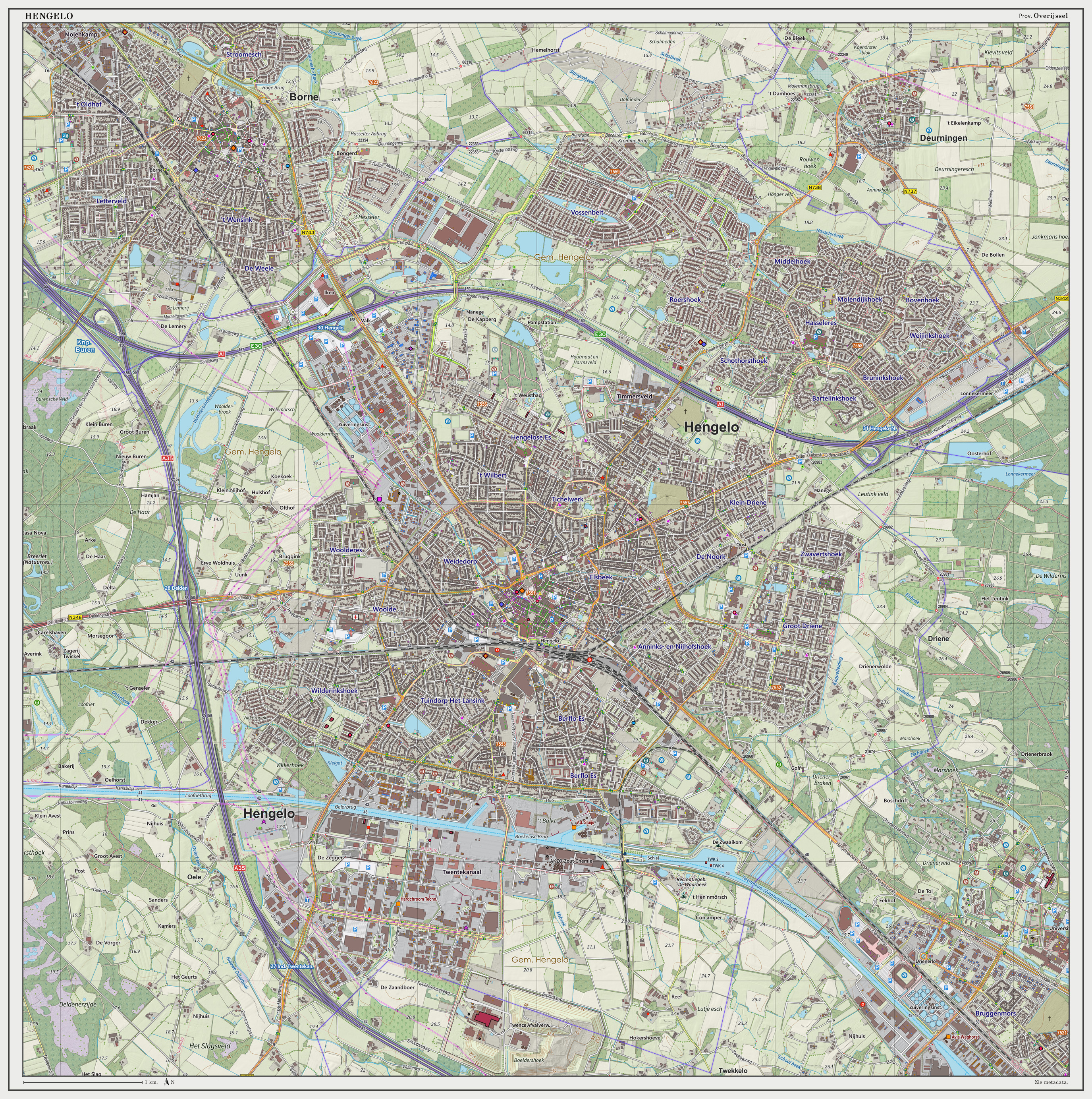
Hengelo (; Tweants: ) is a city in the eastern part of the Netherlands, in the province of Overijssel. The city lies along the motorways A1/E30 and A35 and it has a station for the international Amsterdam – Hannover – Berlin service. Population centres * Beckum *Oele *Hengelo Transport Hengelo is easily reached by train. One can travel from Hengelo railway station, the main station of Hengelo and get directly and regularly to: Apeldoorn, Amersfoort, Hilversum, Southern Amsterdam, Amsterdam Airport Schiphol, Utrecht, Gouda, Rotterdam, The Hague, Zwolle, Zutphen, Oldenzaal, Almelo, Deventer, Enschede. There are international trains daily to Bad Bentheim, Rheine, Osnabrück, Hannover, and Berlin. For information on the train services see Hengelo railway station. One can also plan a journey on the website of Dutch Railways. For Amsterdam, passengers should use the train to Schiphol and change at Amersfoort, where there are regular trains to Amsterdam Centraal railway ... [...More Info...] [...Related Items...] OR: [Wikipedia] [Google] [Baidu] |
Spelle
Spelle is a municipality in the Emsland district, in Lower Saxony, Germany. It is situated approximately 20 km southeast of Lingen, and 10 km north of Rheine. Spelle is also the seat of the ''Samtgemeinde'' ("collective municipality") Spelle Spelle is a municipality in the Emsland district, in Lower Saxony, Germany. It is situated approximately 20 km southeast of Lingen, and 10 km north of Rheine. Spelle is also the seat of the ''Samtgemeinde A ''Samtgemeinde'' (; plu .... References Emsland {{Emsland-geo-stub ... [...More Info...] [...Related Items...] OR: [Wikipedia] [Google] [Baidu] |
Hörstel
is a town in the district of Steinfurt, in North Rhine-Westphalia, Germany. It is situated near the junction of the Mittellandkanal and the Dortmund-Ems Canal, approx. 10 km east of Rheine. Parts of Hörstel are Riesenbeck, Dreierwalde, Birgte and Bevergern Sports S.C.Hörstel-Arena (Waldstadion) home of S.C.Hörstel 1921 e.V. Gallery File:Hörstel, die Friedenskirche Dm39 foto5 2013-09-30 13.26.jpg, Hörstel, church: die Friedenskirche File:Hörstel, katholische Pfarrkirche Sankt Antonius Dm129 foto1 2013-09-30 13.35.jpg , Hörstel, church: katholische Pfarrkirche Sankt Antonius File:Riesenbeck, Sankt Kalixtus Kirche Dm42 foto13 2013-09-28 14.30.jpg, Riesenbeck, church: Sankt Kalixtus Kirche File:Schloss surenburg.jpg, Surenburg in Riesenbeck People * Georg Hermes (1775-1835), Roman Catholic theologian * Clemens Heereman von Zuydwyck (1832-1903), farmer and politician (Zentrum) * Constantin Heereman von Zuydtwyck (1931-2017), farmer, forester and politici ... [...More Info...] [...Related Items...] OR: [Wikipedia] [Google] [Baidu] |
Steinfurt (district)
Steinfurt () is a ''Kreis'' (district) in the northern part of North Rhine-Westphalia, Germany. Neighboring districts are Bentheim, Emsland, district-free Osnabrück and the Osnabrück district, Warendorf, district-free Münster, Coesfeld, Borken. Geography The district is situated at the Lower Saxon border, north of Münster. The Ems river runs through the district from south to north. The highest point in the region is the Westerbecker Berg at 234 metres above sea level; the lowest point is Bentlage Castle at 32 metres. History In the middle ages and early modern period, Steinfurt was an independent county of the Holy Roman Empire. In 1806, it became part of the Grand Dutchy of Berg and in 1815 it became part of the Kingdom of Prussia. In 1975, the old district Steinfurt was merged with the district Tecklenburg, and together with Greven and Saerbeck from the former district Münster the current district was formed. Coat of arms The coat of arms combines elements from th ... [...More Info...] [...Related Items...] OR: [Wikipedia] [Google] [Baidu] |


