|
Rastorguyev Island
Rastorguyev Island or Rastorguyeva Island (russian: остров Расторгуева, ''ostrov Rastorguyeva'') is an island in the Kara Sea, Russian Federation. Geography It is the third largest island of the Kamennyye Islands. It is located close to the shores of the Taymyr Peninsula, about from the coast. A narrow and bent landspit projects northwards of the norther shore. There are two hills on the island, the highest of which is Mount Kolomeitsev ''(Gora Kolomeitseva)'' —named after Nikolai Kolomeitsev— in the eastern part. Winters are long, cold and bitter, and the surrounding sea freezes solid about ten months every year. History The whole area around Rastorguyev Island was explored by Russian geologist Baron Eduard von Toll during his last venture, the Russian Arctic Expedition of 1900–1903. This large island was named by him after Stepan Innokentyevich Rastorguyev, an Imperial Russian Cossack officer accompanying him. Toll sent Rastorguyev along with the for ... [...More Info...] [...Related Items...] OR: [Wikipedia] [Google] [Baidu] |
Kara Sea
The Kara Sea (russian: Ка́рское мо́ре, ''Karskoye more'') is a marginal sea, separated from the Barents Sea to the west by the Kara Strait and Novaya Zemlya, and from the Laptev Sea to the east by the Severnaya Zemlya archipelago. Ultimately the Kara, Barents and Laptev Seas are all extensions of the Arctic Ocean north of Siberia. The Kara Sea's northern limit is marked geographically by a line running from Cape Kohlsaat in Graham Bell Island, Franz Josef Land, to Cape Molotov (Arctic Cape), the northernmost point of Komsomolets Island in Severnaya Zemlya. The Kara Sea is roughly long and wide with an area of around and a mean depth of . Its main ports are Novy Port and Dikson and it is important as a fishing ground although the sea is ice-bound for all but two months of the year. The Kara Sea contains the East-Prinovozemelsky field (an extension of the West Siberian Oil Basin), containing significant undeveloped petroleum and natural gas. In 2014, US gov ... [...More Info...] [...Related Items...] OR: [Wikipedia] [Google] [Baidu] |
Nikolai Nikolaevich Kolomeitsev
Nikolai Nikolaevich Kolomeitsev, also spelt Kolomeytsev (russian: Николай Николаевич Коломейцев) (16 July 1867 – 6 October 1944) was a naval officer of the Russian Empire and Arctic explorer. Early life Nikolai Kolomeitsev was born in the village of Pokrovka in the Kherson Governorate of the Russian Empire (present-day Ukraine) in 1867. He entered military service in 1884 and graduated as an officer of the Imperial Russian Navy in 1887. He was promoted to lieutenant in December 1893. Naval Career In 1894–1895, he was assigned to the Russian Pacific Fleet, and after graduating from mine warfare school, served on several vessels operating in Siberia. Kolomeitsev became a member of the Chief Hydrographic Administration’s Survey Expedition to the White Sea. He also took part in an expedition to the Yenisei Gulf led by L. Dobrotvorskiy, which gave him expertise on sailing in arctic waters. Russian polar expedition of 1900–1902 In 1900, Bar ... [...More Info...] [...Related Items...] OR: [Wikipedia] [Google] [Baidu] |
List Of Islands Of Russia
A ''list'' is any set of items in a row. List or lists may also refer to: People * List (surname) Organizations * List College, an undergraduate division of the Jewish Theological Seminary of America * SC Germania List, German rugby union club Other uses * Angle of list, the leaning to either port or starboard of a ship * List (information), an ordered collection of pieces of information ** List (abstract data type), a method to organize data in computer science * List on Sylt, previously called List, the northernmost village in Germany, on the island of Sylt * ''List'', an alternative term for ''roll'' in flight dynamics * To ''list'' a building, etc., in the UK it means to designate it a listed building that may not be altered without permission * Lists (jousting), the barriers used to designate the tournament area where medieval knights jousted * ''The Book of Lists'', an American series of books with unusual lists See also * The List (other) * Listing ... [...More Info...] [...Related Items...] OR: [Wikipedia] [Google] [Baidu] |
Taymyr Gulf
The Taymyr Gulf (russian: Таймырская губа, Taymyrskaya guba; also known as ''Taymyr Bay'', russian: Таймырский залив, Taymyrsky zaliv, link=no) is a gulf in the Kara Sea that includes the estuary of the Lower Taymyra. The estuary proper is frozen for about nine months in a year and even in summer it is never quite free of ice floes. Fishes like the golets and the muksun are very common in its waters. Geography The estuary opens roughly northwestwise from the western coast of the Taymyr Peninsula into the eastern expanses of the Kara Sea, widening from about 4 km at the river's mouth to about 20 km. Its length, including the wider gulf, is about 50 km, and its width roughly 40 km. Taymyr Island is located about 60 km westwards from the mouth of the estuary. Beyond Cape Oscar, the headland of the Oscar Peninsula that limits the gulf to the northeast, lies the Toll Bay. The climate in the desolate area of the Taymyr Gulf ... [...More Info...] [...Related Items...] OR: [Wikipedia] [Google] [Baidu] |
Kolchak Island
Kolchak Island or Kolchaka Island (russian: остров Колчака, ''ostrov Kolchaka''), is an island in the Kara Sea located in a coastal area of skerries NE of the Shturmanov Peninsula. It is near the southern end of the Nordenskiöld Archipelago, but not geographically part of it. It was known as Rastorguyev Island (russian: остров Расторгуева, ''ostrov Rastorguyeva'') in the period between 1937 and 2005 . Description Compared to other large islands in the area Kolchak has a quite regular shape. Its length is 21 km and its maximum width 6.5 km. It is covered with tundra vegetation in the summer, but most of the year it lies under a shroud of snow. Kolchaka Island is located 40 km from the western end of the Taymyr Gulf and only 14 km southeast of Taymyr Island. It separated from the nearest coast by a narrow sound that is about one km in width in its narrowest stretch. The climate in the area is severe, with long and bitter winters ... [...More Info...] [...Related Items...] OR: [Wikipedia] [Google] [Baidu] |
Siberia
Siberia ( ; rus, Сибирь, r=Sibir', p=sʲɪˈbʲirʲ, a=Ru-Сибирь.ogg) is an extensive geographical region, constituting all of North Asia, from the Ural Mountains in the west to the Pacific Ocean in the east. It has been a part of Russia since the latter half of the 16th century, after the Russians conquered lands east of the Ural Mountains. Siberia is vast and sparsely populated, covering an area of over , but home to merely one-fifth of Russia's population. Novosibirsk, Krasnoyarsk and Omsk are the largest cities in the region. Because Siberia is a geographic and historic region and not a political entity, there is no single precise definition of its territorial borders. Traditionally, Siberia extends eastwards from the Ural Mountains to the Pacific Ocean, and includes most of the drainage basin of the Arctic Ocean. The river Yenisey divides Siberia into two parts, Western and Eastern. Siberia stretches southwards from the Arctic Ocean to the hills of north-ce ... [...More Info...] [...Related Items...] OR: [Wikipedia] [Google] [Baidu] |
Dudinka
Dudinka (russian: Дуди́нка; Nenets: Тут'ын, ''Tutꜧyn'') is a town on the Yenisei River and the administrative center of Taymyrsky Dolgano-Nenetsky District of Krasnoyarsk Krai, Russia. It used to be the administrative center of Taymyr Autonomous Okrug, which was merged into Krasnoyarsk Krai on January 1, 2007. Population: History It was founded in 1667 as a winter settlement connected to Mangazeya. In 1930 it was designated the administrative center of the Taimyr Dolgan-Nenets National Region. In 1935, the polar explorer Otto Schmidt recommended that the settlement be expanded into a town. By 1937, the port facilities and a railroad to Norilsk were completed. Town status was granted in 1951. Administrative and municipal status Within the framework of administrative divisions, Dudinka serves as the administrative center of Taymyrsky Dolgano-Nenetsky District.Law #10-4765 As an administrative division, it is, together with five rural localities, incorporated ... [...More Info...] [...Related Items...] OR: [Wikipedia] [Google] [Baidu] |
Dikson (urban-type Settlement)
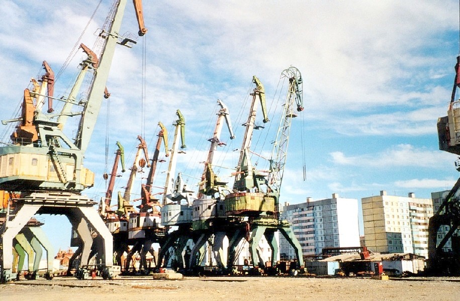
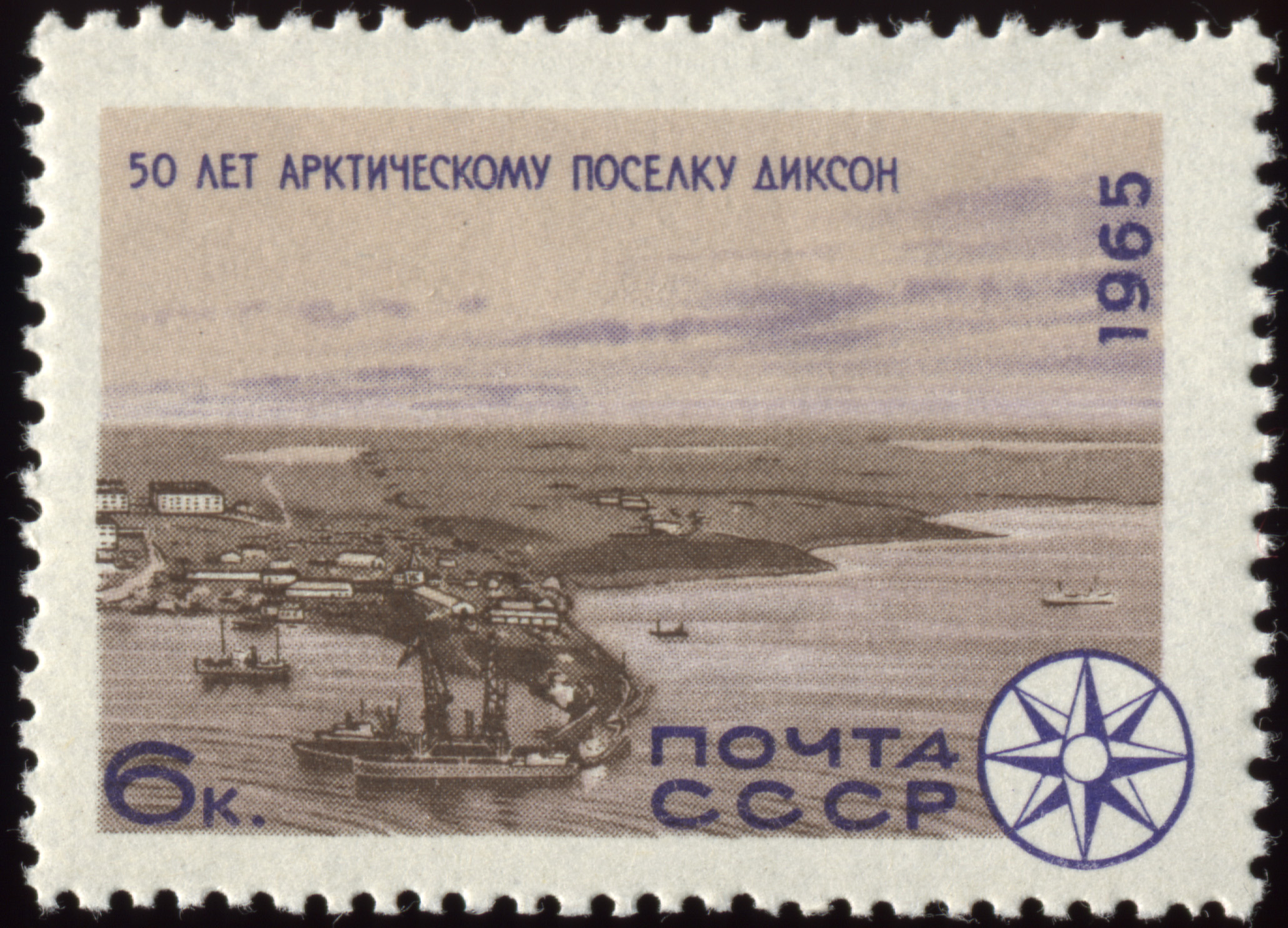
Dikson ( rus, Ди́ксон, , dʲiksən) is a port located in northern Russia and is one of the world's northernmost settlements. Dikson is an urban locality (an urban-type settlement) situated in Taymyrsky Dolgano-Nenetsky District of Krasnoyarsk Krai. It is situated on the Kara Sea, located on a headland at the mouth of the Yenisei Gulf (the Yenisei River estuary), on Russia's Arctic Ocean coast. As of the 2010 Census, its population was 676. Geography Dikson is the northernmost port in Russia and the northernmost settlement on the Asian continent. It is so far north that no civil twilight appears from 8 December to 5 January, but it has 24 hours of civil twilight from 18 April to 26 August. It is one of the world's most isolated settlements. Dikson's inhabitants informally call their settlement "Capital of the Arctic", taken from a popular Soviet song. Dikson and Dikson Island were named after Swedish Arctic pioneer Baron Oscar Dickson. Dickson, along with Aleksa ... [...More Info...] [...Related Items...] OR: [Wikipedia] [Google] [Baidu] |
Kotelny Island
Kotelny Island ( rus, Остров Котельный, r=Ostrov Kotelny; sah, Олгуйдаах Aрыы, translit=Olguydaax Arııta) is part of the Anzhu Islands subgroup of the New Siberian Islands located between the Laptev Sea and the East Siberian Sea in the Russian Arctic. It is administratively and municipally part of Bulunsky District of the Republic of Sakha (Yakutia). Kotelny, Faddeyevsky and Bunge Land are usually named as separate islands on most 20th century maps, although sometimes on the newest maps the name "Kotelny" is applied to the whole island. A flat, low-lying, plain connecting both is known as Bunge Land (russian: link=no, Земля Бунге). The total area of Kotelny Island is 23,165 km2.Great Soviet Encyclopedia Kotelny is one of the 50 largest islands in the world. These merged islands are a practically uninhabited territory belonging to Yakutia of the Russian Federation. History The island was officially discovered by a Russian merchant a ... [...More Info...] [...Related Items...] OR: [Wikipedia] [Google] [Baidu] |
Zarya (polar Ship)
''Zarya'' (russian: Заря, ''Sunrise'' or ''Dawn'') was a steam- and sail-powered brig used by the Russian Academy of Sciences for a polar exploration during 1900–1903. History Toward the end of the 19th century, the Russian Academy of Sciences sought to build a general-purpose research vessel for long-term expeditions. The first such Russian ship—and, for a couple of decades, the only one—was ''Zarya''. In 1899, Baron Eduard Toll, an Arctic explorer preparing to embark on a new polar voyage, bought a Norwegian three-masted barque called ''Harald Harfager'' (the nickname of a King of Norway) for the cost of 60,000 rubles. Toll was helped in his choice by Fridtjof Nansen, who recommended to use a ship similar to his ''Fram''. The ship had a displacement of 450 tonnes and a draught of 5 meters. Renamed ''Zarya'', the ship was sent to the shipyard of Colin Archer in Larvik to be heavily modified in order to deal with the ice. Colin Archer, the renowned Norwegian shipbuilder ... [...More Info...] [...Related Items...] OR: [Wikipedia] [Google] [Baidu] |
Kamennyye Islands
The Kamennye Islands or Kammenny Islands (russian: Каменные Острова; Kamennye Ostrova) is a group of islands in the Kara Sea, Russian Federation. Geography The islands lie off the coast of Siberia, west of the mouths of river Pyasina. They are covered with tundra vegetation. The sea surrounding the Kamennye Islands is covered with pack ice with some polynias in the winter and there are many ice floes even in the summer, so that they are connected with the Siberian mainland during the long winters. The climate is severe and summers last only about two months. This island group belongs to the Krasnoyarsk Krai administrative division of the Russian Federation. Islands The main islands are (from East to West): *Morzhovo Island, with a diameter of only , is the closest to land. It is only about from the Siberian coastline. *Rastorguyev Island. It is long and narrow, and about in length. It is occasionally confused with Kolchak Island (which is located further east ... [...More Info...] [...Related Items...] OR: [Wikipedia] [Google] [Baidu] |
Cossack
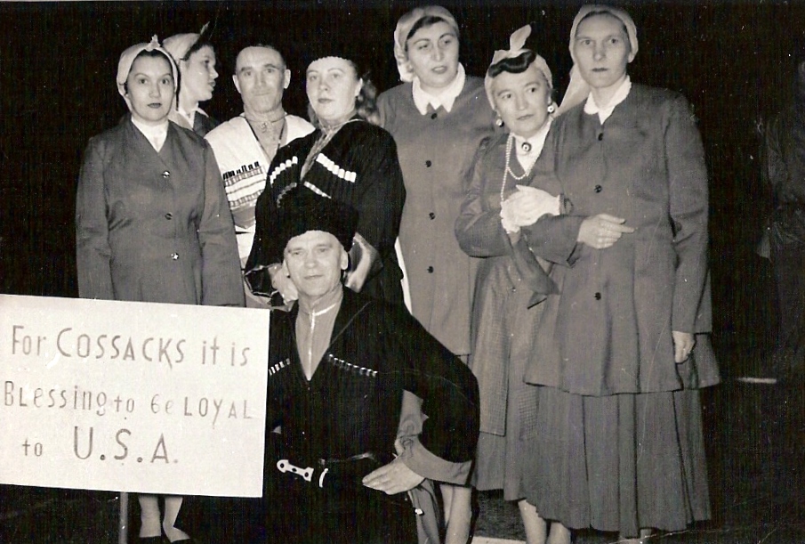
The Cossacks , es, cosaco , et, Kasakad, cazacii , fi, Kasakat, cazacii , french: cosaques , hu, kozákok, cazacii , it, cosacchi , orv, коза́ки, pl, Kozacy , pt, cossacos , ro, cazaci , russian: казаки́ or , sk, kozáci , uk, козаки́ are a predominantly East Slavic Orthodox Christian people originating in the Pontic–Caspian steppe of Ukraine and southern Russia. Historically, they were a semi-nomadic and semi-militarized people, who, while under the nominal suzerainty of various Eastern European states at the time, were allowed a great degree of self-governance in exchange for military service. Although numerous linguistic and religious groups came together to form the Cossacks, most of them coalesced and became East Slavic-speaking Orthodox Christians. The Cossacks were particularly noted for holding democratic traditions. The rulers of the Polish-Lithuanian Commonwealth and Russian Empire endowed Cossacks with certain spe ... [...More Info...] [...Related Items...] OR: [Wikipedia] [Google] [Baidu] |


